
Beginner Off-Road Trails
Near Williamsburg, Kansas
Explore All Beginner Trails Near Williamsburg, Kansas
Beginner Off-Road Trails Near Williamsburg, Kansas
Discover the best beginner-friendly off-road trails near you. These easier, lower-rated trails are a great place to start — browse trail maps, check difficulty ratings, and find your next adventure.
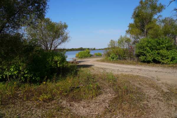
Lake Road West Fork
Lake Rd (west fork) is a graded rock road that forks off to the west for lake access. This was another a great spot for fishing or a picnic. There is a lot of native tallgrass prairie, and is on a flight path for migratory ducks and geese. There is no camping or fires allowed in this area, however t...
Learn more about Lake Road West Fork
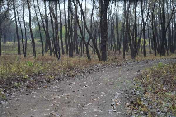
Otter Creek Inner Trail
The Inner trail connects with the main trail throughout the area. This trail is dirt with relatively shallow mud holes, rutted out tracks. This trail gets extremely muddy and slick with the rain. Most of the mud holes are near trees. Take caution with the ones that are not, as you may not have a way...
Learn more about Otter Creek Inner Trail
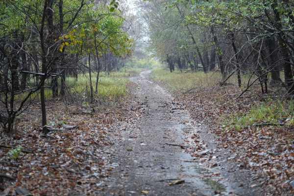
Otter Creek Main Trail
This 2 1/2 mile Trail takes you through the Otter Creek ORV area. The trail is mostly flat, with a few slight elevation changes, and some mud holes that can get deep; however, they are relatively easy to either split or go around entirely. Everything from a small ATV up should have no problem. If th...
Learn more about Otter Creek Main Trail
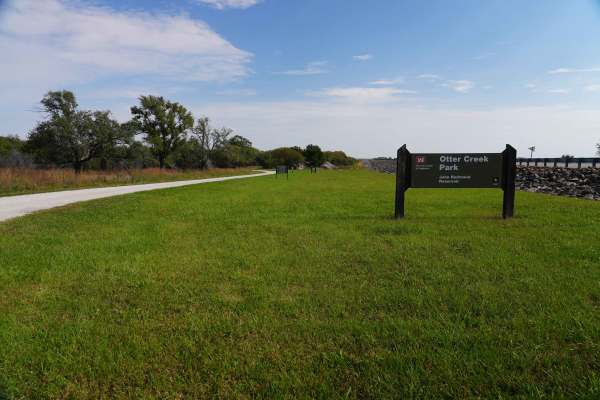
Lake Road
Lake Road is a graded rock road that is a quiet and peaceful drive to the lake at John Redmond Reservoir. This looked like a great spot for fishing or a picnic. There is no camping or fires allowed in this area; however, there is plenty of primitive or RV camping, with 110 hookups just on the other ...
Learn more about Lake Road
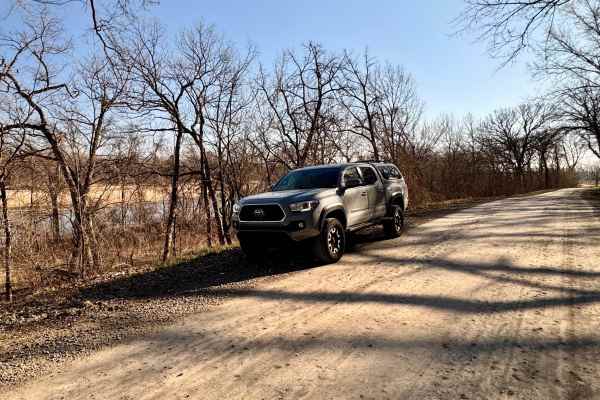
Scenic River Road
The Scenic River Road, County Road N. 2000 Road to N. 2050 Road, travels along the Kansas River Northwest of Lawrence, Kansas, heading west toward historic Lecompton, Kansas, the first state capital. The trail is hard-packed dirt and gravel suitable for any vehicle except in winter conditions with h...
Learn more about Scenic River Road
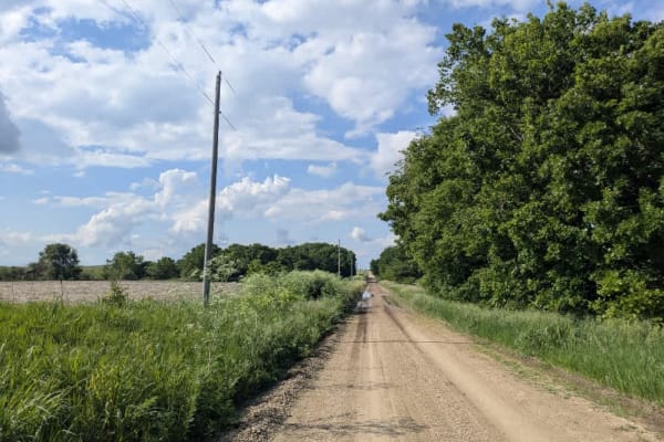
Road D
This trail begins on a narrow, well-maintained track that climbs steadily into the hills and intersects a section of the Flint Trail where motor vehicles are prohibited. In that stretch, free-range bison roam, and the area is popular with hikers and mountain bikers. From there, the route descends pa...
Learn more about Road D
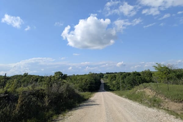
Agnes City Road
This trail winds through a heavily treed landscape where the gravel surface stays buttery smooth for the most part, punctuated by a few gentle climbs and descents. Along the way, you'll cross several shallow rivers and pass fields tended by local farmers. Be mindful of deer and the occasional vehicl...
Learn more about Agnes City Road
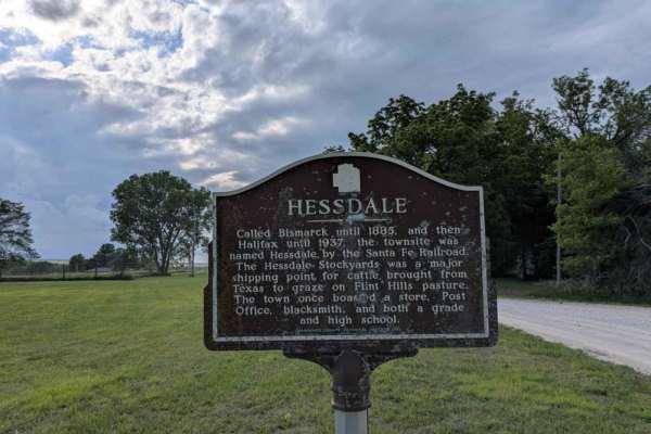
Hessdale Road
This trail is as sublime as the trail before it and unfolds over well-maintained gravel, showing few potholes or bumps as it winds through green rolling hills with gentle ascents and descents. Scattered farms and shallow creek crossings add a quiet, rural rhythm to the drive. There are no formal or ...
Learn more about Hessdale Road
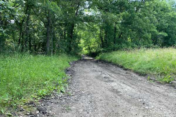
West Bottoms
Do not get the name of this trail confused with Bikini Bottom from Spongebob--this is West Bottoms! West Bottoms runs along the west boundary line of the park. This main loop trail is connected to Buckeye Boonies at one end and East Hill and Main Loop trail at the other. You will have access to many...
Learn more about West Bottoms
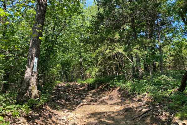
Mike's Malice
Mike's Malice is located within the Rocky Ridge Area of the park. This trail runs along the top of several other trails in this area. You will cross over Creek Run at one end of this trail. Both ends of this trail connect to West Bottoms.
Learn more about Mike's Malice
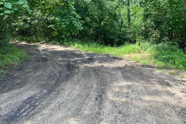
Unpaved Road
Unpaved Road is a very short non-directional trail located within the Takanoah's Hill area of the park, maintained by the Flint Hills Jeep Club. This trail meets Takanoah's Hill at the bottom and also runs right into Ft. Scott Ave. There are no signs for this trail.
Learn more about Unpaved Road
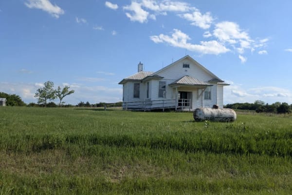
Chalk Road
This trail is sublime, unfolding over well-maintained gravel that shows few potholes or bumps as it winds through green rolling hills with gentle ascents and descents. Scattered farms dot the landscape, and the route crosses several creeks beneath a canopy of trees. There are no designated or disper...
Learn more about Chalk Road
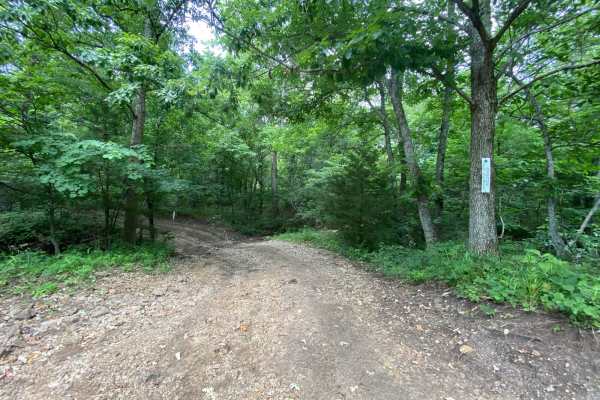
Ft. Scott Ave.
Ft. Scott Ave. is a non-directional trail located within the Takanoah's Hill area of the park, maintained by the Flint Hills Jeep Club. This trail begins where Unpaved Road ends, which is also right in front of where Creek Pass ends. Ft. Scott Ave. ends where it connects to Buckeye Boonies. Towards ...
Learn more about Ft. Scott Ave.
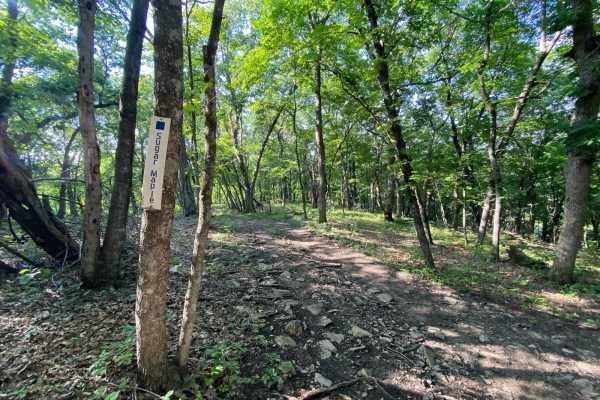
Sugar Maple
Sugar Maple is a non-directional trail within the Turkey Hill area of the park. This trail connects to Jeremys Jaunt at one end and Troxel's Trough at the other end. It also runs parallel to Possum Point and Ruff's Ride. Similar to Possum Point, this is more of a scenic drive through the trees with ...
Learn more about Sugar Maple
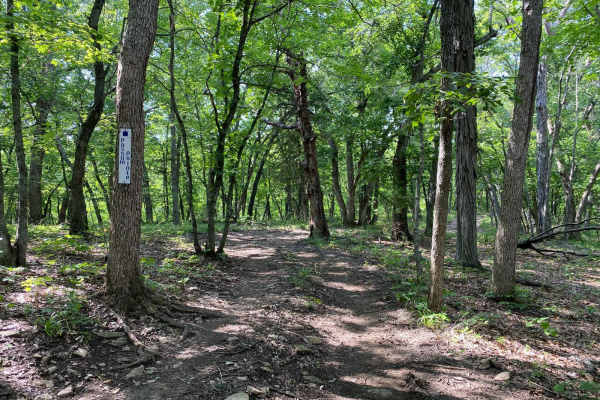
Possum Point
Possum Point is a non-directional trail within the Turkey Hill area of the park. This trail connects to Jeremy's Jaunt at one end and Troxel's Trough at the other end. The trail Sugar Maple runs parallel to this. The drive on this trail is more of a scenic drive through the trees with a slightly ste...
Learn more about Possum Point
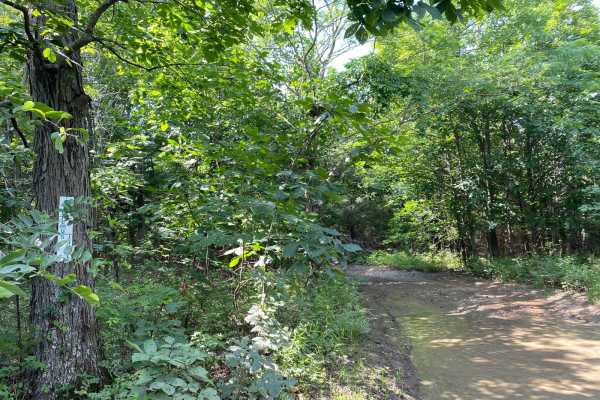
Jeremy's Jaunt
Jeremy's Jaunt is a trail within the Timber Hill and the Turkey Hills areas of the park. When coming from East Hill, the trail comes to a split where you can go left or you can go right. Left leads you to more technical and difficult trails. The right side winds through the trees and connects you to...
Learn more about Jeremy's Jaunt
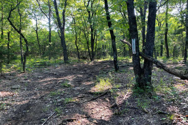
Canary
Canary is a non-directional trail within the Timber Hill area of the park. This could be considered an early connector trail for Wayne's World and Jeremy's Jaunt. You will come to a few spots where a tree is in the middle of the trail, the trail splits both left and right, and then it reconnects.
Learn more about Canary
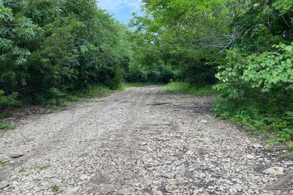
Hangman's Haunt
Hangman's Haunt is a non-directional loop trail within the Takanoah's Hill area of the park, maintained by the Flint Hills Jeep Club. Hangman's Haunt is connected to Takanoah's Hill, Danny's Drive, and Bent Tree. This is a nice flat area where your group can congregate and hang out. There is plenty ...
Learn more about Hangman's Haunt
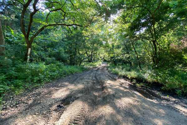
East Hill
East Hill is part of the Main Loop trails around the park and is located within the Buck Hill area. This will connect sections A and B of the park. This part of the main loop is connected to Main Loop, West Bottoms, and Buckeye Boonies. Because this is part of the Main Loop trail system, you will be...
Learn more about East Hill
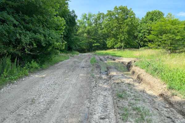
Buckeye Boonies
Buckeye Boonies is part of the main loop trail system within the park. Part of this trail is located in the Wildlife Viewing Area and the Buckeye Boonies Area. Buckeye Boonies is a non-directional trail and can be run from either end. You can also be connected to the Takanoah's Hill area of the park...
Learn more about Buckeye Boonies
Beginner ATV trails near Williamsburg, Kansas
Explore ATV-friendly trails near you. These trails are accessible for vehicles up to 50 inches wide, perfect for ATVs and smaller off-road machines.
Lake Road West Fork
Lake Rd (west fork) is a graded rock road that forks off to the west for lake access. This was another a great spot for fishing or a picnic. There is a lot of native tallgrass prairie, and is on a flight path for migratory ducks and geese. There is no camping or fires allowed in this area, however t...
Learn more about Lake Road West Fork
Otter Creek Inner Trail
The Inner trail connects with the main trail throughout the area. This trail is dirt with relatively shallow mud holes, rutted out tracks. This trail gets extremely muddy and slick with the rain. Most of the mud holes are near trees. Take caution with the ones that are not, as you may not have a way...
Learn more about Otter Creek Inner Trail
Otter Creek Main Trail
This 2 1/2 mile Trail takes you through the Otter Creek ORV area. The trail is mostly flat, with a few slight elevation changes, and some mud holes that can get deep; however, they are relatively easy to either split or go around entirely. Everything from a small ATV up should have no problem. If th...
Learn more about Otter Creek Main Trail
Lake Road
Lake Road is a graded rock road that is a quiet and peaceful drive to the lake at John Redmond Reservoir. This looked like a great spot for fishing or a picnic. There is no camping or fires allowed in this area; however, there is plenty of primitive or RV camping, with 110 hookups just on the other ...
Learn more about Lake Road
Beginner UTV/side-by-side trails near Williamsburg, Kansas
Find UTV and side-by-side trails near you. These trails accommodate vehicles up to 60 inches wide, ideal for UTVs, side-by-sides, and wider off-road rigs.
Lake Road West Fork
Lake Rd (west fork) is a graded rock road that forks off to the west for lake access. This was another a great spot for fishing or a picnic. There is a lot of native tallgrass prairie, and is on a flight path for migratory ducks and geese. There is no camping or fires allowed in this area, however t...
Learn more about Lake Road West Fork
Otter Creek Inner Trail
The Inner trail connects with the main trail throughout the area. This trail is dirt with relatively shallow mud holes, rutted out tracks. This trail gets extremely muddy and slick with the rain. Most of the mud holes are near trees. Take caution with the ones that are not, as you may not have a way...
Learn more about Otter Creek Inner Trail
Otter Creek Main Trail
This 2 1/2 mile Trail takes you through the Otter Creek ORV area. The trail is mostly flat, with a few slight elevation changes, and some mud holes that can get deep; however, they are relatively easy to either split or go around entirely. Everything from a small ATV up should have no problem. If th...
Learn more about Otter Creek Main Trail
Lake Road
Lake Road is a graded rock road that is a quiet and peaceful drive to the lake at John Redmond Reservoir. This looked like a great spot for fishing or a picnic. There is no camping or fires allowed in this area; however, there is plenty of primitive or RV camping, with 110 hookups just on the other ...
Learn more about Lake Road
The onX Offroad Difference
onX Offroad combines trail photos, descriptions, difficulty ratings, width restrictions, seasonality, and more in a user-friendly interface. Available on all devices, with offline access and full compatibility with CarPlay and Android Auto. Discover what you're missing today!
Open Trail Map