
Beginner Off-Road Trails
Near Williams Acres, New Mexico
Explore All Beginner Trails Near Williams Acres, New Mexico
Beginner Off-Road Trails Near Williams Acres, New Mexico
Discover the best beginner-friendly off-road trails near you. These easier, lower-rated trails are a great place to start — browse trail maps, check difficulty ratings, and find your next adventure.
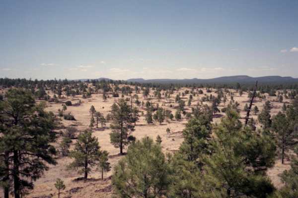
Hole in the Wall at Malpais National Monument
This excellent day trip starts on the western edge of Malpais National Monument, drives by the Big Tubes cave system and then crosses an easy introduction to driving over rock before accessing the "Hole in the Wall" in back country of Malpais Wilderness. Malpais consists of a series of large lava fi...
Learn more about Hole in the Wall at Malpais National Monument
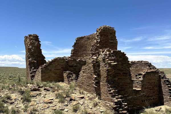
Chaco Canyon to Kin Klizhin
Relatively easy trail to one of the more remote ruins of the Chaco Canyon culture. The trail was rutted and uneven, and the last few hundred yards had significant mud due to recent rains. Otherwise, the trail to the ruins was relatively easy, with incredible views of the high desert and Chaco Canyon...
Learn more about Chaco Canyon to Kin Klizhin
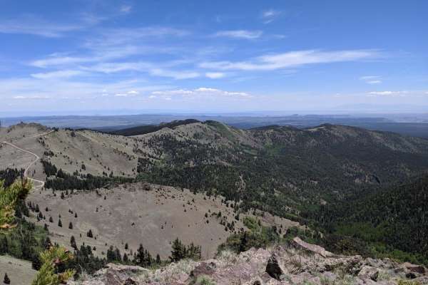
Mt. Taylor Peak 4x4 Road
This 4x4 road is a great intro to overlanding, with stunning views and minimal technical obstacles. Starting from Grants, the road climbs almost 5000 feet to within 1/2 mile of Mt. Taylor peak. The road starts off as graded gravel, giving way to a more primitive dirt road, which is easily passable i...
Learn more about Mt. Taylor Peak 4x4 Road
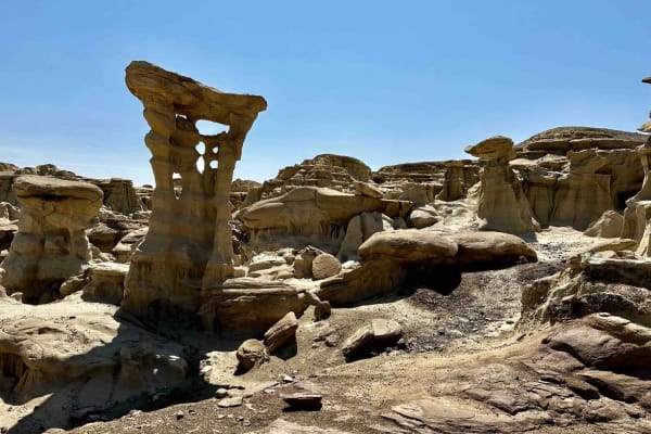
Valley of Dreams East
This is a point-to-point route that takes you from Road 550 in Nageezi to the Valley of Dreams trailhead/parking lot. The first quarter to half mile or so is paved but quickly turns to a graded dirt road which gets increasingly less groomed the closer you get to the trailhead. Rutted and rough in pl...
Learn more about Valley of Dreams East
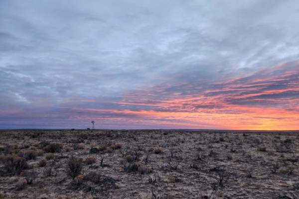
Chaco Overlook
This double-track trail takes you through cattle grazing farmland and ends at an overlook. Cows can be seen near the trail. There is nowhere to camp or turn around until the end of the trail. The trail is smooth and can be done in 2WD under good conditions. The overlook is a great place to camp, rig...
Learn more about Chaco Overlook
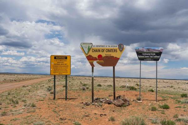
Chain of Craters Backcountry Byway
The trail travels along the south and west boundaries of the El Malpais National Monument and surrounding BLM land. The trail begins in a wide-open plain with desert scrub largely used for cattle grazing before passing into a desert forest, passing numerous volcanic cinder cones with side trails. Th...
Learn more about Chain of Craters Backcountry Byway
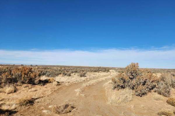
Bisti Badlands Overlook
Off of Da-Na-Zin Road, this short spur trail takes you to an overlook right on the edge of the Bisti badlands. There is a closed gate at the entrance that should be closed behind you. This short two-track trail has a few washouts but can be done in any typical 4WD SUV or truck. The trail is tight, s...
Learn more about Bisti Badlands Overlook
Beginner ATV trails near Williams Acres, New Mexico
Explore ATV-friendly trails near you. These trails are accessible for vehicles up to 50 inches wide, perfect for ATVs and smaller off-road machines.
Mt. Taylor Peak 4x4 Road
This 4x4 road is a great intro to overlanding, with stunning views and minimal technical obstacles. Starting from Grants, the road climbs almost 5000 feet to within 1/2 mile of Mt. Taylor peak. The road starts off as graded gravel, giving way to a more primitive dirt road, which is easily passable i...
Learn more about Mt. Taylor Peak 4x4 Road
Valley of Dreams East
This is a point-to-point route that takes you from Road 550 in Nageezi to the Valley of Dreams trailhead/parking lot. The first quarter to half mile or so is paved but quickly turns to a graded dirt road which gets increasingly less groomed the closer you get to the trailhead. Rutted and rough in pl...
Learn more about Valley of Dreams East
Chaco Overlook
This double-track trail takes you through cattle grazing farmland and ends at an overlook. Cows can be seen near the trail. There is nowhere to camp or turn around until the end of the trail. The trail is smooth and can be done in 2WD under good conditions. The overlook is a great place to camp, rig...
Learn more about Chaco Overlook
Beginner UTV/side-by-side trails near Williams Acres, New Mexico
Find UTV and side-by-side trails near you. These trails accommodate vehicles up to 60 inches wide, ideal for UTVs, side-by-sides, and wider off-road rigs.
Mt. Taylor Peak 4x4 Road
This 4x4 road is a great intro to overlanding, with stunning views and minimal technical obstacles. Starting from Grants, the road climbs almost 5000 feet to within 1/2 mile of Mt. Taylor peak. The road starts off as graded gravel, giving way to a more primitive dirt road, which is easily passable i...
Learn more about Mt. Taylor Peak 4x4 Road
Valley of Dreams East
This is a point-to-point route that takes you from Road 550 in Nageezi to the Valley of Dreams trailhead/parking lot. The first quarter to half mile or so is paved but quickly turns to a graded dirt road which gets increasingly less groomed the closer you get to the trailhead. Rutted and rough in pl...
Learn more about Valley of Dreams East
Chaco Overlook
This double-track trail takes you through cattle grazing farmland and ends at an overlook. Cows can be seen near the trail. There is nowhere to camp or turn around until the end of the trail. The trail is smooth and can be done in 2WD under good conditions. The overlook is a great place to camp, rig...
Learn more about Chaco Overlook
Bisti Badlands Overlook
Off of Da-Na-Zin Road, this short spur trail takes you to an overlook right on the edge of the Bisti badlands. There is a closed gate at the entrance that should be closed behind you. This short two-track trail has a few washouts but can be done in any typical 4WD SUV or truck. The trail is tight, s...
Learn more about Bisti Badlands Overlook
The onX Offroad Difference
onX Offroad combines trail photos, descriptions, difficulty ratings, width restrictions, seasonality, and more in a user-friendly interface. Available on all devices, with offline access and full compatibility with CarPlay and Android Auto. Discover what you're missing today!
Open Trail Map