
Beginner Off-Road Trails
Near West Hammond, New Mexico
Explore All Beginner Trails Near West Hammond, New Mexico
Beginner Off-Road Trails Near West Hammond, New Mexico
Discover the best beginner-friendly off-road trails near you. These easier, lower-rated trails are a great place to start — browse trail maps, check difficulty ratings, and find your next adventure.
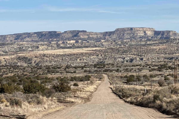
RD 7020
CR 7020 is a 7-mile off-road trail and oil access road that serves as the easiest and most direct route from Highway 550 to the Angel Peak Loop and Kutz Canyon. The trail combines sections of deep sand and packed dirt, providing a generally smooth drive under dry conditions. However, its accessibili...
Learn more about RD 7020
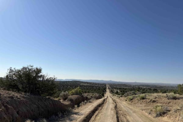
Crouch Mesa
This area is a local Bloomfield favorite. The trail crisscrosses Crouch Mesa, with the northwest end starting in Flora Vista near Road 3100 and the northeast access point picking up a little off of 550. While it is a standard two-car width and sometimes deeply rutted track, it cuts across several tr...
Learn more about Crouch Mesa
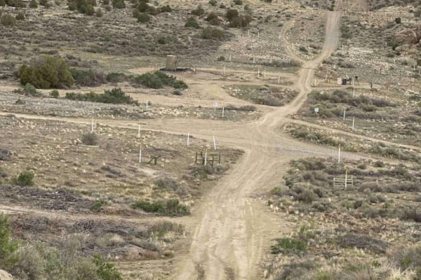
Arizona Road/CR 4900 Extension
Just north of Bloomfield, this route is primarily used by locals and oil and gas trucks to access oil sites or the trails that crisscross the area between NM 550. From Bloomfield, it's the access point to a lot of great places east of US 550, north of US 64, west of the San Juan River, and south of ...
Learn more about Arizona Road/CR 4900 Extension

Arizona to Center Point Fire Station 2
This trail is an unnamed oil road that cuts across BLM land and includes some spectacular views looking south towards Angel Peak and the badlands as well as looking north and northeast towards the Colorado Rockies and Aztec. There are some fairly steep inclines, stretches with heavy ruts, and some s...
Learn more about Arizona to Center Point Fire Station 2
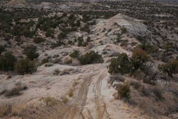
CMT East Loop
This loop starts from an oil well access road and enters the desert terrain on a mid-width trail ideal for 60" SXSs, ATVs, and dirt bikes. Going counterclockwise from the south, it goes out onto a ridgeline on the soft clay dirt hills in this badlands-type terrain. The ridgeline has a lot of whoops....
Learn more about CMT East Loop
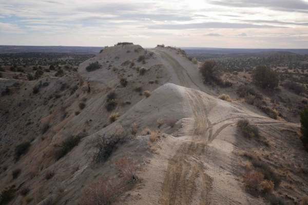
Bloomfield SXS
This is a mid-width trail ideal for 60" SXSs, ATVs, and dirt bikes that goes through a badlands-type desert terrain between Aztec and Bloomfield, New Mexico. It goes on a ridgeline on the soft clay dirt hills, overlooking the valley below. Watch out for the barbed wire fence that parallels the trail...
Learn more about Bloomfield SXS
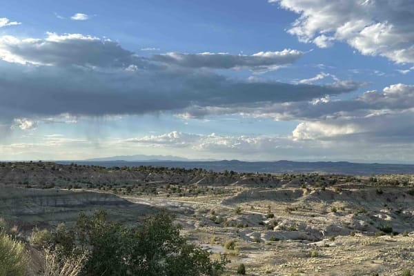
Angel Peak Loop
Starting in the high desert immediately adjacent to a canal, the loop utilizes BLM oil roads to dip down into the badlands surrounding Angel Peak. Zig-zagging across the sandy washes that weave through the bottom of Kutz Canyon, the loop encircles Angel Peak for an all-angles view of the peak and fo...
Learn more about Angel Peak Loop
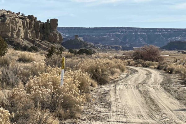
Kutz Canyon West
This oil road starts out wide and sandy but gradually becomes increasingly narrow as it winds its way deeper into the canyon. There are some ledges when entering and exiting washes, but this is a fairly easy trail for anyone with a high-clearance vehicle. Look out for narrow, deeply eroded cuts acro...
Learn more about Kutz Canyon West
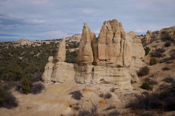
Tent Rocks
This trail starts after Anna's Ridge and continues on the narrow ridgeline on the clay hills. It has sweeping turns and little descents and climbs as it goes from each hilltop to the next. It's super fast and flowy, with whoops, but no major obstacles, just a bit of exposure on each side of the ridg...
Learn more about Tent Rocks
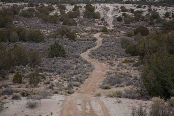
Three Eyed Monkey
This route is a mix of oil well roads, and mid-width trail ideal for 60" SxSs, ATVs, and dirt bikes. It goes through an open desert near Aztec, New Mexico. It's made up of primitive oil well/natural gas access roads that are less maintained, with shallow ruts and washouts and sandy wash crossings. Y...
Learn more about Three Eyed Monkey

Wash ATV
This is a 1.6-mile-long easy ATV trail that is a mix of dirt trail and easy wash. The west end starts on an oil well road and heads east towards the wash on a dirt trail through flat sagebrush desert terrain. There are ATV signs on the route to follow. Once you reach the wash, you can turn right, an...
Learn more about Wash ATV
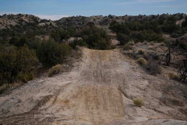
Anna's Ridge
The north end of this easy trail starts at the end of the road between the baseball diamond and dog park near Aztec, New Mexico. It goes up a steep hill right away and gets up on a ridgeline, overlooking the park and fishing pond. It goes over the rolling hills made of soft clay and dirt, on a mid-w...
Learn more about Anna's Ridge
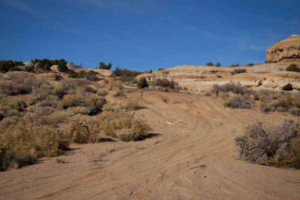
Coyote Cat ATV
This 3.3-mile-long easy ATV trail leaves from a main dirt road on the south end and climbs up a loose dirt hill, then winds up and over the small rolling desert hills and into the washes. It's marked with trail signs to help follow the route. A lot of it is easy sandy washes, but it also has some lo...
Learn more about Coyote Cat ATV
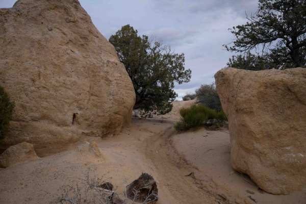
Rhinos Ridge
This short and narrow trail near Aztec, New Mexico, starts on the route for a disc golf course in badlands-type desert terrain. It's a narrow ridgeline that is most ideal for ATVs and dirt bikes but would be rather too narrow for a 60" SXS. It drops down from the ridgeline into the flat part of the ...
Learn more about Rhinos Ridge
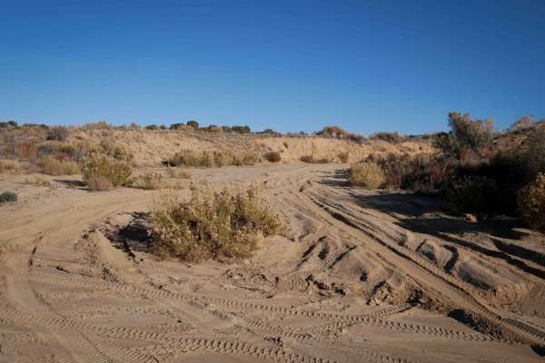
Choke Cherry ATV
The northern half of this loop goes through a wide white sand wash, with big sweeping curves through the open desert. It's lined with bushes and pinyon trees and is smooth with no obstacles. Shortly after a powerline, the wash splits, and this trail goes southeast into another almost similar wash th...
Learn more about Choke Cherry ATV
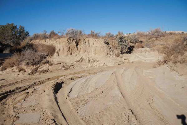
Johnson Arroyo ATV
This trail is 2.7 miles of easy wash trail through the Johnson Arroyo. The wash stays pretty wide the whole time, with lots of tracks to follow. From the south, it goes through the easy, flat and smooth sandy wash, between sage brush, and small pinyon bushes. It curves through the wash around tall d...
Learn more about Johnson Arroyo ATV
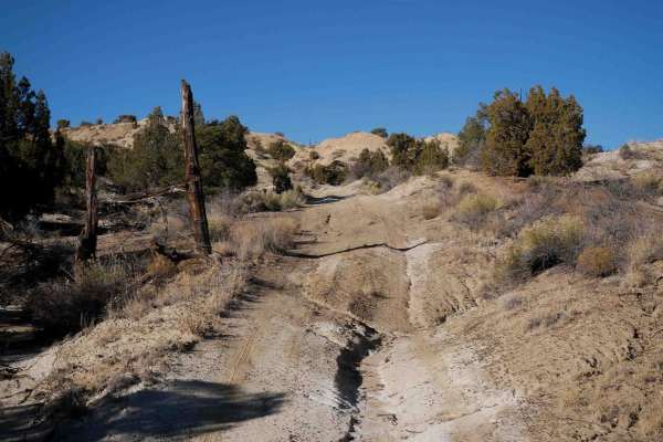
Narrow Wash ATV
From the south, this trail starts as a wide dirt trail between the pinyon trees, with portions of the trail in the beginning that are full-width roads. It turns off of the main road back into pinyon trees on a narrower trail. It's a bit rutted and uneven, with washouts. The trail goes over chunky la...
Learn more about Narrow Wash ATV

Casanova Mount Wash
This is 1.6 miles of Jeep trail through a sand wash. It starts on oilwell roads on either end and stays in the wash the entire time. There's an off-camber entrance into the wash on the east end that makes it more interesting. It's also only one vehicle wide at times, so it's much narrower than most ...
Learn more about Casanova Mount Wash
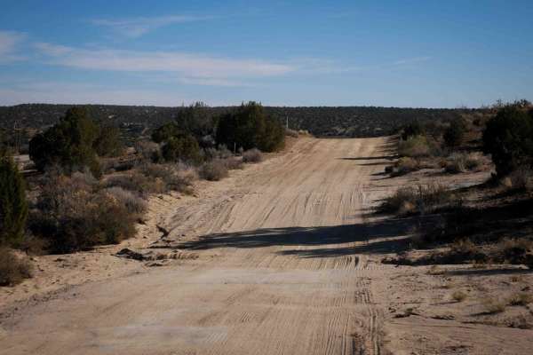
Oilwell Road (Dirt Bike)
This trail is designated for dirt bikes but is actually a road-width trail that accesses the oil wells. It's flat and straight, with essentially no features except a few small ruts. It's a bit sandy and loose but stays very easy the entire time. There are still signs indicating that it is limited to...
Learn more about Oilwell Road (Dirt Bike)
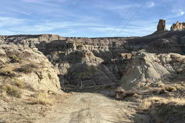
Kutz Canyon East
While this trail is not technically challenging there are a lot of terrain changes over it's 7.5-mile length. The west end of the trail starts with dirt, packed clay, and sand in a fairly open setting before climbing up over some bare sandstone with some minor ledges to drop down through surrounding...
Learn more about Kutz Canyon East
Beginner ATV trails near West Hammond, New Mexico
Explore ATV-friendly trails near you. These trails are accessible for vehicles up to 50 inches wide, perfect for ATVs and smaller off-road machines.
RD 7020
CR 7020 is a 7-mile off-road trail and oil access road that serves as the easiest and most direct route from Highway 550 to the Angel Peak Loop and Kutz Canyon. The trail combines sections of deep sand and packed dirt, providing a generally smooth drive under dry conditions. However, its accessibili...
Learn more about RD 7020
Crouch Mesa
This area is a local Bloomfield favorite. The trail crisscrosses Crouch Mesa, with the northwest end starting in Flora Vista near Road 3100 and the northeast access point picking up a little off of 550. While it is a standard two-car width and sometimes deeply rutted track, it cuts across several tr...
Learn more about Crouch Mesa
Arizona Road/CR 4900 Extension
Just north of Bloomfield, this route is primarily used by locals and oil and gas trucks to access oil sites or the trails that crisscross the area between NM 550. From Bloomfield, it's the access point to a lot of great places east of US 550, north of US 64, west of the San Juan River, and south of ...
Learn more about Arizona Road/CR 4900 Extension
CMT East Loop
This loop starts from an oil well access road and enters the desert terrain on a mid-width trail ideal for 60" SXSs, ATVs, and dirt bikes. Going counterclockwise from the south, it goes out onto a ridgeline on the soft clay dirt hills in this badlands-type terrain. The ridgeline has a lot of whoops....
Learn more about CMT East Loop
Beginner UTV/side-by-side trails near West Hammond, New Mexico
Find UTV and side-by-side trails near you. These trails accommodate vehicles up to 60 inches wide, ideal for UTVs, side-by-sides, and wider off-road rigs.
RD 7020
CR 7020 is a 7-mile off-road trail and oil access road that serves as the easiest and most direct route from Highway 550 to the Angel Peak Loop and Kutz Canyon. The trail combines sections of deep sand and packed dirt, providing a generally smooth drive under dry conditions. However, its accessibili...
Learn more about RD 7020
Crouch Mesa
This area is a local Bloomfield favorite. The trail crisscrosses Crouch Mesa, with the northwest end starting in Flora Vista near Road 3100 and the northeast access point picking up a little off of 550. While it is a standard two-car width and sometimes deeply rutted track, it cuts across several tr...
Learn more about Crouch Mesa
Arizona Road/CR 4900 Extension
Just north of Bloomfield, this route is primarily used by locals and oil and gas trucks to access oil sites or the trails that crisscross the area between NM 550. From Bloomfield, it's the access point to a lot of great places east of US 550, north of US 64, west of the San Juan River, and south of ...
Learn more about Arizona Road/CR 4900 Extension
Arizona to Center Point Fire Station 2
This trail is an unnamed oil road that cuts across BLM land and includes some spectacular views looking south towards Angel Peak and the badlands as well as looking north and northeast towards the Colorado Rockies and Aztec. There are some fairly steep inclines, stretches with heavy ruts, and some s...
Learn more about Arizona to Center Point Fire Station 2
The onX Offroad Difference
onX Offroad combines trail photos, descriptions, difficulty ratings, width restrictions, seasonality, and more in a user-friendly interface. Available on all devices, with offline access and full compatibility with CarPlay and Android Auto. Discover what you're missing today!
Open Trail Map