
Beginner Off-Road Trails
Near Van Lear, Kentucky
Explore All Beginner Trails Near Van Lear, Kentucky
Beginner Off-Road Trails Near Van Lear, Kentucky
Discover the best beginner-friendly off-road trails near you. These easier, lower-rated trails are a great place to start — browse trail maps, check difficulty ratings, and find your next adventure.
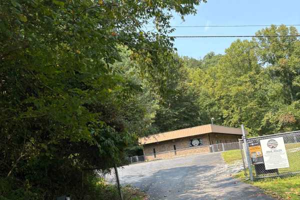
Martin County Trailhead to Trail 1
This is the First Frontier Appalachian Trails office/trailhead. This route takes you from the parking lot to Trail 1. Office/trailhead is located off Route 3 in Martin County. 3548 Davella Road, Debord, KY. There is a porta-john at the trailhead parking. Very easy parking is available in a gravel l...
Learn more about Martin County Trailhead to Trail 1
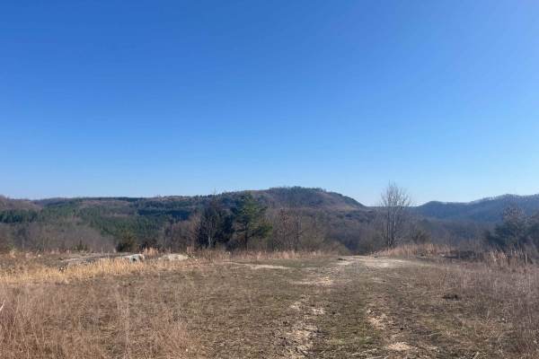
Trail 22 (Lovers Lane)
Trail 22 is a short green trail. When you travel this trail in late summer, early fall, you see why it's called lovers lane with its picturesque views and field of wildflowers. It's a great trail to ride out to the lookout point and have a picnic. You never know what kind of wildlife you will see he...
Learn more about Trail 22 (Lovers Lane)

Trail 33
Trail 33 is a green trail and is just a small loop off Trail 15. Has a great lookout point. It is an old haul road from the mining days and a spot where they used to house equipment. Free range cattle like to hang out back here off the main trail.
Learn more about Trail 33
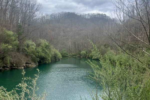
White Oak Branch Raod
The trail begins in White Oak Branch, where you will cross a small creek. After traveling through the creek, a small pond will be on the right. The road is in great shape for UTVs and even Jeeps. Once you ascend to the top of the mountain, it opens up to amazing views. The rest of the trail is old s...
Learn more about White Oak Branch Raod
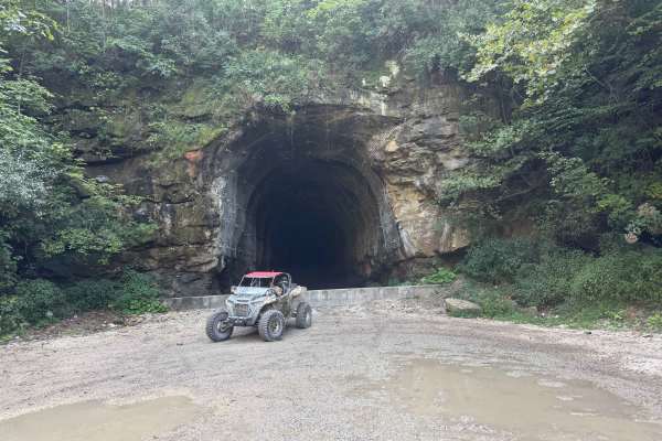
TipTop Tunnel Trail
The trail to TipTop Tunnel follows a wide, unmaintained gravel road through open fields and forest cut-throughs. While high ground clearance is helpful for smooth navigation, the overall terrain remains straightforward and easy-going. It offers a relaxed, scenic drive through nature that leads trave...
Learn more about TipTop Tunnel Trail
BTL
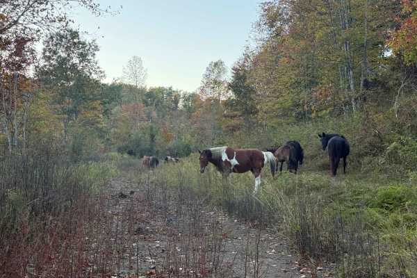
This trail, along with Board Tree Loop, is closed in November and December per the land owner's request. This trail is part of the Board Tree Loop, offering more options and possibilities to ride and explore. The path is easy to travel and takes you through a couple of large open old log yards with ...
Learn more about BTL
Board Tree Loop
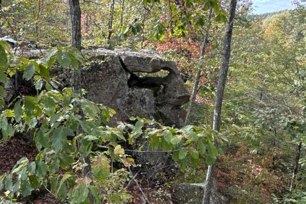
Board Tree Loop is closed in November and December per the land owner's request. This is an easy route with all types of terrain and scenery. This trail offers off-road access to many of the already mapped trails in the area, and there will be more to come. This trail is a great spot to start your o...
Learn more about Board Tree Loop
Decoy-Magoffin Loop
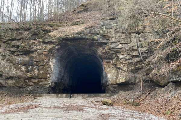
As with many trails in the under-development system that will become Eastern Kentucky's expansive off-road trail offerings, this route is a DIY adventure created by locals that know these mountains like the backs of their hands. Accessed from established trailheads like Mine Made Adventure Park and ...
Learn more about Decoy-Magoffin Loop

Valley Trail
This scenic and well-maintained hillside trail travels through dense vegetation and mature forest, offering excellent wildlife viewing, seasonal wildflowers, and berry patches along the way. The route is short and easy, featuring a mostly smooth surface with only light rocky sections. Riders can enj...
Learn more about Valley Trail
Big Rock Bottom
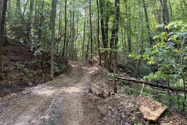
A nice cutoff from another trail to view this beautiful boulder. There is loose dirt, a mild incline, and it ends in an opening with a valley view. The boulder is very large, with a bit of overhang, a great place to catch a few good pics of your group. This trail has potential for extensions; at thi...
Learn more about Big Rock Bottom

Oval Ridge
This short and easy hillside trail travels through dense vegetation and mature timber, offering excellent wildlife viewing, scenic overlooks, and seasonal displays of wildflowers and berries. The route is well maintained, with a clean surface and only minor rocky sections, making it accessible for A...
Learn more about Oval Ridge

Hillside Trail
This well-maintained trail winds through dense vegetation and offers abundant wildlife viewing opportunities, scenic hillside vistas, and seasonal wildflowers and berries. The route features a smooth surface with only minor rocky sections, making it approachable for a wide range of users. The trail ...
Learn more about Hillside Trail
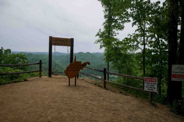
BM 36
BM 36 is a short but steep 0.8-mile climb from south to north, zigzagging up the mountainside on the far west side of the Buffalo Mountain Trail System near Williamson. The trail is narrow and winds through lush forest with tight switchbacks, loose rock, and shallow ruts. A scenic viewpoint on the n...
Learn more about BM 36
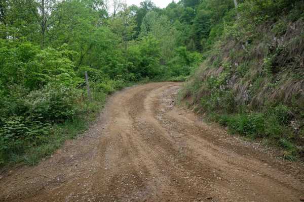
BM 37
BM 37 is a 0.6-mile connector between BM 36 and BM 10, offering an easy alternative route on the west side of the Buffalo Mountain Trail System. The trail passes a radio tower and runs beneath open skies along the power lines, with a wide, smooth, and gradual surface throughout. It's a simple, sceni...
Learn more about BM 37
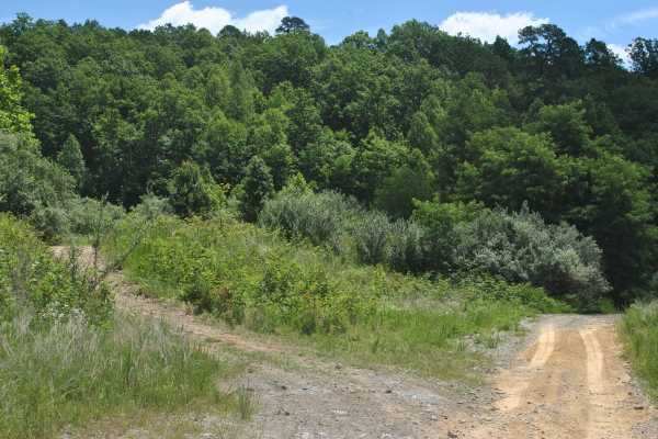
10
Trail 10 is a green trail, and the surface is primarily dirt. It seems tight and overgrown by brush in a few places, but overall, it is wide enough for a full-size vehicle to pass. There are a few mudholes to cross, so 4WD may be needed in places. Just be mindful before hitting those and be in 4WD b...
Learn more about 10
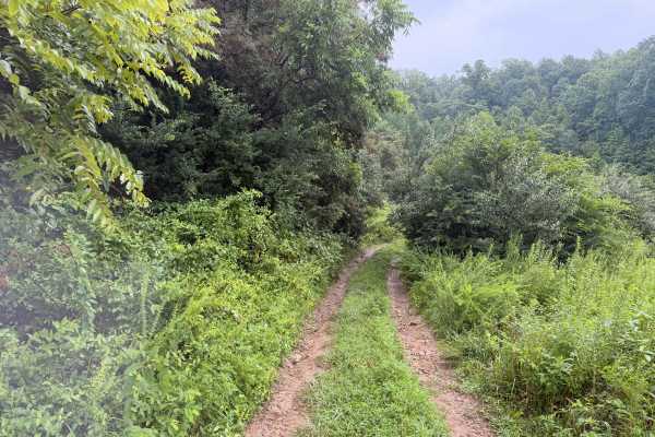
11-A
The trail begins with loose rock and dirt; there are overgrown, low-hanging branches. The trail has an incline; views are obstructed by the overgrowth, and it makes a loop linking Trail 22 and 12, then back to Trail 10. Short trail, great for beginners, and very close to the main campground.
Learn more about 11-A
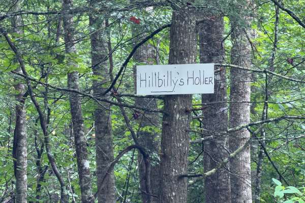
Hillbilly Holler
This trail embodies everything you would expect from a fairly easy creek ride. There are beautiful views of tall trees, a waterfall, mild rocks to climb over, and a flat, rock-bottom creek. If you need a break from the mud, this is the place to go. Take a minute to stop and just listen to the amazin...
Learn more about Hillbilly Holler
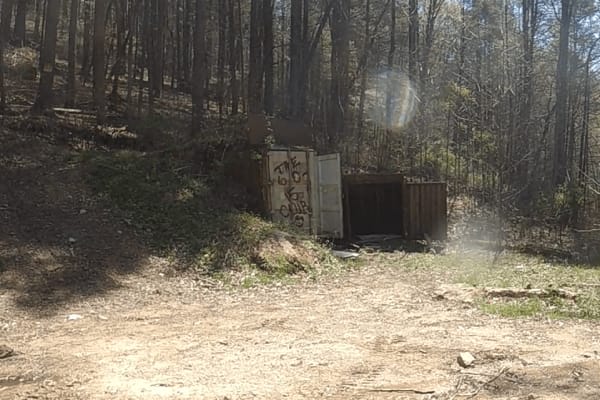
Puncheon Camp Branch
The route is very scenic and fun to travel, with many hidden gems along the way if you know where to look for them. A Bunker is built into the side of the mountain that is fully accessible; the rest are less obvious.
Learn more about Puncheon Camp Branch
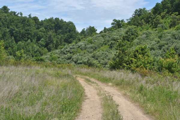
19
Trail 19 is a green trail and it is mainly grass and dirt. The track is relatively flat with no mudholes. This trail is used as a connector trail and brings you back to trail 0. You can ride this track in 2WD, and it is suitable for most OHVs and some high-clearance 2WD.
Learn more about 19
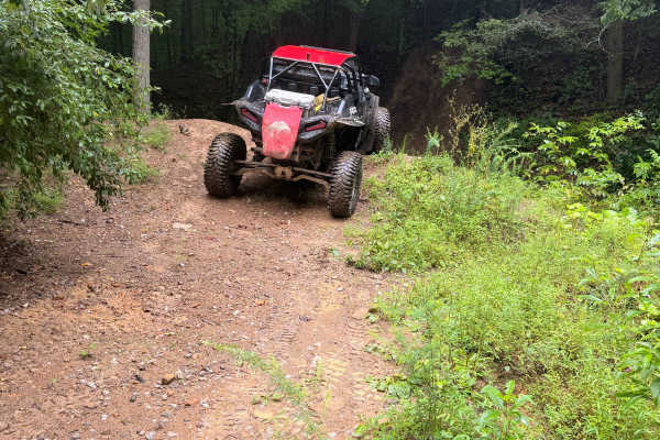
18-A
This trail cuts off the main Trail 10. It is hard to see if you're not looking due to the overgrowth and high grass. This is a short trail that ends at Trail 12; there are no rocks or ruts due to the lack of traffic on this section of trail.
Learn more about 18-A
Beginner ATV trails near Van Lear, Kentucky
Explore ATV-friendly trails near you. These trails are accessible for vehicles up to 50 inches wide, perfect for ATVs and smaller off-road machines.
Martin County Trailhead to Trail 1
This is the First Frontier Appalachian Trails office/trailhead. This route takes you from the parking lot to Trail 1. Office/trailhead is located off Route 3 in Martin County. 3548 Davella Road, Debord, KY. There is a porta-john at the trailhead parking. Very easy parking is available in a gravel l...
Learn more about Martin County Trailhead to Trail 1
Trail 22 (Lovers Lane)
Trail 22 is a short green trail. When you travel this trail in late summer, early fall, you see why it's called lovers lane with its picturesque views and field of wildflowers. It's a great trail to ride out to the lookout point and have a picnic. You never know what kind of wildlife you will see he...
Learn more about Trail 22 (Lovers Lane)
Trail 33
Trail 33 is a green trail and is just a small loop off Trail 15. Has a great lookout point. It is an old haul road from the mining days and a spot where they used to house equipment. Free range cattle like to hang out back here off the main trail.
Learn more about Trail 33
White Oak Branch Raod
The trail begins in White Oak Branch, where you will cross a small creek. After traveling through the creek, a small pond will be on the right. The road is in great shape for UTVs and even Jeeps. Once you ascend to the top of the mountain, it opens up to amazing views. The rest of the trail is old s...
Learn more about White Oak Branch Raod
Beginner UTV/side-by-side trails near Van Lear, Kentucky
Find UTV and side-by-side trails near you. These trails accommodate vehicles up to 60 inches wide, ideal for UTVs, side-by-sides, and wider off-road rigs.
Martin County Trailhead to Trail 1
This is the First Frontier Appalachian Trails office/trailhead. This route takes you from the parking lot to Trail 1. Office/trailhead is located off Route 3 in Martin County. 3548 Davella Road, Debord, KY. There is a porta-john at the trailhead parking. Very easy parking is available in a gravel l...
Learn more about Martin County Trailhead to Trail 1
Trail 22 (Lovers Lane)
Trail 22 is a short green trail. When you travel this trail in late summer, early fall, you see why it's called lovers lane with its picturesque views and field of wildflowers. It's a great trail to ride out to the lookout point and have a picnic. You never know what kind of wildlife you will see he...
Learn more about Trail 22 (Lovers Lane)
Trail 33
Trail 33 is a green trail and is just a small loop off Trail 15. Has a great lookout point. It is an old haul road from the mining days and a spot where they used to house equipment. Free range cattle like to hang out back here off the main trail.
Learn more about Trail 33
White Oak Branch Raod
The trail begins in White Oak Branch, where you will cross a small creek. After traveling through the creek, a small pond will be on the right. The road is in great shape for UTVs and even Jeeps. Once you ascend to the top of the mountain, it opens up to amazing views. The rest of the trail is old s...
Learn more about White Oak Branch Raod
The onX Offroad Difference
onX Offroad combines trail photos, descriptions, difficulty ratings, width restrictions, seasonality, and more in a user-friendly interface. Available on all devices, with offline access and full compatibility with CarPlay and Android Auto. Discover what you're missing today!
Open Trail Map