
Beginner Off-Road Trails
Near St. Elizabeth, Missouri
Explore All Beginner Trails Near St. Elizabeth, Missouri
Beginner Off-Road Trails Near St. Elizabeth, Missouri
Discover the best beginner-friendly off-road trails near you. These easier, lower-rated trails are a great place to start — browse trail maps, check difficulty ratings, and find your next adventure.
Strut
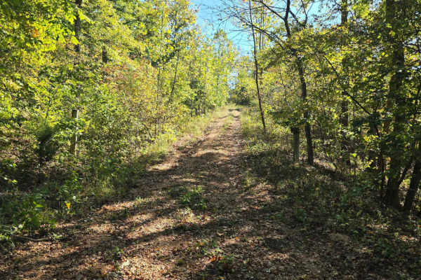
Strut is located in the Coffee Creek area. The terrain is a non-maintained gravel road offering a scenic and easy ride. This trail is a gradual, but easy, climb to the top. Riders use this trail as an option to create their own loop trail or shortcut in the Coffee Creek hills trail area.
Learn more about Strut
The Spur
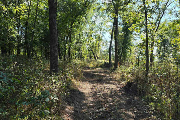
The Spur is located near the Coffee Creek area and offers a slightly more challenging ride compared to Turkey Ridge. The trail is primarily dirt and features a hill climb with a moderate incline. What sets this trail apart is its off-camber hill and narrower path, requiring more focus and control fr...
Learn more about The Spur
Turkey Ridge
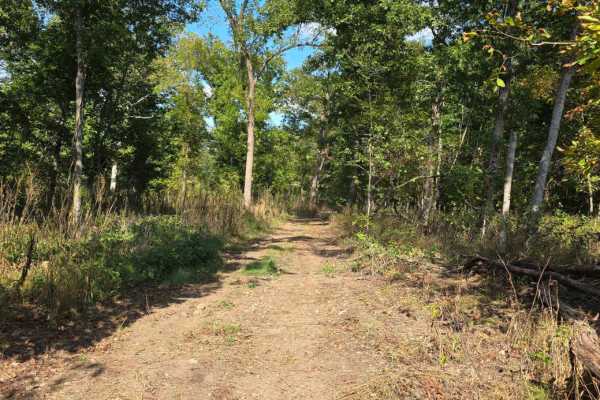
Turkey Ridge is located near the Coffee Creek area and offers a smooth, enjoyable ride for off-road riders of all skill levels. The trail is primarily dirt and features a single, simple hill climb that adds just enough elevation change to keep things interesting. Its wider path makes navigation easy...
Learn more about Turkey Ridge
Critter Cutoff
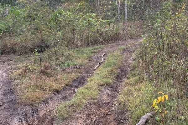
Critter Cutoff is an easy trail that is mostly dirt with a few muddy spots during rainy weather. The lower end connects to Outer Limits on the northeast side of the park and leads uphill to connect with Critter Crossing. Watch for the hunting stand up in the trees close to the north end.
Learn more about Critter Cutoff
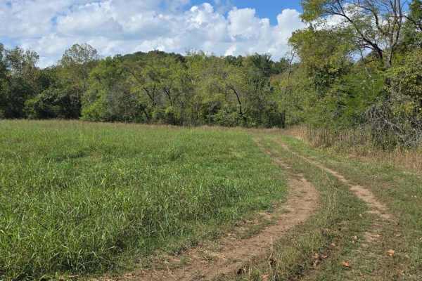
Hay Field Trail
This short and simple offroad trail provides a convenient way to create a loop within the Coffee Creek area or to access the nearby Coffee Creek Hill Trails. It runs along the outer edge of the hay fields, offering a peaceful ride with open views. The trail surface is mostly grass, with no obstacles...
Learn more about Hay Field Trail
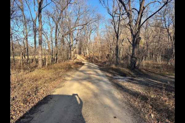
Coffee Creek Road
Coffee Creek Road is one of three private access routes available exclusively to visitors of LOTO Offroad Park. This low-maintenance gravel road is primarily used by local residents, so it's important to remain on the designated path at all times--no off-trail exploring is permitted. While not a tec...
Learn more about Coffee Creek Road

Pointed Rock
Pointed Rock is a shortcut from Rocky Road Trail to the Outer Limits Trail right at the entrance to Coffee Creek and Trail Mix. This trail offers a little more of a challenge than staying on Rocky Road to Outer Limits, with the larger rocks and a greater incline.
Learn more about Pointed Rock
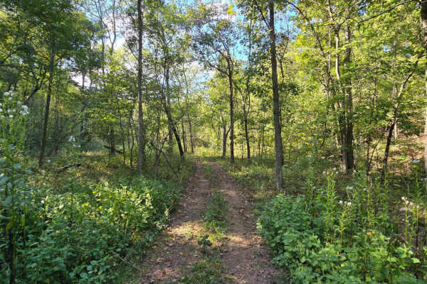
Coffee Crossing
This trail branches off from the original Coffee Creek Trail, continuing along the creek bed until it reaches the edge of the property line. From there, it veers into the woods. Along the way, riders will encounter water crossings. A notable obstacle on this route is a downed tree that requires care...
Learn more about Coffee Crossing
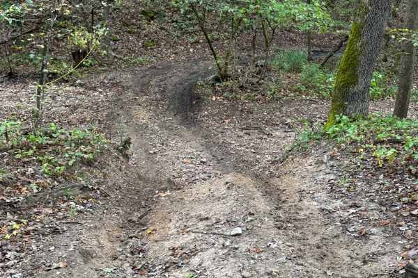
The Wart
The Wart Trail is a short loop off the far northeast corner of the Outer Limits Trail. It drops down fifty feet into a gulch. There is a short, steep drop on the north end of the loop. It is mostly dirt and smaller rocks with muddy areas along the lower gulch section.
Learn more about The Wart
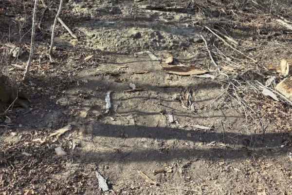
Hill Killer Road
Hill Killer Road is an easy trail accessible by all off-road vehicles. This trail gives access to three of the larger hill climb trails at LOTO Offroad and serves as a parking and viewing area for spectators to watch these extreme climbs just out of the banks of Coffee Creek.
Learn more about Hill Killer Road
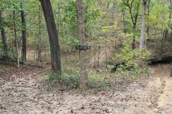
Hungover Trail
This mostly dirt trail provides an easier route through the park and serves as a useful connector to several more challenging trails in the area. This natural rock formation offers a scenic and unique riding experience without requiring advanced technical skills. The trail winds through wooded terra...
Learn more about Hungover Trail
Ledges
This mostly dirt trail provides an easier route through the park and serves as a useful connector to several more challenging trails in the area. This natural rock formation offers a scenic and unique riding experience without requiring advanced technical skills. The trail winds through wooded terra...
Learn more about Ledges
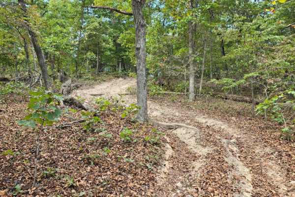
Hungover Loop
This trail is a mostly dirt path that forms a partial loop, reconnecting you to the Hungover Trail and offering a smooth, easy ride through the wooded area. The terrain is straightforward with no major obstacles, making it suitable for all skill levels. The main thing to watch for is a few low-hangi...
Learn more about Hungover Loop
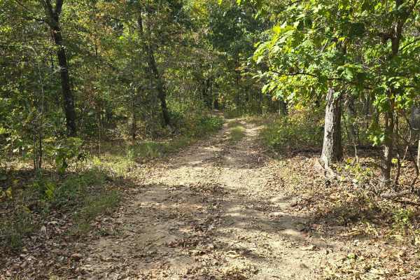
The Saddle
The Saddle is located on the southern side of the park and offers a scenic route that breaks away from the creek area and ventures deep into the wooded terrain. This trail features a 150-foot elevation change, with a couple of moderate hill climbs that add excitement and challenge, especially for le...
Learn more about The Saddle
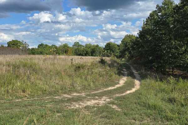
Upper Field Trail
This 0.7-mile offroad trail travels around the upper field of the park, offering an easy and scenic route for riders of all experience levels. It's a great starting point for exploring the park, as it connects to numerous trails in the central area. The trail travels through tall, open fields with w...
Learn more about Upper Field Trail
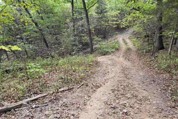
Chigger Lane
Chigger Lane is a mild offroad trail that offers an enjoyable and scenic ride without the intense technical challenges found on tougher routes. The trail traverses along smooth, rolling terrain surrounded by woods and open views of the surrounding property. Small ruts, light gravel, and a few uneven...
Learn more about Chigger Lane
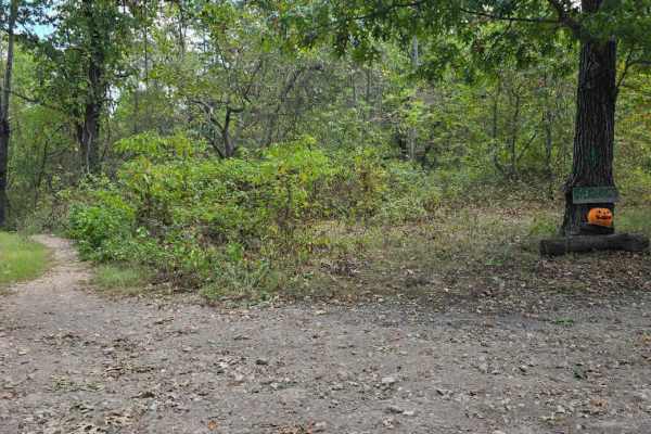
Critter Crossing
This offroad trail, known as Critter Crossing, earns its name from the numerous critters seen along its route. The trail begins by guiding you through a natural wash, then gradually climbs through a series of rocky patches. As you progress, the terrain becomes increasingly technical, culminating at ...
Learn more about Critter Crossing
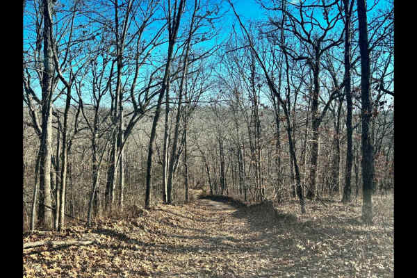
Galveston Road
Galveston Road is one of three private access routes available exclusively to visitors of LOTO Offroad Park. This low-maintenance gravel road is primarily used by local residents, so it's important to remain on the designated path at all times--no off-trail exploring is permitted. While not a techni...
Learn more about Galveston Road
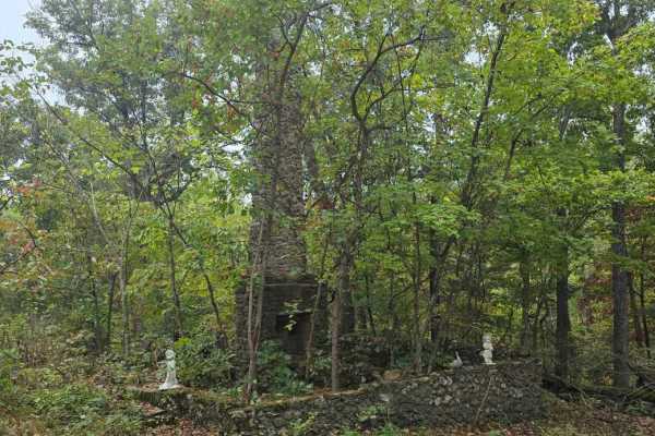
Chimney Trail
Chimney Trail is a scenic offroad route that leads you deep into the woods, passing the remnants of an old homestead where only a lone chimney still stands--hence the name. The trail itself winds through a rocky, wooded landscape but remains relatively moderate in difficulty, with no steep climbs or...
Learn more about Chimney Trail
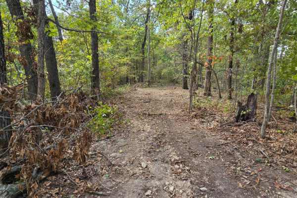
Fur Road
Fur Road is a private-access-only road, but it may be utilized by visitors of LOTO Offroad Park to reach the developing northern logging trail area. This road is a basic, low-maintenance dirt path and should be traveled with caution. Please remain strictly on the trail--do not venture off the road o...
Learn more about Fur Road
Beginner ATV trails near St. Elizabeth, Missouri
Explore ATV-friendly trails near you. These trails are accessible for vehicles up to 50 inches wide, perfect for ATVs and smaller off-road machines.
Strut
Strut is located in the Coffee Creek area. The terrain is a non-maintained gravel road offering a scenic and easy ride. This trail is a gradual, but easy, climb to the top. Riders use this trail as an option to create their own loop trail or shortcut in the Coffee Creek hills trail area.
Learn more about Strut
The Spur
The Spur is located near the Coffee Creek area and offers a slightly more challenging ride compared to Turkey Ridge. The trail is primarily dirt and features a hill climb with a moderate incline. What sets this trail apart is its off-camber hill and narrower path, requiring more focus and control fr...
Learn more about The Spur
Turkey Ridge
Turkey Ridge is located near the Coffee Creek area and offers a smooth, enjoyable ride for off-road riders of all skill levels. The trail is primarily dirt and features a single, simple hill climb that adds just enough elevation change to keep things interesting. Its wider path makes navigation easy...
Learn more about Turkey Ridge
Critter Cutoff
Critter Cutoff is an easy trail that is mostly dirt with a few muddy spots during rainy weather. The lower end connects to Outer Limits on the northeast side of the park and leads uphill to connect with Critter Crossing. Watch for the hunting stand up in the trees close to the north end.
Learn more about Critter Cutoff
Beginner UTV/side-by-side trails near St. Elizabeth, Missouri
Find UTV and side-by-side trails near you. These trails accommodate vehicles up to 60 inches wide, ideal for UTVs, side-by-sides, and wider off-road rigs.
Strut
Strut is located in the Coffee Creek area. The terrain is a non-maintained gravel road offering a scenic and easy ride. This trail is a gradual, but easy, climb to the top. Riders use this trail as an option to create their own loop trail or shortcut in the Coffee Creek hills trail area.
Learn more about Strut
The Spur
The Spur is located near the Coffee Creek area and offers a slightly more challenging ride compared to Turkey Ridge. The trail is primarily dirt and features a hill climb with a moderate incline. What sets this trail apart is its off-camber hill and narrower path, requiring more focus and control fr...
Learn more about The Spur
Turkey Ridge
Turkey Ridge is located near the Coffee Creek area and offers a smooth, enjoyable ride for off-road riders of all skill levels. The trail is primarily dirt and features a single, simple hill climb that adds just enough elevation change to keep things interesting. Its wider path makes navigation easy...
Learn more about Turkey Ridge
Critter Cutoff
Critter Cutoff is an easy trail that is mostly dirt with a few muddy spots during rainy weather. The lower end connects to Outer Limits on the northeast side of the park and leads uphill to connect with Critter Crossing. Watch for the hunting stand up in the trees close to the north end.
Learn more about Critter Cutoff
The onX Offroad Difference
onX Offroad combines trail photos, descriptions, difficulty ratings, width restrictions, seasonality, and more in a user-friendly interface. Available on all devices, with offline access and full compatibility with CarPlay and Android Auto. Discover what you're missing today!
Open Trail Map