
Beginner Off-Road Trails
Near Spring Valley, Arizona
Explore All Beginner Trails Near Spring Valley, Arizona
Beginner Off-Road Trails Near Spring Valley, Arizona
Discover the best beginner-friendly off-road trails near you. These easier, lower-rated trails are a great place to start — browse trail maps, check difficulty ratings, and find your next adventure.
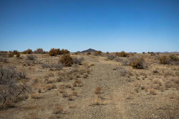
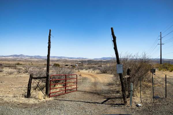
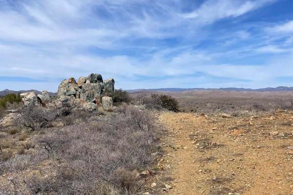
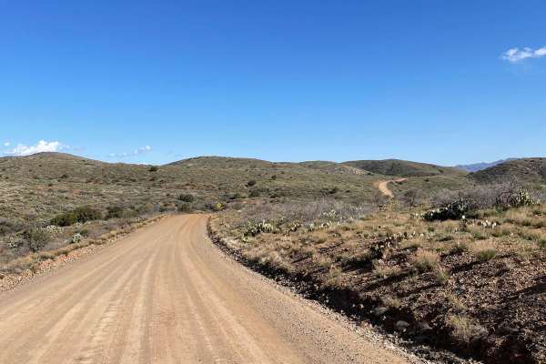
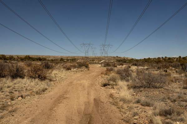
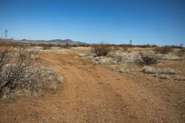
The Way Out
The Way Out is a scenic ridgeline connector trail with curvy gravel terrain and an easygoing drive. With no obstacles along the route, it provides a smooth transition between trails. Cell service is available in some areas with around two bars, but it's still a good idea to have offline maps downloa...
Learn more about The Way Out
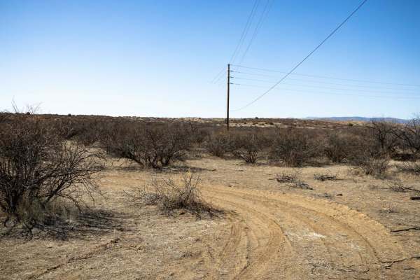
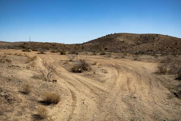
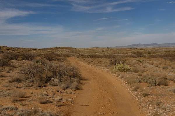
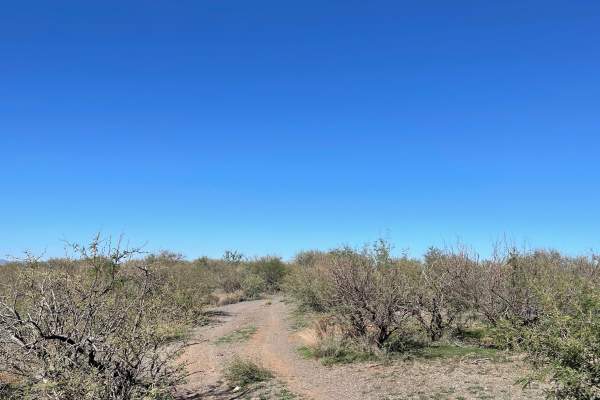
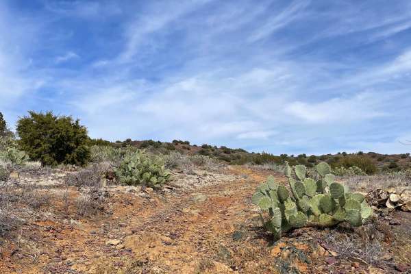
Misled Wash
The Misled Wash Trail is a mellow trail with varying terrain. This trail drops into a sandy wash, but only for a short time. It pops back out into a tight turned section between the overgrown thorny bushes that make their home here in the desert. There are no major obstacles on this trail, though th...
Learn more about Misled Wash
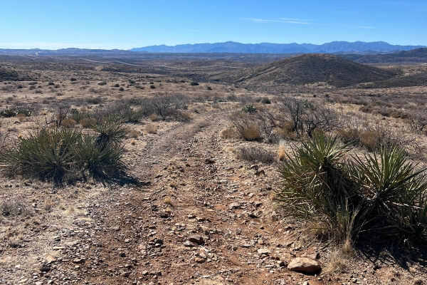
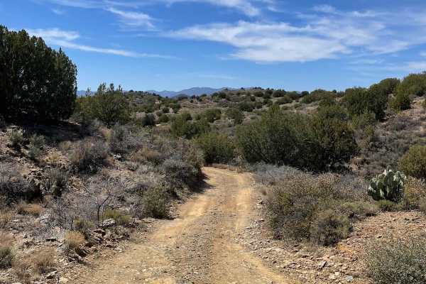
Bc1098
BC1098 is a rugged, one-lane trail that weaves through hills with increasing difficulty as you head south. Erosion and loose rock create challenging sections, with scree-covered slopes adding to the technical nature of the route. Off-camber areas require careful tire placement, making this a trail b...
Learn more about Bc1098
Ridge to Wash
The Ridge to Wash Trail is a narrow, one-lane connector route that descends from rolling hills into a tight, overgrown wash. Expect potential paint damage from encroaching brush, especially in the wash section where vegetation is trying to take over. While the terrain is manageable, the trail's tigh...
Learn more about Ridge to Wash
Backway to 69
Backway to 69 is a narrow, one-lane trail that winds through multiple wash crossings and typical rugged desert terrain. Erosion and ruts are present throughout, but there are no major obstacles, making it a manageable route for most vehicles. There is cell service in the area, but it's always a good...
Learn more about Backway to 69
Bc1099
BC1099 is a pretty straightforward trail with no major obstacles on it. There are some narrow and eroded, off camber sections, as well as dips and curves, but nothing that is too out of the ordinary. The trail is one-lane trail featuring a couple of deep ruts but nothing that will ruin your day. The...
Learn more about Bc1099
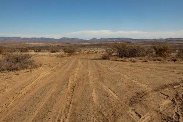
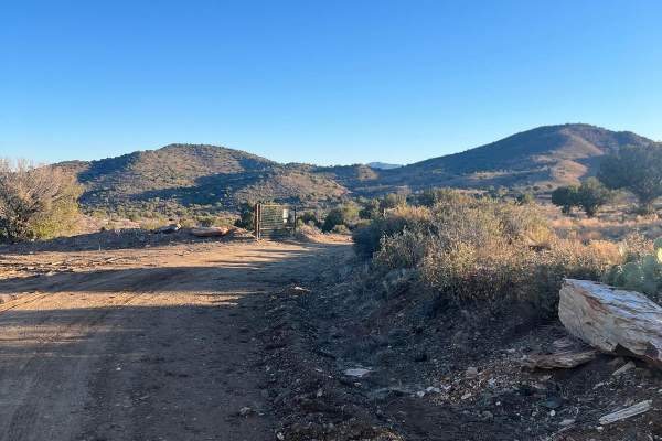
Ranch Road
Ranch Road features a steep wash crossing that serves as the primary obstacle along the route. The trail narrows in sections, requiring careful navigation, but a campsite along the way offers a convenient stopping point. With no cell service in the area, be sure to download offline maps before headi...
Learn more about Ranch Road
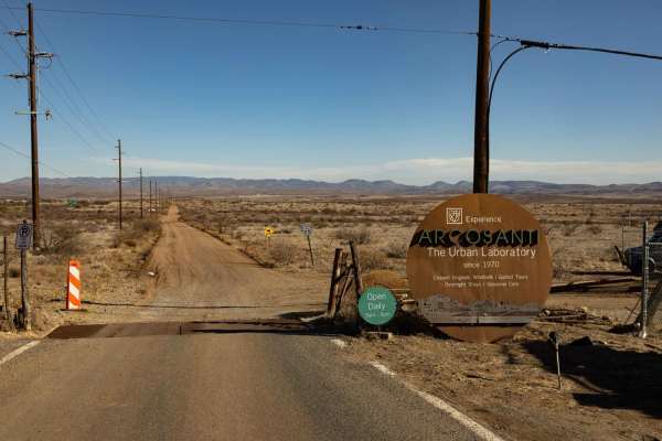
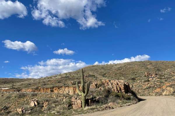
Arcosanti
Arcosanti is a wide and easily accessible trail with no obstacles, making it a great option for a smooth ride. Scattered campsites along the route provide convenient spots to stop and enjoy the surroundings. With 5G service available, staying connected won't be an issue. This trail leads to the Arco...
Learn more about Arcosanti
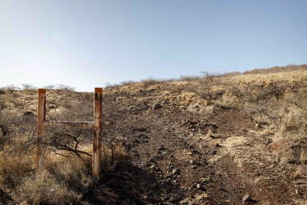
Blue Rock Ridge
The beginning of this trail starts as a maintained dirt road that turns to the northwest. After this maintained dirt road, it starts to get rougher and begins to gain elevation. There are a few small rutted sections as you come to a fence gate you must open and close. After the gate, the road become...
Learn more about Blue Rock Ridge
Bloody Basin Road West
This maintained gravel road connects I-17 to the north entrance to the Crown King Road. This short 3.3-mile road has lots of boondocking sites and a big area for OHV loading and unloading. There are a lot of free-range cattle in this area, so watch out for livestock. There are parts of this road tha...
Learn more about Bloody Basin Road West
Mesa Tanks
It is a winding, mellow trail with rocky terrain and mild erosion. Expect one-lane travel with occasional ditch and wash crossings that add variety to the route. There is the typical rocky and water-damaged terrain, but nothing too unusual. While the trail has some wear and damage, it remains manage...
Learn more about Mesa Tanks
North Blue Bell Road
North Blue Bell Road is a maintained dirt trail that looks to be very muddy after a good rain or snow. This trail starts just off of the North Entrance to Crown King Road guided trail and travels to the Southwest. The trail snakes along and ends abruptly at a locked gate to private property.
Learn more about North Blue Bell Road
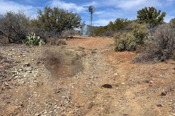
Rock Pasture
Rock Pasture traverses a rugged landscape of rocky pastureland with multiple camping opportunities along the route. A powerline follows portions of the trail, while a steep wash crossing with challenging entrances and exits adds to the terrain's complexity. Expect rocky uphills, ruts, and a final st...
Learn more about Rock Pasture
Interstate 17 Overlook
Interstate 17 Overlook is primarily a dirt trail that runs from Old Sycamore Road and travels to the south. The main obstacle on this trail is a deep rut that is around 12 inches deep and is located right at the beginning off of Old Sycamore Road. As you travel south, the trail has some fairly uneve...
Learn more about Interstate 17 Overlook
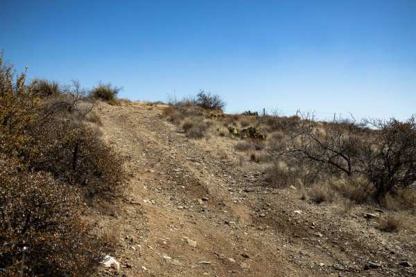
FS 9602X-V Bar Tank
This trail starts laid back and easy, then turns rockier with a few small hills halfway through. The total distance on this trail is 7 miles and takes you through Arizona State Land at the beginning and then onto Prescott National Forest, which is marked by the first gate fence. There are two gates,...
Learn more about FS 9602X-V Bar Tank
North Entrance to Crown King Road
This route takes you from the small town of Mayer to an intersection with the main Crown King Road. This route stretches over 10.5 miles and has nice panoramic views most of the way. You will see several saguaros along with other cacti and ocotillos covering the landscape. There are several nice cam...
Learn more about North Entrance to Crown King Road
Possibles Pasture
The Possibles Pasture Trail is a mellow trail that is just bumpy. A new trail, it was mapped before the masses got a chance to smooth out the terrain. There's plenty of room to camp out on this public land, but you'll have to do it in the long grasses and rock that speckle this landscape. There are ...
Learn more about Possibles Pasture
Copper Mountain Foothills
This trail is short and takes you through the southeast foothills of Copper Mountain. The overall surface of this trail is dirt, with some rutted areas accompanied by loose rocks and small rock outcroppings. You will pass through junipers and cacti with colorful stones on the road's surface.Some are...
Learn more about Copper Mountain Foothills
Copper Mountain
Copper Mountain is a very laid-back and scenic trail. As you traverse up towards Copper Mountain, you will have to open and close a gate. From that gate, the trail climbs to the foot of Copper Mountain. As you get closer to the ending point, the trail will get very scenic with junipers all around an...
Learn more about Copper Mountain
Windmill Way
Windmill Way rolls through the foothills South and Southeast of Copper Mountain. This trail will take you from higher-elevation junipers to a lower-elevation desert landscape. The Western section of this trail has a dirt surface with a few rocky and rutted areas. There is a green gate you must open ...
Learn more about Windmill Way
Beginner ATV trails near Spring Valley, Arizona
Explore ATV-friendly trails near you. These trails are accessible for vehicles up to 50 inches wide, perfect for ATVs and smaller off-road machines.
The Way Out
The Way Out is a scenic ridgeline connector trail with curvy gravel terrain and an easygoing drive. With no obstacles along the route, it provides a smooth transition between trails. Cell service is available in some areas with around two bars, but it's still a good idea to have offline maps downloa...
Learn more about The Way Out
Misled Wash
The Misled Wash Trail is a mellow trail with varying terrain. This trail drops into a sandy wash, but only for a short time. It pops back out into a tight turned section between the overgrown thorny bushes that make their home here in the desert. There are no major obstacles on this trail, though th...
Learn more about Misled Wash
Bc1098
BC1098 is a rugged, one-lane trail that weaves through hills with increasing difficulty as you head south. Erosion and loose rock create challenging sections, with scree-covered slopes adding to the technical nature of the route. Off-camber areas require careful tire placement, making this a trail b...
Learn more about Bc1098
Ridge to Wash
The Ridge to Wash Trail is a narrow, one-lane connector route that descends from rolling hills into a tight, overgrown wash. Expect potential paint damage from encroaching brush, especially in the wash section where vegetation is trying to take over. While the terrain is manageable, the trail's tigh...
Learn more about Ridge to Wash
Beginner UTV/side-by-side trails near Spring Valley, Arizona
Find UTV and side-by-side trails near you. These trails accommodate vehicles up to 60 inches wide, ideal for UTVs, side-by-sides, and wider off-road rigs.
The Way Out
The Way Out is a scenic ridgeline connector trail with curvy gravel terrain and an easygoing drive. With no obstacles along the route, it provides a smooth transition between trails. Cell service is available in some areas with around two bars, but it's still a good idea to have offline maps downloa...
Learn more about The Way Out
Misled Wash
The Misled Wash Trail is a mellow trail with varying terrain. This trail drops into a sandy wash, but only for a short time. It pops back out into a tight turned section between the overgrown thorny bushes that make their home here in the desert. There are no major obstacles on this trail, though th...
Learn more about Misled Wash
Bc1098
BC1098 is a rugged, one-lane trail that weaves through hills with increasing difficulty as you head south. Erosion and loose rock create challenging sections, with scree-covered slopes adding to the technical nature of the route. Off-camber areas require careful tire placement, making this a trail b...
Learn more about Bc1098
Ridge to Wash
The Ridge to Wash Trail is a narrow, one-lane connector route that descends from rolling hills into a tight, overgrown wash. Expect potential paint damage from encroaching brush, especially in the wash section where vegetation is trying to take over. While the terrain is manageable, the trail's tigh...
Learn more about Ridge to Wash
The onX Offroad Difference
onX Offroad combines trail photos, descriptions, difficulty ratings, width restrictions, seasonality, and more in a user-friendly interface. Available on all devices, with offline access and full compatibility with CarPlay and Android Auto. Discover what you're missing today!
Open Trail Map