
Beginner Off-Road Trails
Near Silver Springs, Florida
Explore All Beginner Trails Near Silver Springs, Florida
Beginner Off-Road Trails Near Silver Springs, Florida
Discover the best beginner-friendly off-road trails near you. These easier, lower-rated trails are a great place to start — browse trail maps, check difficulty ratings, and find your next adventure.
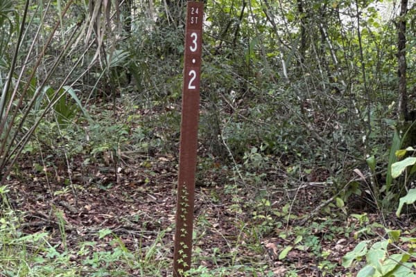
Ocklawaha Trail - ONF SE24ST
The Ocklawaha Trail, also known as Ocala National Forest Road SE24ST, connects SE 1st Road at the west end and Highway 314A at the east end in the southwest of the Ocala National Forest. The trail gives you access to some dirt roads that will take you to the Ocklawaha River. The road conditions are ...
Learn more about Ocklawaha Trail - ONF SE24ST
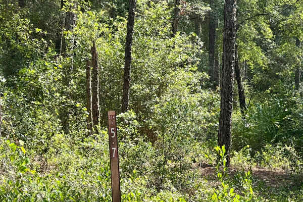
Ocala National Forest | Trail 314A-5.7
This trail consists of mud and dirt and is very wet during raining season. You can expect thick brush that can cause pinstriping so be careful, but also includes patches of pine forest. The cell phone service is okay enough to send messages & make phone calls in an emergency with Verizon.
Learn more about Ocala National Forest | Trail 314A-5.7
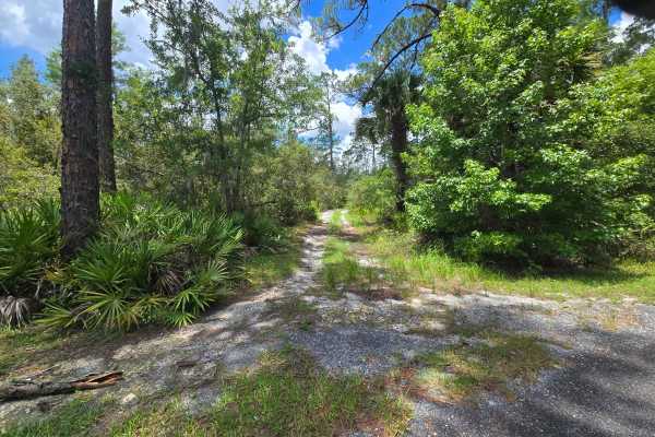
Lake Charles Way
This trail features lots of soft sand and low-hanging tree branches. Guaranteed for vehicle scratches. Some small open areas are available to pull over and rest, and allow other vehicles to go by. There are also several camping spots along this trail, located in proximity to the lake. Be aware of ve...
Learn more about Lake Charles Way
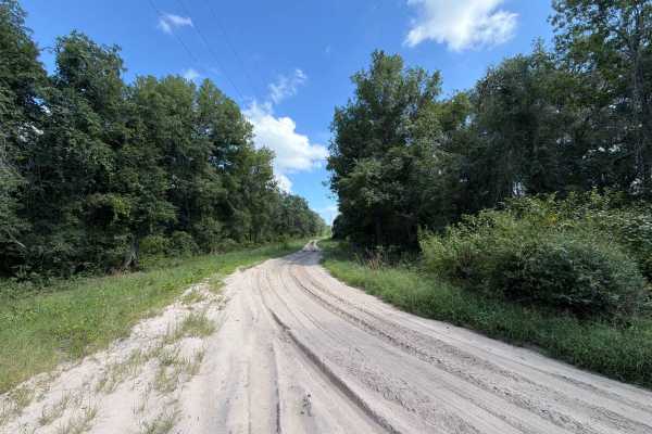
ONF 40-6.1
Ocala National Forest Road 40-6.1 connects SR 40 at the north end and CR 314A at the south end in the south west of the Ocala National Forest. The trail takes you along the power lines and gives you access to a few dirt roads in the area. The road conditions are a mixture of packed sand, loose sand ...
Learn more about ONF 40-6.1
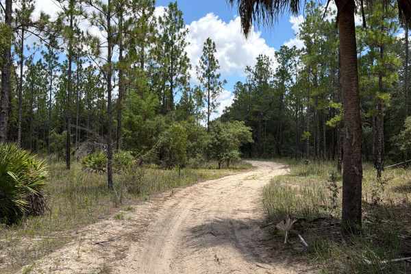
FS 47ST-0.7
Ocala National Forest Road 47ST-0.7 connects Ocklawaha Trail at the north end and FS 137AV-5.0A at the south end in the southwest of the Ocala National Forest. The trail gives you access to a few dirt roads in the area. The road conditions are a mixture of packed and loose sand, with some deep holes...
Learn more about FS 47ST-0.7
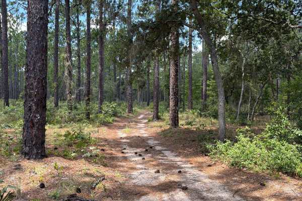
FS 137AV-5.0A
Ocala National Forest Road 137AV-5.0A connects Tomahawk Loop at the north end and Shoesale Lake Loop at the south end in the southwest of the Ocala National Forest. The trail gives you access to a few dirt roads in the area. The road conditions are a mixture of packed and loose sand, with some deep ...
Learn more about FS 137AV-5.0A
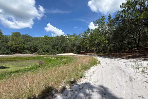
Two Pond Loop
Two Pond Loop is a short, fun loop trail around two fishing ponds in the southwest of the Ocala National Forest. The road conditions are a mixture of packed and loose sand, with some deep holes that can fill with 2-foot-deep mud after rainy days. The road is not always wide enough for two vehicles t...
Learn more about Two Pond Loop
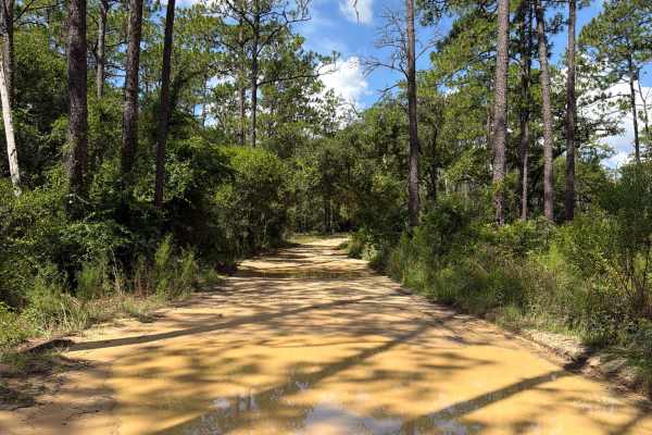
Tomahawk Loop - FS 314A-3.9
Tomahawk Loop, also known as FS 314A-3.9, takes you around Tomahawk Lake in the southwest of the Ocala National Forest. The trail gives you access to the lake and a few dirt roads in the area. The road conditions are a mixture of packed sand, loose sand, and some deep holes that can turn into 2-foot...
Learn more about Tomahawk Loop - FS 314A-3.9
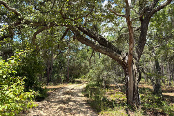
Shoesale Lake Loop
Shoesale Lake Loop takes you around Shoesale Lake in the southwest of the Ocala National Forest. The trail gives you access to Shoesale Lake, Round Lake, a few ponds, and a few dirt roads in the area. The road conditions are a mixture of packed and loose sand, with some deep holes that can fill with...
Learn more about Shoesale Lake Loop
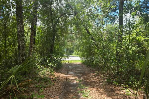
Lake Eaton Way
This trail will lead you to Lake Eaton. A combination of flat white sand and mud, and small water crossings after a rainfall. Halfway through the trail, you can leave the route to view Lake Eaton, where there will be a small pier and an area to launch a boat into the water. Several camping spots are...
Learn more about Lake Eaton Way
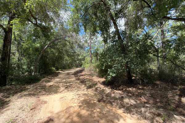
Little Tomahawk - FS 314A-3.9A
Little Tomahawk, also known as Ocala National Forest Road 314A-3.9A, starts and ends at the Tomahawk Loop in the southwest of the Ocala National Forest. The trail gives you access to a few dirt roads in the area, as well as Tomahawk and Sunrise Lake. The road conditions are a mixture of packed and l...
Learn more about Little Tomahawk - FS 314A-3.9A
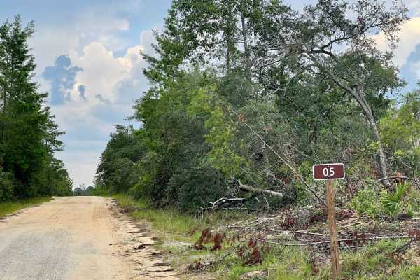
Ocala National Forest | Trail 5
This trail is an easier trail consisting of hard clay roads and gravel/rock. This is the perfect trail to ride around and just enjoy nature around you without crazy obstacles. We did encounter a rattlesnake while driving around this area so be mindful of that. The cell phone service is good enough t...
Learn more about Ocala National Forest | Trail 5
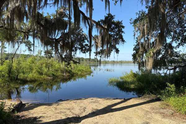
Lake Jumper - ONF 5-18.9
The Lake Jumper Trail, also known as Ocala National Forest Road 5-18.9, connects Lake Eaton Trail at the north end and North Prairie West-East at the south end in the north part of the Ocala National Forest. The trail gives you access to two primitive boat ramps at Lake Jumper and Lake Lou. The road...
Learn more about Lake Jumper - ONF 5-18.9
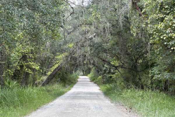
Ocala National Forest SE 13th Avenue
The Ocala National Forest SE 13th Avenue connects Ocklawaha Trail at the north end and State Route 314A at the south end of the trail at the west boundary of the Ocala National Forest. The trail gives you access to some dirt roads around the Tomahawk Lake and the Ocklawaha Prairie. The road conditio...
Learn more about Ocala National Forest SE 13th Avenue
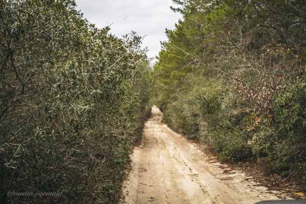
FR 46/Pats Island Rd
Forest Road 46, or Pats Island Road, is located in Ocala National Forest and is the access point for the Pats Island Trailhead. The trail starts in the east on SR-19. The first 5.6 miles of the trail are relatively easy and can be completed with any vehicle. After the first 5.6 miles, you will pass ...
Learn more about FR 46/Pats Island Rd
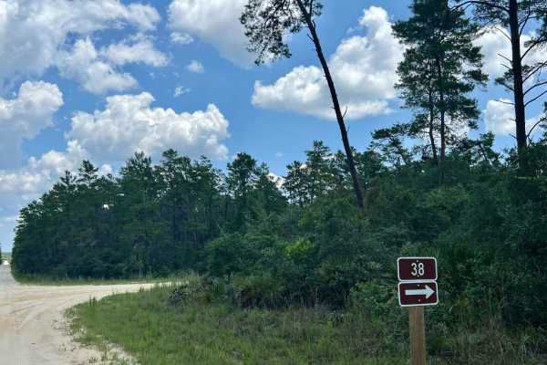
Ocala National Forest | Trail 38
This trail is one of the main roads in Ocala National Forest and is a well-maintained clay/dirt road. On trail 38 you can expect multiple intersections to explore other trails including one paved intersection. This road is very straightforward and can be driven with even a 2wd SUV. The phone signal ...
Learn more about Ocala National Forest | Trail 38
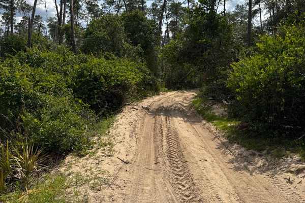
North Prairie West-East - ONF 170 AV-0.7
The North Prairie West-East Trail, also known as Ocala National Forest Road 170 AV-0.7, connects Lake Eaton Trail at the east end and SE 170th AVE at the west end in the north part of the Ocala National Forest. The trail gives you access to the North Prairie and the south end of the Lake Jumper trai...
Learn more about North Prairie West-East - ONF 170 AV-0.7
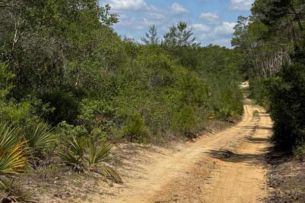
Level 2 - ONF 5-14.5/9-16.2
The Level 2 Trail, also known as Ocala National Forest Road 5-14.5/9-16.2, connects Lake Eaton trail at the west end and ONF 40-14.6 at the east end in the north part of the Ocala National Forest. The trail gives you access to the Tread Lightly! Four Wheel Drive Way and several other trails. The roa...
Learn more about Level 2 - ONF 5-14.5/9-16.2
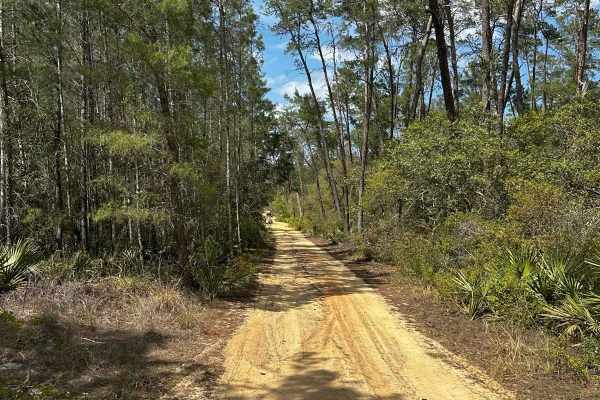
ONF Trail 5-18.4
ONF Trail 5-18.4 runs North to South from ONF Trail 5 to ONF 50. The trail is primarily loose sand;you can expect deep sand in places and be met with tight, mildly technical sections. Some areas can have water and mud after rainfall--potential for dirt and water up to 3 feet deep. The trail is gener...
Learn more about ONF Trail 5-18.4
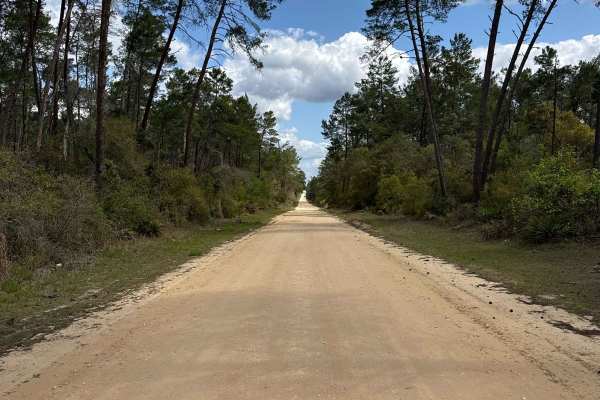
Eaton Creek - ONF 1
The Eaton Creek Trail, also known as Ocala National Forest Road 1, connects CR 316 at the north end and CR 314 at the south end in the North Part of the ONF. The trail shares parts with the Tread Lightly! Four Wheel Drive Way (Florida's only Jeep Badge of Honor trail) and is crossing that trail seve...
Learn more about Eaton Creek - ONF 1
Beginner ATV trails near Silver Springs, Florida
Explore ATV-friendly trails near you. These trails are accessible for vehicles up to 50 inches wide, perfect for ATVs and smaller off-road machines.
Ocklawaha Trail - ONF SE24ST
The Ocklawaha Trail, also known as Ocala National Forest Road SE24ST, connects SE 1st Road at the west end and Highway 314A at the east end in the southwest of the Ocala National Forest. The trail gives you access to some dirt roads that will take you to the Ocklawaha River. The road conditions are ...
Learn more about Ocklawaha Trail - ONF SE24ST
Lake Charles Way
This trail features lots of soft sand and low-hanging tree branches. Guaranteed for vehicle scratches. Some small open areas are available to pull over and rest, and allow other vehicles to go by. There are also several camping spots along this trail, located in proximity to the lake. Be aware of ve...
Learn more about Lake Charles Way
ONF 40-6.1
Ocala National Forest Road 40-6.1 connects SR 40 at the north end and CR 314A at the south end in the south west of the Ocala National Forest. The trail takes you along the power lines and gives you access to a few dirt roads in the area. The road conditions are a mixture of packed sand, loose sand ...
Learn more about ONF 40-6.1
Two Pond Loop
Two Pond Loop is a short, fun loop trail around two fishing ponds in the southwest of the Ocala National Forest. The road conditions are a mixture of packed and loose sand, with some deep holes that can fill with 2-foot-deep mud after rainy days. The road is not always wide enough for two vehicles t...
Learn more about Two Pond Loop
Beginner UTV/side-by-side trails near Silver Springs, Florida
Find UTV and side-by-side trails near you. These trails accommodate vehicles up to 60 inches wide, ideal for UTVs, side-by-sides, and wider off-road rigs.
Ocklawaha Trail - ONF SE24ST
The Ocklawaha Trail, also known as Ocala National Forest Road SE24ST, connects SE 1st Road at the west end and Highway 314A at the east end in the southwest of the Ocala National Forest. The trail gives you access to some dirt roads that will take you to the Ocklawaha River. The road conditions are ...
Learn more about Ocklawaha Trail - ONF SE24ST
Lake Charles Way
This trail features lots of soft sand and low-hanging tree branches. Guaranteed for vehicle scratches. Some small open areas are available to pull over and rest, and allow other vehicles to go by. There are also several camping spots along this trail, located in proximity to the lake. Be aware of ve...
Learn more about Lake Charles Way
ONF 40-6.1
Ocala National Forest Road 40-6.1 connects SR 40 at the north end and CR 314A at the south end in the south west of the Ocala National Forest. The trail takes you along the power lines and gives you access to a few dirt roads in the area. The road conditions are a mixture of packed sand, loose sand ...
Learn more about ONF 40-6.1
Two Pond Loop
Two Pond Loop is a short, fun loop trail around two fishing ponds in the southwest of the Ocala National Forest. The road conditions are a mixture of packed and loose sand, with some deep holes that can fill with 2-foot-deep mud after rainy days. The road is not always wide enough for two vehicles t...
Learn more about Two Pond Loop
The onX Offroad Difference
onX Offroad combines trail photos, descriptions, difficulty ratings, width restrictions, seasonality, and more in a user-friendly interface. Available on all devices, with offline access and full compatibility with CarPlay and Android Auto. Discover what you're missing today!
Open Trail Map