
Beginner Off-Road Trails
Near Omak, Washington
Explore All Beginner Trails Near Omak, Washington
Beginner Off-Road Trails Near Omak, Washington
Discover the best beginner-friendly off-road trails near you. These easier, lower-rated trails are a great place to start — browse trail maps, check difficulty ratings, and find your next adventure.
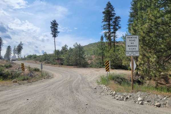
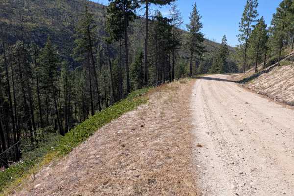
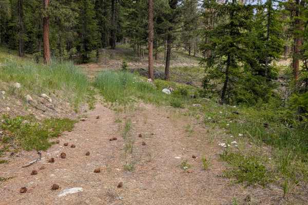
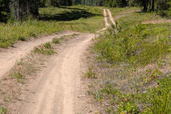
FR 2045 - Loup Loup Canyon Road
This route is a part of the WABDR (Section 5) and is therefore often trafficked by ADV riders. Please use caution. The trail from Highway 20 begins as a gentle and easy dirt road - wide enough for two vehicles to pass one another. Once you reach the Rock Creek Campground, the trail progressively bec...
Learn more about FR 2045 - Loup Loup Canyon Road
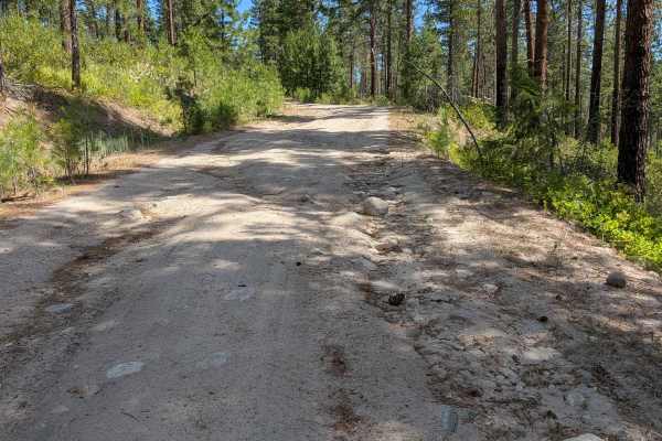
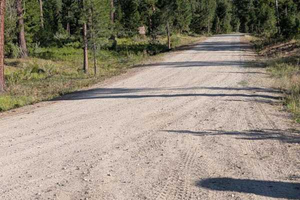
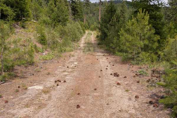
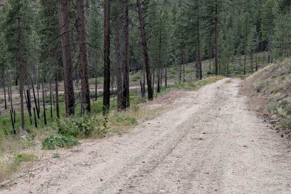
West Fork Rock Creek Road
This dirt road starts out from Highway 20 as a two-lane road, narrowing to 1.5 and finally a single lane as it climbs north. There is ample room to meet another vehicle in most places. Most of the road has open views. There are some ruts and sections of erosion damage, along with some embedded and l...
Learn more about West Fork Rock Creek Road

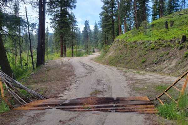
North Cook Mountain Road North half
This road starts as 1.5 lanes of gravel, but the gravel doesn't last for long. It stays about the same width, but the surface reverts to dirt. It meanders along the ridge, giving a glimpse of Highway 20 below, before ending abruptly at a locked gate where the road crosses onto private property. It i...
Learn more about North Cook Mountain Road North half

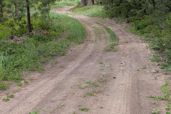
De Pue Creek Road
This is a single-lane dirt road picking up where the West Fork Rock Creek Road ends at an intersection with an unnamed road. It has some embedded and loose rock a little over six inches high, and one or two water bars that are a bit steep. The road is overgrown in places. It travels through both for...
Learn more about De Pue Creek Road
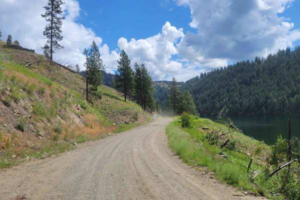
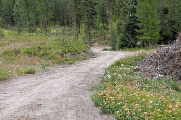
Sinlahekin Road
This is part of the WABDR (Section 5) and is therefore often trafficked by ADV riders and other adventurists. Please use caution. This section of trail is a nice wide dirt road - wide enough for vehicles to pass one another. It is maintained for access to the several campgrounds, lakes, and communit...
Learn more about Sinlahekin Road
North Cook Mountain Road - South half
This is an easy 1.5-lane dirt road that begins at the junction of Cook Mountain Road and South Cook Mountain Road. What shows along the side of where the road starts as a stream is actually a fair-sized pond or small lake, at least at the beginning of summer. The track ends about 2.7 miles later at ...
Learn more about North Cook Mountain Road - South half
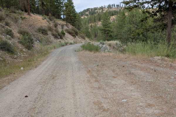
Rock Lakes Road
The northern part of this road is 1.5 lanes and in good condition. The rest of it is a single-lane dirt road with sections of shallow ruts, mild erosion damage, and some embedded and loose rocks. All of those were less than six inches high or deep. There are plenty of places to safely meet another v...
Learn more about Rock Lakes Road
E332411C
This 1- to 1.5-lane dirt road connects to Woody Summit Road and Woody Mountain Road via short DNR spurs. It is wide enough to meet another vehicle's safety standards for much of its length. There were some shallow ruts and both loose and embedded rocks less than six inches deep or high. It travels t...
Learn more about E332411C
3700-100 Conger Creek Rd
This road starts out from the main FS 37 road as a 1.5 lane smooth natural surface road. It stays like that until the national forest boundary, where it starts to climb and has significant erosion ruts and damage. The road here is still wide enough that most of the ruts can be easily avoided. The ro...
Learn more about 3700-100 Conger Creek Rd
Lower Buck Mountain
From Highway 20, this is the route to take to reach Buck Mountain/Fire lookout tower. The trail begins as a nice wide two-track that weaves and winds its way up through the Loup Loup National Forest. There is some erosion damage on the trail - ruts and ridges. The further up you travel, the more nar...
Learn more about Lower Buck Mountain
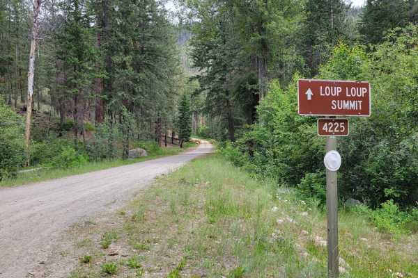
FR 4225 - 42
This is a combination of Forest Road 4225 (South Beaver) and 4200 (South Fork Salmon). This route takes you into the Okanogan National Forest, leading to several other off-shoot trails and trailheads. At the beginning of the trail is Beaver Campground. The road is pretty well maintained during the w...
Learn more about FR 4225 - 42
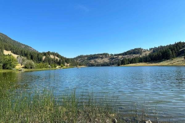
Chopaka Lake
This trail is mostly gravel state and county roads leading through the Sinlahekin Wildlife Refuge. It goes up the steep Chopaka Grade overlooking Palmer Lake and Palmer Mountain (historic gold mining country) and to Chopaka Lake, a favorite camping, swimming, boating, and fishing spot near Loomis, W...
Learn more about Chopaka Lake
E332418G
This single-lane dirt road connects Woody Summit Road to the E332408u and E332418u. It has a fair amount of embedded rocks less than six inches high, with some similar-sized loose rocks as well. It is a little overgrown in places. There are places where two vehicles can meet safely. The road goes th...
Learn more about E332418G
FS 3800-025
This road starts as a 1.5-lane gravel track and narrows to a single lane as it climbs. There is room to safely meet another vehicle in most places. The road also becomes a more natural surface instead of gravel as it climbs. There are a few switchbacks with a reasonable radius, and the area above th...
Learn more about FS 3800-025
E332407T
This single-lane dirt road starts out looking pretty grassy and overgrown, but opens up quickly. There are some ruts and embedded rocks, some obvious and some hidden by vegetation, but none are more than 6" high or deep. The road goes through mixed forest and along an opening. There are also some bo...
Learn more about E332407T
E332408U
This is a single-lane dirt road connecting from the Woody Summit road to the 332418u and 332418g roads. There are several other side roads to explore as well. The road has some ruts, erosion damage, embedded and loose rock, but nothing over six inches deep or high. There were some water bars, but th...
Learn more about E332408U
Chiliwist Creek Road
This mostly dirt road is 1.5 lanes wide for most of its length. There are some areas of gravel and some larger loose rock on decent inclines. There are 18" water bars, but they're not steep or abrupt. The road goes through an area of mixed forest that has been logged. It connects from Woody Mountain...
Learn more about Chiliwist Creek Road
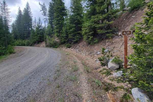
NF 4235 - Starvation Mountain
Turning North off of Forest Road 42, this trail weaves and winds its way upward into the Okanogan National Forest. The trail begins as a nice wide road but the higher up the mountainside, the more narrow it becomes. Water erosion and runoff were noted on the trail during rainy/wet conditions. Aside ...
Learn more about NF 4235 - Starvation Mountain
4100-810
This single-lane dirt road drops down from the main FS 41 road to follow power lines until it comes out at State Highway 20. It does have some ruts cut deeper by erosion damage in some places, and filled back with silt in others. The area is generally forested, although kept a bit more clear right b...
Learn more about 4100-810
Lower Thrapp Mountain - E332419e
This mostly dirt road is 1.5 lanes wide for most of its length. There are some areas of gravel and some larger loose rock on decent inclines. There are 18" water bars, but they're not steep or abrupt. The road goes through an area of mixed forest that has been logged. It connects from Woody Mountain...
Learn more about Lower Thrapp Mountain - E332419e
Beginner ATV trails near Omak, Washington
Explore ATV-friendly trails near you. These trails are accessible for vehicles up to 50 inches wide, perfect for ATVs and smaller off-road machines.
FR 2045 - Loup Loup Canyon Road
This route is a part of the WABDR (Section 5) and is therefore often trafficked by ADV riders. Please use caution. The trail from Highway 20 begins as a gentle and easy dirt road - wide enough for two vehicles to pass one another. Once you reach the Rock Creek Campground, the trail progressively bec...
Learn more about FR 2045 - Loup Loup Canyon Road
West Fork Rock Creek Road
This dirt road starts out from Highway 20 as a two-lane road, narrowing to 1.5 and finally a single lane as it climbs north. There is ample room to meet another vehicle in most places. Most of the road has open views. There are some ruts and sections of erosion damage, along with some embedded and l...
Learn more about West Fork Rock Creek Road
North Cook Mountain Road North half
This road starts as 1.5 lanes of gravel, but the gravel doesn't last for long. It stays about the same width, but the surface reverts to dirt. It meanders along the ridge, giving a glimpse of Highway 20 below, before ending abruptly at a locked gate where the road crosses onto private property. It i...
Learn more about North Cook Mountain Road North half
De Pue Creek Road
This is a single-lane dirt road picking up where the West Fork Rock Creek Road ends at an intersection with an unnamed road. It has some embedded and loose rock a little over six inches high, and one or two water bars that are a bit steep. The road is overgrown in places. It travels through both for...
Learn more about De Pue Creek Road
Beginner UTV/side-by-side trails near Omak, Washington
Find UTV and side-by-side trails near you. These trails accommodate vehicles up to 60 inches wide, ideal for UTVs, side-by-sides, and wider off-road rigs.
FR 2045 - Loup Loup Canyon Road
This route is a part of the WABDR (Section 5) and is therefore often trafficked by ADV riders. Please use caution. The trail from Highway 20 begins as a gentle and easy dirt road - wide enough for two vehicles to pass one another. Once you reach the Rock Creek Campground, the trail progressively bec...
Learn more about FR 2045 - Loup Loup Canyon Road
West Fork Rock Creek Road
This dirt road starts out from Highway 20 as a two-lane road, narrowing to 1.5 and finally a single lane as it climbs north. There is ample room to meet another vehicle in most places. Most of the road has open views. There are some ruts and sections of erosion damage, along with some embedded and l...
Learn more about West Fork Rock Creek Road
North Cook Mountain Road North half
This road starts as 1.5 lanes of gravel, but the gravel doesn't last for long. It stays about the same width, but the surface reverts to dirt. It meanders along the ridge, giving a glimpse of Highway 20 below, before ending abruptly at a locked gate where the road crosses onto private property. It i...
Learn more about North Cook Mountain Road North half
De Pue Creek Road
This is a single-lane dirt road picking up where the West Fork Rock Creek Road ends at an intersection with an unnamed road. It has some embedded and loose rock a little over six inches high, and one or two water bars that are a bit steep. The road is overgrown in places. It travels through both for...
Learn more about De Pue Creek Road
The onX Offroad Difference
onX Offroad combines trail photos, descriptions, difficulty ratings, width restrictions, seasonality, and more in a user-friendly interface. Available on all devices, with offline access and full compatibility with CarPlay and Android Auto. Discover what you're missing today!
Open Trail Map