
Beginner Off-Road Trails
Near Ogdensburg, New York
Explore All Beginner Trails Near Ogdensburg, New York
Beginner Off-Road Trails Near Ogdensburg, New York
Discover the best beginner-friendly off-road trails near you. These easier, lower-rated trails are a great place to start — browse trail maps, check difficulty ratings, and find your next adventure.
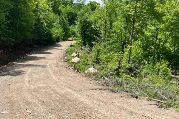
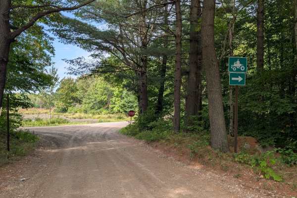
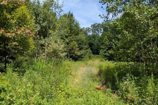
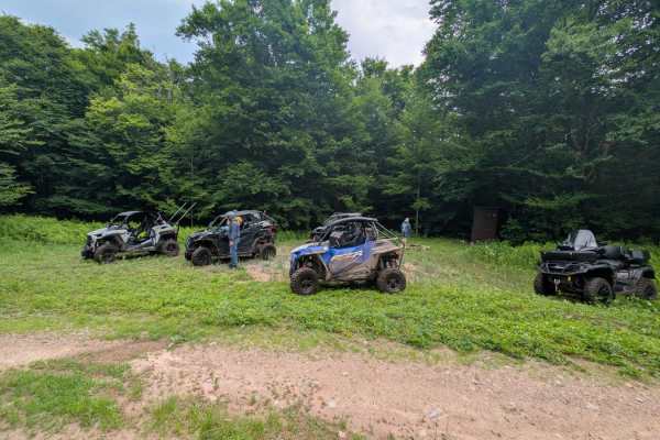
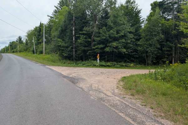
St. Lawrence County - Connector ATV Multi-Use Trail
St. Lawrence County - Connector ATV Multi-Use Trail from GT's in Russell, NY to Parking Lot/Trailhead in South Colton. It is a mix between a little black top, Season roads, and Gravel Logging roads through state forests and hunting clubs. A few parts can get somewhat muddy. Most of the logging trail...
Learn more about St. Lawrence County - Connector ATV Multi-Use Trail
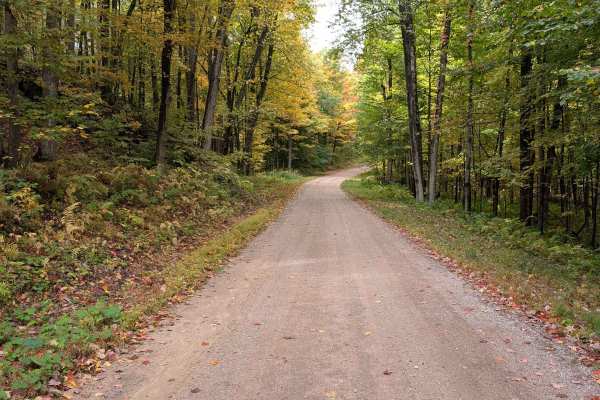
Boyd Pond Access Road
This is an out-and-back gravel, minimum maintenance town road for access to Boyd Pond. There is a hand launch area for small, non-motorized boats. Great trout fishing here. The road is easy and the landscape is attractive, as it winds through the Adirondack forest. Wildlife sightings of deer, turke...
Learn more about Boyd Pond Access Road
Dana Hill-Given Road Connector
This is a new off-road trail built through private land parcels to connect Dana Hill and Given Roads. The roads are part of the St.Lawrence County Multi-Use Trail open to ATVs, SxSs, and Dirt Bikes. The trail meanders through the North Country forest land. This piece will connect St. Lawrence and L...
Learn more about Dana Hill-Given Road Connector
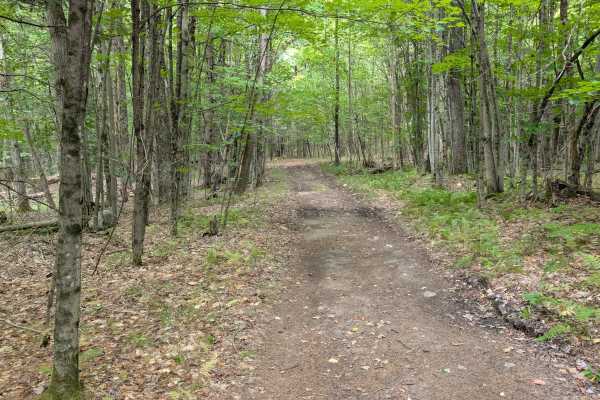
SLC-32
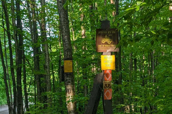
This is a 60-inch Trail on St. Lawrence County Parcel 20. Heavily wooded forest, dirt trail. Easy and fun to ride, observing nature and wildlife. Part of the original County Pilot Trail, formed 20 years ago to promote ATV riding in the county. It is a "multiuse trail" open to horses, hiking, bik...
Learn more about SLC-32
St. Lawrence County Pilot Trail
This is a minimum maintenance gravel road made available through the County Multiuse Trail System. It connects several county parcels with 60-inch trails for ATV and SxS recreation. There are several New York State Forest Parcels it passes through, with multiple hiking trails. Wildlife viewing is po...
Learn more about St. Lawrence County Pilot Trail
SLC-13
This is a 60-inch trail on St. Lawrence County Parcel 20. It is a heavily wooded forest, dirt trail. Easy and fun to ride, observing nature and wildlife. Part of the original County Pilot Trail, formed 20 years ago to promote ATV riding in the county. It is a "multiuse trail" open to horses, hiking...
Learn more about SLC-13
SLC-9
This is a 60-inch trail on St. Lawrence County Parcel 20. Heavily wooded forest, dirt trail. Easy and fun to ride, observing nature and wildlife. Part of the original County Pilot Trail, formed 20 years ago to promote ATV riding in the county. It is a "multiuse trail" open to horses, hiking, bikes, ...
Learn more about SLC-9
Lake George Road
This is a minimum maintenance gravel, town road. It can be used as an alternate route for the County Multi-Use Trail. Will avoid Degrass and other areas. It passes through the Silver Hill State Forest Parcel. There are a few primitive campsites along the road in the State Forest. Suitable for small ...
Learn more about Lake George Road

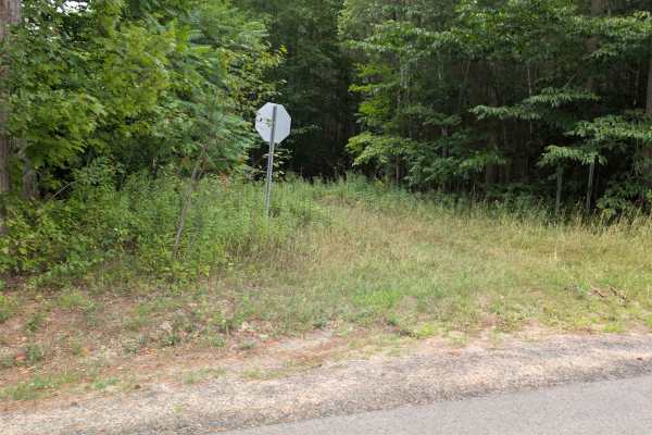
SLC-TRAIL 21
This is a 50" Trail on St. Lawrence County Parcel 20. It is a heavily wooded forest, dirt trail. It is an easy and fun to ride, observing nature and wildlife. Part of the original County Pilot Trail, formed 20 years ago to promote ATV riding in the county. It is a "multiuse trail" open to horses, hi...
Learn more about SLC-TRAIL 21
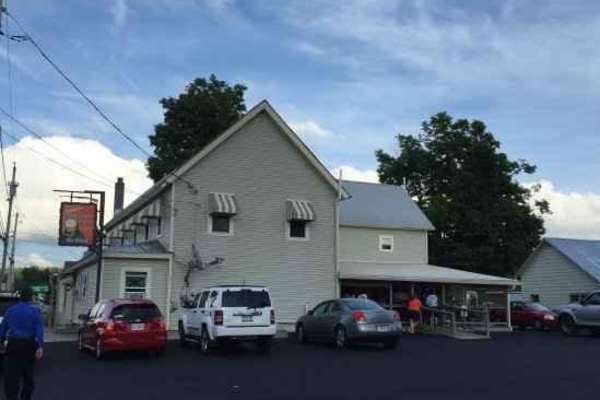
S. Colton to Parishville
This is a route from South Colton to Parishville. Parking is available behind Robideau's Mahogany Ridge where there is food and drinks. Kitty corner to RMR is Boyce's Gas Station which besides gas has food, drinks, and trail supplies. The trail winds through French Pod and Picketville area and comes...
Learn more about S. Colton to Parishville
Albert Marsh Hill Trail
This is a 50 inch trail off the Albert Marsh Hill Road. Easy to start, then the uphill, wet, rocky part comes in. We used winches a few times, more for safety than as an aid to continue. Interesting and challenging ride to the top of the hill. Excellent experience for beginners. Lots of wildlife t...
Learn more about Albert Marsh Hill Trail
SLC-FOREST-14
This is a 50" Trail on St. Lawrence County Parcel 20. Heavily wooded forest, dirt trail. Easy and fun to ride, observing nature and wildlife. Part of the original County Pilot Trail, formed 20 years ago to promote ATV riding in the county. It is a "multiuse trail" open to horses, hiking, bikes, ...
Learn more about SLC-FOREST-14
SLC-Forest-12
This is a 50-inch rail on St. Lawrence County Parcel 20. This is a heavily wooded forest, dirt trail. Easy and fun to ride, observing nature and wildlife. Part of the original County Pilot Trail, formed 20 years ago to promote ATV riding in the county. It is a "multiuse trail" open to horses, hiking...
Learn more about SLC-Forest-12

Albert Marsh Hill Road
This old logging road connects the Albert Marsh Road/county multi-use trail to Goblet Springs Road. There is camping available off this route. The trail extends through some marshy, rocky areas that are not maintained. Down trees may be a problem, so it can be good to be prepared with saws and winc...
Learn more about Albert Marsh Hill Road
Albert Marsh Road
This old logging road runs through the Long Pond Conservation Easement. The trail can become extremely wet and challenging, especially after rain. Large rocks and boulders add to the technical difficulty. Route is open to ATVs and SxSs. It's a great option to include as part of a full day of riding ...
Learn more about Albert Marsh Road
Sellecks Road Loop
This is an old logging road and skidder trail that loops off the Little John Road on the nearby Grass River (good trout stream). Sellecks Road part is an old gravel road, skidder trail is wet, stony, and muddy in several areas. Take it slow and easy over the stones.
Learn more about Sellecks Road Loop
Clare Road
Another unmaintained logging road in the Long Pond Conservation Easement. It's a gravel surface, easy going, with lots of scenery. Several wetland areas (beaver ponds) are along this trail. Wildlife, deer, bear, and beaver are common sightings, along with waterfowl and birds. Enjoy the easy drive he...
Learn more about Clare Road
Goblet Springs Road
This is a gravel logging road to the Goblet Springs site. There is a camping area available on this trail. It's normally an easy drive, but weather and logging conditions can make that change. A high clearance 4x4 vehicle is recommended. Access is wide open and would be quite remote. There are not m...
Learn more about Goblet Springs Road
Goldmine Road
This trail is an unmaintained gravel road on the New York Goldmine Conservation Easement and provides a fun driving experience with wetlands and wildlife to see. The gravel road follows along the Rainbow Reservoir that was formed in the 1950s by a power generation project on the Raquette River. Loca...
Learn more about Goldmine Road
Long Pond Main Haul Road
This is the main access road to all other trails on the easement. It is an umaintained gravel road, starts at NY Rt56 and connects to the St. Lawrence County Multi-Use Trail and other trails and roads with campsites. Generally, easily accessible by high clearance vehicles and RVs. This can vary depe...
Learn more about Long Pond Main Haul Road
Beginner ATV trails near Ogdensburg, New York
Explore ATV-friendly trails near you. These trails are accessible for vehicles up to 50 inches wide, perfect for ATVs and smaller off-road machines.
St. Lawrence County - Connector ATV Multi-Use Trail
St. Lawrence County - Connector ATV Multi-Use Trail from GT's in Russell, NY to Parking Lot/Trailhead in South Colton. It is a mix between a little black top, Season roads, and Gravel Logging roads through state forests and hunting clubs. A few parts can get somewhat muddy. Most of the logging trail...
Learn more about St. Lawrence County - Connector ATV Multi-Use Trail
Boyd Pond Access Road
This is an out-and-back gravel, minimum maintenance town road for access to Boyd Pond. There is a hand launch area for small, non-motorized boats. Great trout fishing here. The road is easy and the landscape is attractive, as it winds through the Adirondack forest. Wildlife sightings of deer, turke...
Learn more about Boyd Pond Access Road
Dana Hill-Given Road Connector
This is a new off-road trail built through private land parcels to connect Dana Hill and Given Roads. The roads are part of the St.Lawrence County Multi-Use Trail open to ATVs, SxSs, and Dirt Bikes. The trail meanders through the North Country forest land. This piece will connect St. Lawrence and L...
Learn more about Dana Hill-Given Road Connector
SLC-32
This is a 60-inch Trail on St. Lawrence County Parcel 20. Heavily wooded forest, dirt trail. Easy and fun to ride, observing nature and wildlife. Part of the original County Pilot Trail, formed 20 years ago to promote ATV riding in the county. It is a "multiuse trail" open to horses, hiking, bik...
Learn more about SLC-32
Beginner UTV/side-by-side trails near Ogdensburg, New York
Find UTV and side-by-side trails near you. These trails accommodate vehicles up to 60 inches wide, ideal for UTVs, side-by-sides, and wider off-road rigs.
St. Lawrence County - Connector ATV Multi-Use Trail
St. Lawrence County - Connector ATV Multi-Use Trail from GT's in Russell, NY to Parking Lot/Trailhead in South Colton. It is a mix between a little black top, Season roads, and Gravel Logging roads through state forests and hunting clubs. A few parts can get somewhat muddy. Most of the logging trail...
Learn more about St. Lawrence County - Connector ATV Multi-Use Trail
Boyd Pond Access Road
This is an out-and-back gravel, minimum maintenance town road for access to Boyd Pond. There is a hand launch area for small, non-motorized boats. Great trout fishing here. The road is easy and the landscape is attractive, as it winds through the Adirondack forest. Wildlife sightings of deer, turke...
Learn more about Boyd Pond Access Road
Dana Hill-Given Road Connector
This is a new off-road trail built through private land parcels to connect Dana Hill and Given Roads. The roads are part of the St.Lawrence County Multi-Use Trail open to ATVs, SxSs, and Dirt Bikes. The trail meanders through the North Country forest land. This piece will connect St. Lawrence and L...
Learn more about Dana Hill-Given Road Connector
SLC-32
This is a 60-inch Trail on St. Lawrence County Parcel 20. Heavily wooded forest, dirt trail. Easy and fun to ride, observing nature and wildlife. Part of the original County Pilot Trail, formed 20 years ago to promote ATV riding in the county. It is a "multiuse trail" open to horses, hiking, bik...
Learn more about SLC-32
The onX Offroad Difference
onX Offroad combines trail photos, descriptions, difficulty ratings, width restrictions, seasonality, and more in a user-friendly interface. Available on all devices, with offline access and full compatibility with CarPlay and Android Auto. Discover what you're missing today!
Open Trail Map