
Beginner Off-Road Trails
Near Mooresville, Missouri
Explore All Beginner Trails Near Mooresville, Missouri
Beginner Off-Road Trails Near Mooresville, Missouri
Discover the best beginner-friendly off-road trails near you. These easier, lower-rated trails are a great place to start — browse trail maps, check difficulty ratings, and find your next adventure.
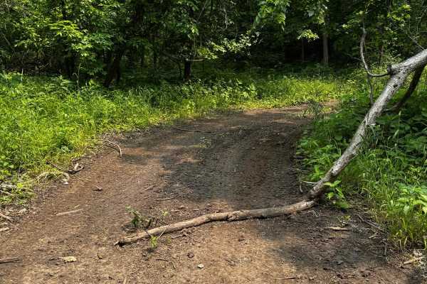
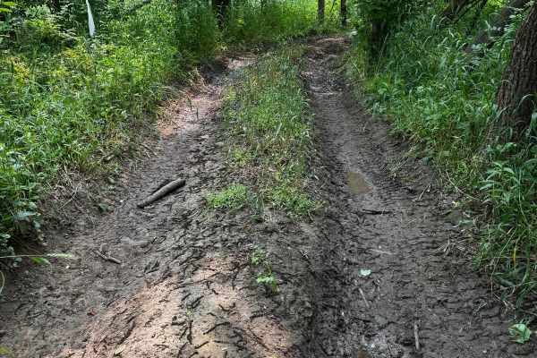
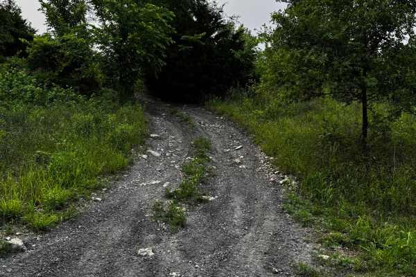
Green 63
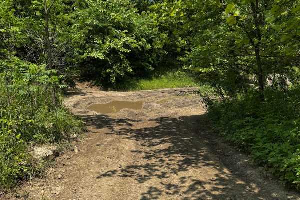
This trail winds through wooded terrain with a dirt base and features moderate hill climbs and sections that are slightly off-camber. In dry conditions, it's manageable for most rigs, but after rainfall, the trail becomes slick and much more challenging. Trees lining the trail increase the risk of b...
Learn more about Green 63
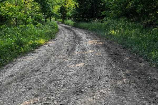
Green 95
Green 95 is located between Yellow 62 and Green 62, providing an alternate path to transition from the more difficult Yellow 62 onto Green 63, or the other way around. This trail is relatively easy and does not feature any major obstacles, making it a smoother route option for drivers looking to avo...
Learn more about Green 95
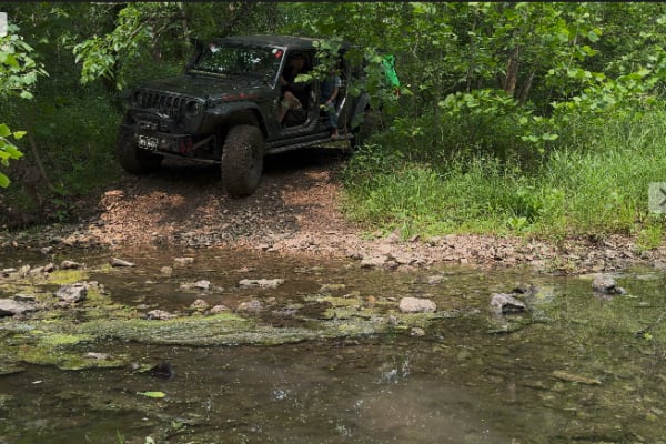
Green 58
This trail descends and crosses the West Fork of the Crooked River, where for a short distance you'll be driving directly in the waterway. During periods of high water levels, this trail becomes extremely hazardous and should be avoided to prevent serious vehicle damage. It links yellow 57 at one en...
Learn more about Green 58
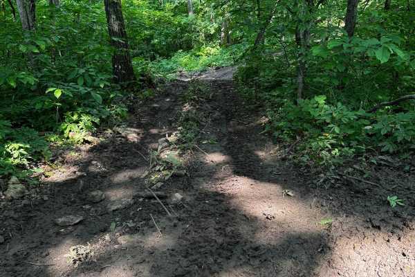
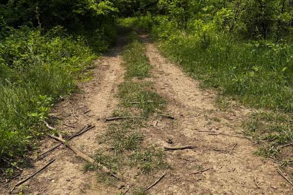
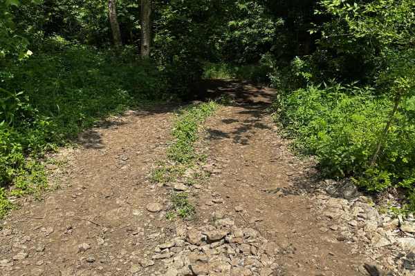
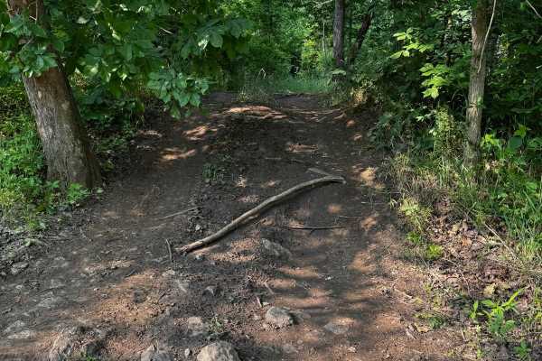
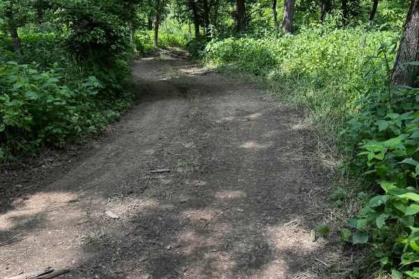
Green 55
This trail winds through a shaded section of the forest and is primarily a dirt base, which means muddy conditions are likely after rain. The route includes several hill sections, but none are overly steep or technical. It zigzags between trees, and some areas are tight, especially for full-size veh...
Learn more about Green 55
Green 60
Ray Rocks Map is as follows: green are easy trails, Moderate trails on their map are orange, hard and extreme trails are colored red. For the trails without names, we have spoken with Marriane, one of the owners, and we are going with green for easy, yellow for moderate, and red for difficult on the...
Learn more about Green 60
Green 65
This trail winds through wooded terrain with several tight spots between trees, making pin striping likely for wider vehicles. While there are no significant obstacles, the trail does have several areas that may collect mud, especially after rainfall. This trail winds through wooded terrain with sev...
Learn more about Green 65
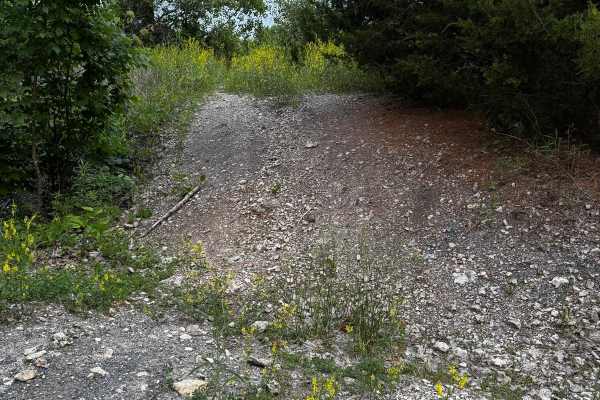
Green 81
This trail is an easygoing path that winds through a wooded area with moderate tree overgrowth, which may lead to some pin striping on wider vehicles. The surface is a mix of dirt and rock, generally firm under normal conditions. It offers a relaxed drive with no significant obstacles to navigate.
Learn more about Green 81

Green 52
This trail travels along the southeast corner and loops around to the backside of the abandoned house. While it presents no major obstacles, sections of the trail have significant overgrowth from nearby vegetation. These areas, especially around the curves, can become tight for longer wheelbases or ...
Learn more about Green 52
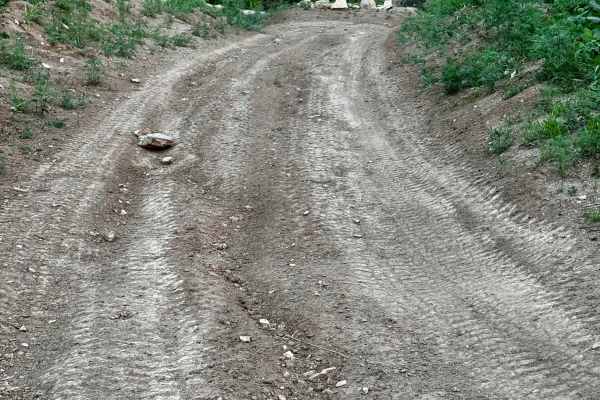
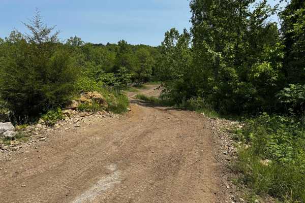
Green 49
This trail consists of a long hill climb on a mostly dirt base, which can become slick and muddy when wet, making traction more difficult. At the top of the hill, there's a dirt mound on the right side that can be driven up for a great photo opportunity. While there are no major obstacles, the combi...
Learn more about Green 49
Green 46
This trail runs between Yellow 40 and Green 42 and is extremely tight due to dense tree coverage and brush overgrowth, making pin striping unavoidable. While the flowers along the way may look harmless, they have large thorns that can scratch paint. The trail follows a steady uphill grade with tight...
Learn more about Green 46
Green 50
This trail parallels Green 49 along a short, gradual uphill route with a dirt and rock surface. It's generally straightforward with no major obstacles to navigate. However, when wet, the terrain can become slick, requiring more attention to traction and vehicle control. This trail follows a short, g...
Learn more about Green 50
Green 74
This trail connects to Yellow 71 and Red 72 at one end, and to Yellow 73 at the other. It features some narrow sections squeezed between trees, requiring careful navigation to avoid scratches. There are a few small mud holes scattered along the route, but otherwise, the trail remains relatively easy...
Learn more about Green 74
Green 48
This trail offers a straightforward path overall, but it does include an off-camber section at a washout area that tilts the vehicle toward nearby trees. When the trail is wet, this spot becomes more challenging and may cause sliding, increasing the risk of body damage. The rest of the trail is rela...
Learn more about Green 48
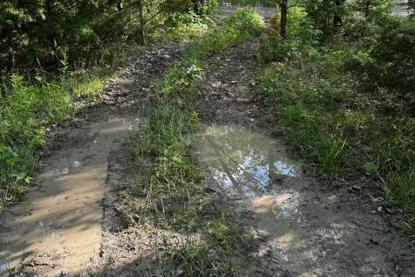
Green 66
This trail winds through a mostly flat stretch with a mix of mud and rutted sections. There are no major obstacles, but recent rain can make the surface slick and messy. Drivers are encouraged to stay within the existing trail path to avoid widening it or causing unnecessary trail damage.
Learn more about Green 66
Green 89
Green 89 is connected to Green 3 at one end and Green 78 at the other end, with access to Mud Bog Run 90 and Green 88 in the middle. This trail winds through wooded terrain and features a few tight sections where tree limbs may brush against wider vehicles, making pinstriping likely. The main challe...
Learn more about Green 89
Green 3
Green 3 is a loop-style trail that features a single hill. It serves as a connector and leads to several other trailheads in the area, making it a great route for exploring multiple sections of the trail system. Its moderate terrain makes it suitable for drivers of varying experience levels who are ...
Learn more about Green 3
Green 216
This short loop trail winds through a narrow tree-lined path near the Donut Bowl, making it a great spot to park and watch others attempt the main obstacle. While the trail itself doesn't have any major technical challenges, the tight spacing between trees means pinstriping is highly likely, especia...
Learn more about Green 216
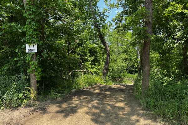
Gateway 70
This trail provides access to a newly developed area of the park and includes a water crossing that should be approached with caution. Water depth can vary depending on recent rainfall, and high levels may make it impassable. When water levels are low, the rocky base is visible. Beyond the crossing,...
Learn more about Gateway 70

Green 51
This trail features several tight sections where pinstriping is likely due to close tree spacing. It leads to an interesting older abandoned house with lots of character, though its deteriorating condition may make it unsafe to enter. The area around the house offers a unique spot that would be perf...
Learn more about Green 51
Green 78
This trail winds through a densely wooded section of the park where overgrown trees make pinstriping likely. It takes you down through the West Fork Crooked River for a short distance, so water levels should be checked before proceeding cautiously. The trail begins off Yellow 71 and runs nearly para...
Learn more about Green 78
Beginner ATV trails near Mooresville, Missouri
Explore ATV-friendly trails near you. These trails are accessible for vehicles up to 50 inches wide, perfect for ATVs and smaller off-road machines.
Green 63
This trail winds through wooded terrain with a dirt base and features moderate hill climbs and sections that are slightly off-camber. In dry conditions, it's manageable for most rigs, but after rainfall, the trail becomes slick and much more challenging. Trees lining the trail increase the risk of b...
Learn more about Green 63
Green 95
Green 95 is located between Yellow 62 and Green 62, providing an alternate path to transition from the more difficult Yellow 62 onto Green 63, or the other way around. This trail is relatively easy and does not feature any major obstacles, making it a smoother route option for drivers looking to avo...
Learn more about Green 95
Green 58
This trail descends and crosses the West Fork of the Crooked River, where for a short distance you'll be driving directly in the waterway. During periods of high water levels, this trail becomes extremely hazardous and should be avoided to prevent serious vehicle damage. It links yellow 57 at one en...
Learn more about Green 58
Green 55
This trail winds through a shaded section of the forest and is primarily a dirt base, which means muddy conditions are likely after rain. The route includes several hill sections, but none are overly steep or technical. It zigzags between trees, and some areas are tight, especially for full-size veh...
Learn more about Green 55
Beginner UTV/side-by-side trails near Mooresville, Missouri
Find UTV and side-by-side trails near you. These trails accommodate vehicles up to 60 inches wide, ideal for UTVs, side-by-sides, and wider off-road rigs.
Green 63
This trail winds through wooded terrain with a dirt base and features moderate hill climbs and sections that are slightly off-camber. In dry conditions, it's manageable for most rigs, but after rainfall, the trail becomes slick and much more challenging. Trees lining the trail increase the risk of b...
Learn more about Green 63
Green 95
Green 95 is located between Yellow 62 and Green 62, providing an alternate path to transition from the more difficult Yellow 62 onto Green 63, or the other way around. This trail is relatively easy and does not feature any major obstacles, making it a smoother route option for drivers looking to avo...
Learn more about Green 95
Green 58
This trail descends and crosses the West Fork of the Crooked River, where for a short distance you'll be driving directly in the waterway. During periods of high water levels, this trail becomes extremely hazardous and should be avoided to prevent serious vehicle damage. It links yellow 57 at one en...
Learn more about Green 58
Green 55
This trail winds through a shaded section of the forest and is primarily a dirt base, which means muddy conditions are likely after rain. The route includes several hill sections, but none are overly steep or technical. It zigzags between trees, and some areas are tight, especially for full-size veh...
Learn more about Green 55
The onX Offroad Difference
onX Offroad combines trail photos, descriptions, difficulty ratings, width restrictions, seasonality, and more in a user-friendly interface. Available on all devices, with offline access and full compatibility with CarPlay and Android Auto. Discover what you're missing today!
Open Trail Map