
Beginner Off-Road Trails
Near Minatare, Nebraska
Explore All Beginner Trails Near Minatare, Nebraska
Beginner Off-Road Trails Near Minatare, Nebraska
Discover the best beginner-friendly off-road trails near you. These easier, lower-rated trails are a great place to start — browse trail maps, check difficulty ratings, and find your next adventure.
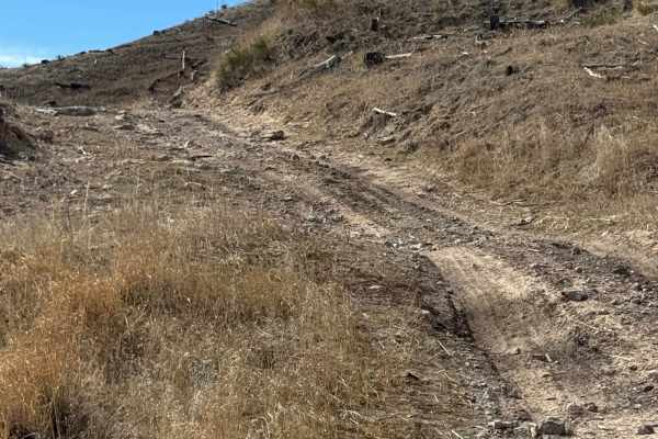
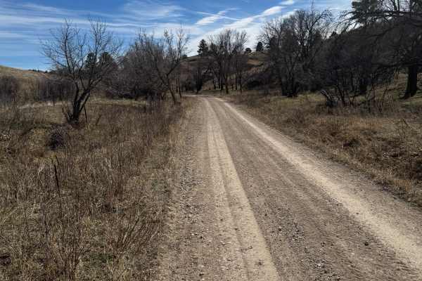
Coffee Mill Butte - FS 702
This is a 2-track trail that's mainly comprised of hard-pack dirt. The trail has ruts, washouts, and whoops that could fill with mud after rain. A few of the whoops could require a vehicle with extra ground clearance, as they are tall and steep. There is also a small section that's filled with loose...
Learn more about Coffee Mill Butte - FS 702
West Hat Creek Road
West Hat Creek Road can be accessed off of Highway 20 just east of the town of Harrison and runs north to Hat Creek Road. This is a double-wide dirt road that is maintained and graded. Sections can become muddy in wet conditions. The surrounding area consists of large ranches, and you have great vie...
Learn more about West Hat Creek Road
Strong Canyon Run
This is a two-part trail that's mainly 2-track and is comprised of hard-pack dirt. The trail starts off pretty tame when accessed from Kings Canyon, but conditions worsen after turning onto Trail 214. There are a few spots on 214 where off-camber conditions will reach 18-20 degrees, maybe more if yo...
Learn more about Strong Canyon Run
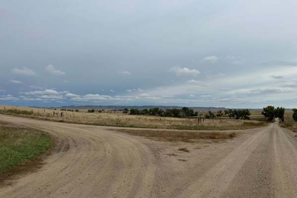
Hat Creek Road
Hat Creek Road can be accessed off of West Hat Creek Road, just northeast of the town of Harrison, and runs north to Montrose Road. This is a double-wide dirt road that is maintained and graded. Sections can become muddy in wet conditions. The surrounding area consists of large ranches, and you have...
Learn more about Hat Creek Road

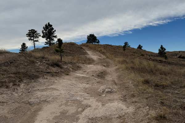
Outrider - FS 779
This is a 2-track trail that is very rough due to it being mainly composed of ruts and washouts. Be prepared to be bounced around quite a bit. It's an out-and-back that offers some amazing views of the area. The trail is mainly comprised of hard pack dirt, but there are a few areas where it becomes ...
Learn more about Outrider - FS 779
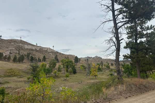
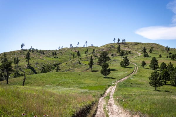
Kings Canyon Trail
The trail starts and ends on loose gravel. The center section of the trail is mainly comprised of 2-track hard pack natural dirt. There are several large 'whoops', ruts, and washouts along the center section where additional ground clearance would be preferred. The center section has the potential t...
Learn more about Kings Canyon Trail
Little Wolves
The three trails that comprise this route are all at or just under 3 miles long. The first two-thirds (Little Wolf East and Highline) are well-maintained gravel;most of the last third is dirt - a portion of which washes out and creates deep, wide ruts. Several areas of the trail also collect runoff ...
Learn more about Little Wolves
Highline Trail
This trail is a 2-track that's mainly comprised of hard pack dirt. There are minor to medium-sized washouts and ruts that can fill with mud after heavy rainfall. There are a few areas on the 213 section of this run that will put you in slight off-camber conditions. The majority of this run is in ope...
Learn more about Highline Trail
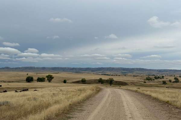
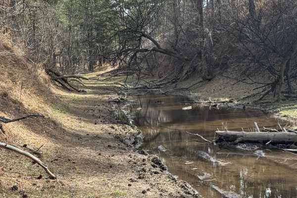
Orella Road
The road begins on the west end off of Hat Creek Road and continues east to Toadstool Road. The area is surrounded by ranch land goes through private property with cattle on the road. Unique geologic features can be seen Toadstool area of the Ogala National Grassland. Beautiful views of grasslands a...
Learn more about Orella Road
Beginner ATV trails near Minatare, Nebraska
Explore ATV-friendly trails near you. These trails are accessible for vehicles up to 50 inches wide, perfect for ATVs and smaller off-road machines.
Coffee Mill Butte - FS 702
This is a 2-track trail that's mainly comprised of hard-pack dirt. The trail has ruts, washouts, and whoops that could fill with mud after rain. A few of the whoops could require a vehicle with extra ground clearance, as they are tall and steep. There is also a small section that's filled with loose...
Learn more about Coffee Mill Butte - FS 702
Strong Canyon Run
This is a two-part trail that's mainly 2-track and is comprised of hard-pack dirt. The trail starts off pretty tame when accessed from Kings Canyon, but conditions worsen after turning onto Trail 214. There are a few spots on 214 where off-camber conditions will reach 18-20 degrees, maybe more if yo...
Learn more about Strong Canyon Run
Outrider - FS 779
This is a 2-track trail that is very rough due to it being mainly composed of ruts and washouts. Be prepared to be bounced around quite a bit. It's an out-and-back that offers some amazing views of the area. The trail is mainly comprised of hard pack dirt, but there are a few areas where it becomes ...
Learn more about Outrider - FS 779
Kings Canyon Trail
The trail starts and ends on loose gravel. The center section of the trail is mainly comprised of 2-track hard pack natural dirt. There are several large 'whoops', ruts, and washouts along the center section where additional ground clearance would be preferred. The center section has the potential t...
Learn more about Kings Canyon Trail
Beginner UTV/side-by-side trails near Minatare, Nebraska
Find UTV and side-by-side trails near you. These trails accommodate vehicles up to 60 inches wide, ideal for UTVs, side-by-sides, and wider off-road rigs.
Coffee Mill Butte - FS 702
This is a 2-track trail that's mainly comprised of hard-pack dirt. The trail has ruts, washouts, and whoops that could fill with mud after rain. A few of the whoops could require a vehicle with extra ground clearance, as they are tall and steep. There is also a small section that's filled with loose...
Learn more about Coffee Mill Butte - FS 702
Strong Canyon Run
This is a two-part trail that's mainly 2-track and is comprised of hard-pack dirt. The trail starts off pretty tame when accessed from Kings Canyon, but conditions worsen after turning onto Trail 214. There are a few spots on 214 where off-camber conditions will reach 18-20 degrees, maybe more if yo...
Learn more about Strong Canyon Run
Outrider - FS 779
This is a 2-track trail that is very rough due to it being mainly composed of ruts and washouts. Be prepared to be bounced around quite a bit. It's an out-and-back that offers some amazing views of the area. The trail is mainly comprised of hard pack dirt, but there are a few areas where it becomes ...
Learn more about Outrider - FS 779
Kings Canyon Trail
The trail starts and ends on loose gravel. The center section of the trail is mainly comprised of 2-track hard pack natural dirt. There are several large 'whoops', ruts, and washouts along the center section where additional ground clearance would be preferred. The center section has the potential t...
Learn more about Kings Canyon Trail
The onX Offroad Difference
onX Offroad combines trail photos, descriptions, difficulty ratings, width restrictions, seasonality, and more in a user-friendly interface. Available on all devices, with offline access and full compatibility with CarPlay and Android Auto. Discover what you're missing today!
Open Trail Map