
Beginner Off-Road Trails
Near McCall, Idaho
Explore All Beginner Trails Near McCall, Idaho
Beginner Off-Road Trails Near McCall, Idaho
Discover the best beginner-friendly off-road trails near you. These easier, lower-rated trails are a great place to start — browse trail maps, check difficulty ratings, and find your next adventure.
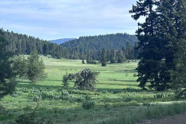
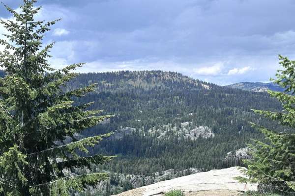
Brundage Mountain
Brundage Mountain trail is an 11.2-mile point-to-point trail that traverses the east slope of Brundage Mountain and ends at Brundage Reservoir. While traveling this trail, you will have the opportunity to see several types of wildlife. This is a single vehicle width trail with erosion damage and loo...
Learn more about Brundage Mountain
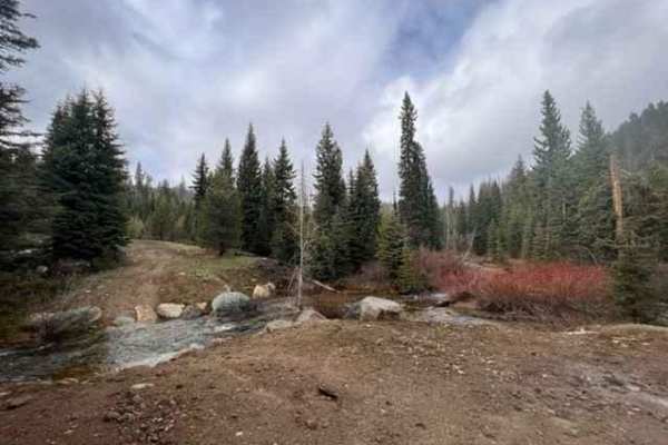
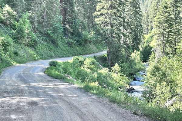
Full Creek Crossing
This trail is a gravel road with many potholes along the way. The scenery is beautiful, with many different locations to pull over and camp. At the end of the route, you will come to a water crossing at Full Creek, which is only passable by a higher clearance vehicle, mainly due to the transition in...
Learn more about Full Creek Crossing
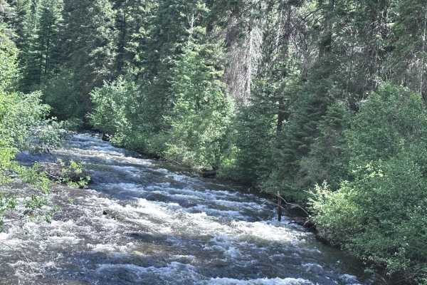
Goose Creek
Goose Creek is a 7.1-mile point-to-point trail that starts off of Highway 55 and travels along Goose Creek and connects with the Meadows Goose Lake Trail. This trail also gives access to the Last Chance Campground. Goose Creek Trail is a well-maintained Forest Service road up to the campground. Afte...
Learn more about Goose Creek
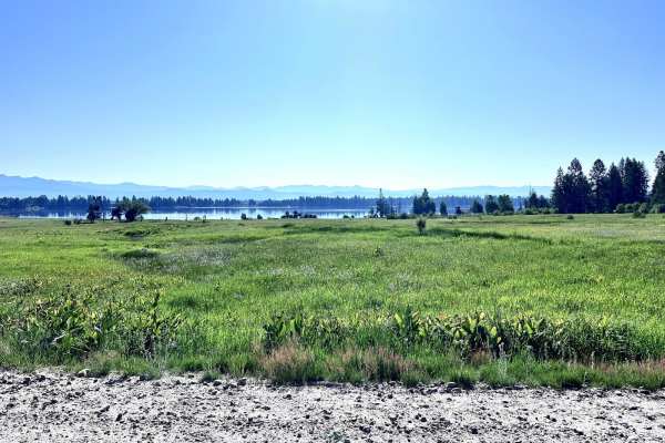
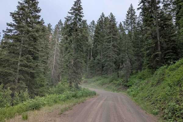
West Mountain Road
West Mountain Road is an 8.8-mile point-to-point road that gives access to many trails in the West Mountains. This is a maintained county road that has light washboarding and shallow mud holes. West Mountain Road passes private property; be respectful and drive slowly to reduce dust.
Learn more about West Mountain Road
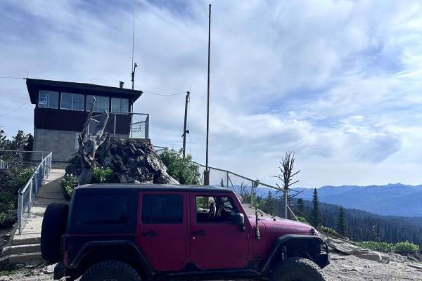
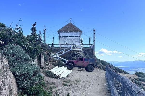
Brundage Outlook Spur
Brundage Outlook Spur is a short 1.9-mile out-and-back trail that takes you from the Brundage Mountain trail to the old Brundage Mountain Fire Outlook station. The trail is single vehicle width with a few turnouts. Brundage Outlook Spur has erosion damage up to 12 inches in depth and loose rocks up ...
Learn more about Brundage Outlook Spur
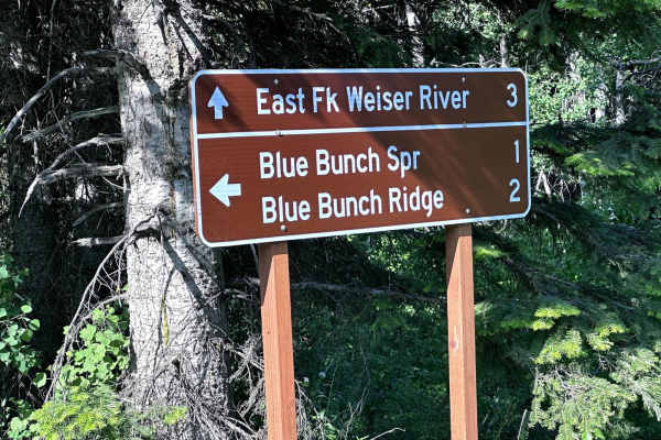
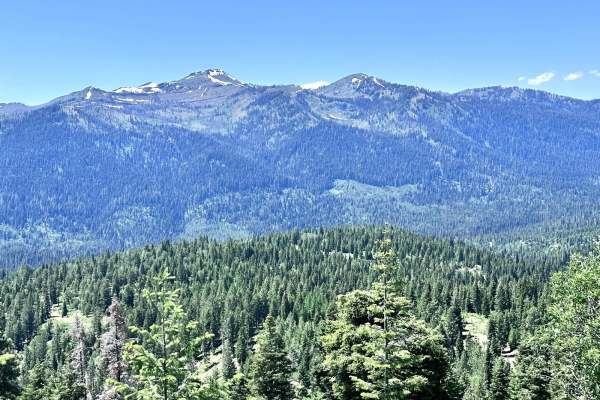
Blue Bunch Ridge
Blue Bunch Ridge is a 7.1-mile point-to-point trail that follows the ridge line and gives majestic views of Payette Lake and the valley below. Blue Bunch Ridge trail also provides great views of Council Mountain. This trail is single vehicle width and has erosion damage and loose rocks under 12" in ...
Learn more about Blue Bunch Ridge
No Business Lookout
No Business Lookout is a 7.6-mile out and back trail in the West Mountains that travels up to an old fire lookout on top of No Business Mountain. This trail is single vehicle width, with erosion damage and loose rocks under 12" in height/depth. The last section up to the Lookout is the roughest port...
Learn more about No Business Lookout
Old Cascade
Old Cascade is a 7.2 mile point to point trail that travels into the West Mountains. The trail starts from North Mill Creek at Cutoff Saddle. Upon leaving North Mill Creek the trail becomes more rough and narrows, with erosion damage and loose rocks under 12 inches in height/depth. Enjoy the three m...
Learn more about Old Cascade
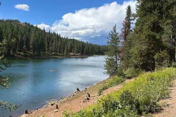
Meadows Goose Lake
Meadows Goose Lake trail is an 11-mile point-to-point trail that starts in Meadows Valley, near New Meadows, and travels up the Grass Mountains and ends at Goose Lake and Campground. This trail travels on top of a spur and gives stunning views of Meadow Valley before you enter the trees. Meadows Goo...
Learn more about Meadows Goose Lake
Goose Lake Road
Goose Lake Road is a 7.1-mile point-to-point trail that starts at Brundage Ski Resort and travels up to Goose Lake and Campground. This is a well-maintained forest service road with no obstacles and only light washboarding and shallow mud holes. This road is passable with stock 2WD, AWD, and 4WD veh...
Learn more about Goose Lake Road
Middle Fork Weiser
Middle Fork Weiser is a 25.8-mile point-to-point road that crosses the West Mountains and parallels the Middle Fork of the Weiser River. This road gives access to several good hiking trails (Sheep Creek and Warm Spring Creek) and the Cabin Creek Campground. This is a maintained forest service road w...
Learn more about Middle Fork Weiser
Lost Valley Reservoir Loop
The Lost Valley Reservoir Loop in Idaho offers a scenic and enjoyable off-road drive that combines easy cruising with plenty of sights worth stopping for. The road surface is primarily well-graded dirt and gravel, making it accessible to most high-clearance vehicles and ideal for those looking for a...
Learn more about Lost Valley Reservoir Loop
Beaver Creek
Beaver Creek is a 12.7-mile point-to-point trail that parallels Beaver Creek in the West Mountains. The trail starts from Highway 95 and passes through private lands;be respectful, stay on the trail, and drive the speed limit. The first half of the trail parallels Beaver Creek in a scenic canyon, th...
Learn more about Beaver Creek
East Fork Weiser
East Fork Weiser is a 13.5-mile point-to-point trail that parallels the East Fork of the Weiser River. This winding trail takes you up into the West Mountains and connects to several other trails. This is a maintained Forest Service Road with light washboarding and shallow mud holes. This trail may ...
Learn more about East Fork Weiser
Cottonwood Rd 50199
Cottonwood Road is a scenic dirt trail that gradually ascends approximately 2,700 feet into the mountains, winding through dense pine forests and groves of cottonwood trees. The route is graded in sections for a smooth but engaging drive. Along the way, you'll be treated to beautiful views of the ca...
Learn more about Cottonwood Rd 50199
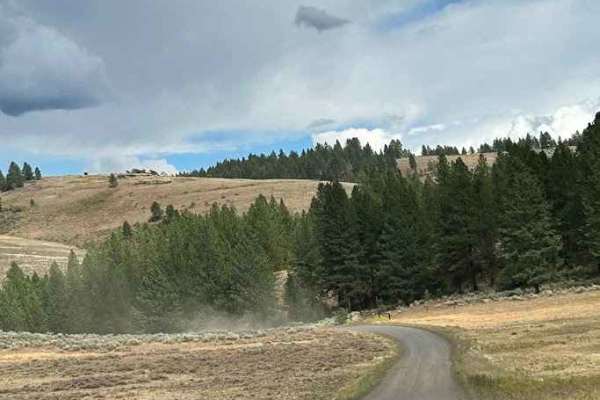
West Mountain
West Mountain is a 9-mile point-to-point trail that has multiple cut-off trails giving access to the West Mountain Jeep trail. The mountain views along this trail are spectacular. The trail is a maintained Forest Service road with light washboarding and shallow mud holes. The southern end of the tra...
Learn more about West Mountain
North Mill Creek 50150
North Mill Creek 50150 is a scenic dirt trail that hugs the edge of a cliff, offering breathtaking views of the surrounding valleys and mountains. The trail is lined with tall pine trees, creating a serene forested atmosphere as you drive. Expect small ruts and washboard sections along the way, whic...
Learn more about North Mill Creek 50150
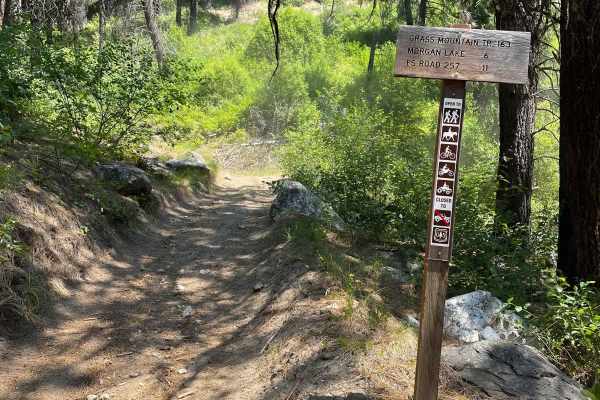
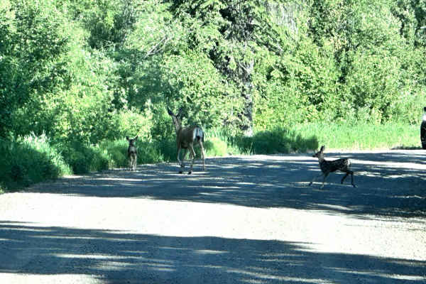
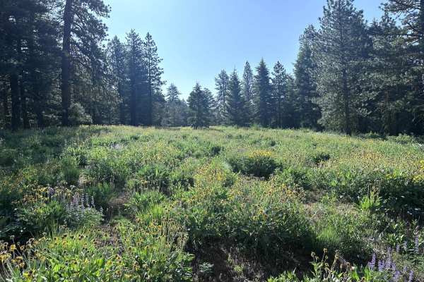
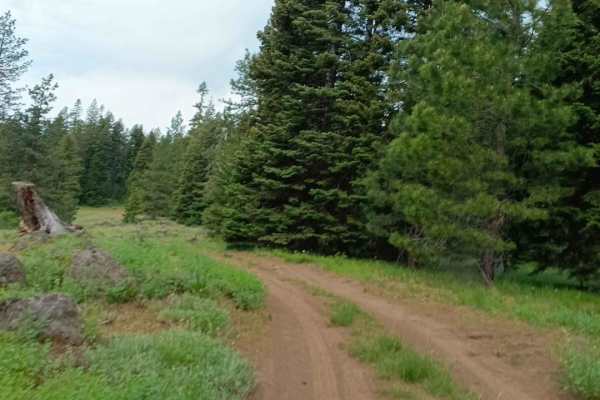
Grass Mountain ATV
The Grass Mountain ATV Trail features an upper section of smooth and fairly level switchbacks starting near Morgan Lake and extending west to the trailhead, which appears to be well-trafficked. Keep an eye out for deer on the trail; this is most likely a popular hunting area with evidence of a primi...
Learn more about Grass Mountain ATV
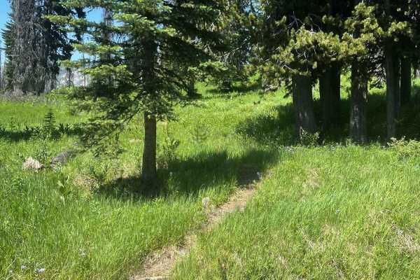
Vance Creek
The Vance Creek trail begins unmarked from Goose Lake Road but is a well-defined single-track path. It's a smooth and flowy ride through a grassy hillside. As you progress towards the middle of the trail, you will encounter some scattered embedded and loose rocks, and a few wet and muddy sections th...
Learn more about Vance Creek
West Fork Weiser
The West Fork Weiser off-road trail, following Forest Service Road 50127, offers a scenic drive through some of Idaho’s most rugged backcountry. The road surface is a mix of compacted dirt, loose gravel, and rocky stretches, with sections that can be muddy or rutted after storms or snowmelt. High-cl...
Learn more about West Fork Weiser
Beginner ATV trails near McCall, Idaho
Explore ATV-friendly trails near you. These trails are accessible for vehicles up to 50 inches wide, perfect for ATVs and smaller off-road machines.
Brundage Mountain
Brundage Mountain trail is an 11.2-mile point-to-point trail that traverses the east slope of Brundage Mountain and ends at Brundage Reservoir. While traveling this trail, you will have the opportunity to see several types of wildlife. This is a single vehicle width trail with erosion damage and loo...
Learn more about Brundage Mountain
Full Creek Crossing
This trail is a gravel road with many potholes along the way. The scenery is beautiful, with many different locations to pull over and camp. At the end of the route, you will come to a water crossing at Full Creek, which is only passable by a higher clearance vehicle, mainly due to the transition in...
Learn more about Full Creek Crossing
Goose Creek
Goose Creek is a 7.1-mile point-to-point trail that starts off of Highway 55 and travels along Goose Creek and connects with the Meadows Goose Lake Trail. This trail also gives access to the Last Chance Campground. Goose Creek Trail is a well-maintained Forest Service road up to the campground. Afte...
Learn more about Goose Creek
West Mountain Road
West Mountain Road is an 8.8-mile point-to-point road that gives access to many trails in the West Mountains. This is a maintained county road that has light washboarding and shallow mud holes. West Mountain Road passes private property; be respectful and drive slowly to reduce dust.
Learn more about West Mountain Road
Beginner UTV/side-by-side trails near McCall, Idaho
Find UTV and side-by-side trails near you. These trails accommodate vehicles up to 60 inches wide, ideal for UTVs, side-by-sides, and wider off-road rigs.
Brundage Mountain
Brundage Mountain trail is an 11.2-mile point-to-point trail that traverses the east slope of Brundage Mountain and ends at Brundage Reservoir. While traveling this trail, you will have the opportunity to see several types of wildlife. This is a single vehicle width trail with erosion damage and loo...
Learn more about Brundage Mountain
Full Creek Crossing
This trail is a gravel road with many potholes along the way. The scenery is beautiful, with many different locations to pull over and camp. At the end of the route, you will come to a water crossing at Full Creek, which is only passable by a higher clearance vehicle, mainly due to the transition in...
Learn more about Full Creek Crossing
Goose Creek
Goose Creek is a 7.1-mile point-to-point trail that starts off of Highway 55 and travels along Goose Creek and connects with the Meadows Goose Lake Trail. This trail also gives access to the Last Chance Campground. Goose Creek Trail is a well-maintained Forest Service road up to the campground. Afte...
Learn more about Goose Creek
West Mountain Road
West Mountain Road is an 8.8-mile point-to-point road that gives access to many trails in the West Mountains. This is a maintained county road that has light washboarding and shallow mud holes. West Mountain Road passes private property; be respectful and drive slowly to reduce dust.
Learn more about West Mountain Road
The onX Offroad Difference
onX Offroad combines trail photos, descriptions, difficulty ratings, width restrictions, seasonality, and more in a user-friendly interface. Available on all devices, with offline access and full compatibility with CarPlay and Android Auto. Discover what you're missing today!
Open Trail Map