
Beginner Off-Road Trails
Near Matamoras, Ohio
Explore All Beginner Trails Near Matamoras, Ohio
Beginner Off-Road Trails Near Matamoras, Ohio
Discover the best beginner-friendly off-road trails near you. These easier, lower-rated trails are a great place to start — browse trail maps, check difficulty ratings, and find your next adventure.
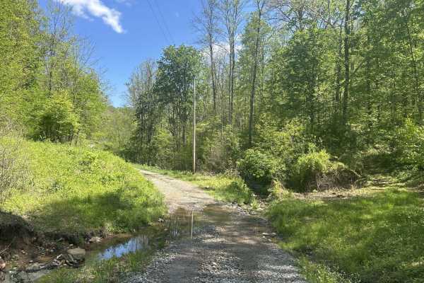
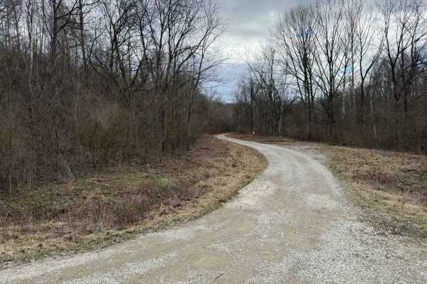
Hopewell Ridge
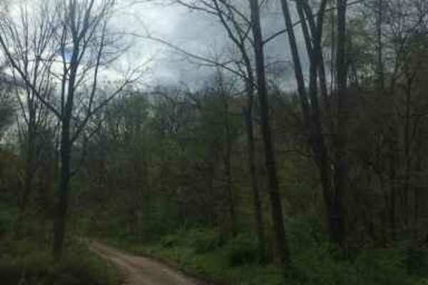
Hopewell Ridge is a beautiful, quiet, and scenic drive in Wayne National Forest. It would make an excellent route for a club ride, especially in the fall when the colors are at their peak. The road is well‑maintained and provides access to hiking trails and public hunting areas. Southern Ohio is kno...
Learn more about Hopewell Ridge
Peggs Fork Road
If you are looking for a quiet, scenic drive just outside the city of Marietta, this is it. Peggs Fork Road takes you through the hollow across three small creek crossings to Milltown Hill Road. There is plenty of hiking and public hunting nearby in Wayne National Forest.
Learn more about Peggs Fork Road
County Route 2 - Wirt County
This is a scenic drive that follows part of Goose Creek in Wirt County, West Virginia. The road is mainly gravel with a few dirt sections and some water crossings but nothing too rough. This road is an absolutely beautiful drive in the fall when the leaves are turning color. There is one stretch of ...
Learn more about County Route 2 - Wirt County
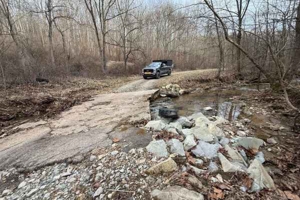
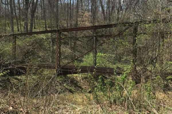
Junkyard Town - low water bridges along Onion Creek - Hackney
This route starts at Junkyard Town (a town owned by an entire family and appears to be an open-air private junkyard). The path winds through the countryside, crossing multiple steel bridges over Meigs Creek, and eventually turns left, crossing a multitude of low-water concrete bridges that will be u...
Learn more about Junkyard Town - low water bridges along Onion Creek - Hackney
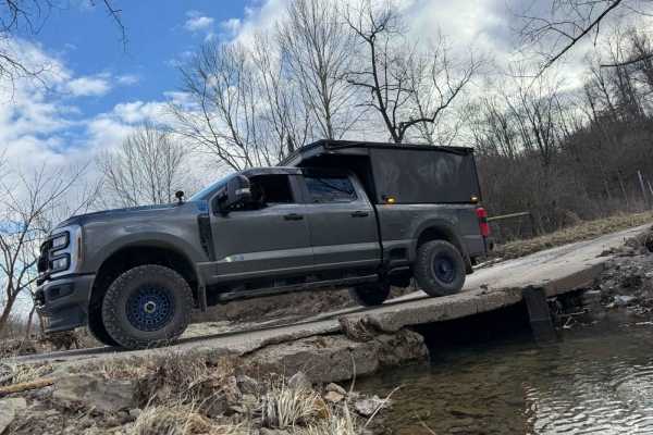
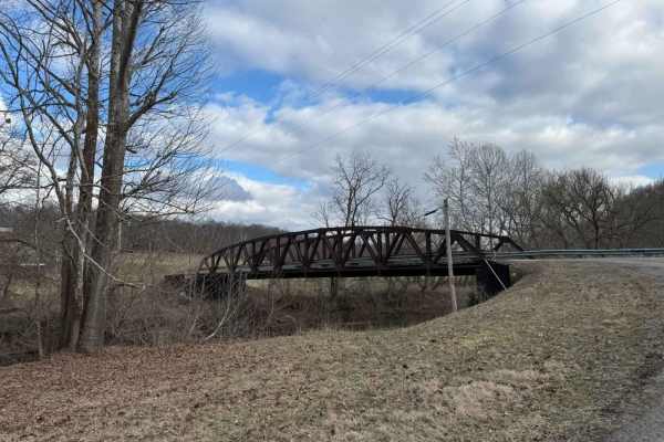
AEP Onion Creek - Allen Run 3 Creek Slab Bridges
Very Steep entry/exit on both ends. The creeks are always flowing and constantly changing the appearance of the roadway. Three sizeable concrete slab bridges span the waterways that wind in and out of the valley as you descend before going right back up again. The western valley ridgeline is very na...
Learn more about AEP Onion Creek - Allen Run 3 Creek Slab Bridges
Miners Memorial (Big Muskie Bucket) across Dakota Plains - Junkyardtown
I started at the Big Musky Bucket in the Miners Memorial AEP Picnic area across the main road to a beautiful ridge line backroad with amazing expansive open views that remind me of traveling to the significant plains areas. The road is high-speed gravel and very wide and passes a civil war cemetery ...
Learn more about Miners Memorial (Big Muskie Bucket) across Dakota Plains - Junkyardtown
Horse Run Road
This short trail offers lots of great activities like hunting, HUGE clear lakes for fishing, and a dispersed camping area that is free to stay at throughout the Spring, Fall, and Summer seasons. This trail is mainly rough gravel with big potholes and very small washouts but is accessible by just abo...
Learn more about Horse Run Road
The Ridge Run
This trail is one of my favorites! This track will take you along some of the best sights and open landscapes Ohio has to offer. If you are camping at one of the local dispersed campsites, Overlanding with buddies, scouting for deer, or want to park somewhere and see for miles while eating your favo...
Learn more about The Ridge Run
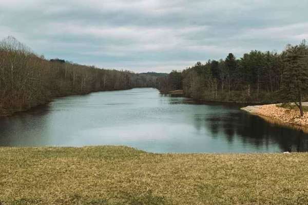
AEP SandHollow Camp C to Equine Day use F no gates
This is a backroad connector route from Campground C to the Equine day-use area. It's a great little route through the woods and along a beautiful clear creek. You will pass by many wonderful ponds that can be fished and even a Civil War cemetery. There are several offshoots for the more adventurous...
Learn more about AEP SandHollow Camp C to Equine Day use F no gates
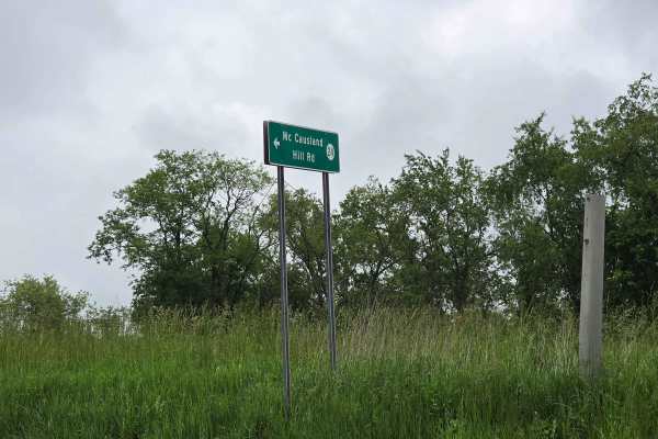
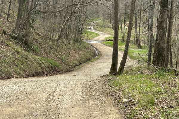
McCausland Hill Road
McCausland Hill Road is a gravel road that is simple to navigate; any car, truck, or SUV can make it through this road without any problems. Very few potholes, a few tight areas, but manageable for two vehicles to pass at once in some locations. Just keep an eye out for downed trees around turns. Th...
Learn more about McCausland Hill Road
Halstead Hill Road
Halstead Hill Road is a gravel road that is fairly easy with a small hill and a few washboards. A few ninety-degree and one hundred and eighty-degree turns. No real hazards other than occasionally down tree and no guardrail. This road is not maintained in the winter. Cars could make this road.
Learn more about Halstead Hill Road

Life Wide Open - Scenic Trail
This trail is short, but VERY scenic and perfect for almost any Subaru-style vehicle. It is an excellent add-on trail in this area and is worth a run-through. Very uncharacteristic for Ohio, this trail has some out west style features! Offering very wide open ranges of rolling hills. While I was run...
Learn more about Life Wide Open - Scenic Trail
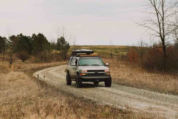
Ridgeview Road - Subarus Paradise
If you are someone that loves exploring new terrain and experiencing the true country living of Ohio, this is for you. This trail takes you by beautiful wildlife, farm animals, rustic houses, wide-open scenery, and even a fire tower. Subarus would feel right at home on this mostly gravel forest serv...
Learn more about Ridgeview Road - Subarus Paradise
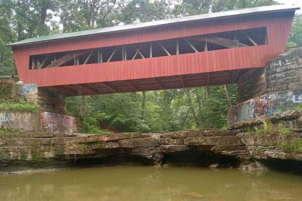
Helmick Mill Covered Bridge
Expect to go through one of the most scenic roads in Perry County. This trail is all gravel but very slick steep hills with sharp turns. Once you enter the trail you go down into a nice little creek crossing that flows when the water is higher. After that, you will continue down until you hit a fork...
Learn more about Helmick Mill Covered Bridge
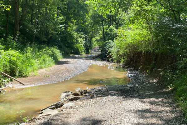
Wildcat
This trail will take you down a valley in Wayne National Forrest. Much of this trail is a gravel road but you will find sections of big rocks, creek water over the road, and even a small section of mud holes to get dirty. You first start out by traveling down a curvey gravel road with plenty of rock...
Learn more about Wildcat
Plecher Road to Pyramid House
Pelcher Road along Spring Run is very scenic with multiple hills and beautiful vistas with a surprise building at the end. Class 1 roadway may be very slippery during rains and should use caution on blind corners and be aware of wildlife and livestock. You may encounter Amish buggies on this route a...
Learn more about Plecher Road to Pyramid House

Shaler Road
Shaler Road is primarily a graded gravel road with sections of dirt. It is an easy ride in the summer months. However, there is no winter maintenance. The road can become rutted and harder to travel on during rain, snow, and ice. The eastern half of Shaler Road is dirt and gravel up to the intersect...
Learn more about Shaler Road
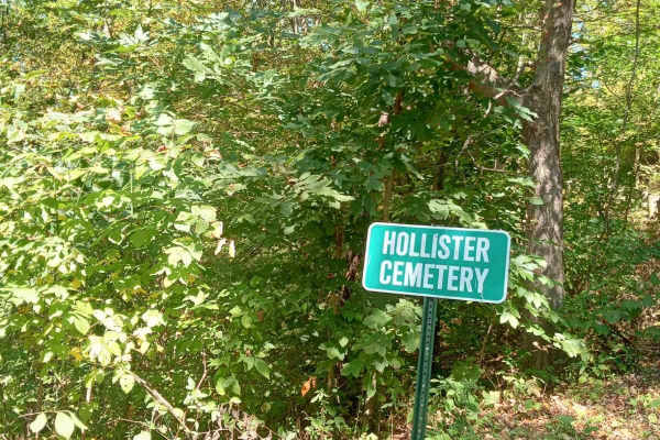
Township 283
You wouldn't know this road was even here without adventuring down some old gravel roads; it is packed full of history from the past. When you first approach a graveyard sits to your left that has been there for many, many years. As you start to travel down this narrow gravel road, you are filled w...
Learn more about Township 283
Hunterdon Road
This gravel route takes you through one of the nicest roads in the area. Once you start, you will head up a very steep gravel hill that will take you back to Hunterdon Cemetery. You will enter the wildlife preserve at the top of the steep hill and head down the windy gravel road that gets narrow at ...
Learn more about Hunterdon Road
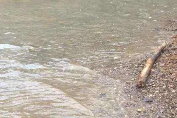
Indian Run
This will take you out on a township road. It starts off on a narrow gravel road, shortly after you start the trail you will find a small section of muddy ruts to kick up some dirt. Once you get to the bottom of the hill you will come across a rushing creek crossing that has plenty of small side obs...
Learn more about Indian Run
Beginner ATV trails near Matamoras, Ohio
Explore ATV-friendly trails near you. These trails are accessible for vehicles up to 50 inches wide, perfect for ATVs and smaller off-road machines.
County Route 2 - Wirt County
This is a scenic drive that follows part of Goose Creek in Wirt County, West Virginia. The road is mainly gravel with a few dirt sections and some water crossings but nothing too rough. This road is an absolutely beautiful drive in the fall when the leaves are turning color. There is one stretch of ...
Learn more about County Route 2 - Wirt County
The Ridge Run
This trail is one of my favorites! This track will take you along some of the best sights and open landscapes Ohio has to offer. If you are camping at one of the local dispersed campsites, Overlanding with buddies, scouting for deer, or want to park somewhere and see for miles while eating your favo...
Learn more about The Ridge Run
Ridgeview Road - Subarus Paradise
If you are someone that loves exploring new terrain and experiencing the true country living of Ohio, this is for you. This trail takes you by beautiful wildlife, farm animals, rustic houses, wide-open scenery, and even a fire tower. Subarus would feel right at home on this mostly gravel forest serv...
Learn more about Ridgeview Road - Subarus Paradise
Helmick Mill Covered Bridge
Expect to go through one of the most scenic roads in Perry County. This trail is all gravel but very slick steep hills with sharp turns. Once you enter the trail you go down into a nice little creek crossing that flows when the water is higher. After that, you will continue down until you hit a fork...
Learn more about Helmick Mill Covered Bridge
Beginner UTV/side-by-side trails near Matamoras, Ohio
Find UTV and side-by-side trails near you. These trails accommodate vehicles up to 60 inches wide, ideal for UTVs, side-by-sides, and wider off-road rigs.
County Route 2 - Wirt County
This is a scenic drive that follows part of Goose Creek in Wirt County, West Virginia. The road is mainly gravel with a few dirt sections and some water crossings but nothing too rough. This road is an absolutely beautiful drive in the fall when the leaves are turning color. There is one stretch of ...
Learn more about County Route 2 - Wirt County
The Ridge Run
This trail is one of my favorites! This track will take you along some of the best sights and open landscapes Ohio has to offer. If you are camping at one of the local dispersed campsites, Overlanding with buddies, scouting for deer, or want to park somewhere and see for miles while eating your favo...
Learn more about The Ridge Run
McCausland Hill Road
McCausland Hill Road is a gravel road that is simple to navigate; any car, truck, or SUV can make it through this road without any problems. Very few potholes, a few tight areas, but manageable for two vehicles to pass at once in some locations. Just keep an eye out for downed trees around turns. Th...
Learn more about McCausland Hill Road
Halstead Hill Road
Halstead Hill Road is a gravel road that is fairly easy with a small hill and a few washboards. A few ninety-degree and one hundred and eighty-degree turns. No real hazards other than occasionally down tree and no guardrail. This road is not maintained in the winter. Cars could make this road.
Learn more about Halstead Hill Road
The onX Offroad Difference
onX Offroad combines trail photos, descriptions, difficulty ratings, width restrictions, seasonality, and more in a user-friendly interface. Available on all devices, with offline access and full compatibility with CarPlay and Android Auto. Discover what you're missing today!
Open Trail Map