
Beginner Off-Road Trails
Near Lepanto, Arkansas
Explore All Beginner Trails Near Lepanto, Arkansas
Beginner Off-Road Trails Near Lepanto, Arkansas
Discover the best beginner-friendly off-road trails near you. These easier, lower-rated trails are a great place to start — browse trail maps, check difficulty ratings, and find your next adventure.
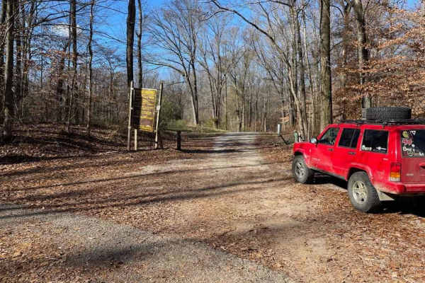
Island Forty Road
The Island Forty Road, is a dirt based road that traverses into the Shelby Wildlife Management Area which is part of the greater Meeman-Shelby State Park. The road is mostly dirt with a few patches of old gravel here and there, there is high potential the road will easily softened when rain or wet c...
Learn more about Island Forty Road
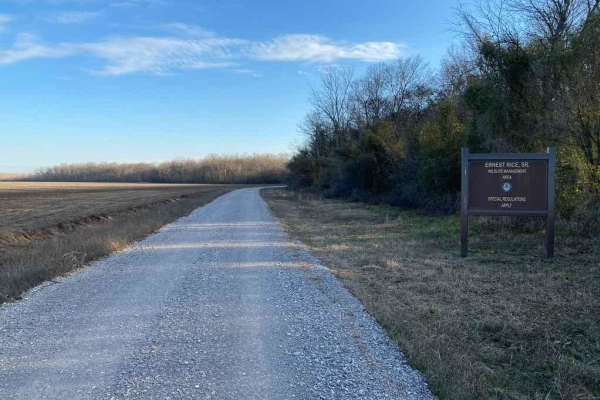
Ernest Rice Road
The Ernest Rice Road is a gravel access road to the Wildlife Management Area of the same name. It features an easy to traverse gravel road on the northern side of the area, expect course gravel in sections, potholes, and mild water collection in spots, the parking areas are also a little soft where ...
Learn more about Ernest Rice Road
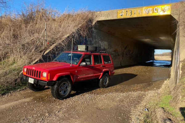
I-155 Tunnel Crossing
The I-155 Tunnel Crossing is based off of the Pemiscot County Road 362 and 534. Together the two roads form a gravel loop to connect with Missouri Route Y and Missouri Route 84. The gravel road leads you to the river levee's edge giving you access to many great fishing holes and Missouri low land (s...
Learn more about I-155 Tunnel Crossing
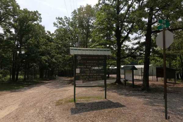
Rainey Brake WMA Road
The Rainey Brake WMA Road, or Lawrence Road 316, is a road through the western side of the Shirley Bay Rainey Brake Wildlife Management Area. The road is a casual gravel ride down to and through the swampy lowlands west of the Black River and the bottoms that surround it. The road is generally flat ...
Learn more about Rainey Brake WMA Road
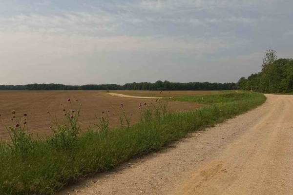
Thistle Bottoms
Thistle Bottoms is a group of Lawrence County Roads (301, 303, 309, and 317) that when joined together give a great context to the low-laying bottoms along the stretch of the Black River that exists between Lake Charles State Park and the Shirley Bay Rainey Brake Wildlife Management Area. When drivi...
Learn more about Thistle Bottoms
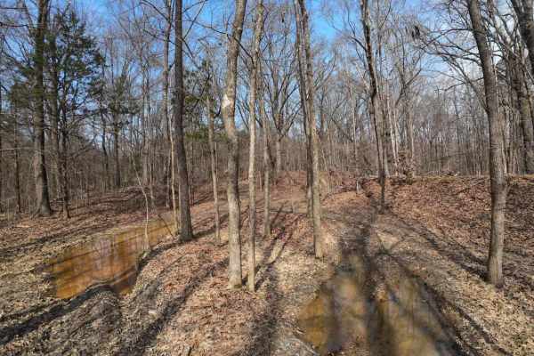
Wolf Creek Trail
Starts as a hard ground trail entering the woods with shallow puddles and ruts. Ruts are not deep on this trail, so they're manageable. There is a small creek named Wolf Creek. It is shallow and not too soft. The rest of the trail goes deep into the woods through various rolling hills, but none too ...
Learn more about Wolf Creek Trail
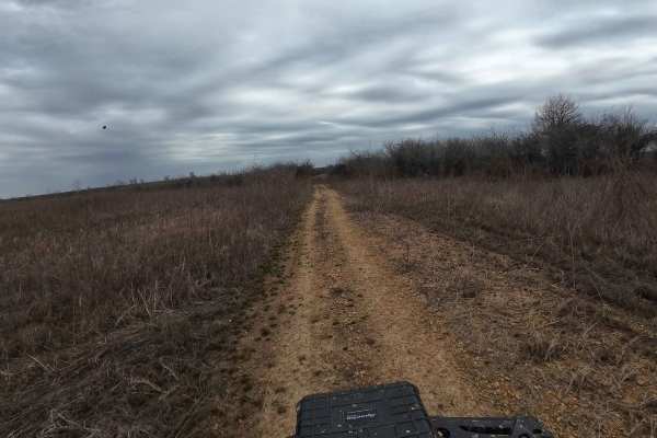
Hurricane Creek Trail
This trail is in the Arkabutla Lake Bottoms. This part of the lake does not flood due to the shutdown of the dam. The terrain is fairly flat with some small ruts, but nothing major. The trail does retain some water and makes it swampy in areas, but it's always pretty shallow and passable. Make sure ...
Learn more about Hurricane Creek Trail
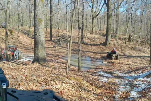
Crawford's Point Trail
The trail starts at the Pleasant Hill Public Use Area. Follow the boat ramp to the end where there's a dirt trail and go south. Follow it around until you see the trail veering to the left. You will enter the woods from there on a good trail and follow it through rolling hills, small ditch crossings...
Learn more about Crawford's Point Trail
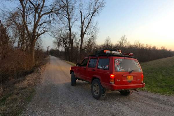
Wolf Bayou Road
Wolf Bayou Road is a gravel access road to the Wolf Bayou section of the greater Black Island Conservation Area, managed by the Missouri Department of Conservation. The Wolf Bayou is a fish lover's and waterfowl hunter's little hidden gem, featuring several water channels to access the rest within t...
Learn more about Wolf Bayou Road

Hickahala Creek Trail
Start off in a wide area outside the parking area. From there, take the trail riding along the creek banks. It can be muddy at times, but it's hard ground. About half a mile down the trail, the trail becomes sandy. There are 2 small ditches to cross with very shallow water running in them. The ditch...
Learn more about Hickahala Creek Trail
Beginner ATV trails near Lepanto, Arkansas
Explore ATV-friendly trails near you. These trails are accessible for vehicles up to 50 inches wide, perfect for ATVs and smaller off-road machines.
Wolf Creek Trail
Starts as a hard ground trail entering the woods with shallow puddles and ruts. Ruts are not deep on this trail, so they're manageable. There is a small creek named Wolf Creek. It is shallow and not too soft. The rest of the trail goes deep into the woods through various rolling hills, but none too ...
Learn more about Wolf Creek Trail
Hurricane Creek Trail
This trail is in the Arkabutla Lake Bottoms. This part of the lake does not flood due to the shutdown of the dam. The terrain is fairly flat with some small ruts, but nothing major. The trail does retain some water and makes it swampy in areas, but it's always pretty shallow and passable. Make sure ...
Learn more about Hurricane Creek Trail
Crawford's Point Trail
The trail starts at the Pleasant Hill Public Use Area. Follow the boat ramp to the end where there's a dirt trail and go south. Follow it around until you see the trail veering to the left. You will enter the woods from there on a good trail and follow it through rolling hills, small ditch crossings...
Learn more about Crawford's Point Trail
Hickahala Creek Trail
Start off in a wide area outside the parking area. From there, take the trail riding along the creek banks. It can be muddy at times, but it's hard ground. About half a mile down the trail, the trail becomes sandy. There are 2 small ditches to cross with very shallow water running in them. The ditch...
Learn more about Hickahala Creek Trail
Beginner UTV/side-by-side trails near Lepanto, Arkansas
Find UTV and side-by-side trails near you. These trails accommodate vehicles up to 60 inches wide, ideal for UTVs, side-by-sides, and wider off-road rigs.
Wolf Creek Trail
Starts as a hard ground trail entering the woods with shallow puddles and ruts. Ruts are not deep on this trail, so they're manageable. There is a small creek named Wolf Creek. It is shallow and not too soft. The rest of the trail goes deep into the woods through various rolling hills, but none too ...
Learn more about Wolf Creek Trail
Hurricane Creek Trail
This trail is in the Arkabutla Lake Bottoms. This part of the lake does not flood due to the shutdown of the dam. The terrain is fairly flat with some small ruts, but nothing major. The trail does retain some water and makes it swampy in areas, but it's always pretty shallow and passable. Make sure ...
Learn more about Hurricane Creek Trail
Crawford's Point Trail
The trail starts at the Pleasant Hill Public Use Area. Follow the boat ramp to the end where there's a dirt trail and go south. Follow it around until you see the trail veering to the left. You will enter the woods from there on a good trail and follow it through rolling hills, small ditch crossings...
Learn more about Crawford's Point Trail
Hickahala Creek Trail
Start off in a wide area outside the parking area. From there, take the trail riding along the creek banks. It can be muddy at times, but it's hard ground. About half a mile down the trail, the trail becomes sandy. There are 2 small ditches to cross with very shallow water running in them. The ditch...
Learn more about Hickahala Creek Trail
The onX Offroad Difference
onX Offroad combines trail photos, descriptions, difficulty ratings, width restrictions, seasonality, and more in a user-friendly interface. Available on all devices, with offline access and full compatibility with CarPlay and Android Auto. Discover what you're missing today!
Open Trail Map