
Beginner Off-Road Trails
Near Lake Mystic, Florida
Explore All Beginner Trails Near Lake Mystic, Florida
Beginner Off-Road Trails Near Lake Mystic, Florida
Discover the best beginner-friendly off-road trails near you. These easier, lower-rated trails are a great place to start — browse trail maps, check difficulty ratings, and find your next adventure.
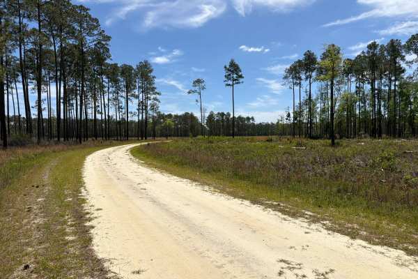
Little Gully Creek - FS 150
Little Gully Creek, also known as Apalachicola National Forest Road 150, is a dead-end road that starts at County Road 12. It takes you through the southwest part of the Apalachicola National Forest into the Johnson Juniper Swamp and gives you access to a few OHV trails and the Florida National Scen...
Learn more about Little Gully Creek - FS 150
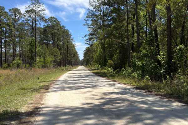
Mercer West - FS 105
Mercer West, also known as Apalachicola National Forest Road 105, connects Mercer Trail at the east end and County Road 12 at the west end. It takes you through the southwest part of the Apalachicola National Forest along Camel Pond and gives you access to Camel Pond Recreation Area with Restrooms, ...
Learn more about Mercer West - FS 105
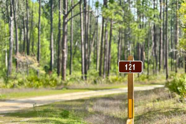
Big Gulley - FS 121
Big Gulley - 121 is a narrow, one-lane sandy road that offers a laid-back drive through the forest--until you hit the single deep mud hole. This obstacle has a soft bottom and can become especially tricky after rain, requiring a careful approach and possibly 4WD. The rest of the trail is relatively ...
Learn more about Big Gulley - FS 121
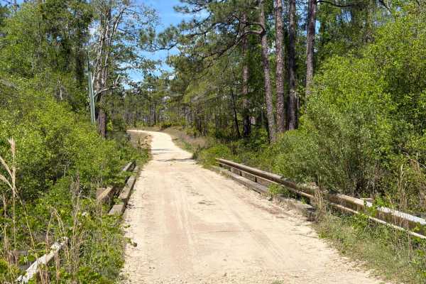
Bill Dick - FS 108
Bill Dick, also known as Apalachicola National Forest Road 108, connects Mercer Trail at the east end and County Road 12 at the west end. It takes you through the southwest part of the Apalachicola National Forest along Fillman Hill Bay and gives you access to several OHV and off-road trails in the ...
Learn more about Bill Dick - FS 108
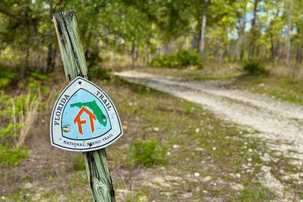
Mini Shot Trail - FS 105K
Mini Shot Trail - FS 105K is a scenic and dynamic trail that changes dramatically with the weather. When dry, it's an easy and enjoyable ride--rated a 2--offering sandy terrain and beautiful forest views. But during the rainy season, the trail transforms into a mini "Gunshot"-style drop-in, reminisc...
Learn more about Mini Shot Trail - FS 105K
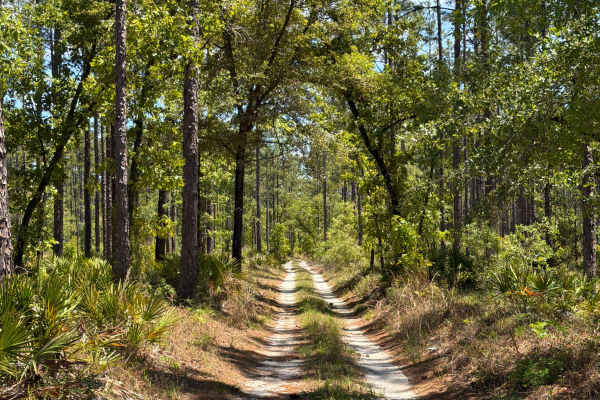
FS 108 D
Apalachicola National Forest Road 108-D connects Mercer Trail at the west end and Bill Dick at the east end. It takes you through the southwest part of the Apalachicola National Forest and gives you access to the Bonnet Pond and the Florida National Scenic Trail. The road conditions are a mixture of...
Learn more about FS 108 D

Big Gully Creek South - FS 131
Big Gully Creek South is a smooth, sandy, and fun winding trail that leads you through a scenic stretch of forest. It intersects at a large four-way junction, making it a key connector in the area and providing access to Camel Lake and Camel Lake Campground. The trail is well-maintained and easy to ...
Learn more about Big Gully Creek South - FS 131
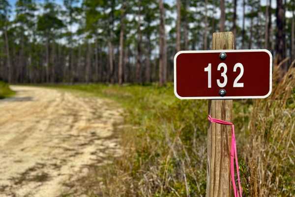
Hosford - FS 132
This bumpy, sandy two-track in the Apalachicola National Forest is a fairly uneventful route, serving primarily as a connector to more interesting nearby trails. While it doesn't offer much in terms of scenery or technical challenges, it's a solid option for covering ground or accessing deeper parts...
Learn more about Hosford - FS 132
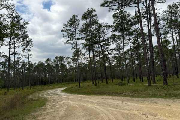
Evano South - FS 103
Evano South (FS 103) is a scenic two-track winding through the Apalachicola National Forest. This trail offers a quiet, laid-back ride with dense pine stands and subtle changes in terrain. It's well-suited for a slower pace, with the occasional bump and soft sand to keep things interesting. Some sec...
Learn more about Evano South - FS 103
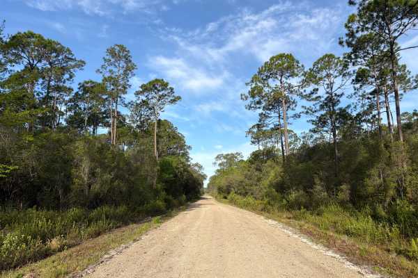
Evano West - FS 103
Evano West, also known as Apalachicola National Forest Road 103, connects Evano South at the west end and County Road 65 at the east end. It takes you through the southwest part of the Apalachicola National Forest along Western Branch and gives you access to a few OHV and off-road trails in the area...
Learn more about Evano West - FS 103
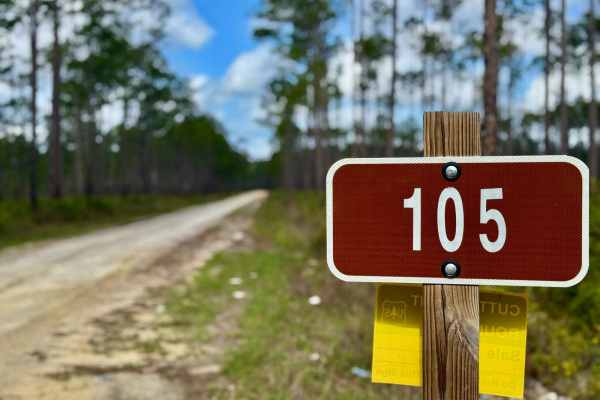
Mercer - FS 105
Mercer FS 105 is a mellow, one-lane forest road that's smooth and sandy when dry--perfect for a relaxing cruise through the woods. The trail offers several great dispersed campsites and serves as a gateway to a wide array of spur roads and deeper access into the surrounding forest. However, due to a...
Learn more about Mercer - FS 105

Mercer Branch 117
This short, one-lane connector serves as a quick and scenic route between larger trails. While mostly straightforward and sandy, it features a few side shoots that offer additional exploring or potential camping spots. During the wet season, there is one deeper hole that can pose a challenge and may...
Learn more about Mercer Branch 117

Jensen - FS 112-H
Jensen, also known as Apalachicola National Forest Road 112-H, is a dead-end road that starts at the Five Points Trail. It takes you through the southwest part of the Apalachicola National Forest along Hostage Branch and gives you access to several OHV and off-road trails in the area, and connects t...
Learn more about Jensen - FS 112-H
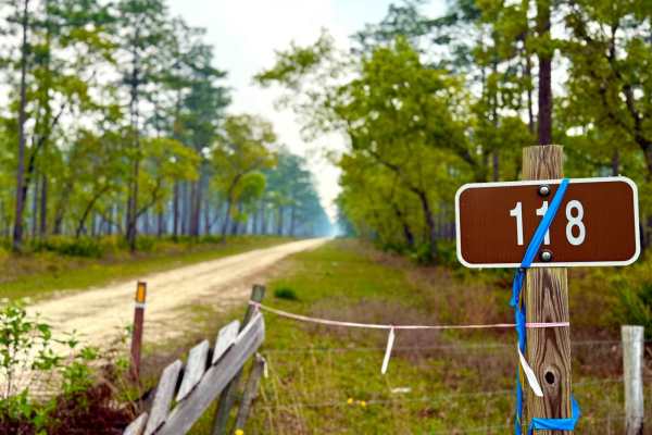
Bow West 118
Starting right off Highway 65, Bow West runs for 5.2 miles into a cool, swampy stretch of classic Florida backcountry. While not particularly technical or scenic, it offers a peaceful drive with a few side shoots for exploring or pulling off. The terrain is mostly sandy with occasional muddy patches...
Learn more about Bow West 118
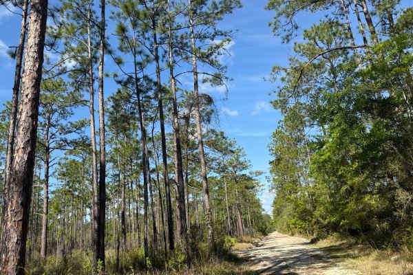
Evano Trail
Freshly graded and well-maintained, this main thoroughfare cuts through Tates Hell with ease. It's a wide, fast-moving route ideal for connecting deeper into the forest or staging for a day of trail exploration. The surface is smooth hardpack with minimal obstacles, making it suitable for most vehic...
Learn more about Evano Trail

Five Points - FS 112
Five Points, also known as Apalachicola National Forest Road 112, connects Bill Dick Trail at the north end and County Road 65 at the south end. It takes you through the southwest part of the Apalachicola National Forest along Hostage Branch and gives you access to several OHV and off-road trails in...
Learn more about Five Points - FS 112

Glover Head - FS 118-D
Glover Head, also known as Apalachicola National Forest Road 118-D, connects Bow East at the south end and County Road 65 at the north end. It takes you through the southwest part of the Apalachicola National Forest along the Glover Head District and gives you access to a few OHV trails. You have to...
Learn more about Glover Head - FS 118-D
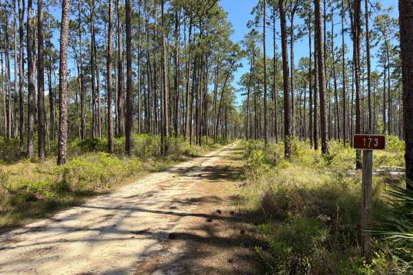
Old Pete - FS 173
Old Pete, also known as Apalachicola National Forest Road 173, connects Lewis Trail at the north end and Larkin Trail at the south end. It takes you through the southwest part of the Apalachicola National Forest along Kennedy Creek and gives you access to a few OHV trails. The road conditions are a ...
Learn more about Old Pete - FS 173

Bow East 118
This single-lane trail follows the path of old railroad tracks, offering a unique ride through a piece of local history. The terrain is sandy with deep bumps and ruts in certain areas, making for a mildly technical experience even when dry. During the rainy season, sections can hold significant wate...
Learn more about Bow East 118

Indian Creek - FS 176
Indian Creek, also known as Apalachicola National Forest Road 176, connects Black Cat at the north end and Queens Bay at the south end. It takes you through the southwest part of the Apalachicola National Forest along Bay Creek and gives you access to a few OHV and Off-Road trails. The road conditio...
Learn more about Indian Creek - FS 176
Beginner ATV trails near Lake Mystic, Florida
Explore ATV-friendly trails near you. These trails are accessible for vehicles up to 50 inches wide, perfect for ATVs and smaller off-road machines.
Little Gully Creek - FS 150
Little Gully Creek, also known as Apalachicola National Forest Road 150, is a dead-end road that starts at County Road 12. It takes you through the southwest part of the Apalachicola National Forest into the Johnson Juniper Swamp and gives you access to a few OHV trails and the Florida National Scen...
Learn more about Little Gully Creek - FS 150
Mercer West - FS 105
Mercer West, also known as Apalachicola National Forest Road 105, connects Mercer Trail at the east end and County Road 12 at the west end. It takes you through the southwest part of the Apalachicola National Forest along Camel Pond and gives you access to Camel Pond Recreation Area with Restrooms, ...
Learn more about Mercer West - FS 105
Big Gulley - FS 121
Big Gulley - 121 is a narrow, one-lane sandy road that offers a laid-back drive through the forest--until you hit the single deep mud hole. This obstacle has a soft bottom and can become especially tricky after rain, requiring a careful approach and possibly 4WD. The rest of the trail is relatively ...
Learn more about Big Gulley - FS 121
Bill Dick - FS 108
Bill Dick, also known as Apalachicola National Forest Road 108, connects Mercer Trail at the east end and County Road 12 at the west end. It takes you through the southwest part of the Apalachicola National Forest along Fillman Hill Bay and gives you access to several OHV and off-road trails in the ...
Learn more about Bill Dick - FS 108
Beginner UTV/side-by-side trails near Lake Mystic, Florida
Find UTV and side-by-side trails near you. These trails accommodate vehicles up to 60 inches wide, ideal for UTVs, side-by-sides, and wider off-road rigs.
Little Gully Creek - FS 150
Little Gully Creek, also known as Apalachicola National Forest Road 150, is a dead-end road that starts at County Road 12. It takes you through the southwest part of the Apalachicola National Forest into the Johnson Juniper Swamp and gives you access to a few OHV trails and the Florida National Scen...
Learn more about Little Gully Creek - FS 150
Mercer West - FS 105
Mercer West, also known as Apalachicola National Forest Road 105, connects Mercer Trail at the east end and County Road 12 at the west end. It takes you through the southwest part of the Apalachicola National Forest along Camel Pond and gives you access to Camel Pond Recreation Area with Restrooms, ...
Learn more about Mercer West - FS 105
Big Gulley - FS 121
Big Gulley - 121 is a narrow, one-lane sandy road that offers a laid-back drive through the forest--until you hit the single deep mud hole. This obstacle has a soft bottom and can become especially tricky after rain, requiring a careful approach and possibly 4WD. The rest of the trail is relatively ...
Learn more about Big Gulley - FS 121
Bill Dick - FS 108
Bill Dick, also known as Apalachicola National Forest Road 108, connects Mercer Trail at the east end and County Road 12 at the west end. It takes you through the southwest part of the Apalachicola National Forest along Fillman Hill Bay and gives you access to several OHV and off-road trails in the ...
Learn more about Bill Dick - FS 108
The onX Offroad Difference
onX Offroad combines trail photos, descriptions, difficulty ratings, width restrictions, seasonality, and more in a user-friendly interface. Available on all devices, with offline access and full compatibility with CarPlay and Android Auto. Discover what you're missing today!
Open Trail Map