
Beginner Off-Road Trails
Near Lake Erie Beach, New York
Explore All Beginner Trails Near Lake Erie Beach, New York
Beginner Off-Road Trails Near Lake Erie Beach, New York
Discover the best beginner-friendly off-road trails near you. These easier, lower-rated trails are a great place to start — browse trail maps, check difficulty ratings, and find your next adventure.
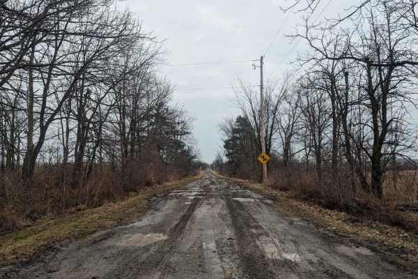
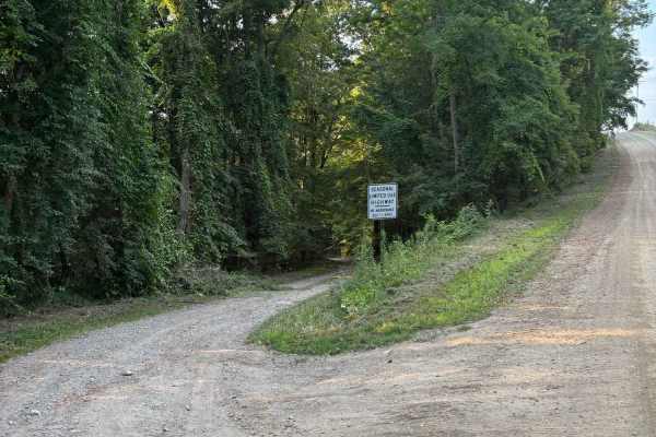
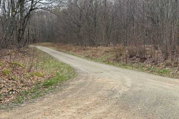
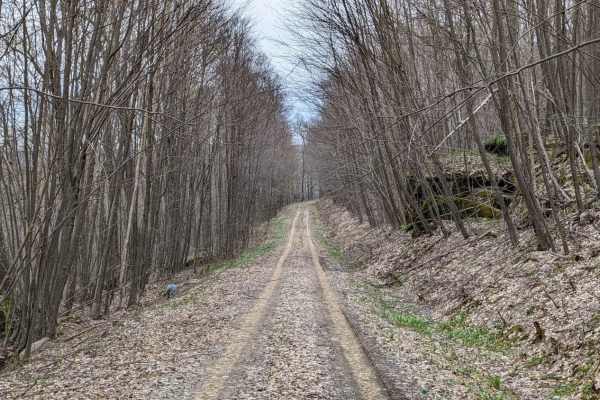
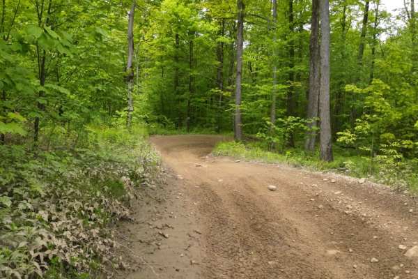
Hysert Crossroad
A crossroad trail located in Grimsby, Ontario, sandwiched between Mud Street and Ridge Road, the trail consists of a thick clay-covered pathway littered with large ruts and mud. It can be very sticky and difficult to navigate in wet conditions as the main hazard of this trail is the large 5-foot dee...
Learn more about Hysert Crossroad
CDW Run Road
CDW Run Road in the Allegheny National Forest is located in Warren County. It provides access for vehicles, though a 2017 document notes it was open for hunting at that time. It does not appear to be a designated boat launch site with amenities, but rather a forest road providing some type of water ...
Learn more about CDW Run Road
Boatroad Run - FSR 252
Forest Service Road (FSR) 252 in the Allegheny National Forest is identified as the "Boat Road Run" and is located in Warren County. It provides access for vehicles, though a 2017 document notes it was open for hunting at that time. It does not appear to be a designated boat launch site with ameniti...
Learn more about Boatroad Run - FSR 252
North Branch Sugar Run - FS 271
North Branch Sugar Run - FS 271 is a nice, hard dirt surface road. There are a few nice streams along this road. The southern end is Sugar Bay of Kinzua Reservoir. Accessibility: Like many forest roads, its condition can vary, and it is best to check the Allegheny National Forest Motor Vehicle Use M...
Learn more about North Branch Sugar Run - FS 271
Bucklick - FS 176
Forest Service Road 176 in the Allegheny National Forest is a popular route for scenic drives, 4x4 adventures, and accessing dispersed camping often found in the southern part of the forest near the Kinzua Dam area, offering a rustic, unpaved experience through wooded landscapes. It's part of the ex...
Learn more about Bucklick - FS 176
Marshwillow - FS 173
Marshwillow - FS 173 is a dirt-gravel surface road. It is a nice drive through the Allegheny National Forest. There are a few streams along this road. There are also a few dispersed camping spots. There might be some down trees. Accessibility: Like many forest roads, its condition can vary, and it i...
Learn more about Marshwillow - FS 173
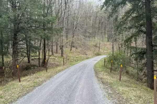
Fire Road 137
Fire Road 137 is a narrow but mellow road with patches of potholes running through the Allegheny National Forest. Along the way, you will pass several small designated dispersed campsites, with one sitting next to a babbling brook. A numbered white triangle marks all of the campsites. Logging and oi...
Learn more about Fire Road 137
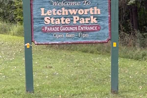
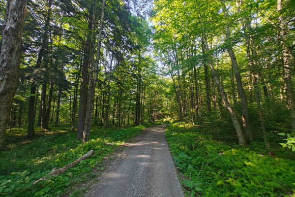
East Park Road
This road runs along the eastern edge of the gorge of Letchworth State Park. The road is closed during the winter months, but is open to the public during Spring, Summer, and Fall. The road is initially paved, but in rough shape, up to the parade grounds area. After that, it turns to dirt and offers...
Learn more about East Park Road

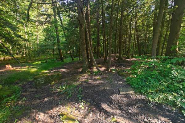
Hemlock Trail - FS 327
Hemlock Trail - FS 327 is a short road and starts with gravel. Further down the road, it turns a bit more rocky. Nothing too bad. There are a few camping spots. This road is unique as it is right next to Route 59, but there is such thick brush between the roads that you can not see Hemlock Trail - F...
Learn more about Hemlock Trail - FS 327
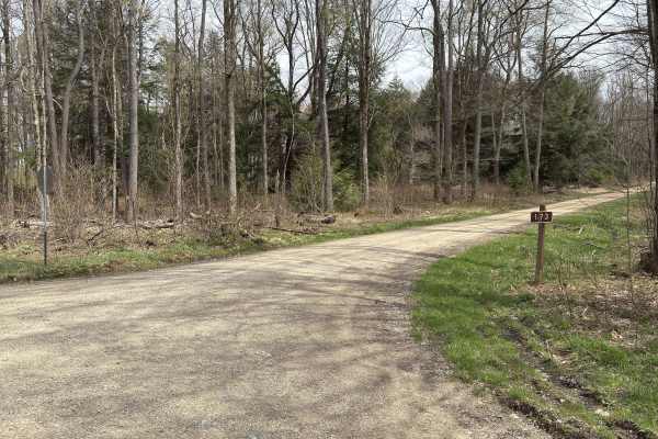
Totsline Road
This seasonal road runs along the Genesee River, offering some great views of the river before it heads into the Letchworth Gorge. It is located near River Road and East Park Road. Near the east end of the road, a piped natural spring can be found pouring out of the side of the hill. At the west end...
Learn more about Totsline Road
River Road
This seasonal road runs through the eastern portion of Letchworth State Park. Letchworth State Park is a canyon with several waterfalls and attracts tourists from far and wide. This road is not one of the main roads and does not require payment to access. This road offers access to several hiking tr...
Learn more about River Road
Hemlock Run - FS 267
Hemlock Run - FS 267 starts as a nice gravel road. Great drive through the Allegheny National Forest. Getting into this drive, you will find large racks buried into the surface of the road. Toward the end, you will find bigger ruts from rainfall runoff. There are a few nice camping spots. Accessibil...
Learn more about Hemlock Run - FS 267
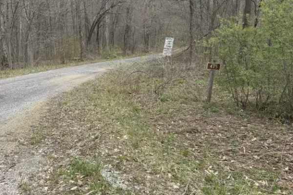
East Bucklick - FS 435
East Bucklick - FS 435 is a gravel surface road. It is a nice, pleasant drive. On one side is a slope down toward Sugar Run Creek. The opposite side goes uphill and has some large rock deposits from the ice age. If you find yourself traveling down East Bucklick - FS 435 in late April, bring some bag...
Learn more about East Bucklick - FS 435
Morrison Run - FS 266
Morrison Run - FS 266 is an easy road. The surface is hard, dirt-packed. The drive has some nice fir trees. There are a few dispersed camping spots. Accessibility: Like many forest roads, its condition can vary, and it is best to check the Allegheny National Forest Motor Vehicle Use Map (MVUM) for t...
Learn more about Morrison Run - FS 266
Van Valkenburg Road
This is a north/south road west of Perry Center. There are horse and cow farms at the north end. Scenic views of the low rolling hills can be found on either end on clear days. The road is a great addition to any route if you are coming from the west, heading to Letchworth State Park or other destin...
Learn more about Van Valkenburg Road
Briggs Run - FS 177
Briggs Run - FS 177 is a hard dirt-packed road. There are various potholes where rainfall collects. About 3/4 down the length of Briggs, you will find a fairly large rock pit where it looks like some blasting was done. The pit is estimated to be 15-20 feet deep. Do not recommend driving your rig int...
Learn more about Briggs Run - FS 177
Jakes Rocks Road - FSR 160
Jakes Rocks Road - FSR 160 is a dirt road easy traveling for one vehicle. This road leads into the back of Jakes Rock Recreation Area. There is plenty to do like Hiking, Mountain Biking or just standing on rocky outcrops enjoying the scenic views. Side roads off of Jakes Rocks Road will lead you to ...
Learn more about Jakes Rocks Road - FSR 160
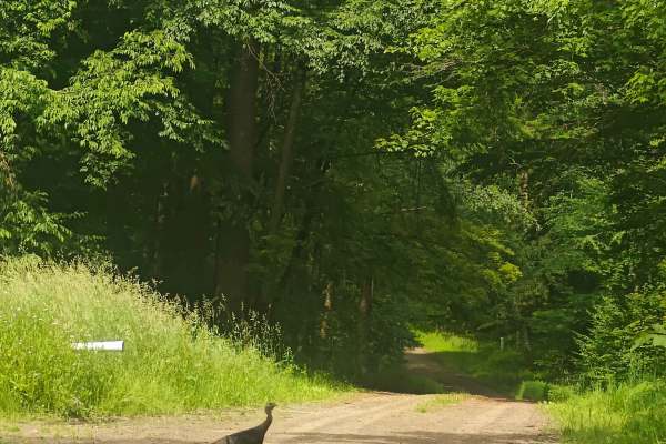
Overlook Rock Trail
This is a 3-mile out and back trail consisting of light gravel, dirt, and some two-track sections across small elevation changes, water spots, and sweeping turns. This small trail offers some fun spots as it takes you deep into the Allegheny National Forest. Along the route are some small turn-offs ...
Learn more about Overlook Rock Trail
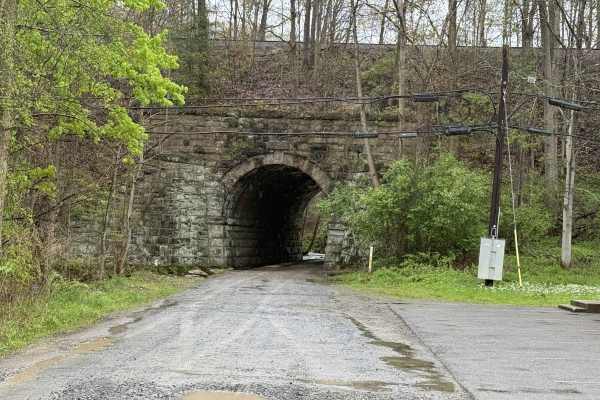
Warrpen - FS 156
Warrpen (FS 156) is a nice scenic road with mountain streams and fir trees. It starts off under the railroad with a stream built into the side of the road, which is the Morrison Run watershed. Along this road, you can find the Warren Archery Club. This road is open year-round to highway-legal vehicl...
Learn more about Warrpen - FS 156
Williams Road
On the western end, this seasonal road grants access to Letchworth State Park and River Road. Some interesting signs can be found along the road. The vegetation in some spots narrows the road and can make it difficult to see oncoming traffic. The eastern intersection of the road also grants parking ...
Learn more about Williams Road
Beginner ATV trails near Lake Erie Beach, New York
Explore ATV-friendly trails near you. These trails are accessible for vehicles up to 50 inches wide, perfect for ATVs and smaller off-road machines.
Hysert Crossroad
A crossroad trail located in Grimsby, Ontario, sandwiched between Mud Street and Ridge Road, the trail consists of a thick clay-covered pathway littered with large ruts and mud. It can be very sticky and difficult to navigate in wet conditions as the main hazard of this trail is the large 5-foot dee...
Learn more about Hysert Crossroad
I Green I1-I9
I trail is the direct way from the campground entrance road to the trail head. Being a one-way trail, this is the one that leads in that direction. It is an easy trail but does have some fun sections like hills and plenty of turns, and you go down the mountain.
Learn more about I Green I1-I9
G3 Pee Wee Area
The area marked for this has one way in and out from the campground area. This is a nice easier section to ride that can be a great start to the day to get warmed up and prepared. The other thing is to have an area that is safe to ride.
Learn more about G3 Pee Wee Area
G Green G-G10
This is an easier trail that works from the campground over to H or the I sections. There are plenty of turns and twists while traversing the woods. This is a nice connection from the campground over to the parking lot or office area. The directional path may loop you around, so be careful of your d...
Learn more about G Green G-G10
Beginner UTV/side-by-side trails near Lake Erie Beach, New York
Find UTV and side-by-side trails near you. These trails accommodate vehicles up to 60 inches wide, ideal for UTVs, side-by-sides, and wider off-road rigs.
Hysert Crossroad
A crossroad trail located in Grimsby, Ontario, sandwiched between Mud Street and Ridge Road, the trail consists of a thick clay-covered pathway littered with large ruts and mud. It can be very sticky and difficult to navigate in wet conditions as the main hazard of this trail is the large 5-foot dee...
Learn more about Hysert Crossroad
I Green I1-I9
I trail is the direct way from the campground entrance road to the trail head. Being a one-way trail, this is the one that leads in that direction. It is an easy trail but does have some fun sections like hills and plenty of turns, and you go down the mountain.
Learn more about I Green I1-I9
G3 Pee Wee Area
The area marked for this has one way in and out from the campground area. This is a nice easier section to ride that can be a great start to the day to get warmed up and prepared. The other thing is to have an area that is safe to ride.
Learn more about G3 Pee Wee Area
G Green G-G10
This is an easier trail that works from the campground over to H or the I sections. There are plenty of turns and twists while traversing the woods. This is a nice connection from the campground over to the parking lot or office area. The directional path may loop you around, so be careful of your d...
Learn more about G Green G-G10
The onX Offroad Difference
onX Offroad combines trail photos, descriptions, difficulty ratings, width restrictions, seasonality, and more in a user-friendly interface. Available on all devices, with offline access and full compatibility with CarPlay and Android Auto. Discover what you're missing today!
Open Trail Map