
Beginner Off-Road Trails
Near Germantown, Kentucky
Explore All Beginner Trails Near Germantown, Kentucky
Beginner Off-Road Trails Near Germantown, Kentucky
Discover the best beginner-friendly off-road trails near you. These easier, lower-rated trails are a great place to start — browse trail maps, check difficulty ratings, and find your next adventure.
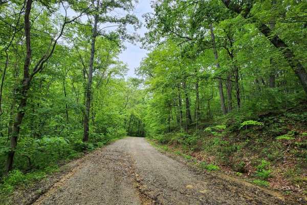
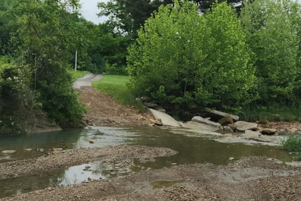
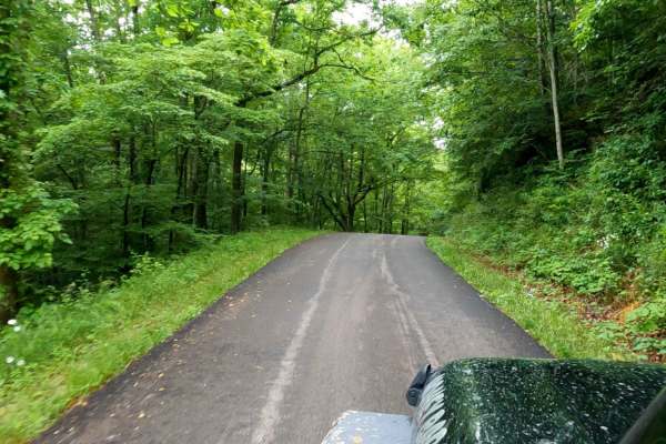
Blacks Run Road
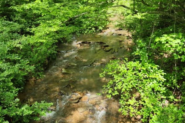
This is an easy scenic trail that can be done with a 4WD vehicle. You can expect some ruts and a couple of steep grades. The trail meanders through the Appalachian plateau. It is very lush and green in the spring and summer. In the fall, you can take in all of the beautiful fall colors of southern O...
Learn more about Blacks Run Road
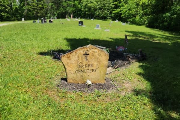
Abner Run Road
A very nice ride out to McKee Cemetery, this trail is very easy, and any 4WD vehicle should be able to handle the route. The trail will allow you to enjoy the beautiful Appalachian Plateau of southern Ohio. This is a township road, so you will need a licensed vehicle.
Learn more about Abner Run Road
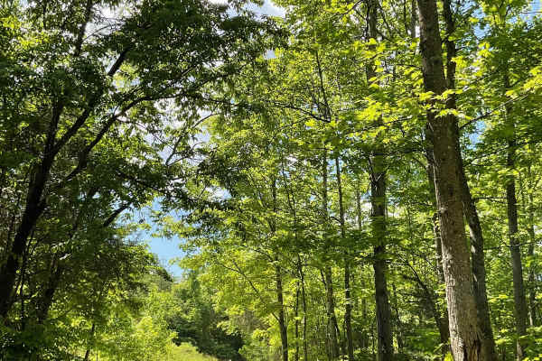
Hamm Road
This is a nice gravel road with great views and a large tree canopy once you get into the trail a little ways. It's a very easy trail, doable with most 4WD vehicles. You can stop for a picnic along the trail and enjoy a great view of Mother Nature. You must have a licensed vehicle for this trail.
Learn more about Hamm Road
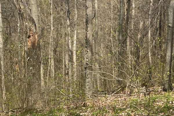
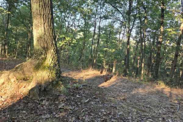
Morrell Hollow
A mixture of mud and off-camber areas with some steep rocky climbs, this trail will test the typical factory-built rig. It starts near an old hunting cabin and continues into the forest past an old cemetery. It is a great trail, however, about halfway down, it is blocked due to tornado damage. There...
Learn more about Morrell Hollow
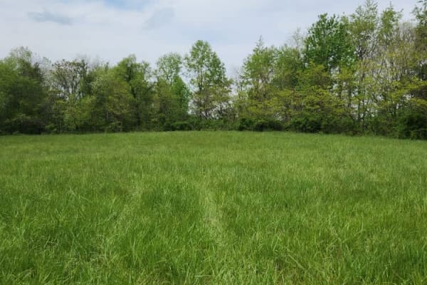
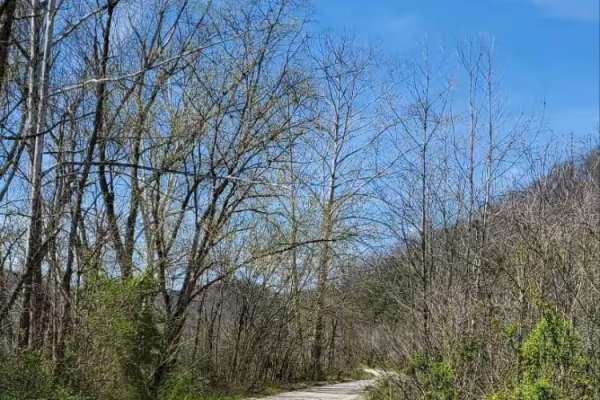
Mouth Hollow Road
This is an easy scenic trail that passes through a meadow on the outskirts of the Shawnee State Forest. This trail is easily passable by any high-clearance vehicle; there are few ruts/obstacles to get through or around. It is just a mellow, slow-paced trail to enjoy nature.
Learn more about Mouth Hollow Road

Sunshine Ridge Road
The trail starts easy, however, once you cross over Blue Creek Road, the trail climbs up a hill and can be slick during and or after some rain. Once on the top, it levels out for a bit until you come to some mud holes. These are about 2 feet deep but have solid bottoms. Continue on the trail until y...
Learn more about Sunshine Ridge Road
Real Ridge Road
This trail follows an easy gravel road on the outskirts of Shawnee State Forest. Small boulders appear along the route but present no significant obstacles. It is a relaxing drive through the Appalachian Plateau of southern Ohio and offers a peaceful way to enjoy the surrounding forest and scenery.
Learn more about Real Ridge Road
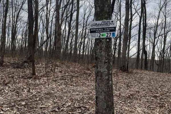
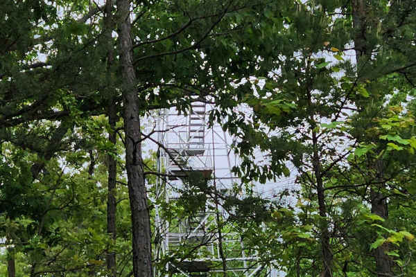
Trail 2 - High Ground
Start or end at the Abandon Communication Tower. The trail follows ridge tops the entire trail. There are tight sections, but they are passable in full-size vehicles. The trail stays dry 90% of the year and is suitable for all ages. The trail has some spur ridge lines off it for future trail expansi...
Learn more about Trail 2 - High Ground

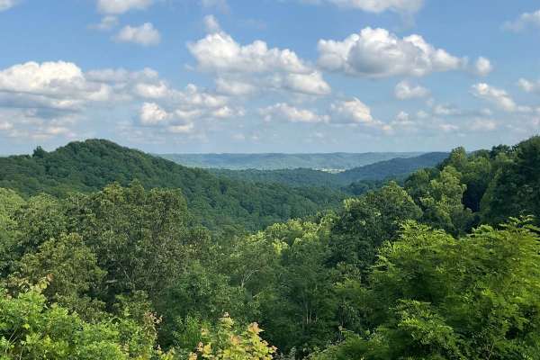
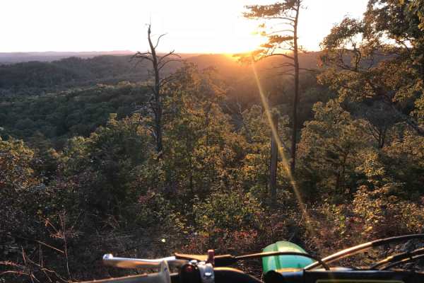
Trail 1 - Tower Ride
Trail 1 will start at the Straight Fork Parking area and ends in "Deep Hole Hollow." This Trail is well maintained and once on the ridge top, it is smooth and easy riding. Be sure to make the hard right at the 201 Trail intersection if you wish to continue on Trail 1. The Trail offers towering views...
Learn more about Trail 1 - Tower Ride
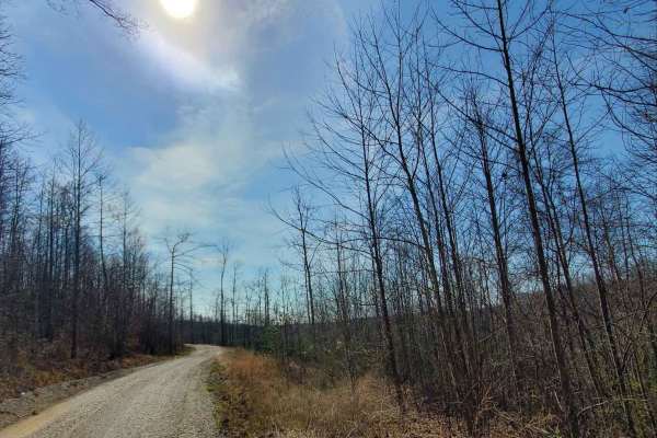
State Forest Road 2
This State Forest road is a well-maintained Forest Service road inside Shawnee State Forest. It is easily doable in a 2WD vehicle, however, there are a few steep climbs and tight switchbacks to be wary of. This is a lovely trail to drive and enjoy the beauty that Mother Nature provides. It also conn...
Learn more about State Forest Road 2
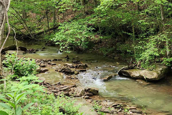
Beech Fork Road
The trail is a nice mix of dirt and gravel with a couple of creek crossings. It is easily doable in a 4x4 vehicle, although some AWD vehicles may have issues with the two water crossings along the route. If you enjoy getting out, taking in your surroundings, and listening to a running creek, then th...
Learn more about Beech Fork Road
Forest Road 16
A well-maintained gravel road that leads to some beautiful views of the Shawnee State Forest, the trail passes through some lush forest. However, do not venture off of the road; it is illegal. You must stay on the marked forest roads. Remember to Tread Lightly and leave it better than you found it.
Learn more about Forest Road 16
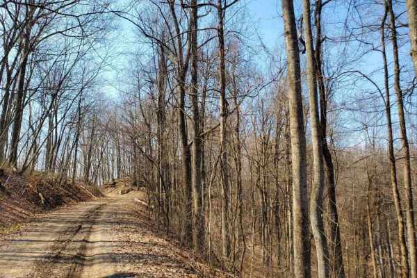
Forest Road 6
This route is a well-maintained gravel road that meanders through the Shawnee State Forest. It is an easy-going route with some excellent views and relaxing overlooks. Please do not venture off of the marked Forest Service roads in the State Forest land. There are no OHV trails.
Learn more about Forest Road 6
White Sulphur ATV Loop to Overlook
White Sulphur OHV Trail System is composed of several Forest Service roads and trails in the White Sulphur area, forming a 17-mile trail system of connecting loops. It is located near Cave Run Lake in the Cumberland Ranger District. The trail is located in moderately rugged terrain, primarily follow...
Learn more about White Sulphur ATV Loop to Overlook
State Forest Road 14
This is an easy, well-maintained gravel road that meanders through the Shawnee State Forest. You will enjoy lush vegetation and bubbling creeks, with a meadow thrown in for good measure. Please do not venture off of the marked Forest Service roads. There are no OHV trails available in the State Fore...
Learn more about State Forest Road 14
Amos Cut
Nice, easy gravel road, following an abandoned railroad. It offers views of the valley below and an operational rock quarry across the way. This road is an abandoned rail bed from the days when the Red River Gorge was being logged. There are no obstacles along this route in typical conditions, but o...
Learn more about Amos Cut
June Bug
Easy gravel drive on a semi-maintained Forest Service road. No destination, just out and back. Offers views of the valley below and geological formations to explore. seen two cave entrances. There is an abandoned cabin that sits off down in the valley below. Great trail for someone looking for a saf...
Learn more about June Bug
Indian Creek Road
Indian Creek Road located in one of the northern portions of Daniel Boone National Forest and is a popular local summer destination for camping, swimming, and fishing. The majority of the road is gravel, two vehicles wide, and well maintained. Camping spots are spread out along the entire length of ...
Learn more about Indian Creek Road
Myers Fork Road
A very scenic paved back road. This road will take you down and in between many trails in the area. This road is also part of the Daniel Boone Backcountry Byway. A fantastic set of trails that run all over the area. Myers Fork leads to some beautiful parts of Frenchburg.
Learn more about Myers Fork Road
Bowen Service Road
Gravel service road for Bowen, Kentucky, that runs along the Mountain Parkway. This trail is out-and-back only, no thruway traffic. Ends at a farmer's field, which is closed off by a gate. It provides views of farmland and the Mountain Parkway along the way, with only a couple of shallow mudholes.
Learn more about Bowen Service Road
Beginner ATV trails near Germantown, Kentucky
Explore ATV-friendly trails near you. These trails are accessible for vehicles up to 50 inches wide, perfect for ATVs and smaller off-road machines.
Morrell Hollow
A mixture of mud and off-camber areas with some steep rocky climbs, this trail will test the typical factory-built rig. It starts near an old hunting cabin and continues into the forest past an old cemetery. It is a great trail, however, about halfway down, it is blocked due to tornado damage. There...
Learn more about Morrell Hollow
Mouth Hollow Road
This is an easy scenic trail that passes through a meadow on the outskirts of the Shawnee State Forest. This trail is easily passable by any high-clearance vehicle; there are few ruts/obstacles to get through or around. It is just a mellow, slow-paced trail to enjoy nature.
Learn more about Mouth Hollow Road
Sunshine Ridge Road
The trail starts easy, however, once you cross over Blue Creek Road, the trail climbs up a hill and can be slick during and or after some rain. Once on the top, it levels out for a bit until you come to some mud holes. These are about 2 feet deep but have solid bottoms. Continue on the trail until y...
Learn more about Sunshine Ridge Road
Trail 2 - High Ground
Start or end at the Abandon Communication Tower. The trail follows ridge tops the entire trail. There are tight sections, but they are passable in full-size vehicles. The trail stays dry 90% of the year and is suitable for all ages. The trail has some spur ridge lines off it for future trail expansi...
Learn more about Trail 2 - High Ground
Beginner UTV/side-by-side trails near Germantown, Kentucky
Find UTV and side-by-side trails near you. These trails accommodate vehicles up to 60 inches wide, ideal for UTVs, side-by-sides, and wider off-road rigs.
Morrell Hollow
A mixture of mud and off-camber areas with some steep rocky climbs, this trail will test the typical factory-built rig. It starts near an old hunting cabin and continues into the forest past an old cemetery. It is a great trail, however, about halfway down, it is blocked due to tornado damage. There...
Learn more about Morrell Hollow
Mouth Hollow Road
This is an easy scenic trail that passes through a meadow on the outskirts of the Shawnee State Forest. This trail is easily passable by any high-clearance vehicle; there are few ruts/obstacles to get through or around. It is just a mellow, slow-paced trail to enjoy nature.
Learn more about Mouth Hollow Road
Sunshine Ridge Road
The trail starts easy, however, once you cross over Blue Creek Road, the trail climbs up a hill and can be slick during and or after some rain. Once on the top, it levels out for a bit until you come to some mud holes. These are about 2 feet deep but have solid bottoms. Continue on the trail until y...
Learn more about Sunshine Ridge Road
Trail 2 - High Ground
Start or end at the Abandon Communication Tower. The trail follows ridge tops the entire trail. There are tight sections, but they are passable in full-size vehicles. The trail stays dry 90% of the year and is suitable for all ages. The trail has some spur ridge lines off it for future trail expansi...
Learn more about Trail 2 - High Ground
The onX Offroad Difference
onX Offroad combines trail photos, descriptions, difficulty ratings, width restrictions, seasonality, and more in a user-friendly interface. Available on all devices, with offline access and full compatibility with CarPlay and Android Auto. Discover what you're missing today!
Open Trail Map