
Off-road trails in undefined

Beginner Off-Road TrailsUnited States of AmericaFort Defiance, Arizona

Beginner Off-Road Trails
Near Fort Defiance, Arizona

Explore All Beginner Trails Near Fort Defiance, Arizona

Trail Length
Technical Rating
Best Time of Year
Sort By

Beginner Off-Road Trails Near Fort Defiance, Arizona

Discover the best beginner-friendly off-road trails near you. These easier, lower-rated trails are a great place to start — browse trail maps, check difficulty ratings, and find your next adventure.
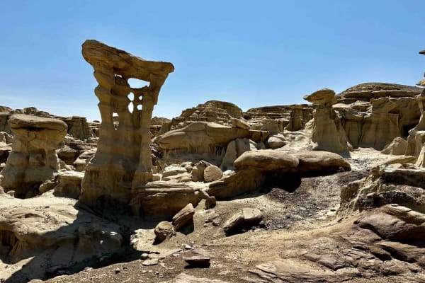
Learn more about Valley of Dreams East
Valley of Dreams East

Valley of Dreams East

This is a point-to-point route that takes you from Road 550 in Nageezi to the Valley of Dreams trailhead/parking lot. The first quarter to half mile or so is paved but quickly turns to a graded dirt road which gets increasingly less groomed the closer you get to the trailhead. Rutted and rough in pl...
Learn more about Valley of Dreams East
Total Miles
19.8
Tech Rating
2Easy
Best Time
Fall, Spring, Summer, Winter
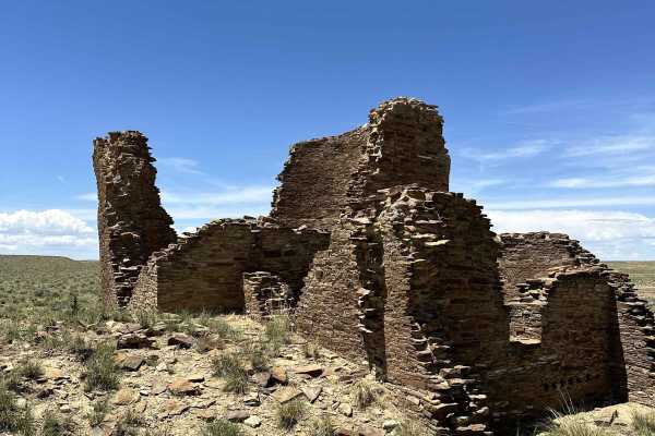
Learn more about Chaco Canyon to Kin Klizhin
Chaco Canyon to Kin Klizhin

Chaco Canyon to Kin Klizhin

Relatively easy trail to one of the more remote ruins of the Chaco Canyon culture. The trail was rutted and uneven, and the last few hundred yards had significant mud due to recent rains. Otherwise, the trail to the ruins was relatively easy, with incredible views of the high desert and Chaco Canyon...
Learn more about Chaco Canyon to Kin Klizhin
Total Miles
11.7
Tech Rating
2Easy
Best Time
Spring, Fall, Summer
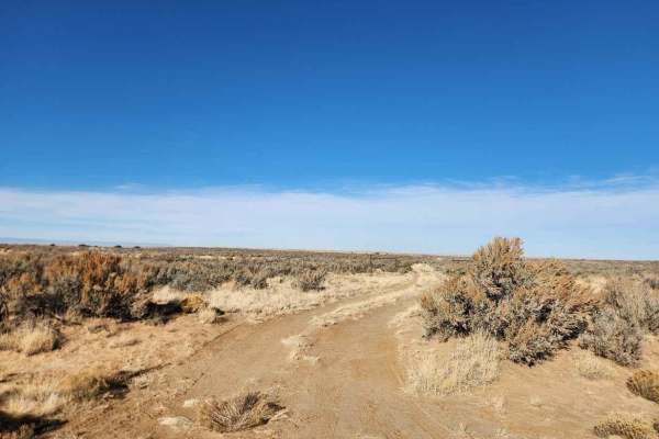
Learn more about Bisti Badlands Overlook
Bisti Badlands Overlook

Bisti Badlands Overlook

Off of Da-Na-Zin Road, this short spur trail takes you to an overlook right on the edge of the Bisti badlands. There is a closed gate at the entrance that should be closed behind you. This short two-track trail has a few washouts but can be done in any typical 4WD SUV or truck. The trail is tight, s...
Learn more about Bisti Badlands Overlook
Total Miles
0.7
Tech Rating
2Easy
Best Time
Spring, Winter, Fall
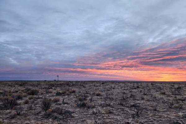
Learn more about Chaco Overlook
Chaco Overlook

Chaco Overlook

This double-track trail takes you through cattle grazing farmland and ends at an overlook. Cows can be seen near the trail. There is nowhere to camp or turn around until the end of the trail. The trail is smooth and can be done in 2WD under good conditions. The overlook is a great place to camp, rig...
Learn more about Chaco Overlook

Total Miles
1.1
Tech Rating
2Easy
Best Time
Spring, Winter, Fall
Learn more about Mt. Taylor Peak 4x4 Road
Mt. Taylor Peak 4x4 Road

Mt. Taylor Peak 4x4 Road

This 4x4 road is a great intro to overlanding, with stunning views and minimal technical obstacles. Starting from Grants, the road climbs almost 5000 feet to within 1/2 mile of Mt. Taylor peak. The road starts off as graded gravel, giving way to a more primitive dirt road, which is easily passable i...
Learn more about Mt. Taylor Peak 4x4 Road

Total Miles
17.5
Tech Rating
2Easy
Best Time
Spring, Summer, Fall
Learn more about Jacquez Canyon Road
Jacquez Canyon Road

Jacquez Canyon Road

This trail is a mixed-use oil and ranching road that runs between Route 550 and Road 7007. It offers relatively rapid access to the trails that zig-zag between Angel's Edge and Largo Canyon. From 550, the trail starts as a clay-based, deeply rutted road that cuts across the open, high desert grassl...
Learn more about Jacquez Canyon Road

Total Miles
13.6
Tech Rating
2Easy
Best Time
Spring, Summer, Fall, Winter
Learn more about Angel Peak Picnic and Campground
Angel Peak Picnic and Campground

Angel Peak Picnic and Campground

The route is relatively easy except for washboarding and ruts in spots. It takes you to breathtaking views of rock formations, including Castle Rock and Angel Peak. Picnic tables overlook the amazing canyons. The campground can accommodate single-vehicle campers and small trailers. There are several...
Learn more about Angel Peak Picnic and Campground

Total Miles
6.5
Tech Rating
2Easy
Best Time
Spring, Summer, Fall
Learn more about RD 7020
RD 7020

RD 7020

CR 7020 is a 7-mile off-road trail and oil access road that serves as the easiest and most direct route from Highway 550 to the Angel Peak Loop and Kutz Canyon. The trail combines sections of deep sand and packed dirt, providing a generally smooth drive under dry conditions. However, its accessibili...
Learn more about RD 7020

Total Miles
6
Tech Rating
2Easy
Best Time
Fall, Spring
Learn more about Hole in the Wall at Malpais National Monument
Hole in the Wall at Malpais National Monument

Hole in the Wall at Malpais National Monument

This excellent day trip starts on the western edge of Malpais National Monument, drives by the Big Tubes cave system and then crosses an easy introduction to driving over rock before accessing the "Hole in the Wall" in back country of Malpais Wilderness. Malpais consists of a series of large lava fi...
Learn more about Hole in the Wall at Malpais National Monument

Total Miles
15
Tech Rating
2Easy
Best Time
Spring, Summer, Fall, Winter
Learn more about Kutz Canyon East
Kutz Canyon East

Kutz Canyon East

While this trail is not technically challenging there are a lot of terrain changes over it's 7.5-mile length. The west end of the trail starts with dirt, packed clay, and sand in a fairly open setting before climbing up over some bare sandstone with some minor ledges to drop down through surrounding...
Learn more about Kutz Canyon East

Total Miles
6.7
Tech Rating
2Easy
Best Time
Spring, Summer, Fall, Winter
Learn more about Kutz Canyon West
Kutz Canyon West

Kutz Canyon West

This oil road starts out wide and sandy but gradually becomes increasingly narrow as it winds its way deeper into the canyon. There are some ledges when entering and exiting washes, but this is a fairly easy trail for anyone with a high-clearance vehicle. Look out for narrow, deeply eroded cuts acro...
Learn more about Kutz Canyon West

Total Miles
7.8
Tech Rating
2Easy
Best Time
Spring, Summer, Fall, Winter
Learn more about Glade Run ATV
Glade Run ATV

Glade Run ATV

This is an easy desert ATV trail through the Glade Run Recreation Area. It's a mix of hardpacked dirt and slickrock with 1-foot ramped rock ledges and uneven layers of slickrock. It goes between cool rock formations and big juniper trees, making quick curves through the trees. It's a fun and fast tr...
Learn more about Glade Run ATV

Total Miles
2.2
Tech Rating
3Easy
Best Time
Spring, Summer, Winter, Fall
Learn more about Choke Cherry ATV
Choke Cherry ATV

Choke Cherry ATV

The northern half of this loop goes through a wide white sand wash, with big sweeping curves through the open desert. It's lined with bushes and pinyon trees and is smooth with no obstacles. Shortly after a powerline, the wash splits, and this trail goes southeast into another almost similar wash th...
Learn more about Choke Cherry ATV

Total Miles
2.9
Tech Rating
3Easy
Best Time
Spring, Summer, Fall, Winter
Learn more about Angel Peak Loop
Angel Peak Loop

Angel Peak Loop

Starting in the high desert immediately adjacent to a canal, the loop utilizes BLM oil roads to dip down into the badlands surrounding Angel Peak. Zig-zagging across the sandy washes that weave through the bottom of Kutz Canyon, the loop encircles Angel Peak for an all-angles view of the peak and fo...
Learn more about Angel Peak Loop

Total Miles
20.5
Tech Rating
3Easy
Best Time
Spring, Fall, Summer, Winter
Learn more about Oilwell Road (Dirt Bike)
Oilwell Road (Dirt Bike)

Oilwell Road (Dirt Bike)

This trail is designated for dirt bikes but is actually a road-width trail that accesses the oil wells. It's flat and straight, with essentially no features except a few small ruts. It's a bit sandy and loose but stays very easy the entire time. There are still signs indicating that it is limited to...
Learn more about Oilwell Road (Dirt Bike)

Total Miles
1.8
Tech Rating
1Easy
Best Time
Spring, Summer, Fall, Winter
Learn more about Coyote Cat ATV
Coyote Cat ATV

Coyote Cat ATV

This 3.3-mile-long easy ATV trail leaves from a main dirt road on the south end and climbs up a loose dirt hill, then winds up and over the small rolling desert hills and into the washes. It's marked with trail signs to help follow the route. A lot of it is easy sandy washes, but it also has some lo...
Learn more about Coyote Cat ATV

Total Miles
3.3
Tech Rating
3Easy
Best Time
Spring, Summer, Fall, Winter
Learn more about Wash ATV
Wash ATV

Wash ATV

This is a 1.6-mile-long easy ATV trail that is a mix of dirt trail and easy wash. The west end starts on an oil well road and heads east towards the wash on a dirt trail through flat sagebrush desert terrain. There are ATV signs on the route to follow. Once you reach the wash, you can turn right, an...
Learn more about Wash ATV

Total Miles
1.6
Tech Rating
2Easy
Best Time
Spring, Summer, Fall, Winter
Learn more about North Twin Wash to Pickering Arroyo ATV
North Twin Wash to Pickering Arroyo ATV

North Twin Wash to Pickering Arroyo ATV

This is an almost 4-mile-long wash loop that is designated for ATVs. The southeast entrance enters the North Twin Wash and heads west. It's a smooth and wide white sand wash, with rock walls to the side, lots of bushes, and pinyon lining the wash. There are several unmarked wash intersections, so th...
Learn more about North Twin Wash to Pickering Arroyo ATV

Total Miles
3.4
Tech Rating
2Easy
Best Time
Spring, Summer, Fall, Winter
Learn more about ATV Loop
ATV Loop

ATV Loop

This is a 4-mile-long ATV loop in the Glade Run Recreation Area. It mostly goes through washes, oilwell roads, and easy ridge lines. The washes are smooth and sandy, with lots of tracks to follow, but they do have lots of intersections and split lines, so make sure to keep looking out for the ATV si...
Learn more about ATV Loop

Total Miles
3.7
Tech Rating
3Easy
Best Time
Spring, Summer, Fall, Winter
Learn more about Casanova Mount Wash
Casanova Mount Wash

Casanova Mount Wash

This is 1.6 miles of Jeep trail through a sand wash. It starts on oilwell roads on either end and stays in the wash the entire time. There's an off-camber entrance into the wash on the east end that makes it more interesting. It's also only one vehicle wide at times, so it's much narrower than most ...
Learn more about Casanova Mount Wash

Total Miles
1.6
Tech Rating
3Easy
Best Time
Spring, Fall, Summer, Winter

Beginner ATV trails near Fort Defiance, Arizona

Explore ATV-friendly trails near you. These trails are accessible for vehicles up to 50 inches wide, perfect for ATVs and smaller off-road machines.

Learn more about Valley of Dreams East
Valley of Dreams East

Valley of Dreams East

This is a point-to-point route that takes you from Road 550 in Nageezi to the Valley of Dreams trailhead/parking lot. The first quarter to half mile or so is paved but quickly turns to a graded dirt road which gets increasingly less groomed the closer you get to the trailhead. Rutted and rough in pl...
Learn more about Valley of Dreams East

Total Miles
19.8
Tech Rating
2Easy
Best Time
Fall, Spring, Summer, Winter
Learn more about Chaco Overlook
Chaco Overlook

Chaco Overlook

This double-track trail takes you through cattle grazing farmland and ends at an overlook. Cows can be seen near the trail. There is nowhere to camp or turn around until the end of the trail. The trail is smooth and can be done in 2WD under good conditions. The overlook is a great place to camp, rig...
Learn more about Chaco Overlook

Total Miles
1.1
Tech Rating
2Easy
Best Time
Spring, Winter, Fall
Learn more about Mt. Taylor Peak 4x4 Road
Mt. Taylor Peak 4x4 Road

Mt. Taylor Peak 4x4 Road

This 4x4 road is a great intro to overlanding, with stunning views and minimal technical obstacles. Starting from Grants, the road climbs almost 5000 feet to within 1/2 mile of Mt. Taylor peak. The road starts off as graded gravel, giving way to a more primitive dirt road, which is easily passable i...
Learn more about Mt. Taylor Peak 4x4 Road

Total Miles
17.5
Tech Rating
2Easy
Best Time
Spring, Summer, Fall
Learn more about Jacquez Canyon Road
Jacquez Canyon Road

Jacquez Canyon Road

This trail is a mixed-use oil and ranching road that runs between Route 550 and Road 7007. It offers relatively rapid access to the trails that zig-zag between Angel's Edge and Largo Canyon. From 550, the trail starts as a clay-based, deeply rutted road that cuts across the open, high desert grassl...
Learn more about Jacquez Canyon Road

Total Miles
13.6
Tech Rating
2Easy
Best Time
Spring, Summer, Fall, Winter

Beginner UTV/side-by-side trails near Fort Defiance, Arizona

Find UTV and side-by-side trails near you. These trails accommodate vehicles up to 60 inches wide, ideal for UTVs, side-by-sides, and wider off-road rigs.

Learn more about Valley of Dreams East
Valley of Dreams East

Valley of Dreams East

This is a point-to-point route that takes you from Road 550 in Nageezi to the Valley of Dreams trailhead/parking lot. The first quarter to half mile or so is paved but quickly turns to a graded dirt road which gets increasingly less groomed the closer you get to the trailhead. Rutted and rough in pl...
Learn more about Valley of Dreams East

Total Miles
19.8
Tech Rating
2Easy
Best Time
Fall, Spring, Summer, Winter
Learn more about Bisti Badlands Overlook
Bisti Badlands Overlook

Bisti Badlands Overlook

Off of Da-Na-Zin Road, this short spur trail takes you to an overlook right on the edge of the Bisti badlands. There is a closed gate at the entrance that should be closed behind you. This short two-track trail has a few washouts but can be done in any typical 4WD SUV or truck. The trail is tight, s...
Learn more about Bisti Badlands Overlook

Total Miles
0.7
Tech Rating
2Easy
Best Time
Spring, Winter, Fall
Learn more about Chaco Overlook
Chaco Overlook

Chaco Overlook

This double-track trail takes you through cattle grazing farmland and ends at an overlook. Cows can be seen near the trail. There is nowhere to camp or turn around until the end of the trail. The trail is smooth and can be done in 2WD under good conditions. The overlook is a great place to camp, rig...
Learn more about Chaco Overlook

Total Miles
1.1
Tech Rating
2Easy
Best Time
Spring, Winter, Fall
Learn more about Mt. Taylor Peak 4x4 Road
Mt. Taylor Peak 4x4 Road

Mt. Taylor Peak 4x4 Road

This 4x4 road is a great intro to overlanding, with stunning views and minimal technical obstacles. Starting from Grants, the road climbs almost 5000 feet to within 1/2 mile of Mt. Taylor peak. The road starts off as graded gravel, giving way to a more primitive dirt road, which is easily passable i...
Learn more about Mt. Taylor Peak 4x4 Road

Total Miles
17.5
Tech Rating
2Easy
Best Time
Spring, Summer, Fall

The onX Offroad Difference

onX Offroad combines trail photos, descriptions, difficulty ratings, width restrictions, seasonality, and more in a user-friendly interface. Available on all devices, with offline access and full compatibility with CarPlay and Android Auto. Discover what you're missing today!

Open Trail Map