
Beginner Off-Road Trails
Near Fleming-Neon, Kentucky
Explore All Beginner Trails Near Fleming-Neon, Kentucky
Beginner Off-Road Trails Near Fleming-Neon, Kentucky
Discover the best beginner-friendly off-road trails near you. These easier, lower-rated trails are a great place to start — browse trail maps, check difficulty ratings, and find your next adventure.
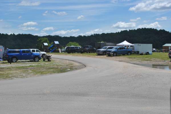
Trail 1
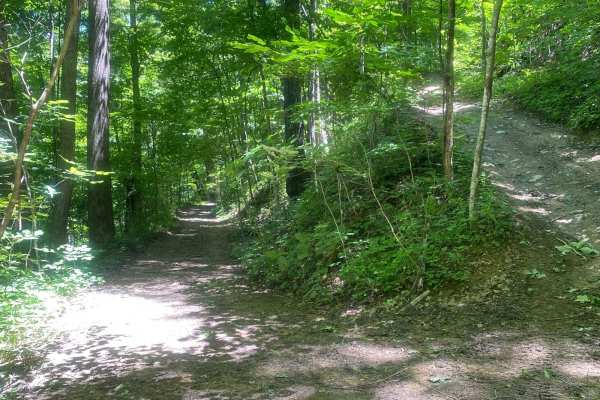
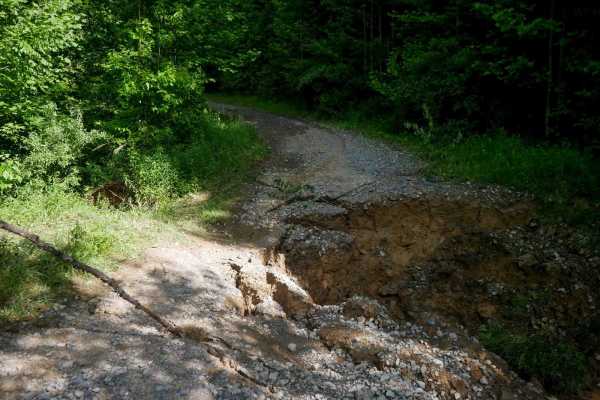
This is the main trail from the parking behind Fishpond Lake. It connects all other trails currently in the marked system. The trail is mostly dirt; expect a lot of standing water even in the summer, occasional tight switchbacks, and short climbs. This trail leads to Trail 6 which eventually wraps b...
Learn more about Trail 1
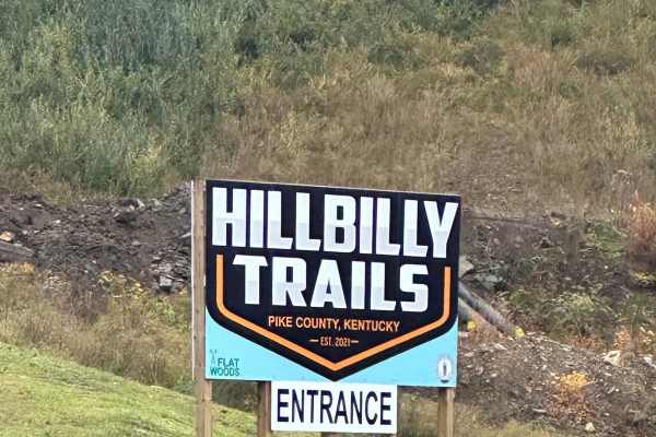
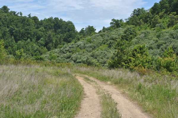
Trail 23 - Flatwoods Road
Trail 23 is the main artery for the Dorton/Flatwoods Area of the new Pike County Hillbilly Trails System. Trail 23 is a wide, graded dirt and gravel access road for an array of utilities and other infrastructure located on Caney Mountain. This trail can be driven with basic 4x4 and street tires when...
Learn more about Trail 23 - Flatwoods Road
23 Main Loop
Trail 23 is the Main Loop around and through the Hillbilly Trails Offroad Park. Connect this section with Trail 23- Flatwoods Road to make a complete loop. This is the easiest of the trails and will be the thoroughfare for finding most all the other trails in the park. This trail is roughly just ove...
Learn more about 23 Main Loop
Trail 25
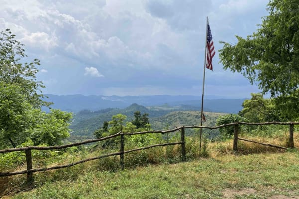
This is a connector trail from Main 23 to Laura's Lookout and beyond. It has a hard base with numerous shallow water holes. It's wide enough for most vehicles, including some full-size vehicles. This short route leads to one of the most scenic overlooks on a Kentucky OHV trail and there's a picnic t...
Learn more about Trail 25
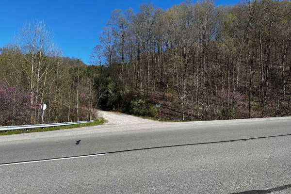
Flat Fork
This is the alternate entrance to Hillbilly Trails of Pike County. It's a gravel road that leads to Trail 23 of Hillbilly Trails. Once you get to the top there are a lot of trails that is developed and many more to develop. There's plenty of primitive camping available with nearly 6,000 acres in the...
Learn more about Flat Fork
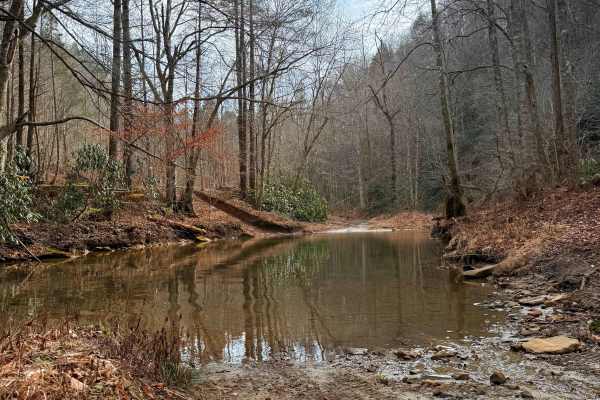
Caney Creek
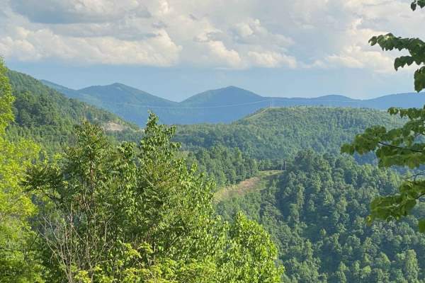
This trail is a point-to-point route that begins as a two-track gravel road following Caney Creek. Expect multiple water crossings; depending on recent rainfall, these can range from A foot deep to completely impassable. The initial stretch features several pull-offs offering stunning views of tower...
Learn more about Caney Creek
19
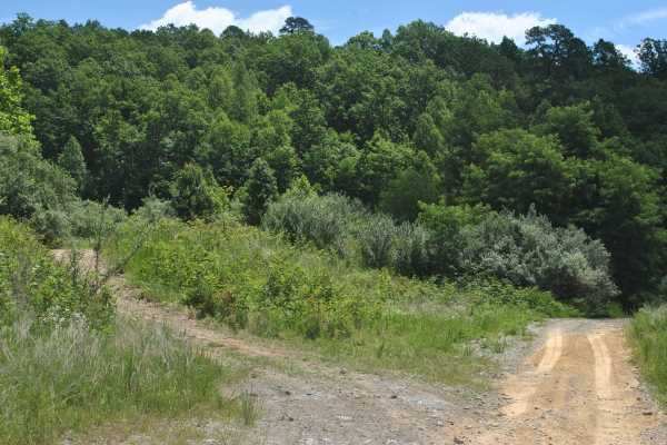
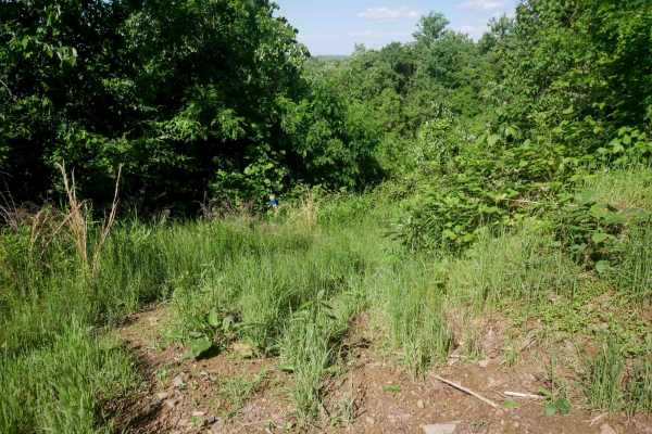
Trail 19 is a green trail and it is mainly grass and dirt. The track is relatively flat with no mudholes. This trail is used as a connector trail and brings you back to trail 0. You can ride this track in 2WD, and it is suitable for most OHVs and some high-clearance 2WD.
Learn more about 19
Campground Road
This track is an access road through the campground area. The first part close to the park office is paved, and then it turns into a dirt road. You can use this road to access all parts of the campground area and the trails that are part of the northeast area of the park. It can be muddy in places, ...
Learn more about Campground Road
1
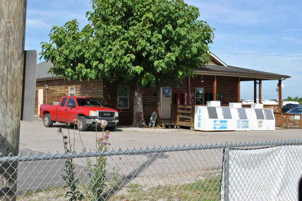
Beginning at the park's General Store, Trail 1 starts out on a paved road. Moving along through the track, it turns into a gravel road. The trail remains gravel through most of its length. The road gets quite dusty, so wear eye protection if you are not in an enclosed cab. This is a 5-mile track tha...
Learn more about 1
10
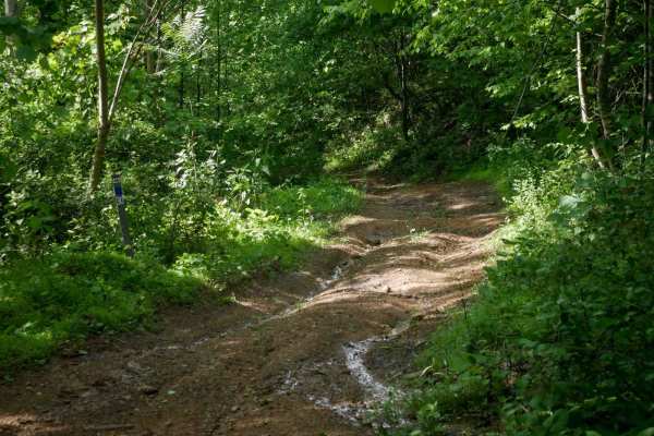
Trail 10 is a green trail, and the surface is primarily dirt. It seems tight and overgrown by brush in a few places, but overall, it is wide enough for a full-size vehicle to pass. There are a few mudholes to cross, so 4WD may be needed in places. Just be mindful before hitting those and be in 4WD b...
Learn more about 10
RV26
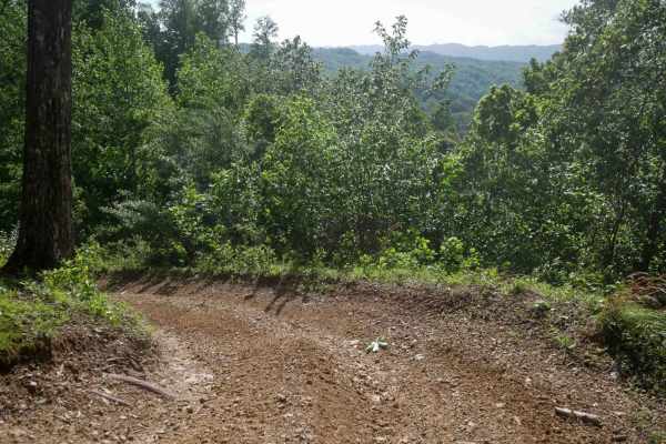
RV 26 is a short connector between segments of RV40 in the Ridgeview trail system, offering an easy dirt surface with a semi-steep slope. Light ruts are present, but the trail is easy overall. When descending, riders are rewarded with a scenic view overlooking the surrounding mountains, making it a ...
Learn more about RV26
RV24
RV 24 is a very short, 100-foot long connector between segments of RV40 in the Ridgeview trail system. It features a semi-steep climb from north to south over smooth dirt with light ruts. The trail presents no significant obstacles and is easy to navigate. It allows you to bail out early from the lo...
Learn more about RV24
RV1
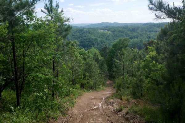
RV1 is a 12-mile main access route through the Ridgeview trail system, suitable for all skill levels. The trail features mostly easy, gradual grades with narrow ridgeline sections, shelf-like paths, small loose rocks, ruts, debris, and some slick spots. The northern end is the steepest part of the t...
Learn more about RV1

2
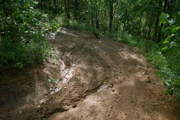
Trail 2 is marked green and is mostly a dirt trail. Depending on the weather, there could be mud holes scattered throughout the track. Towards the end of the track, there are a few hill climbs with softball-sized rocks scattered across the entire width of the trail. Take care navigating these in a l...
Learn more about 2
RV22
RV 22 is a short, 120-yard connector trail between segments of RV40 in the Ridgeview trail system. It is a grassy and overgrown shelf cut into the hillside and appears to see very little traffic. While easy overall, its narrow width and lack of recent use may require cautious navigation.
Learn more about RV22

Oval Ridge
This short and easy hillside trail travels through dense vegetation and mature timber, offering excellent wildlife viewing, scenic overlooks, and seasonal displays of wildflowers and berries. The route is well maintained, with a clean surface and only minor rocky sections, making it accessible for A...
Learn more about Oval Ridge
RV30
RV30 is a short connector trail in the Ridgeview trail system that climbs from the intersection with RV28 back up to RV1. While it is less rocky than RV28, it does feature some pronounced ruts and a semi-steep grade. Despite the slope, the trail remains easy overall with no significant obstacles.
Learn more about RV30

Valley Trail
This scenic and well-maintained hillside trail travels through dense vegetation and mature forest, offering excellent wildlife viewing, seasonal wildflowers, and berry patches along the way. The route is short and easy, featuring a mostly smooth surface with only light rocky sections. Riders can enj...
Learn more about Valley Trail
RV20
RV 20 is a 540-yard-long spur off of RV1 in the Ridgeview trail system. The trail is grassy and overgrown, with tight corners and dense tree cover on both sides. It features some dips, bumps, and a small rutted climb, but remains easy overall with no significant technical challenges.
Learn more about RV20

Hillside Trail
This well-maintained trail winds through dense vegetation and offers abundant wildlife viewing opportunities, scenic hillside vistas, and seasonal wildflowers and berries. The route features a smooth surface with only minor rocky sections, making it approachable for a wide range of users. The trail ...
Learn more about Hillside Trail
Beginner ATV trails near Fleming-Neon, Kentucky
Explore ATV-friendly trails near you. These trails are accessible for vehicles up to 50 inches wide, perfect for ATVs and smaller off-road machines.
Trail 1
This is the main trail from the parking behind Fishpond Lake. It connects all other trails currently in the marked system. The trail is mostly dirt; expect a lot of standing water even in the summer, occasional tight switchbacks, and short climbs. This trail leads to Trail 6 which eventually wraps b...
Learn more about Trail 1
Trail 23 - Flatwoods Road
Trail 23 is the main artery for the Dorton/Flatwoods Area of the new Pike County Hillbilly Trails System. Trail 23 is a wide, graded dirt and gravel access road for an array of utilities and other infrastructure located on Caney Mountain. This trail can be driven with basic 4x4 and street tires when...
Learn more about Trail 23 - Flatwoods Road
23 Main Loop
Trail 23 is the Main Loop around and through the Hillbilly Trails Offroad Park. Connect this section with Trail 23- Flatwoods Road to make a complete loop. This is the easiest of the trails and will be the thoroughfare for finding most all the other trails in the park. This trail is roughly just ove...
Learn more about 23 Main Loop
Trail 25
This is a connector trail from Main 23 to Laura's Lookout and beyond. It has a hard base with numerous shallow water holes. It's wide enough for most vehicles, including some full-size vehicles. This short route leads to one of the most scenic overlooks on a Kentucky OHV trail and there's a picnic t...
Learn more about Trail 25
Beginner UTV/side-by-side trails near Fleming-Neon, Kentucky
Find UTV and side-by-side trails near you. These trails accommodate vehicles up to 60 inches wide, ideal for UTVs, side-by-sides, and wider off-road rigs.
Trail 1
This is the main trail from the parking behind Fishpond Lake. It connects all other trails currently in the marked system. The trail is mostly dirt; expect a lot of standing water even in the summer, occasional tight switchbacks, and short climbs. This trail leads to Trail 6 which eventually wraps b...
Learn more about Trail 1
Trail 23 - Flatwoods Road
Trail 23 is the main artery for the Dorton/Flatwoods Area of the new Pike County Hillbilly Trails System. Trail 23 is a wide, graded dirt and gravel access road for an array of utilities and other infrastructure located on Caney Mountain. This trail can be driven with basic 4x4 and street tires when...
Learn more about Trail 23 - Flatwoods Road
23 Main Loop
Trail 23 is the Main Loop around and through the Hillbilly Trails Offroad Park. Connect this section with Trail 23- Flatwoods Road to make a complete loop. This is the easiest of the trails and will be the thoroughfare for finding most all the other trails in the park. This trail is roughly just ove...
Learn more about 23 Main Loop
Trail 25
This is a connector trail from Main 23 to Laura's Lookout and beyond. It has a hard base with numerous shallow water holes. It's wide enough for most vehicles, including some full-size vehicles. This short route leads to one of the most scenic overlooks on a Kentucky OHV trail and there's a picnic t...
Learn more about Trail 25
The onX Offroad Difference
onX Offroad combines trail photos, descriptions, difficulty ratings, width restrictions, seasonality, and more in a user-friendly interface. Available on all devices, with offline access and full compatibility with CarPlay and Android Auto. Discover what you're missing today!
Open Trail Map