
Beginner Off-Road Trails
Near Farwell, Michigan
Explore All Beginner Trails Near Farwell, Michigan
Beginner Off-Road Trails Near Farwell, Michigan
Discover the best beginner-friendly off-road trails near you. These easier, lower-rated trails are a great place to start — browse trail maps, check difficulty ratings, and find your next adventure.
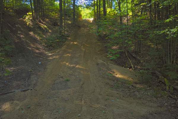
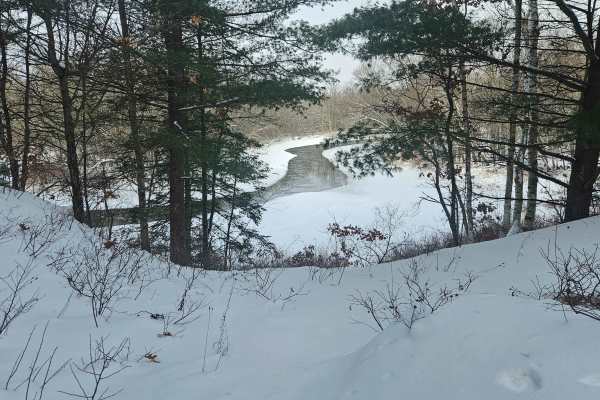
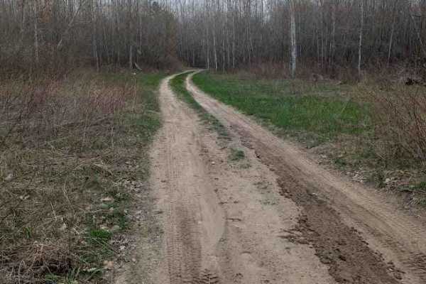
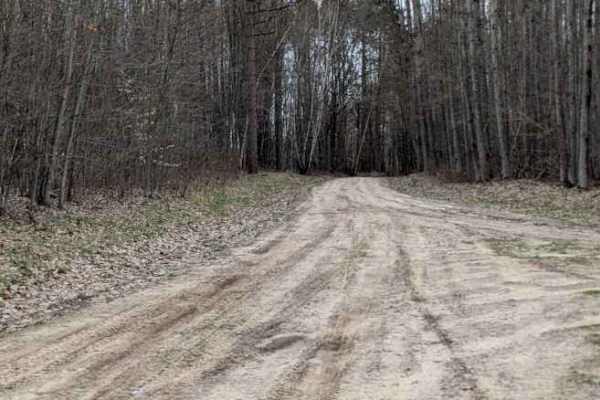
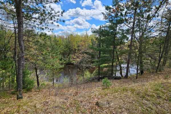
The Missing Bowls
This trail includes 2 large bowls that can be climbed into and out of from many different paths. My trail only shows 1 of the options, but almost all are accessible in one way or another. There are some tight areas in this trail system, however, they can be navigated or if trees are in the way (many...
Learn more about The Missing Bowls
Whisker's Trail
While it seems like a straightforward trail, there are many overgrown trees, which we attempted to groom back, and towards the end (depending on the direction you go) there is a little bit of an off-camber uphill section. While this is overgrown some, it was groomed back by myself and a friend. But ...
Learn more about Whisker's Trail
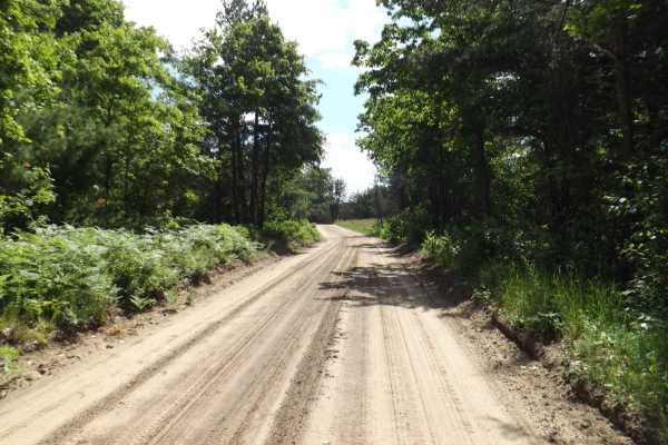
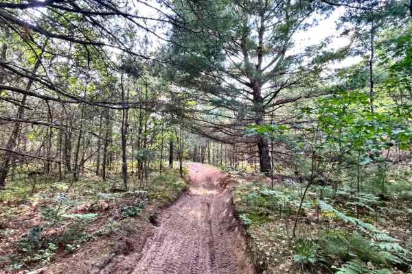
Loose Lane
This trail winds out and back through the Pine and hardwood forest in the Gladwin Forest Management Unit. It is a combination of a single lane dirt trail and a narrow dirt two-track. The trail gets quite narrow in spots, so be prepared for some possible scraping from the trees. You will also encount...
Learn more about Loose Lane
Mostetler Road Ride
A single lane and two-track trail that is sandy dirt in most areas. It is a narrow trail with overgrown vegetation that could scrape the sides of your vehicle. You will also encounter some low-hanging tree branches. The out-and-back portion dead ends into private property, but there are some camping...
Learn more about Mostetler Road Ride
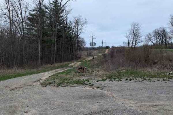
Thornapple Trail
This is a Seasonal Road that leads back to an area known as the High Banks. This used to be a State Forest Campground accessible to full-size campers. The State has since installed gates to keep traffic from the actual High Banks area itself. There are two separate River View turnouts that allow cam...
Learn more about Thornapple Trail
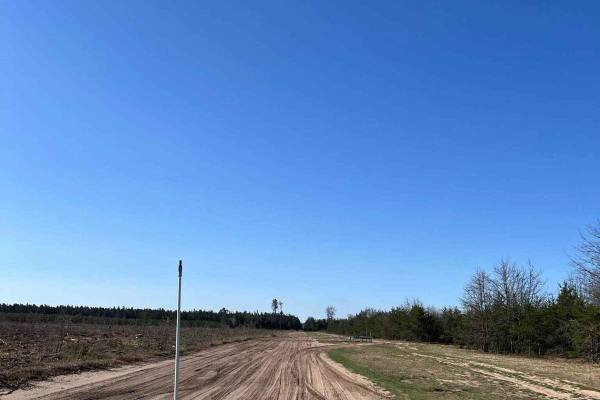
Sumac Trail
This is a standard Michigan seasonal road that passes through the Gladwin Forest Management Area. If you travel too far south, you'll eventually leave the system of trails. This seasonal road will reconnect you to many of the trails in the north. It is easy as well as scenic and relaxing.
Learn more about Sumac Trail
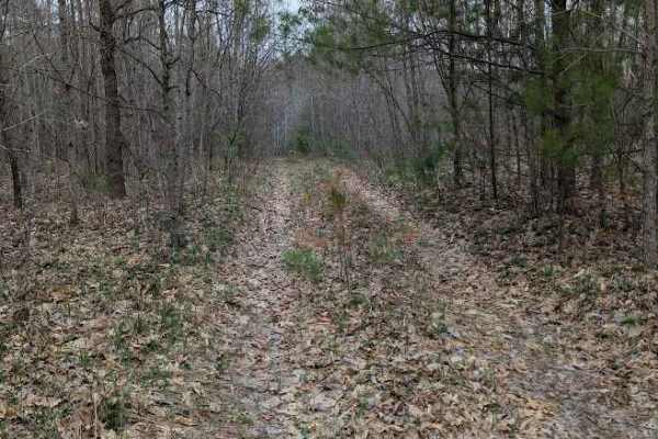
Creek Crossing
Creek Crossing is an entertaining trail that winds through the hardwoods of the Gladwin Forest Management Unit. It's a sandy dirt two-track that travels through wooded areas, clearings, and logged areas. Opportunities to observe wildlife are numerous. There is a large downed tree and a water hole on...
Learn more about Creek Crossing
Lake Station
Take a quick shortcut to Temple, Michigan, through this scenic trail that begins near Marion, Michigan. This trail passes through the Gladwin Forest Management Unit and also many Consumer Energy paths that are interconnected throughout the area. This area is also occasionally active with logging ope...
Learn more about Lake Station
Birch Tree Trail
An enjoyable, winding trail through a section of the Gladwin Forest Management Unit. You will see varied hardwood trees along the trail, including plenty of Birch trees. There is a small clearing that could be used for a staging area at the East Long Lake Road access point. It is primarily a single-...
Learn more about Birch Tree Trail
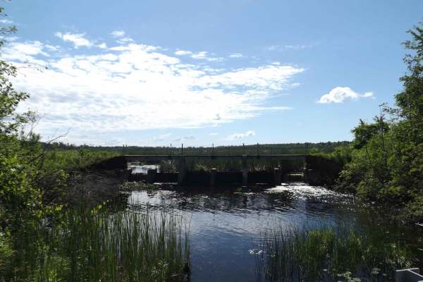
Floodwood Swamp Reservoir
This is a beautiful and fun trail that runs through the Floodwood Swamp Reservoir in the Gladwin Forest Management Area, offering some obstacles and amazing wildlife spotting opportunities. It's a full-width trail with mixed traffic. You will encounter a bridge crossing, banks, and lots of mud, sand...
Learn more about Floodwood Swamp Reservoir
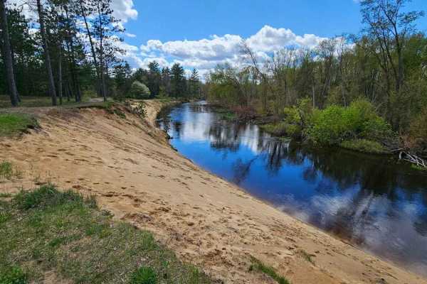
Leota South River Route
This is a combination of ORV route and Forest Service roads. The trail can have numerous chatter bumps if it hasn't been groomed recently. There are some great views of the Muskegon River at 3 different locations along the way. These are very popular places for dispersed camping. The trail is very s...
Learn more about Leota South River Route
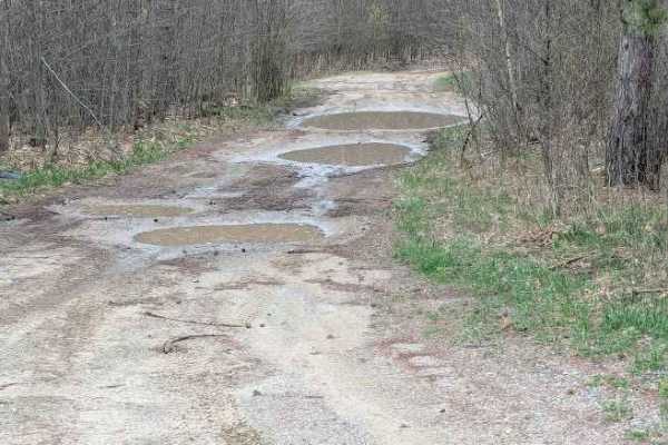
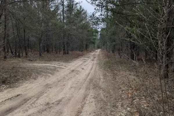
West Olson Trail
The trail starts at the intersection of West Olson Road and Geneva Road. There are large yellow turn signs on either side of the trail marking the normal roads. It is 1 to 2 vehicles wide with numerous mud holes, though most were not very deep, even in the spring, no more than a few inches. This cou...
Learn more about West Olson Trail
Riske Road
This trail winds through the hardwoods in the Gladwin Forest Management Unit. A relatively smooth dirt two-track that is part of a larger network of trails in the area. There are spurs off the main trail that you can explore if desired. You will also encounter an optional mudhole to play in on one o...
Learn more about Riske Road
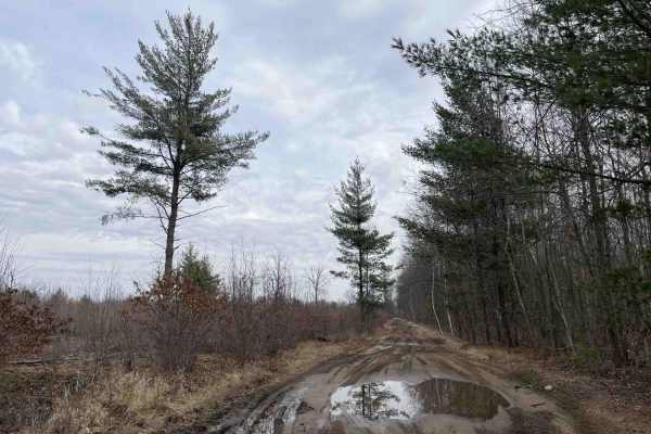
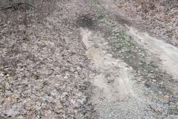
Little Leota Trail
The trail is nicely wooded with soft-packed sand, with a few sandier sections at intersections and in the corners. In August, mudholes are still possible. Little Leota has many intersections to hop back onto the hard-packed two-track to take you back to the trailhead. This is a wonderful sand trail ...
Learn more about Little Leota Trail
Playground Pass
Playground Pass is a grass and dirt two-track trail that is part of a larger network of trails in the area. The trail offers a little for all offroad levels. There are a few spurs off the trail that can be explored. You will also find two play areas that consist of a small, sandy pit where you can h...
Learn more about Playground Pass
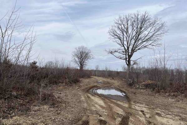
Lone Oak
This out-and-back trail starts off as a two-track through a logged area with a few lone oak trees still standing before getting sandier and heading into the woods. The first half of the trail is fairly dry, but near the end, there are several large water holes. Depending on the season and weather, t...
Learn more about Lone Oak
Leota High Banks
This is a direct line to the Leota High Banks on the north side of the Muskegon River. This will take you through a mix of recently forested and older-growth forest. Along the way, you will encounter mostly Forest Service roads that are easily passable with a high-clearance vehicle. The draw to this...
Learn more about Leota High Banks
Benzie Lane West
An entertaining trail that could be easily overlooked due to its location alongside the highway, this trail offers an out-and-back ride that can be enjoyed by most stock offroad vehicles. It is a dirt one-lane trail through a mostly evergreen section of the forest. There is plenty of wildlife to enj...
Learn more about Benzie Lane West
Osceola Trail South
This trail is a fun ride through the hardwood forest on a mostly smooth but sometimes bumpy dirt road that is a part of a larger network of trails in the area. There are water/mud holes all along the trail, but they shouldn't be a significant problem during normal conditions. This trail is accessibl...
Learn more about Osceola Trail South
Harrison Loop
This is a loop trail that starts and ends at South Harrison Road. There is a large staging area at the southern access point. This trail is a single lane in spots, and a very tight two-track in other sections. The northern two-track portion is very tight with tree branches on both sides as well as o...
Learn more about Harrison Loop
Beginner ATV trails near Farwell, Michigan
Explore ATV-friendly trails near you. These trails are accessible for vehicles up to 50 inches wide, perfect for ATVs and smaller off-road machines.
The Missing Bowls
This trail includes 2 large bowls that can be climbed into and out of from many different paths. My trail only shows 1 of the options, but almost all are accessible in one way or another. There are some tight areas in this trail system, however, they can be navigated or if trees are in the way (many...
Learn more about The Missing Bowls
Loose Lane
This trail winds out and back through the Pine and hardwood forest in the Gladwin Forest Management Unit. It is a combination of a single lane dirt trail and a narrow dirt two-track. The trail gets quite narrow in spots, so be prepared for some possible scraping from the trees. You will also encount...
Learn more about Loose Lane
Mostetler Road Ride
A single lane and two-track trail that is sandy dirt in most areas. It is a narrow trail with overgrown vegetation that could scrape the sides of your vehicle. You will also encounter some low-hanging tree branches. The out-and-back portion dead ends into private property, but there are some camping...
Learn more about Mostetler Road Ride
Thornapple Trail
This is a Seasonal Road that leads back to an area known as the High Banks. This used to be a State Forest Campground accessible to full-size campers. The State has since installed gates to keep traffic from the actual High Banks area itself. There are two separate River View turnouts that allow cam...
Learn more about Thornapple Trail
Beginner UTV/side-by-side trails near Farwell, Michigan
Find UTV and side-by-side trails near you. These trails accommodate vehicles up to 60 inches wide, ideal for UTVs, side-by-sides, and wider off-road rigs.
The Missing Bowls
This trail includes 2 large bowls that can be climbed into and out of from many different paths. My trail only shows 1 of the options, but almost all are accessible in one way or another. There are some tight areas in this trail system, however, they can be navigated or if trees are in the way (many...
Learn more about The Missing Bowls
Whisker's Trail
While it seems like a straightforward trail, there are many overgrown trees, which we attempted to groom back, and towards the end (depending on the direction you go) there is a little bit of an off-camber uphill section. While this is overgrown some, it was groomed back by myself and a friend. But ...
Learn more about Whisker's Trail
Loose Lane
This trail winds out and back through the Pine and hardwood forest in the Gladwin Forest Management Unit. It is a combination of a single lane dirt trail and a narrow dirt two-track. The trail gets quite narrow in spots, so be prepared for some possible scraping from the trees. You will also encount...
Learn more about Loose Lane
Mostetler Road Ride
A single lane and two-track trail that is sandy dirt in most areas. It is a narrow trail with overgrown vegetation that could scrape the sides of your vehicle. You will also encounter some low-hanging tree branches. The out-and-back portion dead ends into private property, but there are some camping...
Learn more about Mostetler Road Ride
The onX Offroad Difference
onX Offroad combines trail photos, descriptions, difficulty ratings, width restrictions, seasonality, and more in a user-friendly interface. Available on all devices, with offline access and full compatibility with CarPlay and Android Auto. Discover what you're missing today!
Open Trail Map