
Beginner Off-Road Trails
Near Emerald Lake Hills, California
Explore All Beginner Trails Near Emerald Lake Hills, California
Beginner Off-Road Trails Near Emerald Lake Hills, California
Discover the best beginner-friendly off-road trails near you. These easier, lower-rated trails are a great place to start — browse trail maps, check difficulty ratings, and find your next adventure.
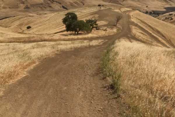
Juniper Trail
Juniper Trail is one of the park's primary connector routes, linking riders to the broader trail network. The trail features mostly smooth hardpack dirt with a mix of winding turns, climbs, and descents that make for an enjoyable ride.
As the route progresses, riders gain access to several steeper h...
Learn more about Juniper Trail
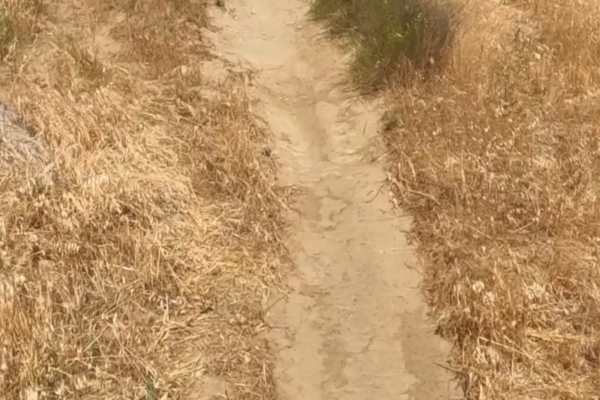
Badger
Badger Trail runs parallel to Ridge Trail, following the same hillside at a lower elevation. The route consists of firm hardpack dirt and a series of winding turns that contour along the slope. Technical obstacles are minimal, with few rocks or ruts to navigate. However, the steep hillside and narro...
Learn more about Badger
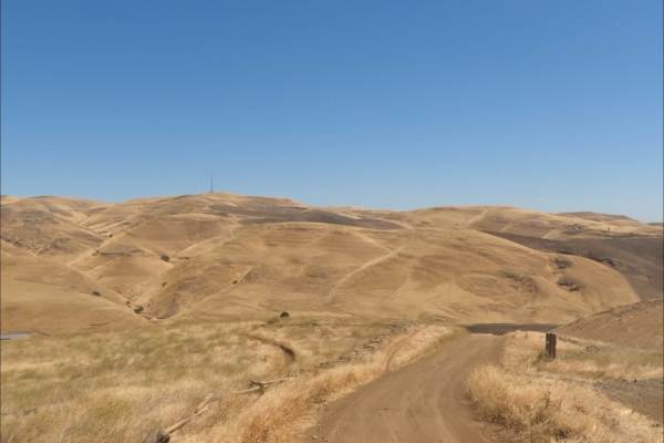
Los Osos Trail
The Los Osos Trail is one of the park's main connector routes, providing access to many of the surrounding trails and trail networks. The trail consists mostly of smooth, well-groomed hardpack dirt and offers an easy, enjoyable ride through the park.
Expect a mix of winding turns, gradual climbs, an...
Learn more about Los Osos Trail
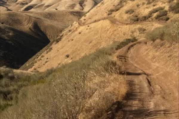
Red Trail
Juniper Trail is one of the park's primary connector routes, linking riders to the broader trail network. The trail features mostly smooth hardpack dirt with a mix of winding turns, climbs, and descents that make for an enjoyable ride.
As the route progresses, riders gain access to several steeper h...
Learn more about Red Trail
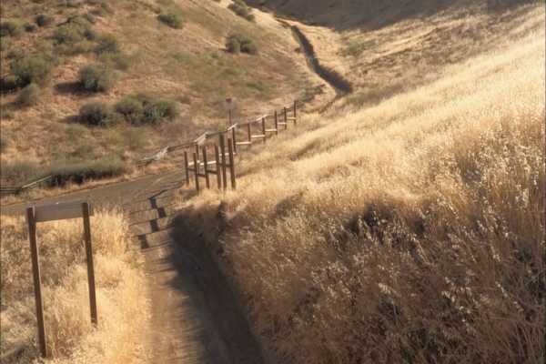
Golden Eagle
Golden Eagle Trail is a mellow hardpack dirt route that serves as a connector to SRI Loop and several other trails within the network. The trail is generally smooth and easy to follow, with a mix of steep climbs and descents along the way.
Riders traveling toward SRI Loop will need to cross a paved ...
Learn more about Golden Eagle
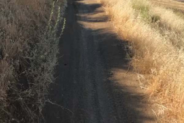
Sri Loop
SRI Loop begins with a steep, winding descent on hardpack dirt. The trail follows a narrow, mostly groomed path with rolling terrain, featuring several steep climbs and descents along the way. Expect light rutting in places, but few significant obstacles. After the loop, you can enter the Golden Eag...
Learn more about Sri Loop
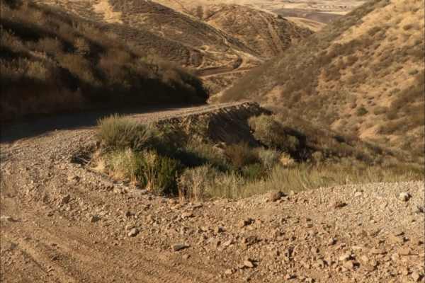
Kiln Trail
Kiln Trail is one of the primary entrances to the park. The route begins as a mellow hardpack dirt road leading to the park boundary, where signs outline park regulations and warn visitors about mountain lions. Shortly after entering, riders encounter the first notable obstacle: a steep climb with l...
Learn more about Kiln Trail
Beginner ATV trails near Emerald Lake Hills, California
Explore ATV-friendly trails near you. These trails are accessible for vehicles up to 50 inches wide, perfect for ATVs and smaller off-road machines.
Juniper Trail
Juniper Trail is one of the park's primary connector routes, linking riders to the broader trail network. The trail features mostly smooth hardpack dirt with a mix of winding turns, climbs, and descents that make for an enjoyable ride.
As the route progresses, riders gain access to several steeper h...
Learn more about Juniper Trail
Badger
Badger Trail runs parallel to Ridge Trail, following the same hillside at a lower elevation. The route consists of firm hardpack dirt and a series of winding turns that contour along the slope. Technical obstacles are minimal, with few rocks or ruts to navigate. However, the steep hillside and narro...
Learn more about Badger
Los Osos Trail
The Los Osos Trail is one of the park's main connector routes, providing access to many of the surrounding trails and trail networks. The trail consists mostly of smooth, well-groomed hardpack dirt and offers an easy, enjoyable ride through the park.
Expect a mix of winding turns, gradual climbs, an...
Learn more about Los Osos Trail
Red Trail
Juniper Trail is one of the park's primary connector routes, linking riders to the broader trail network. The trail features mostly smooth hardpack dirt with a mix of winding turns, climbs, and descents that make for an enjoyable ride.
As the route progresses, riders gain access to several steeper h...
Learn more about Red Trail
Beginner UTV/side-by-side trails near Emerald Lake Hills, California
Find UTV and side-by-side trails near you. These trails accommodate vehicles up to 60 inches wide, ideal for UTVs, side-by-sides, and wider off-road rigs.
Juniper Trail
Juniper Trail is one of the park's primary connector routes, linking riders to the broader trail network. The trail features mostly smooth hardpack dirt with a mix of winding turns, climbs, and descents that make for an enjoyable ride.
As the route progresses, riders gain access to several steeper h...
Learn more about Juniper Trail
Los Osos Trail
The Los Osos Trail is one of the park's main connector routes, providing access to many of the surrounding trails and trail networks. The trail consists mostly of smooth, well-groomed hardpack dirt and offers an easy, enjoyable ride through the park.
Expect a mix of winding turns, gradual climbs, an...
Learn more about Los Osos Trail
Kiln Trail
Kiln Trail is one of the primary entrances to the park. The route begins as a mellow hardpack dirt road leading to the park boundary, where signs outline park regulations and warn visitors about mountain lions. Shortly after entering, riders encounter the first notable obstacle: a steep climb with l...
Learn more about Kiln Trail
The onX Offroad Difference
onX Offroad combines trail photos, descriptions, difficulty ratings, width restrictions, seasonality, and more in a user-friendly interface. Available on all devices, with offline access and full compatibility with CarPlay and Android Auto. Discover what you're missing today!
Open Trail Map