
Beginner Off-Road Trails
Near East Palatka, Florida
Explore All Beginner Trails Near East Palatka, Florida
Beginner Off-Road Trails Near East Palatka, Florida
Discover the best beginner-friendly off-road trails near you. These easier, lower-rated trails are a great place to start — browse trail maps, check difficulty ratings, and find your next adventure.
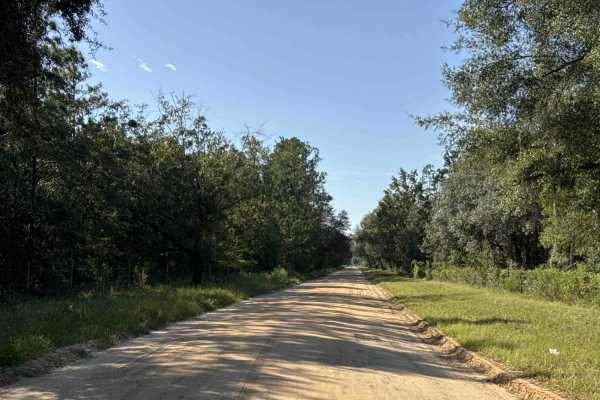
Old Starke Road
Old Starke Road is an old country road that takes you from County Road 309D to the eastern part of the Etoniah Creek State Forest. It's another way to explore the area. The road conditions are a mixture of packed sand, loose sand, and some deep holes that can turn into 2-foot deep mud holes after ra...
Learn more about Old Starke Road
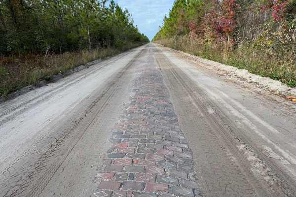
Old Brick Road (Old Dixie Highway)
Citrus WMA Trail 11B, identified as Forest Road 11B on Florida Forest Service maps, is a 2.6-mile, full-width 4WD route in the Citrus Tract of Withlacoochee State Forest near Inverness, Florida. The trail connects with West Stage Coach Trail and provides access to the Citrus Wildlife Management Area...
Learn more about Old Brick Road (Old Dixie Highway)
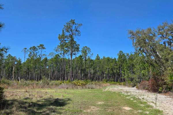
State Forest Road
This segment is part of the Etoniah Creek State Forest trail network and serves as an easy connector between nearby forest service roads. The surface shifts away from the heavier crush-and-run found on adjacent segments and is made up mostly of hard-packed sand and dirt, with a small amount of remai...
Learn more about State Forest Road
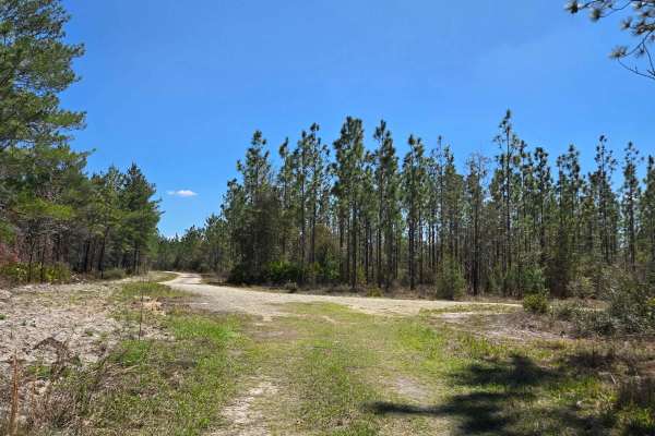
Sandy Trail
This segment is part of the Etoniah Creek State Forest trail system and serves as a useful connector within the larger network. The trail is generally one vehicle wide, with only infrequent places to pass. The surface is mostly soft, loose sand with some grassy sections, making it more demanding tha...
Learn more about Sandy Trail
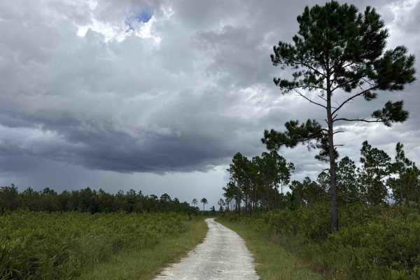
East V Road
East V Road takes you from State Route 100 at the south end of the trail into the east part of the Etoniah Creek State Forest. The road conditions are a mixture of packed sand, loose sand, and some deep holes that can turn into 2-foot deep mud holes after rainy days. The road is not always wide enou...
Learn more about East V Road
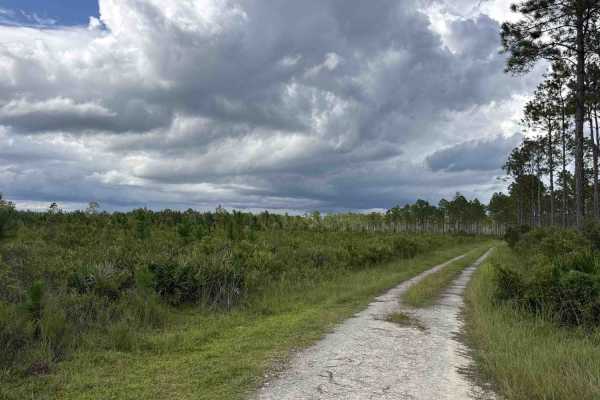
Fire Road
Fire Road is a loop road that starts and ends at East V Road in the eastern part of the Etoniah Creek State Forest. The road conditions are a mixture of packed sand, loose sand, and some deep holes that can turn into 2-foot deep mud holes after rainy days. The road is not always wide enough for two ...
Learn more about Fire Road
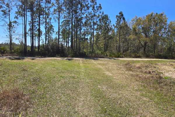
Firebreak Road
This segment is part of the Etoniah Creek State Forest trail network and serves as an easy connector between several nearby forest service roads of similar construction. The surface is mostly hard-packed crush-and-run, with a few sandy areas that add minor variation but do not significantly increase...
Learn more about Firebreak Road
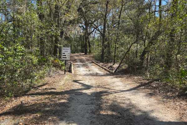
West V Road
This short segment is part of the Etoniah Creek State Forest trail network and serves as an easy connector within the larger system. The surface is hard-packed crush-and-run, making it easy to travel in normal dry conditions, including for most passenger vehicles. The segment crosses Etoniah Creek o...
Learn more about West V Road
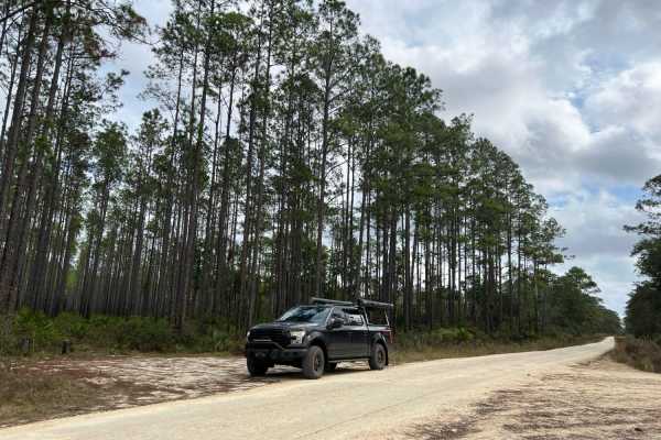
New River Road
New River Road is an improved road of hard-packed gravel and sand. It gains access to Davenport Landing Campground and trailhead along the Ocklawaha River. It's a cool secluded campsite sheltered by a hammock in Ocala National Forest. It also connects to many forest roads with more technical terrain...
Learn more about New River Road
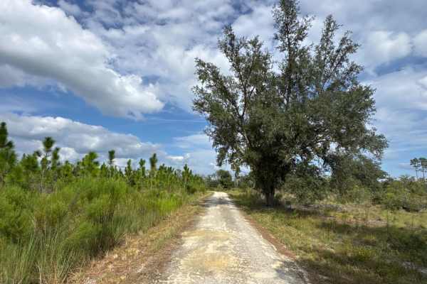
Quail Road
Quail Road connects Fieldhouse Road and Halloway Road in the eastern part of the Etoniah Creek State Forest. The road conditions are a mixture of packed sand, loose sand, and some deep holes that can turn into 2-foot deep mud holes after rainy days. The road is not always wide enough for two vehicle...
Learn more about Quail Road
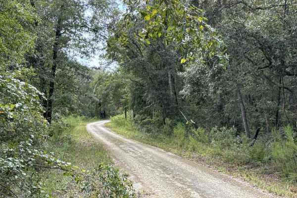
North Creek Road
North Creek Road connects Fieldhouse Road and Quail Road in the eastern part of the Etoniah Creek State Forest. The road conditions are a mixture of packed sand, loose sand, and some deep holes that can turn into 2-foot deep mud holes after rainy days. The road is not always wide enough for two vehi...
Learn more about North Creek Road
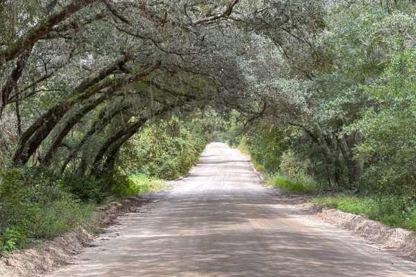
Halloway Road
Halloway Road connects State Route 100 at the south end of the trail and Tinsley Road at the north end. It takes you through the Etoniah Creek State Forest and gives you access to several trails, hiking trails, and the 10-mile horseback riding trail. The road conditions are a mixture of packed sand,...
Learn more about Halloway Road
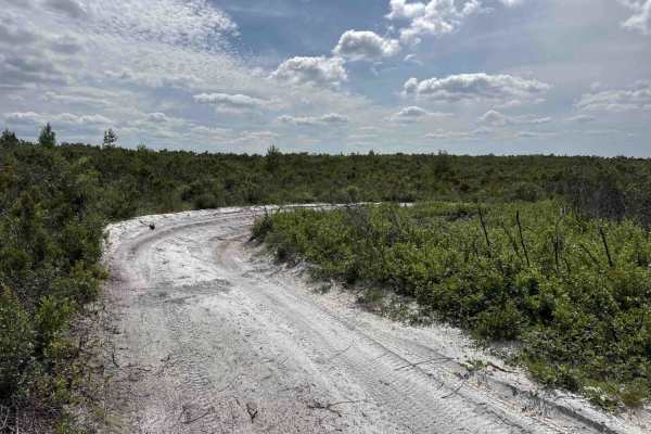
Cablegate Road
Cablegate Road is a loop that starts and ends at Halloway Road in the north-west part of the Etoniah Creek State Forest. The trail gives you access to several hiking trails and crosses the 10-mile horseback riding trail several times. The road conditions are a mixture of packed sand, loose sand, and...
Learn more about Cablegate Road
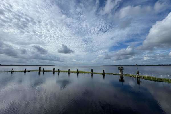
Kirkpatrick Dam Trail
The Kirkpatrick Dam Trail takes you to the Kirkpatrick Dam Boat Ramp and the Recreation Area with picnic tables, restrooms, and a fishing pier. The road conditions are a mixture of packed sand, loose sand, and deep holes that can turn into 2 feet deep mud holes after rainy days. The road is always w...
Learn more about Kirkpatrick Dam Trail
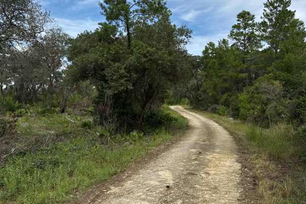
Scrub Road
Scrub Road takes you from Halloway Road at the south end to Tinsley Road at the north end of the trail in the northeast part of the Etoniah Creek State Forest. The road conditions are a mixture of packed sand, loose sand, and some deep holes that can turn into 2-foot deep mud holes after rainy days....
Learn more about Scrub Road
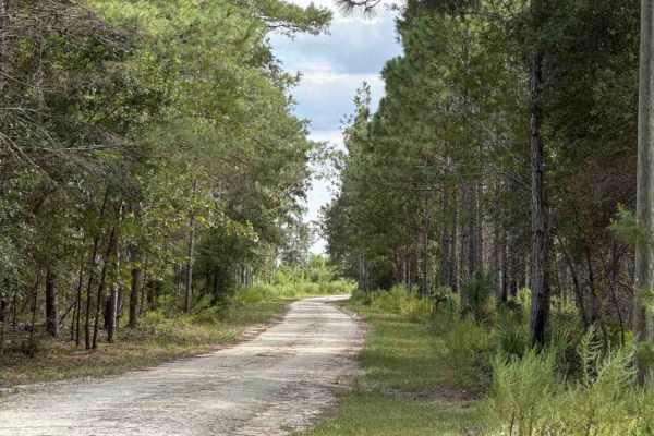
Fieldhouse Road
Fieldhouse Road takes you from Halloway Road at the west end and North Creek Road at the east end of the trail in the eastern part of the Etoniah Creek State Forest. The trail gives you access to the only restrooms in the Wildlife Management Area (WMA), the staging area to access the 10-mile horseba...
Learn more about Fieldhouse Road
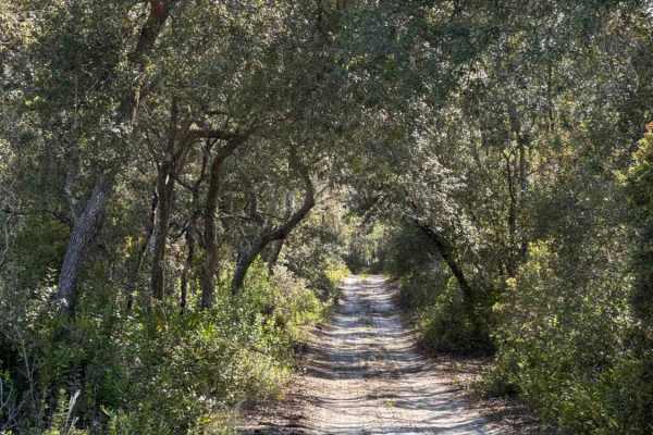
Cemetery Road
Cemetery Road takes you from Cablegate Road at the south end and Easy Street at the north end of the trail in the northwest part of the Etoniah Creek State Forest. The trail gives you access to several trails, hiking trails, and crosses the 10-mile horseback riding trail several times. The road cond...
Learn more about Cemetery Road
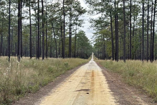
North Tower Trail - ONF 70
The North Tower Trail, also known as Ocala National Forest Road 70, connects Halfmoon North Trail at the east end and NE 160th Ave Rd at the west end in the North Part of the ONF. The trail crosses the Sandy Pipeline Run and Longleaf Trail (OHV). The road conditions are a mixture of packed sand, loo...
Learn more about North Tower Trail - ONF 70
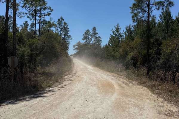
West Cross Br Bay - ONF 21
West Cross Br Bay, also known as Ocala National Forest Road 21, connects North Cross at the south end and New River Road at the north end in the North Part of the ONF. It gives you access to Davenport Landing Campsite with access to the Ocklawaha River. The road conditions are a mixture of packed sa...
Learn more about West Cross Br Bay - ONF 21
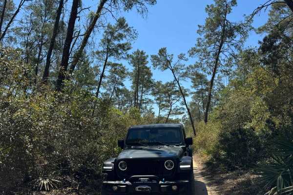
Neck - ONF 41
The Neck Trail, also known as Ocala National Forest Road 41, connects North Cross at the north end and Fort Gates Ferry Road at the south end in the North Part of the ONF. The trail is a shortcut to avoid the narrow part of the North Cross trail. The road conditions are a mixture of packed sand, loo...
Learn more about Neck - ONF 41
Beginner ATV trails near East Palatka, Florida
Explore ATV-friendly trails near you. These trails are accessible for vehicles up to 50 inches wide, perfect for ATVs and smaller off-road machines.
Old Starke Road
Old Starke Road is an old country road that takes you from County Road 309D to the eastern part of the Etoniah Creek State Forest. It's another way to explore the area. The road conditions are a mixture of packed sand, loose sand, and some deep holes that can turn into 2-foot deep mud holes after ra...
Learn more about Old Starke Road
Old Brick Road (Old Dixie Highway)
Citrus WMA Trail 11B, identified as Forest Road 11B on Florida Forest Service maps, is a 2.6-mile, full-width 4WD route in the Citrus Tract of Withlacoochee State Forest near Inverness, Florida. The trail connects with West Stage Coach Trail and provides access to the Citrus Wildlife Management Area...
Learn more about Old Brick Road (Old Dixie Highway)
North Tower Trail - ONF 70
The North Tower Trail, also known as Ocala National Forest Road 70, connects Halfmoon North Trail at the east end and NE 160th Ave Rd at the west end in the North Part of the ONF. The trail crosses the Sandy Pipeline Run and Longleaf Trail (OHV). The road conditions are a mixture of packed sand, loo...
Learn more about North Tower Trail - ONF 70
West Cross Br Bay - ONF 21
West Cross Br Bay, also known as Ocala National Forest Road 21, connects North Cross at the south end and New River Road at the north end in the North Part of the ONF. It gives you access to Davenport Landing Campsite with access to the Ocklawaha River. The road conditions are a mixture of packed sa...
Learn more about West Cross Br Bay - ONF 21
Beginner UTV/side-by-side trails near East Palatka, Florida
Find UTV and side-by-side trails near you. These trails accommodate vehicles up to 60 inches wide, ideal for UTVs, side-by-sides, and wider off-road rigs.
Old Starke Road
Old Starke Road is an old country road that takes you from County Road 309D to the eastern part of the Etoniah Creek State Forest. It's another way to explore the area. The road conditions are a mixture of packed sand, loose sand, and some deep holes that can turn into 2-foot deep mud holes after ra...
Learn more about Old Starke Road
Old Brick Road (Old Dixie Highway)
Citrus WMA Trail 11B, identified as Forest Road 11B on Florida Forest Service maps, is a 2.6-mile, full-width 4WD route in the Citrus Tract of Withlacoochee State Forest near Inverness, Florida. The trail connects with West Stage Coach Trail and provides access to the Citrus Wildlife Management Area...
Learn more about Old Brick Road (Old Dixie Highway)
East V Road
East V Road takes you from State Route 100 at the south end of the trail into the east part of the Etoniah Creek State Forest. The road conditions are a mixture of packed sand, loose sand, and some deep holes that can turn into 2-foot deep mud holes after rainy days. The road is not always wide enou...
Learn more about East V Road
Fire Road
Fire Road is a loop road that starts and ends at East V Road in the eastern part of the Etoniah Creek State Forest. The road conditions are a mixture of packed sand, loose sand, and some deep holes that can turn into 2-foot deep mud holes after rainy days. The road is not always wide enough for two ...
Learn more about Fire Road
The onX Offroad Difference
onX Offroad combines trail photos, descriptions, difficulty ratings, width restrictions, seasonality, and more in a user-friendly interface. Available on all devices, with offline access and full compatibility with CarPlay and Android Auto. Discover what you're missing today!
Open Trail Map