
Beginner Off-Road Trails
Near Des Arc, Missouri
Explore All Beginner Trails Near Des Arc, Missouri
Beginner Off-Road Trails Near Des Arc, Missouri
Discover the best beginner-friendly off-road trails near you. These easier, lower-rated trails are a great place to start — browse trail maps, check difficulty ratings, and find your next adventure.
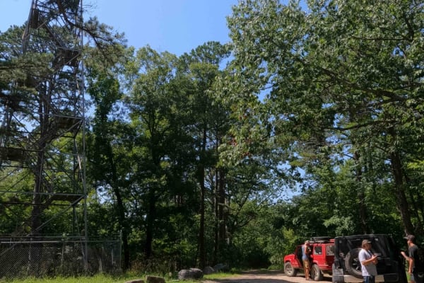
Funk Tower Road
Funk Tower Road is a gravel access road on the Missouri Department of Conservation's Riverside Conservation Area land and is near the neighboring Funk Memorial State Forest and Wildlife Area land, the two plots total 530+ acres of land. The general purpose of the road is to provide access up to the ...
Learn more about Funk Tower Road
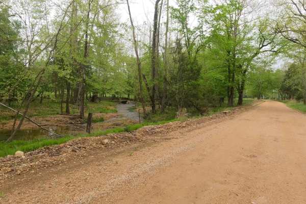
Funk Branch Road
Funk Branch Road, or the combination road of Reynolds County Road 456 and Iron County Road 149, is a coarse gravel county road along the Funk Branch Creek, providing access to the north side of the Black River Bottoms area within the Clearwater Lake U.S. Army Corps of Engineer Land. The road begins ...
Learn more about Funk Branch Road
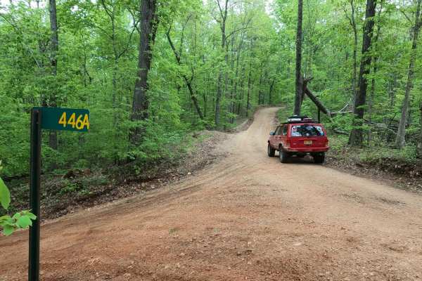
Long Ridge Road
Long Ridge Road (Reynolds County Road 462 and Iron County Road 151) is a coarse gravel county road providing access to the northeast portion of the Black River Bottoms area within the Clearwater Lake U.S. Army Corps of Engineer Land. The road starts from Missouri Route-BB, 0.1 miles east of the Funk...
Learn more about Long Ridge Road
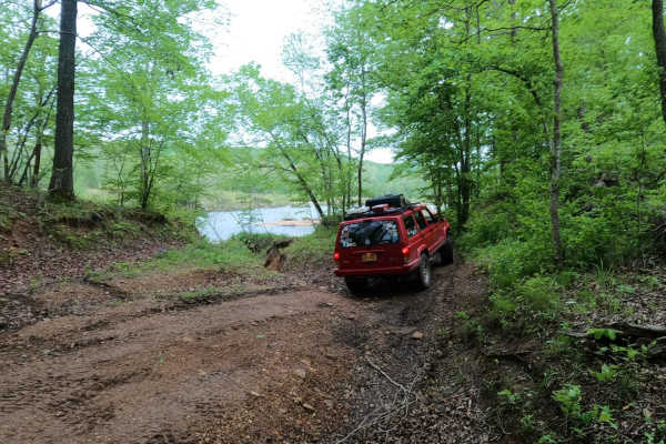
Mann Cemetery Road
Mann Cemetery Road, or Reynolds County Road 456, is a coarse gravel road transforming to a natural dirt road in the northern portion of the Black River Bottoms area within the Clearwater Lake U.S. Army Corps of Engineer Land. This road features views of the valley surrounded by the rolling hills of ...
Learn more about Mann Cemetery Road
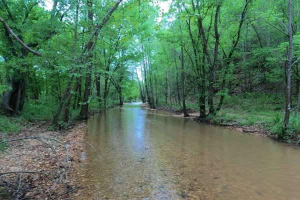
Hackworth Hollow Trail
Hackworth Hollow Trail, also known locally as part of Funk Branch Road or Reynolds County Road 446A, is a coarse gravel road transforming to a creek bottom road and back to a coarse gravel road through the northern portion of the Black River Bottoms area within the Clearwater Lake U.S. Army Corps of...
Learn more about Hackworth Hollow Trail
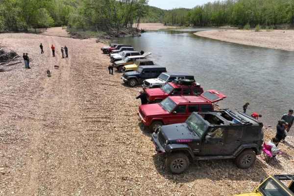
Funk Branch Delta
Funk Branch Delta Trail, or Funk Shore Access, is a coarse creek gravel and dirt/mud trail through the northern portion of the Black River Bottoms area within the Clearwater Lake U.S. Army Corps of Engineer Land. The trail is an in/out track that features an entry point off the creek bottom section ...
Learn more about Funk Branch Delta
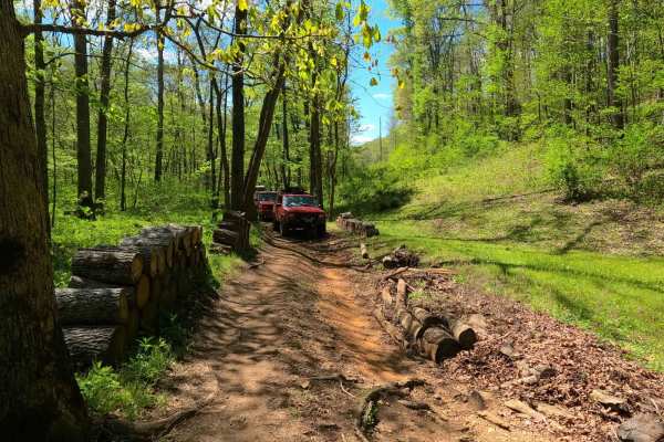
Stacked Log Trail
Stacked Log Trail, also known as the Spool Bypass or Reynolds County Road 458, is a half coarse gravel road, half natural dirt/small rock trail through the north central portion of the Black River Bottoms area within the Clearwater Lake U.S. Army Corps of Engineer Land. Stacked Log starts at the Cen...
Learn more about Stacked Log Trail
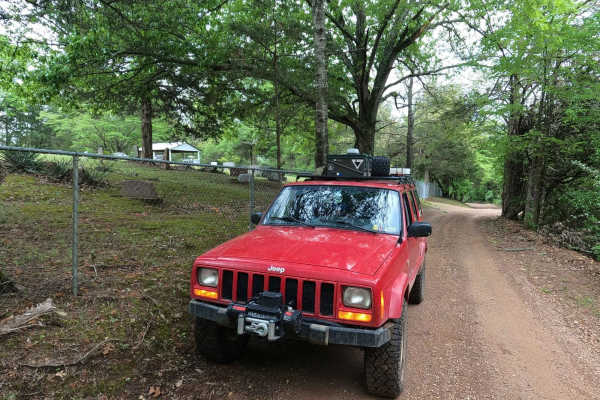
Murphy Cemetery Road
Murphy Cemetery Road, including part of the Reynolds County Road 466, is a coarse gravel road with natural tendencies. It tracks through the southern portion of the Black River Bottoms area within the Clearwater Lake U.S. Army Corps of Engineers, Reynolds County, and "Riverside" Missouri Department ...
Learn more about Murphy Cemetery Road
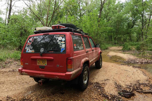
Central Riverside Connector
Central Riverside Connector is a coarse gravel and natural dirt/mud trail through the center portion of the Black River Bottoms area within the Clearwater Lake U.S. Army Corps of Engineer Land. The Central Riverside Connector is so named because it connects the midway points of the North Riverside T...
Learn more about Central Riverside Connector
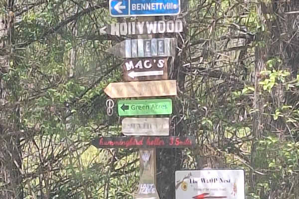
K-Bridge West
This road starts as an asphalt road (.08 miles) at the K Bridge West entrance. There is a campground to your right and a "day use" area at your left that leads down to the river. This road follows CR 452 until your turn at CR 442. As you come off the asphalt, you will find yourself on a well-maintai...
Learn more about K-Bridge West
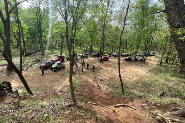
Central Bluffs Trail
Central Bluffs Trail, or Black River Bottoms Central Hub, consists of parts of the Reynolds County Roads 462 and 464 and is a dirt/sand mix and natural creek-bottom rock trail through the center portion of the Black River Bottoms area within the Clearwater Lake U.S. Army Corps of Engineer Land. The ...
Learn more about Central Bluffs Trail
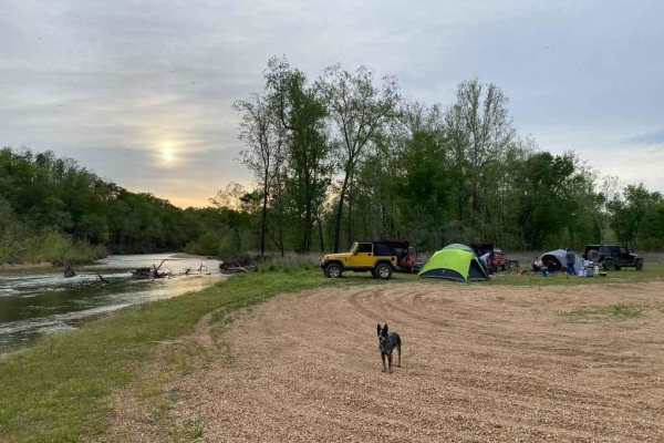
Whizenhunt Bottoms
Whizenhunt Bottoms, also known as Whizenhunt Hollow Trail or simply The Bottoms, is a natural creek/river rock, sand, and dirt, with wooded trails leading to roughly 115 acres of open area along the Riverside Depths route of the Black River Bottoms area within the Clearwater Lake U.S. Army Corps of ...
Learn more about Whizenhunt Bottoms

Reynolds - CR 468
The Reynolds County Road 468, what could be known as the Lower or South Black River Bottoms Access Road, is a gravel-based county road that makes its way through the US Army Corps of Engineers Land on the east side of Black River. It features scenic views of the hilly river landscape of the area it ...
Learn more about Reynolds - CR 468

Charlton Bluff/Seematter Hollow Road
The Charlton Bluff/Seematter Hollow Road is a US Army Corps of Engineers Road that leads down into the eastern shore bottoms of the Black River, where Charlton Bluff sticks out towards the river on the west side shoreline. The road first begins by passing the Seematter Cemetery, right after you turn...
Learn more about Charlton Bluff/Seematter Hollow Road
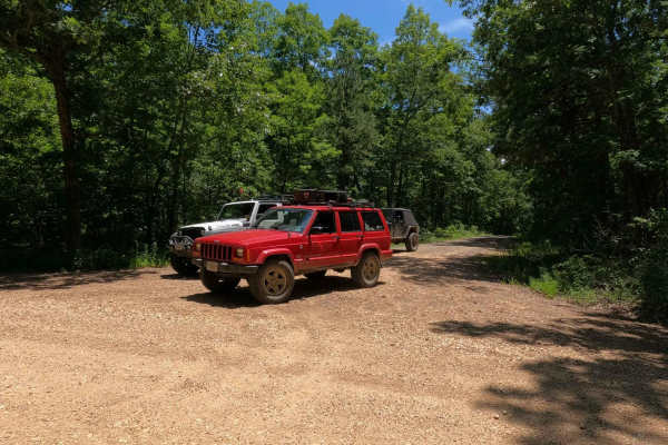
Corner - FSR 2113
Corner - FSR 2113, is an easy-going gravel forestry road through the Fredericktown sector of Mark Twain National Forest. It features small rolling hills with mild climbs, mild feeder creek crossings, and several campable cutouts along its path. The primary draw to the road appears to be hunting seas...
Learn more about Corner - FSR 2113
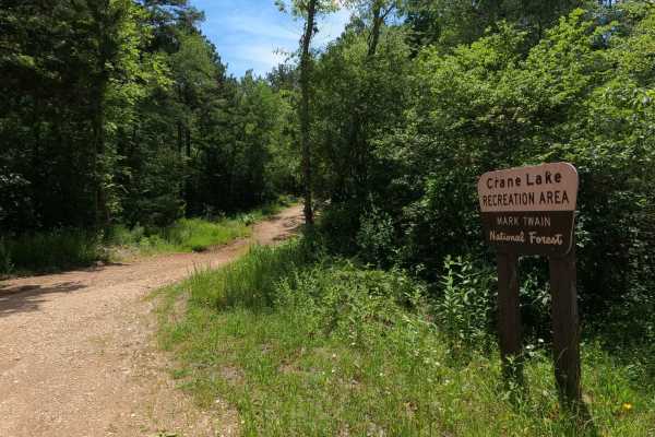
Crane Lake Recreation Area FRS 2117
The Crane Lake Recreation Area FSR 2117 is a gravel Forest Service road along the northeast corner of Crane Lake, which is within the Fredericktown Sector of Mark Twain National Forest. This is a great central hub for exploration in the area, located amongst many of the area's other Forest Service r...
Learn more about Crane Lake Recreation Area FRS 2117
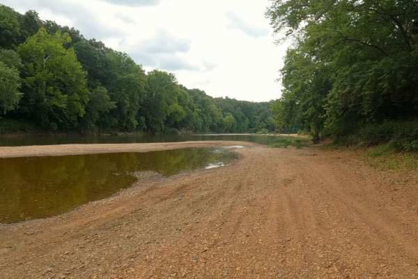
Joe Bill Bluff - RD27
Joe Bill Bluff or Corps of Engineers Road 27, formerly the Wayne County Road 381, is a maintained gravel road that transforms into a river gravel bar trail along the St. Francis River within the Corps of Engineers Wappapello Lake District. The trail features maintained gravel on the higher land lead...
Learn more about Joe Bill Bluff - RD27
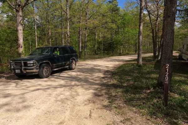
Nine Mile (Marsh Creek FSR 2120)
Nine Mile, also known as Marsh Creek FSR 2120, is a gravel forestry route through the Fredericktown sector of Mark Twain National Forest. The road features generally easy riding through the part of the St Francois mountains it lays upon, it features some moderate hill climbs, loose gravel, mounding,...
Learn more about Nine Mile (Marsh Creek FSR 2120)
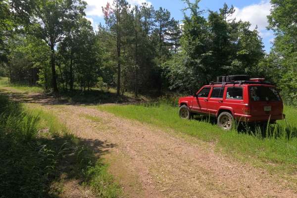
Chloride Leatherwood FSR 2142
Chloride Leatherwood FSR 2142 is a gravel forestry route within the Fredericktown Sector of Mark Twain National Forest, closed yearly for turkey season from 3/31 to 5/16. It features rolling hills leading through the wooded forest area of the Crane Lake area. The primary use of the area is turkey hu...
Learn more about Chloride Leatherwood FSR 2142
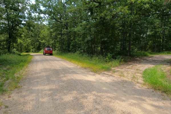
Wayne - CR 212
Wayne County Road 212 is a gravel road traversing the Coldwater Conservation Area, which is managed by the Missouri Department of Conservation. The gravel throughout is coarse and rough, likely being creek gravel, easily forming potholes, washboards, and mounding situations. Along the track, the roa...
Learn more about Wayne - CR 212
Beginner ATV trails near Des Arc, Missouri
Explore ATV-friendly trails near you. These trails are accessible for vehicles up to 50 inches wide, perfect for ATVs and smaller off-road machines.
Funk Branch Road
Funk Branch Road, or the combination road of Reynolds County Road 456 and Iron County Road 149, is a coarse gravel county road along the Funk Branch Creek, providing access to the north side of the Black River Bottoms area within the Clearwater Lake U.S. Army Corps of Engineer Land. The road begins ...
Learn more about Funk Branch Road
Long Ridge Road
Long Ridge Road (Reynolds County Road 462 and Iron County Road 151) is a coarse gravel county road providing access to the northeast portion of the Black River Bottoms area within the Clearwater Lake U.S. Army Corps of Engineer Land. The road starts from Missouri Route-BB, 0.1 miles east of the Funk...
Learn more about Long Ridge Road
Mann Cemetery Road
Mann Cemetery Road, or Reynolds County Road 456, is a coarse gravel road transforming to a natural dirt road in the northern portion of the Black River Bottoms area within the Clearwater Lake U.S. Army Corps of Engineer Land. This road features views of the valley surrounded by the rolling hills of ...
Learn more about Mann Cemetery Road
Hackworth Hollow Trail
Hackworth Hollow Trail, also known locally as part of Funk Branch Road or Reynolds County Road 446A, is a coarse gravel road transforming to a creek bottom road and back to a coarse gravel road through the northern portion of the Black River Bottoms area within the Clearwater Lake U.S. Army Corps of...
Learn more about Hackworth Hollow Trail
Beginner UTV/side-by-side trails near Des Arc, Missouri
Find UTV and side-by-side trails near you. These trails accommodate vehicles up to 60 inches wide, ideal for UTVs, side-by-sides, and wider off-road rigs.
Funk Branch Road
Funk Branch Road, or the combination road of Reynolds County Road 456 and Iron County Road 149, is a coarse gravel county road along the Funk Branch Creek, providing access to the north side of the Black River Bottoms area within the Clearwater Lake U.S. Army Corps of Engineer Land. The road begins ...
Learn more about Funk Branch Road
Long Ridge Road
Long Ridge Road (Reynolds County Road 462 and Iron County Road 151) is a coarse gravel county road providing access to the northeast portion of the Black River Bottoms area within the Clearwater Lake U.S. Army Corps of Engineer Land. The road starts from Missouri Route-BB, 0.1 miles east of the Funk...
Learn more about Long Ridge Road
Mann Cemetery Road
Mann Cemetery Road, or Reynolds County Road 456, is a coarse gravel road transforming to a natural dirt road in the northern portion of the Black River Bottoms area within the Clearwater Lake U.S. Army Corps of Engineer Land. This road features views of the valley surrounded by the rolling hills of ...
Learn more about Mann Cemetery Road
Hackworth Hollow Trail
Hackworth Hollow Trail, also known locally as part of Funk Branch Road or Reynolds County Road 446A, is a coarse gravel road transforming to a creek bottom road and back to a coarse gravel road through the northern portion of the Black River Bottoms area within the Clearwater Lake U.S. Army Corps of...
Learn more about Hackworth Hollow Trail
The onX Offroad Difference
onX Offroad combines trail photos, descriptions, difficulty ratings, width restrictions, seasonality, and more in a user-friendly interface. Available on all devices, with offline access and full compatibility with CarPlay and Android Auto. Discover what you're missing today!
Open Trail Map