
Beginner Off-Road Trails
Near Dayton, Ohio
Explore All Beginner Trails Near Dayton, Ohio
Beginner Off-Road Trails Near Dayton, Ohio
Discover the best beginner-friendly off-road trails near you. These easier, lower-rated trails are a great place to start — browse trail maps, check difficulty ratings, and find your next adventure.
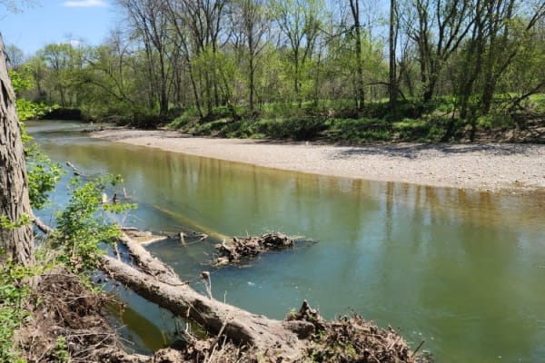
Anthony Road
This is an easy gravel road near Germantown, Ohio. This route takes you along a beautiful creek with an old and pretty cool bridge crossing. It's easily accessible for any vehicle that is licensed to be on public roadways. Stop at one of the pull-offs and enjoy the sounds of a running creek. Please ...
Learn more about Anthony Road
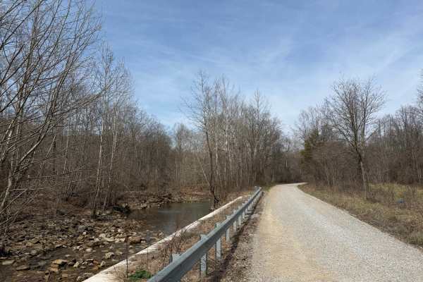
Turkey Run Road
Turkey Run Road is a leisurely gravel road that provides beautiful views of Pee Pee Creek and the Hawe Fork of Pee Pee Creek. (Yes, that is the actual name of the creek.) The road turns and puts you into mature forest along Turkey Run. The road is generally single-lane wide. Excellent route for gett...
Learn more about Turkey Run Road
Beginner ATV trails near Dayton, Ohio
Explore ATV-friendly trails near you. These trails are accessible for vehicles up to 50 inches wide, perfect for ATVs and smaller off-road machines.
Beginner UTV/side-by-side trails near Dayton, Ohio
Find UTV and side-by-side trails near you. These trails accommodate vehicles up to 60 inches wide, ideal for UTVs, side-by-sides, and wider off-road rigs.
The onX Offroad Difference
onX Offroad combines trail photos, descriptions, difficulty ratings, width restrictions, seasonality, and more in a user-friendly interface. Available on all devices, with offline access and full compatibility with CarPlay and Android Auto. Discover what you're missing today!
Open Trail Map