
Beginner Off-Road Trails
Near Cucumber, West Virginia
Explore All Beginner Trails Near Cucumber, West Virginia
Beginner Off-Road Trails Near Cucumber, West Virginia
Discover the best beginner-friendly off-road trails near you. These easier, lower-rated trails are a great place to start — browse trail maps, check difficulty ratings, and find your next adventure.
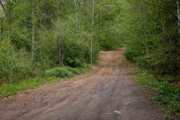
W17
Trail W17 is a wide, smooth route that winds between leafy trees with minimal embedded rock, offering an easy and scenic ride. The trail passes alongside striking rock walls and cliffs, adding visual interest. Visibility is excellent throughout, and the width allows for comfortable two-way travel al...
Learn more about W17

W22
Trail W22 is a 3.7-mile, wide and smooth route that runs alongside a ravine and stream, with scenic mossy rock walls adding visual interest. The trail features long, straight sections with excellent visibility and some gentle corners, making it an easy, fast-moving connector through the Warrior trai...
Learn more about W22
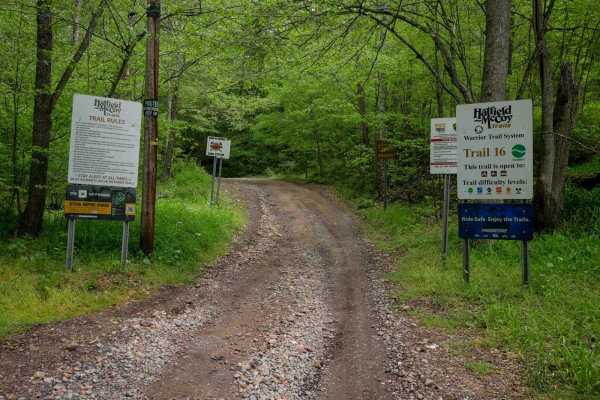
W16
Trail W16 is a 4.2-mile primary access route starting at the town of War, with a half-mile segment of pavement through a neighborhood before the official start of the trail. It begins wide through open hillsides and transitions into forested terrain, running shelf-like along a ravine at the base of ...
Learn more about W16
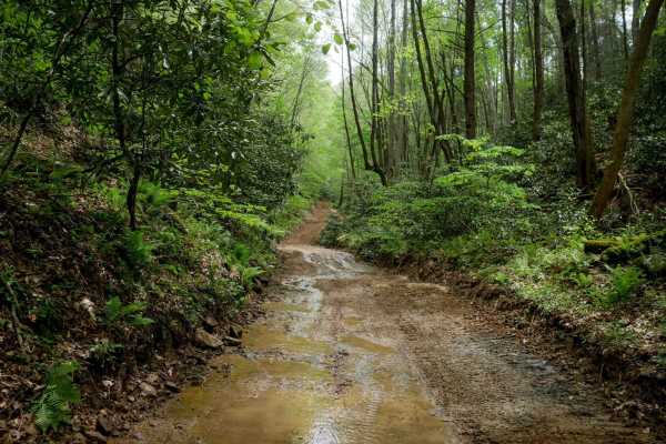
W21
Trail W21 is a long, scenic, and easy 5.2-mile route through lush forest in the Warrior Trail System. From the south, it begins as a wide shelf trail with flat embedded slickrock surfaces that do not increase difficulty. The trail winds alongside mossy rock walls and through gradual corners, includi...
Learn more about W21

W30
Trail W30 is a wide, easy route that descends toward the town of Gary, featuring broad, sweeping corners and a road-like surface ideal for all skill levels. Serving as a primary access route, it connects riders to OHV-approved highways that link trail systems and provide access to fuel, food, and lo...
Learn more about W30
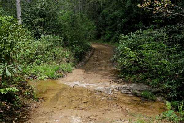
W31
Trail W31 is a 1.3-mile, easy route that begins at its southern junction with Trail W21 on the forest floor. It starts with a small stream crossing and follows the stream and ravine before gradually climbing up on a shelf-like path. The trail features smooth terrain with minimal rock, shaded by fore...
Learn more about W31
W32
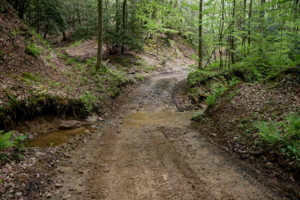
Trail W32 is an easy, scenic route that begins at its north end with a narrow, shelf-like path along the mountainside, passing mossy rock cliffs and dense forest. It gradually descends to the forest floor, meeting Trail W71, before climbing back out. South of that intersection, the trail becomes wid...
Learn more about W32
W29
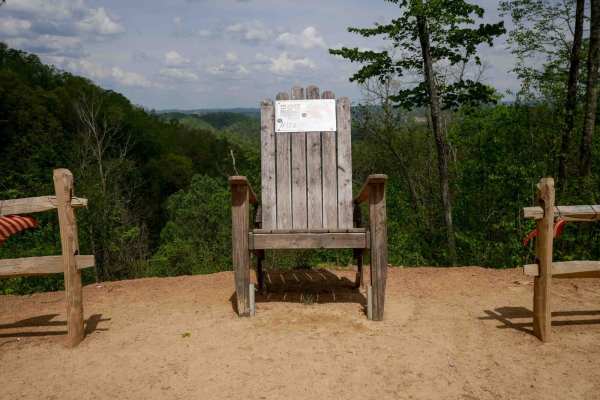
Trail W29 is a 3.3-mile easy trail with shelf sections, smooth terrain, and occasional mud puddles and ruts. The route offers scenic views through the trees along the mountainside and includes wide corners, though drivers should remain alert for oncoming traffic. After climbing up the first mile, it...
Learn more about W29

W44
Trail W44 is a wide, well-maintained route that runs 3.7 miles along the mountainside with a smooth, gradual descent from south to north. The trail features minor embedded rocks, gentle hairpin turns, and follows a ridge line for part of its length. It is an easy traverse suitable for all skill leve...
Learn more about W44

W11
Trail W11 begins on Stadium Drive just south of Welch, West Virginia, with no designated parking at the northern access point. The trail climbs steeply from the pavement via several wide, rutted switchbacks with loose rock; momentum is key on the steep grade. Though the surface is somewhat rutted, t...
Learn more about W11
Belcher Ridge Run
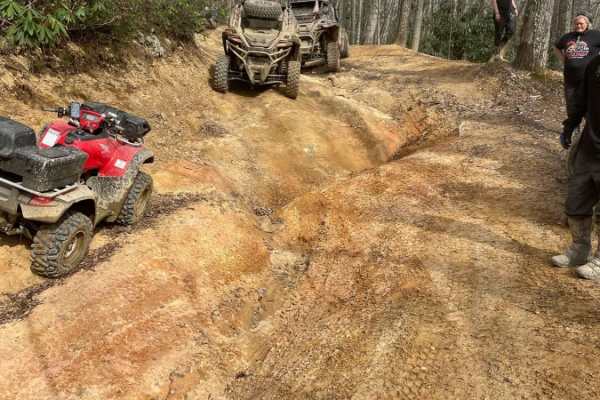
Belcher Ridge Run is a thrilling 30-mile journey designed for intermediate to advanced offroaders seeking a diverse mix of challenging terrain, scenic high-ridge vistas, and local Appalachian culture. This point-to-point route, which ranges in elevation from 1,458 to 2,845 feet, features over 4,000 ...
Learn more about Belcher Ridge Run

OP 34
OP 34 is a 0.6-mile trail connecting OP 67 to OP 15. It follows a narrow, one-lane shelf path cut into a hillside. The trail runs through lush Appalachian forest, with dense vegetation and thickets lining the route, creating a shaded, enclosed feel. The surface features shallow ruts, loose rock, and...
Learn more about OP 34
OP 40
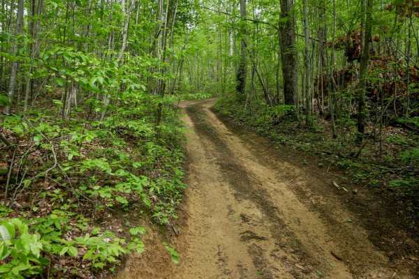
Original Pocahontas 40 is a very short, easy connector trail linking OP 67 to OP 92. The trail follows a smooth, one-lane-wide path through dense Appalachian forest with hardly any rocks. Shaded by a thick canopy and surrounded by native undergrowth, it's just a quick stretch through classic Virgini...
Learn more about OP 40

OP 32
OP 32 is a 0.6-mile easy trail that winds through scenic forest with tall ash and maple trees, offering a high canopy and consistent shade. The path is smooth with gradual curves and scattered mud puddles, making for a relaxed ride. A few short sections feature steeper grades and loose rock, but the...
Learn more about OP 32

OP 12
The north end of OP 12 is a continuation from OP 43. It traverses a scenic forest with a dense leaf canopy along a shelf path cut into the hillside. The trail features small climbs and descents with numerous curvy sections. The surface includes muddy ruts and areas with loose rock, narrowing to a on...
Learn more about OP 12
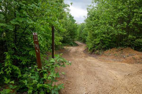
OP 56
OP 56 is a flat, quarter-mile trail connecting two segments of OP 19. It follows a narrow shelf path cut into the hillside along a hilltop, with open skies and minimal elevation change. The surface is smooth with only minor shallow ruts. Leafy poplars and elder trees line the route.
Learn more about OP 56

OP 11
The north end of OP 11 parallels a section of OP 12 and runs less than half a mile before ending at OP 46. This easy, one-lane-wide shelf path passes through dense forest with low-hanging branches and is lined with rhododendron and thick undergrowth. The trail shows lighter use, with grass growing i...
Learn more about OP 11

OP 19
OP 19 is an easy trail starting at the north end of OP 100 and continuing to the intersection with OP 18 and OP 57, passing OP 56 along the way. Trail 19 also spurs back south from that intersection to the intersection with OP 59. Both sections are easy;it follows a smooth, easy shelf path next to d...
Learn more about OP 19
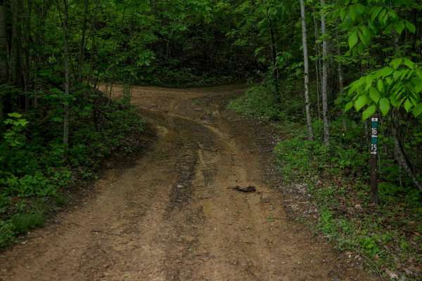
OP 15
OP 15 is a 0.6-mile loop branching off OP 16. It follows a wide, easy path through scenic forest with gradual grades and smooth terrain, crossing Tank Hill Road about halfway through. The trail has some muddy ruts but remains accessible and beginner-friendly. It also provides access to several other...
Learn more about OP 15
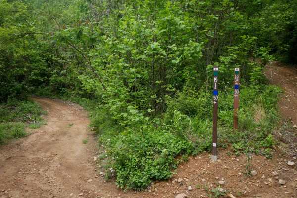
19 Connector
This connector is a flat, quarter-mile link between OP 19 and OP 50. It runs along a hillside with short trees and open skies, on a smooth dirt surface with mildly uneven ground. No obstacles or technical features make it a simple and easy transitional route through the trail system.
Learn more about 19 Connector
Beginner ATV trails near Cucumber, West Virginia
Explore ATV-friendly trails near you. These trails are accessible for vehicles up to 50 inches wide, perfect for ATVs and smaller off-road machines.
W17
Trail W17 is a wide, smooth route that winds between leafy trees with minimal embedded rock, offering an easy and scenic ride. The trail passes alongside striking rock walls and cliffs, adding visual interest. Visibility is excellent throughout, and the width allows for comfortable two-way travel al...
Learn more about W17
W22
Trail W22 is a 3.7-mile, wide and smooth route that runs alongside a ravine and stream, with scenic mossy rock walls adding visual interest. The trail features long, straight sections with excellent visibility and some gentle corners, making it an easy, fast-moving connector through the Warrior trai...
Learn more about W22
W16
Trail W16 is a 4.2-mile primary access route starting at the town of War, with a half-mile segment of pavement through a neighborhood before the official start of the trail. It begins wide through open hillsides and transitions into forested terrain, running shelf-like along a ravine at the base of ...
Learn more about W16
W21
Trail W21 is a long, scenic, and easy 5.2-mile route through lush forest in the Warrior Trail System. From the south, it begins as a wide shelf trail with flat embedded slickrock surfaces that do not increase difficulty. The trail winds alongside mossy rock walls and through gradual corners, includi...
Learn more about W21
Beginner UTV/side-by-side trails near Cucumber, West Virginia
Find UTV and side-by-side trails near you. These trails accommodate vehicles up to 60 inches wide, ideal for UTVs, side-by-sides, and wider off-road rigs.
W17
Trail W17 is a wide, smooth route that winds between leafy trees with minimal embedded rock, offering an easy and scenic ride. The trail passes alongside striking rock walls and cliffs, adding visual interest. Visibility is excellent throughout, and the width allows for comfortable two-way travel al...
Learn more about W17
W22
Trail W22 is a 3.7-mile, wide and smooth route that runs alongside a ravine and stream, with scenic mossy rock walls adding visual interest. The trail features long, straight sections with excellent visibility and some gentle corners, making it an easy, fast-moving connector through the Warrior trai...
Learn more about W22
W16
Trail W16 is a 4.2-mile primary access route starting at the town of War, with a half-mile segment of pavement through a neighborhood before the official start of the trail. It begins wide through open hillsides and transitions into forested terrain, running shelf-like along a ravine at the base of ...
Learn more about W16
W21
Trail W21 is a long, scenic, and easy 5.2-mile route through lush forest in the Warrior Trail System. From the south, it begins as a wide shelf trail with flat embedded slickrock surfaces that do not increase difficulty. The trail winds alongside mossy rock walls and through gradual corners, includi...
Learn more about W21
The onX Offroad Difference
onX Offroad combines trail photos, descriptions, difficulty ratings, width restrictions, seasonality, and more in a user-friendly interface. Available on all devices, with offline access and full compatibility with CarPlay and Android Auto. Discover what you're missing today!
Open Trail Map