
Beginner Off-Road Trails
Near Coal Run Village, Kentucky
Explore All Beginner Trails Near Coal Run Village, Kentucky
Beginner Off-Road Trails Near Coal Run Village, Kentucky
Discover the best beginner-friendly off-road trails near you. These easier, lower-rated trails are a great place to start — browse trail maps, check difficulty ratings, and find your next adventure.
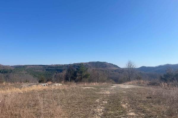
Trail 22 (Lovers Lane)
Trail 22 is a short green trail. When you travel this trail in late summer, early fall, you see why it's called lovers lane with its picturesque views and field of wildflowers. It's a great trail to ride out to the lookout point and have a picnic. You never know what kind of wildlife you will see he...
Learn more about Trail 22 (Lovers Lane)
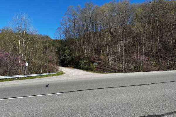
Flat Fork
This is the alternate entrance to Hillbilly Trails of Pike County. It's a gravel road that leads to Trail 23 of Hillbilly Trails. Once you get to the top there are a lot of trails that is developed and many more to develop. There's plenty of primitive camping available with nearly 6,000 acres in the...
Learn more about Flat Fork

Trail 33
Trail 33 is a green trail and is just a small loop off Trail 15. Has a great lookout point. It is an old haul road from the mining days and a spot where they used to house equipment. Free range cattle like to hang out back here off the main trail.
Learn more about Trail 33
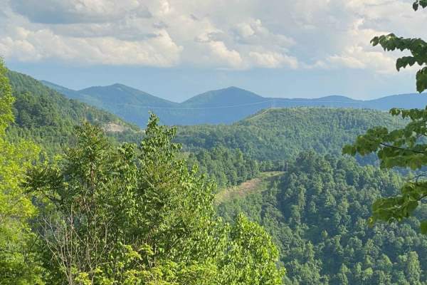
Trail 23 - Flatwoods Road
Trail 23 is the main artery for the Dorton/Flatwoods Area of the new Pike County Hillbilly Trails System. Trail 23 is a wide, graded dirt and gravel access road for an array of utilities and other infrastructure located on Caney Mountain. This trail can be driven with basic 4x4 and street tires when...
Learn more about Trail 23 - Flatwoods Road
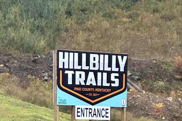
23 Main Loop
Trail 23 is the Main Loop around and through the Hillbilly Trails Offroad Park. Connect this section with Trail 23- Flatwoods Road to make a complete loop. This is the easiest of the trails and will be the thoroughfare for finding most all the other trails in the park. This trail is roughly just ove...
Learn more about 23 Main Loop
Trail 25
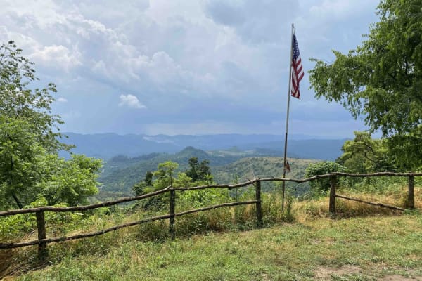
This is a connector trail from Main 23 to Laura's Lookout and beyond. It has a hard base with numerous shallow water holes. It's wide enough for most vehicles, including some full-size vehicles. This short route leads to one of the most scenic overlooks on a Kentucky OHV trail and there's a picnic t...
Learn more about Trail 25
Martin County Trailhead to Trail 1
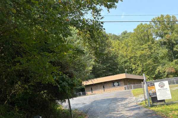
This is the First Frontier Appalachian Trails office/trailhead. This route takes you from the parking lot to Trail 1. Office/trailhead is located off Route 3 in Martin County. 3548 Davella Road, Debord, KY. There is a porta-john at the trailhead parking. Very easy parking is available in a gravel l...
Learn more about Martin County Trailhead to Trail 1
BM 36
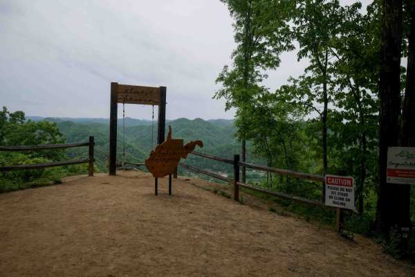
BM 36 is a short but steep 0.8-mile climb from south to north, zigzagging up the mountainside on the far west side of the Buffalo Mountain Trail System near Williamson. The trail is narrow and winds through lush forest with tight switchbacks, loose rock, and shallow ruts. A scenic viewpoint on the n...
Learn more about BM 36
BM 37
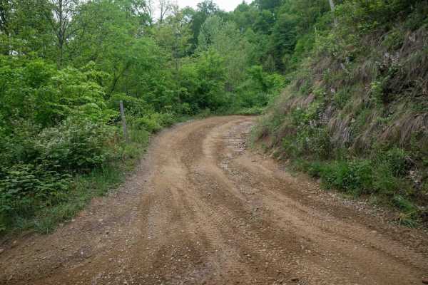
BM 37 is a 0.6-mile connector between BM 36 and BM 10, offering an easy alternative route on the west side of the Buffalo Mountain Trail System. The trail passes a radio tower and runs beneath open skies along the power lines, with a wide, smooth, and gradual surface throughout. It's a simple, sceni...
Learn more about BM 37
White Oak Branch Raod
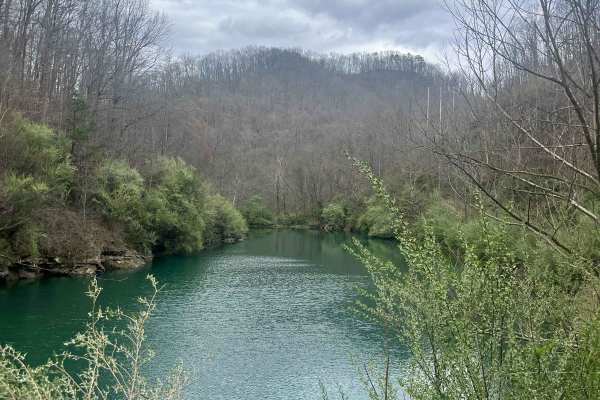
The trail begins in White Oak Branch, where you will cross a small creek. After traveling through the creek, a small pond will be on the right. The road is in great shape for UTVs and even Jeeps. Once you ascend to the top of the mountain, it opens up to amazing views. The rest of the trail is old s...
Learn more about White Oak Branch Raod
BM 10
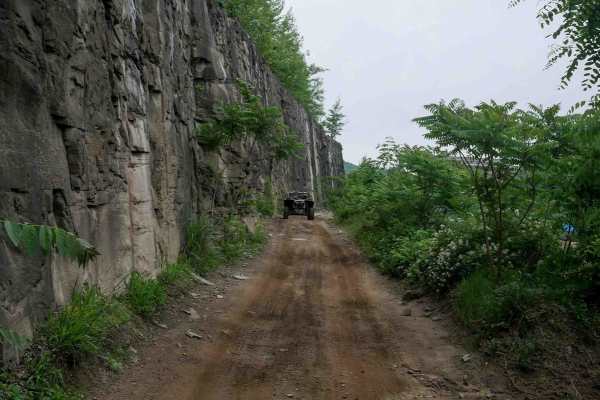
BM 10 is a long, easy access route connecting the town of Williamson to the Buffalo Mountain Trail System. Primarily wide, smooth, and gradual with sweeping corners, it serves as a convenient community connector for riders seeking food, fuel, or access to trails on the far west side of the trail sys...
Learn more about BM 10
BM 11
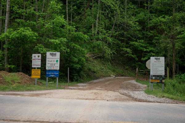
Trail BM 11 is a 5-mile access corridor in the Buffalo Mountain Trail System, beginning from highway 52 and climbing steadily through a lush forest. It starts as a wide dirt trail with gradual, sweeping switchbacks, minor ruts, and waterbars. While there are a few narrower, rockier sections, the maj...
Learn more about BM 11
BM 12
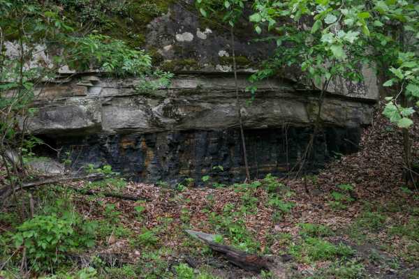
BM 12 climbs from Highway 52 on the west end with a rutted ascent and tight switchbacks, then levels out into a wide shelfy path that serves as an easy access corridor. The 2.3-mile trail features minor ruts, multiple intersections, and scenic mossy rock walls, with good visibility and room for two-...
Learn more about BM 12
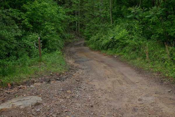
BM 22
BM 22 is a 2-mile easy connector descending down from the hilltops at trail 15, down to near Highway 52 and the intersection with trail 10. It offers a mostly wide path with occasional narrower sections, minor loose rock, and shallow ruts. The grades are gradual throughout, and the route passes alon...
Learn more about BM 22
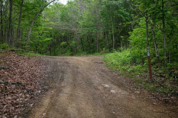
BM 19
BM 19 forms an easy 2.5-mile loop through lush forest with wide paths, scenic rocky cliffs, and dark coal-like soil in places. While mostly gradual with minimal elevation change, the trail includes narrower shelfy sections along the hillside. Riders should be prepared for occasional mud puddles and ...
Learn more about BM 19
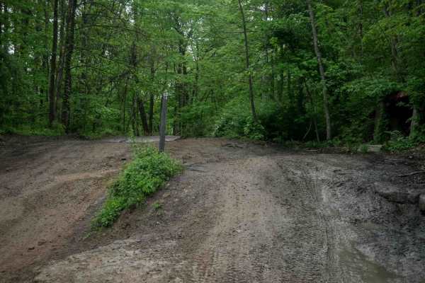
BM 13
BM 13 is a 4.3-mile easy-rated access corridor typical of the Buffalo Mountain system, offering wide, smooth, and graded terrain with room for two-way travel and excellent visibility. It features gradual grades, casual wide corners, and passes through lush forest with scenic rock walls, making it a ...
Learn more about BM 13
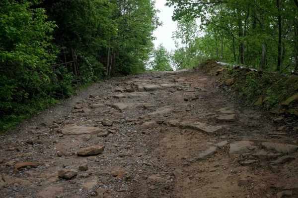
BM 26
BM 26, when approached from the north, begins as a narrow, shelf-like descent down the mountain with a mostly smooth surface and occasional rocky patches. It drops to the forest floor beside Lick Creek, where lush, jungle-like surroundings and intermittent water on the trail are the norm. The trail ...
Learn more about BM 26
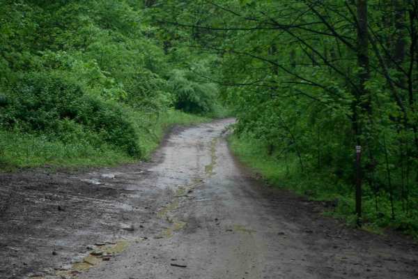
BM 20
BM 20 is a 5-mile, wide, easy access corridor that winds through lush forest with a high tree canopy and excellent visibility. The trail follows a curvy, shelfy path along the hillside beside scenic rock walls, passing a massive boulder that has fallen from the wall above. The trail maintains good w...
Learn more about BM 20
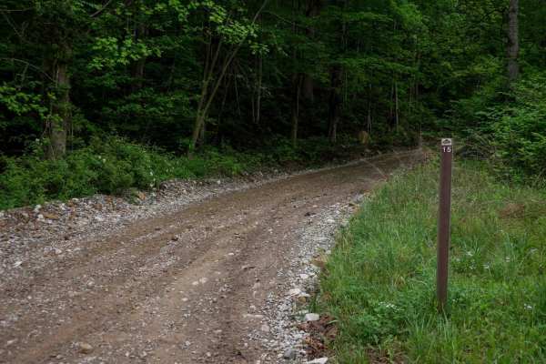
BM 15
BM 15 is a 4.8-mile access route in the Buffalo Mountain Trail System, offering a smooth, gradual ascent from the staging area into the hills. The trail begins as a wide, gravel path under consistent tree cover, narrowing slightly after the first intersection into a shelf-like track that curves alon...
Learn more about BM 15
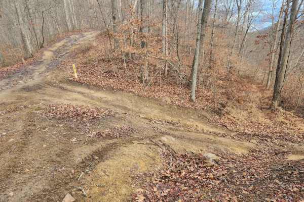
Emily Creek
This trail will take you from "mud hole point" down to the "Right Fork of Hell Creek" to gain quick access out of the hills for help or repair. It does not have any side rides to confuse you and is pretty straightforward.
Learn more about Emily Creek
Beginner ATV trails near Coal Run Village, Kentucky
Explore ATV-friendly trails near you. These trails are accessible for vehicles up to 50 inches wide, perfect for ATVs and smaller off-road machines.
Trail 22 (Lovers Lane)
Trail 22 is a short green trail. When you travel this trail in late summer, early fall, you see why it's called lovers lane with its picturesque views and field of wildflowers. It's a great trail to ride out to the lookout point and have a picnic. You never know what kind of wildlife you will see he...
Learn more about Trail 22 (Lovers Lane)
Flat Fork
This is the alternate entrance to Hillbilly Trails of Pike County. It's a gravel road that leads to Trail 23 of Hillbilly Trails. Once you get to the top there are a lot of trails that is developed and many more to develop. There's plenty of primitive camping available with nearly 6,000 acres in the...
Learn more about Flat Fork
Trail 33
Trail 33 is a green trail and is just a small loop off Trail 15. Has a great lookout point. It is an old haul road from the mining days and a spot where they used to house equipment. Free range cattle like to hang out back here off the main trail.
Learn more about Trail 33
Trail 23 - Flatwoods Road
Trail 23 is the main artery for the Dorton/Flatwoods Area of the new Pike County Hillbilly Trails System. Trail 23 is a wide, graded dirt and gravel access road for an array of utilities and other infrastructure located on Caney Mountain. This trail can be driven with basic 4x4 and street tires when...
Learn more about Trail 23 - Flatwoods Road
Beginner UTV/side-by-side trails near Coal Run Village, Kentucky
Find UTV and side-by-side trails near you. These trails accommodate vehicles up to 60 inches wide, ideal for UTVs, side-by-sides, and wider off-road rigs.
Trail 22 (Lovers Lane)
Trail 22 is a short green trail. When you travel this trail in late summer, early fall, you see why it's called lovers lane with its picturesque views and field of wildflowers. It's a great trail to ride out to the lookout point and have a picnic. You never know what kind of wildlife you will see he...
Learn more about Trail 22 (Lovers Lane)
Flat Fork
This is the alternate entrance to Hillbilly Trails of Pike County. It's a gravel road that leads to Trail 23 of Hillbilly Trails. Once you get to the top there are a lot of trails that is developed and many more to develop. There's plenty of primitive camping available with nearly 6,000 acres in the...
Learn more about Flat Fork
Trail 33
Trail 33 is a green trail and is just a small loop off Trail 15. Has a great lookout point. It is an old haul road from the mining days and a spot where they used to house equipment. Free range cattle like to hang out back here off the main trail.
Learn more about Trail 33
Trail 23 - Flatwoods Road
Trail 23 is the main artery for the Dorton/Flatwoods Area of the new Pike County Hillbilly Trails System. Trail 23 is a wide, graded dirt and gravel access road for an array of utilities and other infrastructure located on Caney Mountain. This trail can be driven with basic 4x4 and street tires when...
Learn more about Trail 23 - Flatwoods Road
The onX Offroad Difference
onX Offroad combines trail photos, descriptions, difficulty ratings, width restrictions, seasonality, and more in a user-friendly interface. Available on all devices, with offline access and full compatibility with CarPlay and Android Auto. Discover what you're missing today!
Open Trail Map