
Beginner Off-Road Trails
Near Circle Pines, Minnesota
Explore All Beginner Trails Near Circle Pines, Minnesota
Beginner Off-Road Trails Near Circle Pines, Minnesota
Discover the best beginner-friendly off-road trails near you. These easier, lower-rated trails are a great place to start — browse trail maps, check difficulty ratings, and find your next adventure.

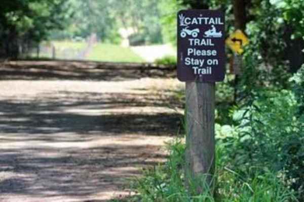
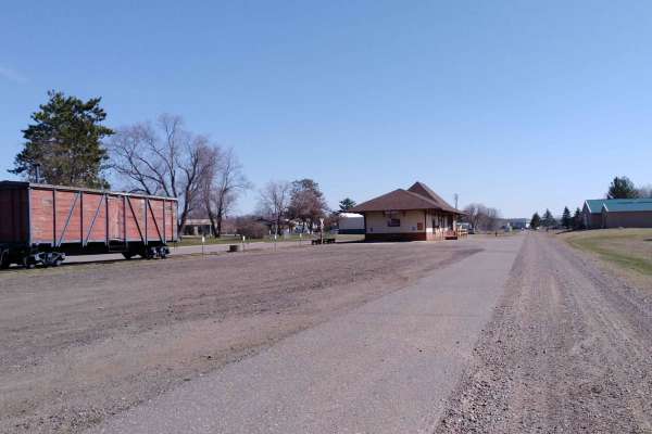
Cattail State Trail: Amery to Turtle Lake
Cattail State Trail: Amery to Turtle Lake is an 11.8-mile point-to-point trail rated 2 of 10 located in Polk County. The Amery to Turtle Lake section of the Cattail State Trail is a packed gravel rail-to-trail that has a gentle elevation gain of 200 feet over the length of the trail. Departing Amery...
Learn more about Cattail State Trail: Amery to Turtle Lake
Cattail State Trail: Turtle Lake to Almena
Cattail State Trail: Turtle Lake to Almena is a 6.4-mile point-to-point trail rated 2 of 10 located in Barron County. The Turtle Lake to Almena section of the Cattail State Trail is a packed gravel rail-to-trail that has a gentle descent, losing about 75 feet over the length of the trail. Departing ...
Learn more about Cattail State Trail: Turtle Lake to Almena
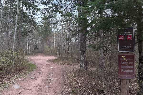
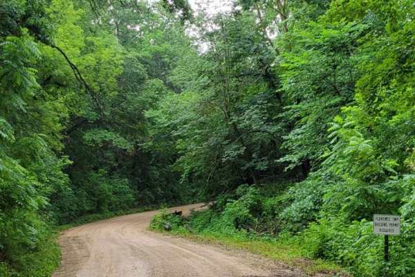
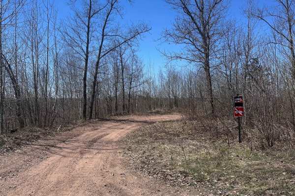
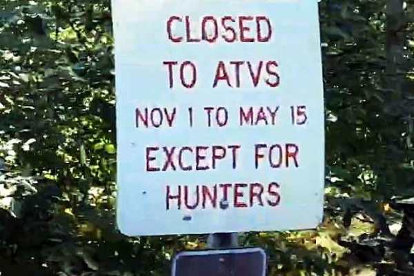
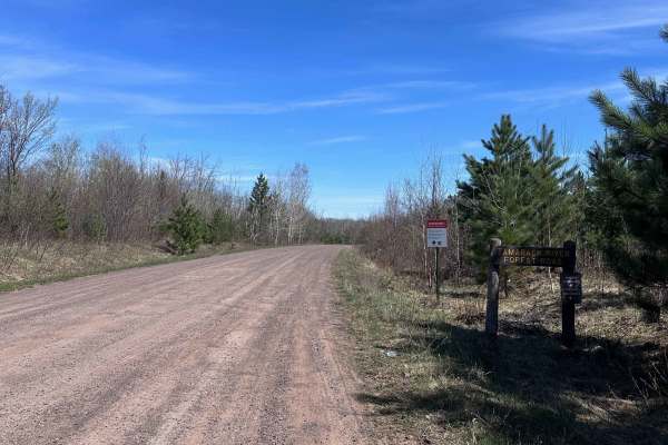
Chengwatana Forest Road
This is a simple dirt road serving as the main avenue to the rest of the forest. Along the way, there are some nice views, especially where it opens up to the main bog/marshland. Keep in mind, this road sits very close to the waterline in several spots, so the ground may get soft in those sections d...
Learn more about Chengwatana Forest Road
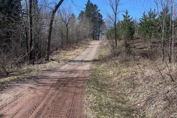
High Ground
This trail is one of the few in the whole forest that does not have any deep water crossings. There are a few shallow puddles that you'll encounter, but nothing extreme. Overall, this route is a nice break from the boggy trails in the rest of the system. It also smells wonderfully of pine.
Learn more about High Ground
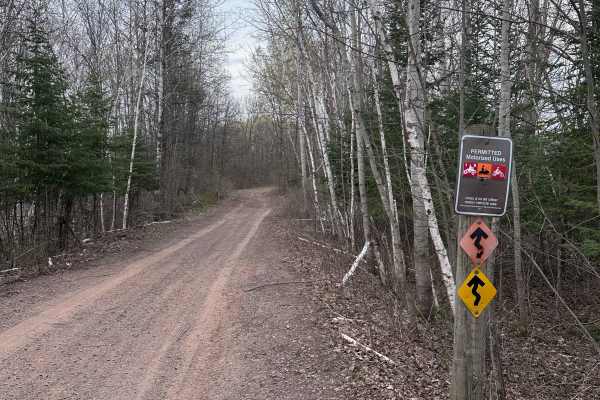
Matthew Lourey State Trail
This is a short section of the Matthew Lourey State Trail that's accessible to OHVs in the summertime. Note that this is an out-and-back trail because OHV access ends at a dirt turn-around while the snowmobile trail continues north. Expect some smaller whoops, braking bumps, a few mud holes, and roc...
Learn more about Matthew Lourey State Trail
East Central Scenic Trail
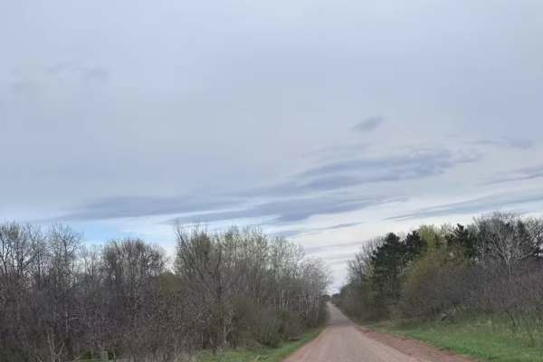
Beautiful easy dirt road. Great views year-round, especially in the fall or in the winter after a light snow. This is an easy-maintained gravel road meandering through the driftless area of east central Minnesota. Close to many other beautiful gravel roads to explore. There are many nice small towns...
Learn more about East Central Scenic Trail
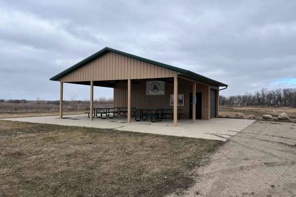
Meeker County OHV Park Outer Loop
Narrow and winding trails travel through this 40-acre parcel of woods. There is a youth training area on site, as well as a picnic shelter area, restroom facilities, and plenty of parking. There is a constructed mud pit area and good cell service. Standard Minnesota ATV permits/licenses are required...
Learn more about Meeker County OHV Park Outer Loop

Barron to Cameron - Blueberry Trail Extension
This is an easy trail with sections of red rock gravel base. Plenty of wetter areas to keep the ride interesting, and many winding trails through the trees and edges of farmers' fields. This segment is bookended by picnic areas at Anderson Park in Barron and a pavilion just off the Red Cedar River o...
Learn more about Barron to Cameron - Blueberry Trail Extension
Hillman to Onamia
Hillman to Onamia on the Soo Line South Trail is a section of converted rail grade. At 12 miles long, it takes about 30 minutes with an average speed of 24.1 mph. This section of the Soo Line South Trail is provided by Mille Lacs County and maintained by the Mille Lacs Drift Skippers Snowmobile/ATV ...
Learn more about Hillman to Onamia
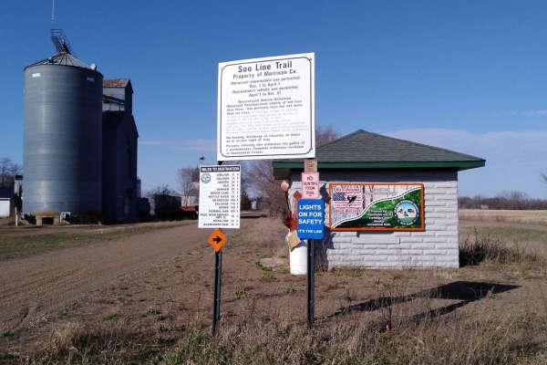
Genola to Hillman
Genola to Hillman on the Soo Line South Trail is a section of converted rail grade that is 12 miles long and takes about 40 minutes with an average speed of 19.6 mph. This section of the Soo Line South Trail is provided by Morrison County and maintained by the Eastern Morrison County 4 Wheelers Club...
Learn more about Genola to Hillman
Onamia to Wahkon
Onamia to Wahkon on the Soo Line South is a section of converted rail grade. At 8.2 miles long, it takes about 30 minutes with an average speed of 13.7 MPH. This section of the Soo Line South Trail is provided by Mille Lacs County and maintained by the Mille Lacs Drift Skippers Snowmobile/ATV Club. ...
Learn more about Onamia to Wahkon
Sand Road Driftless Loop
A relaxing drive through the Driftless area north of Pepin, Wisconsin. There is nothing technical;this is a gravel county road drive with a few tar sections. You can take a hike at Five Mile Bluff Prairie State Natural Area. This trail would be extra beautiful in the fall and after a fresh snowstorm...
Learn more about Sand Road Driftless Loop
Gandy Dancer Trail
The Minnesota portion of the Gandy Dancer trail is an easy 30-mile ride. The trail is open year-round to ATV/UTV/ORV and bikes. In winter, the trail is groomed and shared with snowmobiles. The trail connects to other trails in the Danbury area, Nemadji State Forest, and Douglas County, WI. The trail...
Learn more about Gandy Dancer Trail
Tamarack Sandway
Tamarack Sandway is a long sand track that runs adjacent to the Lower Tamarack River. The trail begins at the end of St.Croix High Line South and is OHV only. Expect rolling terrain with deep, sugary sand that's loose and dusty in dry conditions. There are lots of blind corners and hills, so be sure...
Learn more about Tamarack Sandway
Foxy Loop Main
The Foxy Loop is the first ATV trail network along the Soo Line Trail just north of Isle, Minnesota. There are about 2.5 miles of trail within the Foxy Loop network. The 1.5-mile main trail runs between the north and south gates of this bidirectional trail. Several side trails can be run as loops of...
Learn more about Foxy Loop Main
Foxy Loop 2
The Foxy Loop 2 is a shorter loop trail within the Foxy Loop network, accessed a short distance in from either entrance on the Soo Line. The trail is a little shorter than the Foxy Loop Main at only 1 mile. Combined with the Foxy Main, the network is roughly 2.5 miles of trail. This network is a gr...
Learn more about Foxy Loop 2
Red Top Loop
The Red Top Loop is located within a wooded area between the communities of Isle and McGrath in Aitkin County. The Red Top Loop trail network is made up of several different trails, all generally looping back to the main Red Top Loop. The entire network consists of more than 25 miles of ATV accessib...
Learn more about Red Top Loop
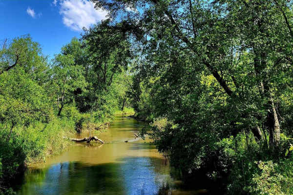
Churchill Lake Trail
Churchill Lake Trail is a fairly relaxed route that connects Grace and Churchill Lakes via Tamarack Forest Road and Grace Lake Road. It's mostly sand and has fewer rocks than most of the trails in this system. There are a few shallow water crossings, most of which have by-passes. There is one sectio...
Learn more about Churchill Lake Trail
Tamarack River Forest Road
Tamarack River Forest Road is a smooth gravel road with gentle grades. It serves as one of the main roads through St. Croix State Forest with many trail crossings along the way. It begins at Grace Lake Road and ends at Boulder Campground and Rock Lake. Note that OHVs are not permitted inside the cam...
Learn more about Tamarack River Forest Road
St. Croix High Line South
St. Croix High Line South is the southern portion of the trail, which begins at the staging area along Mallard Lake Forest Road. It ends at a large clearing with a small shelter and a vault toilet. OHV riders can continue beyond that point, but 4x4 drivers will have to use this as an out-and-back, a...
Learn more about St. Croix High Line South
Beginner ATV trails near Circle Pines, Minnesota
Explore ATV-friendly trails near you. These trails are accessible for vehicles up to 50 inches wide, perfect for ATVs and smaller off-road machines.
Cattail State Trail: Amery to Turtle Lake
Cattail State Trail: Amery to Turtle Lake is an 11.8-mile point-to-point trail rated 2 of 10 located in Polk County. The Amery to Turtle Lake section of the Cattail State Trail is a packed gravel rail-to-trail that has a gentle elevation gain of 200 feet over the length of the trail. Departing Amery...
Learn more about Cattail State Trail: Amery to Turtle Lake
Cattail State Trail: Turtle Lake to Almena
Cattail State Trail: Turtle Lake to Almena is a 6.4-mile point-to-point trail rated 2 of 10 located in Barron County. The Turtle Lake to Almena section of the Cattail State Trail is a packed gravel rail-to-trail that has a gentle descent, losing about 75 feet over the length of the trail. Departing ...
Learn more about Cattail State Trail: Turtle Lake to Almena
Chengwatana Forest Road
This is a simple dirt road serving as the main avenue to the rest of the forest. Along the way, there are some nice views, especially where it opens up to the main bog/marshland. Keep in mind, this road sits very close to the waterline in several spots, so the ground may get soft in those sections d...
Learn more about Chengwatana Forest Road
High Ground
This trail is one of the few in the whole forest that does not have any deep water crossings. There are a few shallow puddles that you'll encounter, but nothing extreme. Overall, this route is a nice break from the boggy trails in the rest of the system. It also smells wonderfully of pine.
Learn more about High Ground
Beginner UTV/side-by-side trails near Circle Pines, Minnesota
Find UTV and side-by-side trails near you. These trails accommodate vehicles up to 60 inches wide, ideal for UTVs, side-by-sides, and wider off-road rigs.
Chengwatana Forest Road
This is a simple dirt road serving as the main avenue to the rest of the forest. Along the way, there are some nice views, especially where it opens up to the main bog/marshland. Keep in mind, this road sits very close to the waterline in several spots, so the ground may get soft in those sections d...
Learn more about Chengwatana Forest Road
Matthew Lourey State Trail
This is a short section of the Matthew Lourey State Trail that's accessible to OHVs in the summertime. Note that this is an out-and-back trail because OHV access ends at a dirt turn-around while the snowmobile trail continues north. Expect some smaller whoops, braking bumps, a few mud holes, and roc...
Learn more about Matthew Lourey State Trail
East Central Scenic Trail
Beautiful easy dirt road. Great views year-round, especially in the fall or in the winter after a light snow. This is an easy-maintained gravel road meandering through the driftless area of east central Minnesota. Close to many other beautiful gravel roads to explore. There are many nice small towns...
Learn more about East Central Scenic Trail
Meeker County OHV Park Outer Loop
Narrow and winding trails travel through this 40-acre parcel of woods. There is a youth training area on site, as well as a picnic shelter area, restroom facilities, and plenty of parking. There is a constructed mud pit area and good cell service. Standard Minnesota ATV permits/licenses are required...
Learn more about Meeker County OHV Park Outer Loop
The onX Offroad Difference
onX Offroad combines trail photos, descriptions, difficulty ratings, width restrictions, seasonality, and more in a user-friendly interface. Available on all devices, with offline access and full compatibility with CarPlay and Android Auto. Discover what you're missing today!
Open Trail Map