
Beginner Off-Road Trails
Near Carlton, Minnesota
Explore All Beginner Trails Near Carlton, Minnesota
Beginner Off-Road Trails Near Carlton, Minnesota
Discover the best beginner-friendly off-road trails near you. These easier, lower-rated trails are a great place to start — browse trail maps, check difficulty ratings, and find your next adventure.
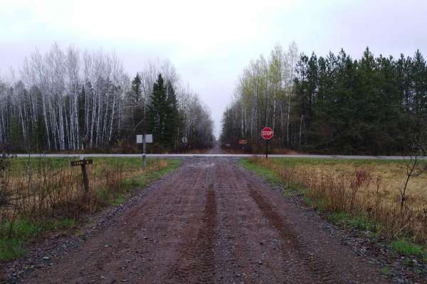
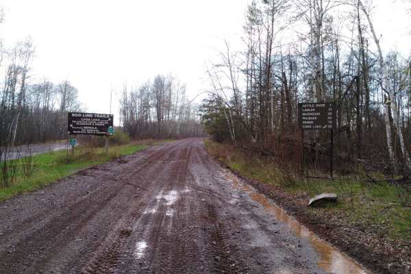
County Road 3 to Wisconsin Border
Carlton County Road 3 to the Wisconsin border on the Soo Line South is a section of converted rail grade that is 7.3 miles long and takes about 30 minutes with an average speed of 15.2 MPH. This converted rail grade is raised enough that it sheds water very well. Even on a rainy day or after several...
Learn more about County Road 3 to Wisconsin Border
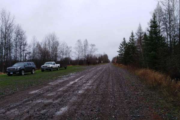
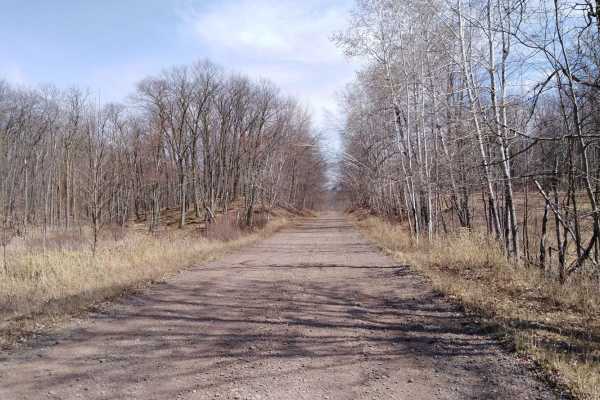
Nemadji to County Road 3
Nemadji to Carlton County Road 3 on the Soo Line South is a section of converted rail grade that is 9.4 miles long and takes about 30 minutes with an average speed of 16.4 MPH. This converted rail grade is raised enough that it sheds water very well. Even on a rainy day or after several days of rain...
Learn more about Nemadji to County Road 3
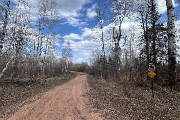
Interstate Trail North
Interstate Trail North is a sand track that carves through the pines and birch trees and is an out-and-back for 4x4 traffic. OHVs can continue further north. The terrain is mostly sand with some parts that hold water frequently. There is one steeper hill along the way. All riders should be mindful o...
Learn more about Interstate Trail North
Tamarack Straight Arrow East Trail
Straight Arrow Enduro Riders (SAER) maintains approximately 45 miles of single-track / ATV trail in the Nemadji State Forest. This 5-mile singletrack loop features mostly hard-packed, narrow trail with a few bridges and sections of buried old snowmobile trail designed to reduce erosion. Expect long ...
Learn more about Tamarack Straight Arrow East Trail
Harlis Bypass
Harlis Bypass is a mix of gently loamy single track and some greasy, muddy sections with areas that stay wet year-round. You'll also find some medium-sized rocks and some step-up ledgy roots throughout. It's a shorter trail compared to the rest of the system, but it's a good way to get warmed up bef...
Learn more about Harlis Bypass
Tamarack Straight Arrow Blue Trail
Straight Arrow Enduro Riders (SAER) maintains approximately 45 miles of single-track / ATV trail in the Nemadji State Forest. This 3-mile singletrack trail isn’t as tight as other trails and flows much faster with deep sweeping turns and fewer switchbacks. It does have a few bridges—when wet, be car...
Learn more about Tamarack Straight Arrow Blue Trail
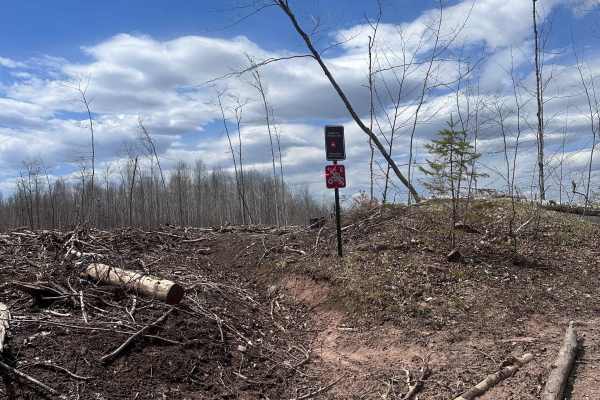
Gandy Dancer Bypass
The southern part of this trail was logged heavily over the winter of 2025, so the route will require a bit of interpretation until that section gets rutted in more. Aside from that, the forest that remains is beautiful. Along the way, you'll find a twisty single track with some sections of tight tr...
Learn more about Gandy Dancer Bypass
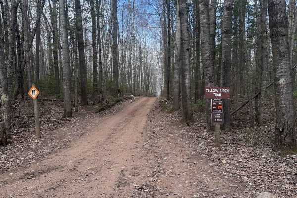
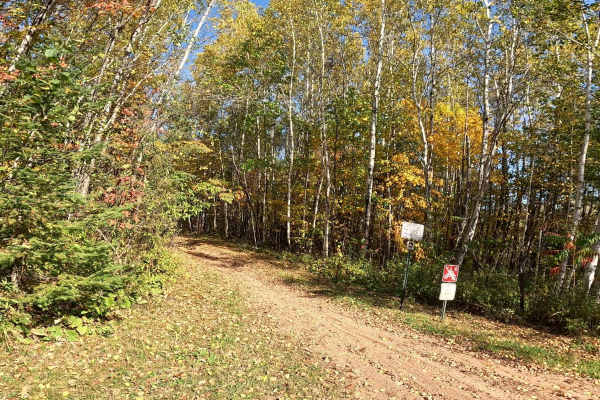
Yellow Birch Trail
Yellow Birch Trail is a winding sand track with water holes along the way. It connects the Matthew Loury State Trail to the Gandy Dancer Trail with the Harlis Road staging area in between. This trail is open to all OHVs and ORVs and is two-way, so be mindful of normal left/right traffic separation a...
Learn more about Yellow Birch Trail
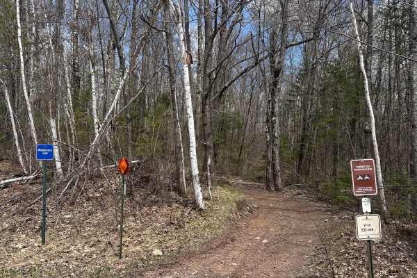
Wilderness Trail
Wilderness Trail is a twisty two-track that runs alongside Harlis Road for most of the way. It's a rocky, rutted trail with some up and down hills throughout. There are a couple of areas where ruts will fill up with water, and a few bridges. Wilderness Trail isn't especially technical, but it is nar...
Learn more about Wilderness Trail
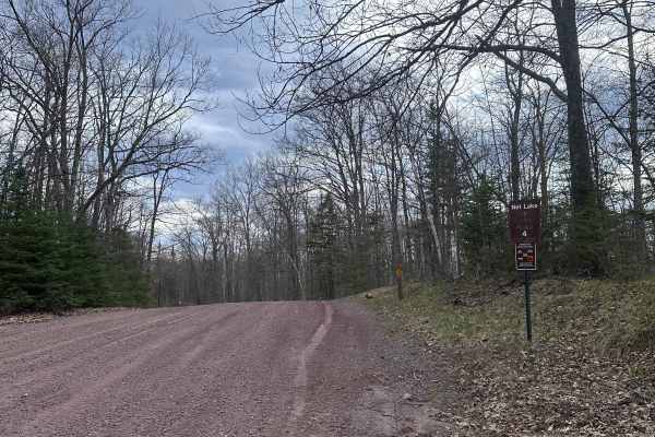
Net Lake Forest Road
Net Lake Forest Road is the main east/west road through Nemadji. There are tons of dispersed campsites along it and many trail crossings. Be mindful of OHV traffic as it's used as one of the busiest connecting routes in the forest. There are some slightly off-camber sections around blind corners whe...
Learn more about Net Lake Forest Road
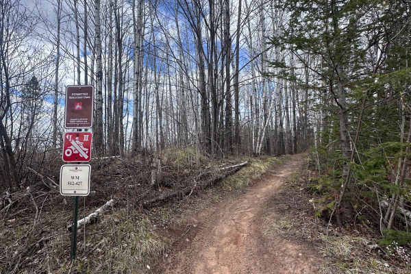
Iron Pipe
Iron Pipe, of the Straight Arrows OHM Trail system, is a novice-level single-track motorcycle trail that alternates between flowy and somewhat tight woods sections. Whether you're new to woods single track riding or experienced in all terrain types, this can be a fun trail for riders of all skill le...
Learn more about Iron Pipe
Corduroy Trail
As the name implies, Corduroy Trail is full of choppy roots throughout. Riders should also expect tight trees along the way (some narrower than bar length), several areas that hold water for most of the year, short but frequent climbs and descents, and a few old bridges crossing swampy sections. It'...
Learn more about Corduroy Trail
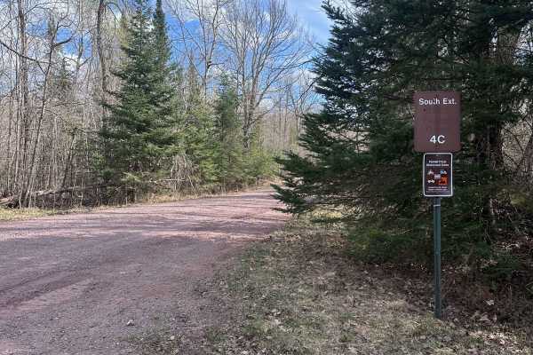
South Extension
South Extension is the main north/south forest road through Nemadji. It's a simple gravel road with gentle grades throughout, with several dispersed campsites all along the road. South Extension itself ends with a dirt turnaround, but just before that, there is a connection to Nemadji Hilton Trail, ...
Learn more about South Extension
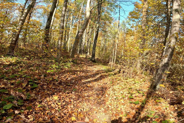
Straight Arrows Trail
This trail features forest-lined paths typical of Nemadji’s landscape, with a mix of packed dirt and occasional muddy patches depending on recent weather. Nemadji is known for its network of ATV and OHV trails, so Straight Arrows Trail could be a great starting point or a scenic detour.
Learn more about Straight Arrows Trail
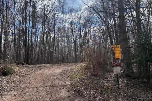
Grouse Forest Road
Grouse Forest Road is a minimum maintenance road lined by thick brushy forest habitat favored by grouse. You will likely see some standing in the middle of the trail at dawn and dusk. Be careful not to hit them because they seem to wait until the last second to flush. The road itself is mostly sand ...
Learn more about Grouse Forest Road
Park Forest, Potlatch, and Hilton Trails
This route is an out-and-back starting from the Gandy Dancer Trail and traversing through the heart of Nemadji State Forest. The route begins at the Park Forest Trail and eventually becomes the Potlatch Trail. The Potlatch is a fun dirt trail that features several standing water areas that can get b...
Learn more about Park Forest, Potlatch, and Hilton Trails
Moose Lake to Kettle River
Moose Lake to Kettle River on the Soo Line North is a section of converted rail grade that is 7 miles long and takes about 20 minutes with an average speed of 21.3 MPH. This converted rail grade is raised enough that it sheds water very well. Even after rain for several days, the water on the trail ...
Learn more about Moose Lake to Kettle River
Denham to Moose Lake
Denham to Moose Lake on the Soo Line South is a section of converted rail grade that is 12.6 miles long and takes about 45 minutes with an average speed of 16.8 MPH. This section has a few muddy areas due to spring thaw and could be wet during rainy times later in the season. There are great views o...
Learn more about Denham to Moose Lake
Moose Lake to Nemadji
Moose Lake to Nemadji (Carlton County Road 11 at Ballou Road) on the Soo Line South is a section of converted rail grade that is 9.2 miles long and takes about 30 minutes with an average speed of 19.6 MPH. This converted rail grade is raised enough that it sheds water very well. Even on a rainy day ...
Learn more about Moose Lake to Nemadji
Kettle River to Lawler Loop Trails
Kettle River to Lawler Loop Trails on the Soo Line North is a section of converted rail grade that is 9.6 miles long and takes about 25 minutes with an average speed of 23.3 MPH. This converted rail grade is raised enough that it sheds water very well. Even after rain for several days, the water on ...
Learn more about Kettle River to Lawler Loop Trails
Beginner ATV trails near Carlton, Minnesota
Explore ATV-friendly trails near you. These trails are accessible for vehicles up to 50 inches wide, perfect for ATVs and smaller off-road machines.
County Road 3 to Wisconsin Border
Carlton County Road 3 to the Wisconsin border on the Soo Line South is a section of converted rail grade that is 7.3 miles long and takes about 30 minutes with an average speed of 15.2 MPH. This converted rail grade is raised enough that it sheds water very well. Even on a rainy day or after several...
Learn more about County Road 3 to Wisconsin Border
Nemadji to County Road 3
Nemadji to Carlton County Road 3 on the Soo Line South is a section of converted rail grade that is 9.4 miles long and takes about 30 minutes with an average speed of 16.4 MPH. This converted rail grade is raised enough that it sheds water very well. Even on a rainy day or after several days of rain...
Learn more about Nemadji to County Road 3
Interstate Trail North
Interstate Trail North is a sand track that carves through the pines and birch trees and is an out-and-back for 4x4 traffic. OHVs can continue further north. The terrain is mostly sand with some parts that hold water frequently. There is one steeper hill along the way. All riders should be mindful o...
Learn more about Interstate Trail North
Yellow Birch Trail
Yellow Birch Trail is a winding sand track with water holes along the way. It connects the Matthew Loury State Trail to the Gandy Dancer Trail with the Harlis Road staging area in between. This trail is open to all OHVs and ORVs and is two-way, so be mindful of normal left/right traffic separation a...
Learn more about Yellow Birch Trail
Beginner UTV/side-by-side trails near Carlton, Minnesota
Find UTV and side-by-side trails near you. These trails accommodate vehicles up to 60 inches wide, ideal for UTVs, side-by-sides, and wider off-road rigs.
County Road 3 to Wisconsin Border
Carlton County Road 3 to the Wisconsin border on the Soo Line South is a section of converted rail grade that is 7.3 miles long and takes about 30 minutes with an average speed of 15.2 MPH. This converted rail grade is raised enough that it sheds water very well. Even on a rainy day or after several...
Learn more about County Road 3 to Wisconsin Border
Nemadji to County Road 3
Nemadji to Carlton County Road 3 on the Soo Line South is a section of converted rail grade that is 9.4 miles long and takes about 30 minutes with an average speed of 16.4 MPH. This converted rail grade is raised enough that it sheds water very well. Even on a rainy day or after several days of rain...
Learn more about Nemadji to County Road 3
Interstate Trail North
Interstate Trail North is a sand track that carves through the pines and birch trees and is an out-and-back for 4x4 traffic. OHVs can continue further north. The terrain is mostly sand with some parts that hold water frequently. There is one steeper hill along the way. All riders should be mindful o...
Learn more about Interstate Trail North
Yellow Birch Trail
Yellow Birch Trail is a winding sand track with water holes along the way. It connects the Matthew Loury State Trail to the Gandy Dancer Trail with the Harlis Road staging area in between. This trail is open to all OHVs and ORVs and is two-way, so be mindful of normal left/right traffic separation a...
Learn more about Yellow Birch Trail
The onX Offroad Difference
onX Offroad combines trail photos, descriptions, difficulty ratings, width restrictions, seasonality, and more in a user-friendly interface. Available on all devices, with offline access and full compatibility with CarPlay and Android Auto. Discover what you're missing today!
Open Trail Map