
Beginner Off-Road Trails
Near Brooker, Florida
Explore All Beginner Trails Near Brooker, Florida
Beginner Off-Road Trails Near Brooker, Florida
Discover the best beginner-friendly off-road trails near you. These easier, lower-rated trails are a great place to start — browse trail maps, check difficulty ratings, and find your next adventure.
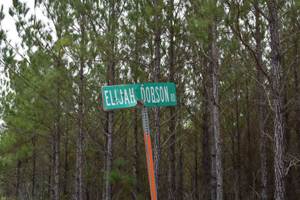
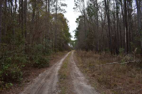
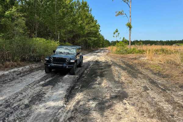
Elijah Dobson Road
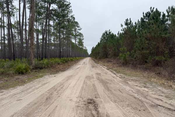
This trail cuts through private forest lands and private ranches. The trail is a public easement/right of way that is open to public access year-round. Any properties abutting the trail are private. Going off-trail or entering those properties without permission may be considered trespassing. Mainte...
Learn more about Elijah Dobson Road
FR 783
This trail runs through the Osceola National Forest (NF) and Wildlife Management Area (WMA). The trail is open to public access year-round unless otherwise posted. The trail is open only to registered highway legal motor vehicles. All-terrain vehicles (ATV’s), Off-Highway Vehicles (OHV’s), Side-by-s...
Learn more about FR 783
FR 775-B
This trail runs through the Osceola National Forest (NF) and Wildlife Management Area (WMA). The trail is open to public access year-round unless otherwise posted. The trail is open only to registered highway legal motor vehicles. All-terrain vehicles (ATV’s), Off-Highway Vehicles (OHV’s), Side-by-s...
Learn more about FR 775-B
FR 728
This trail runs through the Osceola National Forest (NF) and Wildlife Management Area (WMA). The trail is open to public access year-round unless otherwise posted. The trail is open only to registered highway legal motor vehicles. All-terrain vehicles (ATV’s), Off-Highway Vehicles (OHV’s), Side-by-s...
Learn more about FR 728
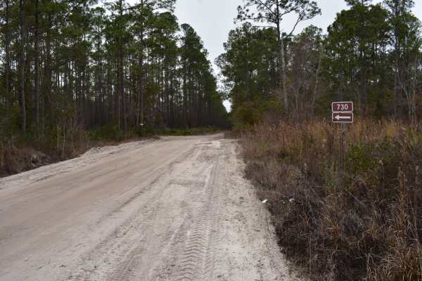
FR 730
This trail runs through the Osceola National Forest (NF) and Wildlife Management Area (WMA). The trail is open to public access year-round unless otherwise posted. The trail is open only to registered highway legal motor vehicles. All-terrain vehicles (ATV’s), Off-Highway Vehicles (OHV’s), Side-by-s...
Learn more about FR 730
FR 775
This trail runs through the Osceola National Forest (NF) and Wildlife Management Area (WMA). The trail is open to public access year-round unless otherwise posted. The trail is open only to registered highway legal motor vehicles. All-terrain vehicles (ATV’s), Off-Highway Vehicles (OHV’s), Side-by-s...
Learn more about FR 775

FR 784
This trail runs through the Osceola National Forest (NF) and Wildlife Management Area (WMA). The trail is open to public access year-round unless otherwise posted. The trail is open only to registered highway legal motor vehicles. All-terrain vehicles (ATV’s), Off-Highway Vehicles (OHV’s), Side-by-s...
Learn more about FR 784
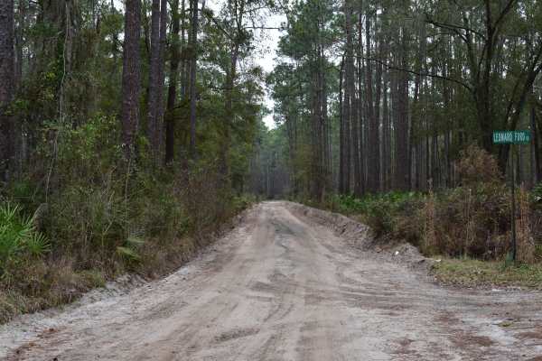
CC Road
This trail borders the Osceola National Forest (NF), the Osceola Wildlife Management Area (WMA), and private forest lands. The trail is a public easement/county right of way that is open to public access year-round. Being a county/public easement, the trail is only open to registered/licensed street...
Learn more about CC Road
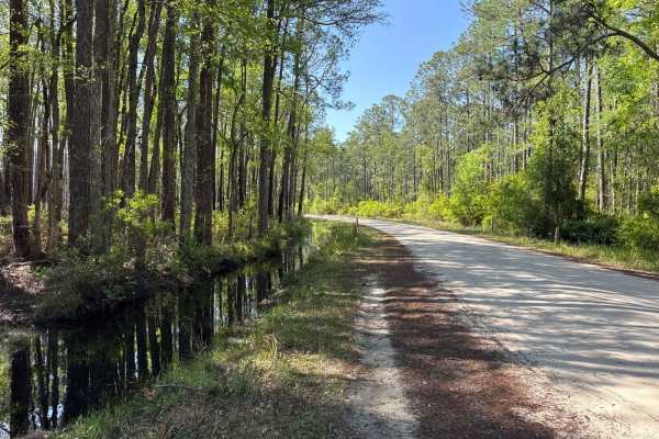
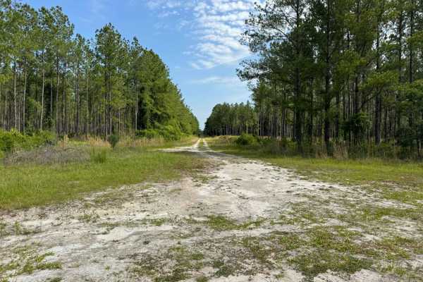
St. Johns River WMD West
St. Johns River WMD West connects CR 325 with CR 346. The road conditions are a mixture of packed sand, loose sand, and some deep holes that can turn into 2-foot-deep mud holes after rainy days. Some sections require 4WD and high clearance is recommended. The road is very narrow in some sections. Do...
Learn more about St. Johns River WMD West
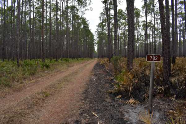
FR 782
This trail runs through the Osceola National Forest (NF) and Wildlife Management Area (WMA). The trail is open to public access year-round unless otherwise posted. The trail is open only to registered highway legal motor vehicles. All-terrain vehicles (ATV’s), Off-Highway Vehicles (OHV’s), Side-by-s...
Learn more about FR 782
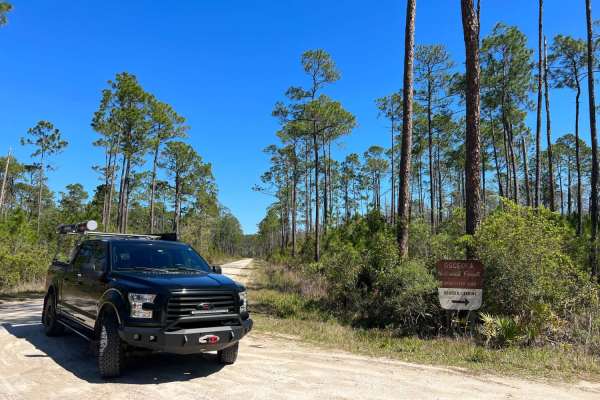
Southeast County Line Road
This trail runs through the Osceola National Forest (NF) and Wildlife Management Area (WMA). The trail is an unimproved county right of way and is open to public access year-round. Only registered highway legal motor vehicles are allowed to operate on this trail. The use of all-terrain vehicles (ATV...
Learn more about Southeast County Line Road

FR 732
This trail is located within Osceola National Forest and the Osceola Wildlife Management Area. The trail is open to public access year-round unless otherwise posted. This trail may be ridden by registered motor vehicles, all-terrain vehicles, recreational off-highway vehicles (side-by-sides), and un...
Learn more about FR 732
Hog Pen
Hog Pen is a fun sandy road that is well maintained, leading between County Road 250 and Highway 90 that passes by Hog Pen Landing and campground nestled along Ocean Pond Lake. This is a hidden gem for water enthusiasts wanting to enjoy the two-mile-wide natural lake in Osceola National Forest. This...
Learn more about Hog Pen

Battlefield Trail
This trail is located within Osceola National Forest and the Osceola Wildlife Management Area. The trail is open to public access year-round unless otherwise posted. This trail may be ridden by registered motor vehicles, all-terrain vehicles, recreational off-highway vehicles (side-by-sides), and un...
Learn more about Battlefield Trail
Coleman - Osceola NF 215
The Coleman Trail, also known as Osceola National Forest Road 215, connects CR 250 at the north end and SR 90 at the south end. It takes you through the Osceola National Forest from north to south and gives you access to the Mount Carrie OHV Trailhead. The road conditions are a mixture of packed san...
Learn more about Coleman - Osceola NF 215
Fish Camp Road North
Fish Camp Road North takes you through the Lochloosa Wildlife Conservation Area. The trail connects CR325 and the Lochloosa WMA West Loop. The road conditions are a mixture of packed sand, loose sand, and some deep holes that can turn into 2-foot-deep mud holes after rainy days. Some sections requir...
Learn more about Fish Camp Road North

FR 207-B
This trail runs through the Osceola National Forest (NF) and Wildlife Management Area (WMA). The trail is open to public access year-round unless otherwise posted. The trail is open to registered highway legal motor vehicles, all-terrain vehicles, recreational off-highway vehicles (side-by-sides), a...
Learn more about FR 207-B
Grove Park WMA West Trail
Grove Park WMA West Trail takes you through the Grove Park Water Management Area. The trail cuts through the Lochloosa WMA West Loop. The road conditions are a mixture of packed sand, loose sand, and some deep holes that can turn into 2-foot-deep mud holes after rainy days. Some sections require 4WD...
Learn more about Grove Park WMA West Trail
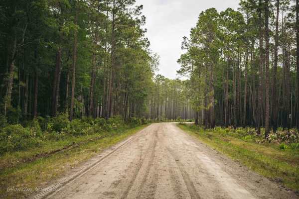
Osceola National Forest FR 235/17 Mile Camp Rd
FR 235/17 Mile Camp Rd is a North-South easy trail through Osceola National Forest that gets you into the heart of the forest. 95% of the trail is packed sand and light gravel with a few sections of loosely packed sand. 4WD and high clearance are not required on the trail except for a fun little wat...
Learn more about Osceola National Forest FR 235/17 Mile Camp Rd
Grove Park WMA East Trail
Grove Park WMA East Trail takes you through the Grove Park Water Management Area. The trail cuts through the Lochloosa WMA West Loop. The road conditions are a mixture of packed sand, loose sand, and some deep holes that can turn into 2-foot-deep mud holes after rainy days. Some sections require 4WD...
Learn more about Grove Park WMA East Trail
Beginner ATV trails near Brooker, Florida
Explore ATV-friendly trails near you. These trails are accessible for vehicles up to 50 inches wide, perfect for ATVs and smaller off-road machines.
FR 783
This trail runs through the Osceola National Forest (NF) and Wildlife Management Area (WMA). The trail is open to public access year-round unless otherwise posted. The trail is open only to registered highway legal motor vehicles. All-terrain vehicles (ATV’s), Off-Highway Vehicles (OHV’s), Side-by-s...
Learn more about FR 783
FR 775-B
This trail runs through the Osceola National Forest (NF) and Wildlife Management Area (WMA). The trail is open to public access year-round unless otherwise posted. The trail is open only to registered highway legal motor vehicles. All-terrain vehicles (ATV’s), Off-Highway Vehicles (OHV’s), Side-by-s...
Learn more about FR 775-B
FR 784
This trail runs through the Osceola National Forest (NF) and Wildlife Management Area (WMA). The trail is open to public access year-round unless otherwise posted. The trail is open only to registered highway legal motor vehicles. All-terrain vehicles (ATV’s), Off-Highway Vehicles (OHV’s), Side-by-s...
Learn more about FR 784
FR 732
This trail is located within Osceola National Forest and the Osceola Wildlife Management Area. The trail is open to public access year-round unless otherwise posted. This trail may be ridden by registered motor vehicles, all-terrain vehicles, recreational off-highway vehicles (side-by-sides), and un...
Learn more about FR 732
Beginner UTV/side-by-side trails near Brooker, Florida
Find UTV and side-by-side trails near you. These trails accommodate vehicles up to 60 inches wide, ideal for UTVs, side-by-sides, and wider off-road rigs.
FR 783
This trail runs through the Osceola National Forest (NF) and Wildlife Management Area (WMA). The trail is open to public access year-round unless otherwise posted. The trail is open only to registered highway legal motor vehicles. All-terrain vehicles (ATV’s), Off-Highway Vehicles (OHV’s), Side-by-s...
Learn more about FR 783
FR 775-B
This trail runs through the Osceola National Forest (NF) and Wildlife Management Area (WMA). The trail is open to public access year-round unless otherwise posted. The trail is open only to registered highway legal motor vehicles. All-terrain vehicles (ATV’s), Off-Highway Vehicles (OHV’s), Side-by-s...
Learn more about FR 775-B
FR 784
This trail runs through the Osceola National Forest (NF) and Wildlife Management Area (WMA). The trail is open to public access year-round unless otherwise posted. The trail is open only to registered highway legal motor vehicles. All-terrain vehicles (ATV’s), Off-Highway Vehicles (OHV’s), Side-by-s...
Learn more about FR 784
FR 732
This trail is located within Osceola National Forest and the Osceola Wildlife Management Area. The trail is open to public access year-round unless otherwise posted. This trail may be ridden by registered motor vehicles, all-terrain vehicles, recreational off-highway vehicles (side-by-sides), and un...
Learn more about FR 732
The onX Offroad Difference
onX Offroad combines trail photos, descriptions, difficulty ratings, width restrictions, seasonality, and more in a user-friendly interface. Available on all devices, with offline access and full compatibility with CarPlay and Android Auto. Discover what you're missing today!
Open Trail Map