
Beginner Off-Road Trails
Near Broadwater, Nebraska
Explore All Beginner Trails Near Broadwater, Nebraska
Beginner Off-Road Trails Near Broadwater, Nebraska
Discover the best beginner-friendly off-road trails near you. These easier, lower-rated trails are a great place to start — browse trail maps, check difficulty ratings, and find your next adventure.
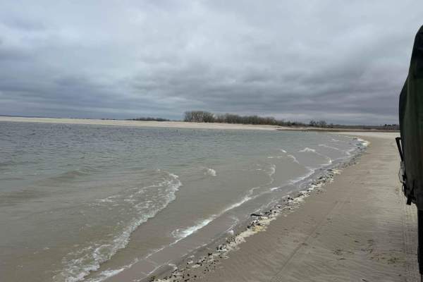
Lake Mac Shoreline Cruise
This is a quick, casual, scenic shoreline cruise at Lake McConaughy. Due to the soft sand, a 4x4 is required. Nebraska Game and Parks requires a park pass for lake use. This is an excellent path for beginners or those looking to take in some scenery leisurely.
Learn more about Lake Mac Shoreline Cruise
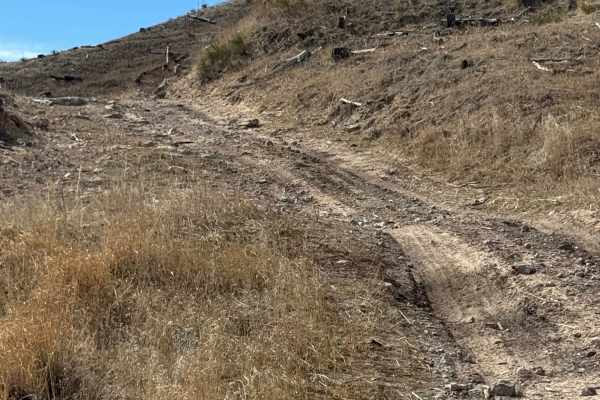
Coffee Mill Butte - FS 702
This is a 2-track trail that's mainly comprised of hard-pack dirt. The trail has ruts, washouts, and whoops that could fill with mud after rain. A few of the whoops could require a vehicle with extra ground clearance, as they are tall and steep. There is also a small section that's filled with loose...
Learn more about Coffee Mill Butte - FS 702
Beginner ATV trails near Broadwater, Nebraska
Explore ATV-friendly trails near you. These trails are accessible for vehicles up to 50 inches wide, perfect for ATVs and smaller off-road machines.
Coffee Mill Butte - FS 702
This is a 2-track trail that's mainly comprised of hard-pack dirt. The trail has ruts, washouts, and whoops that could fill with mud after rain. A few of the whoops could require a vehicle with extra ground clearance, as they are tall and steep. There is also a small section that's filled with loose...
Learn more about Coffee Mill Butte - FS 702
Beginner UTV/side-by-side trails near Broadwater, Nebraska
Find UTV and side-by-side trails near you. These trails accommodate vehicles up to 60 inches wide, ideal for UTVs, side-by-sides, and wider off-road rigs.
Coffee Mill Butte - FS 702
This is a 2-track trail that's mainly comprised of hard-pack dirt. The trail has ruts, washouts, and whoops that could fill with mud after rain. A few of the whoops could require a vehicle with extra ground clearance, as they are tall and steep. There is also a small section that's filled with loose...
Learn more about Coffee Mill Butte - FS 702
The onX Offroad Difference
onX Offroad combines trail photos, descriptions, difficulty ratings, width restrictions, seasonality, and more in a user-friendly interface. Available on all devices, with offline access and full compatibility with CarPlay and Android Auto. Discover what you're missing today!
Open Trail Map