
Beginner Off-Road Trails
Near Baxter, Minnesota
Explore All Beginner Trails Near Baxter, Minnesota
Beginner Off-Road Trails Near Baxter, Minnesota
Discover the best beginner-friendly off-road trails near you. These easier, lower-rated trails are a great place to start — browse trail maps, check difficulty ratings, and find your next adventure.
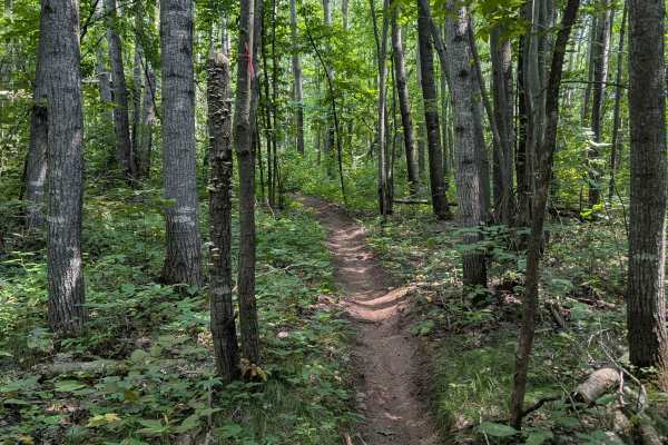
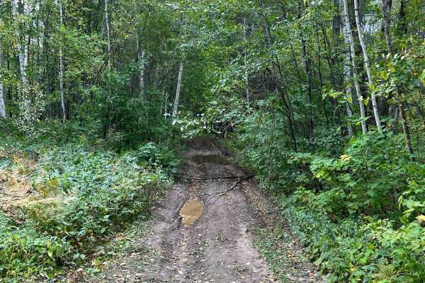
Outer Loop
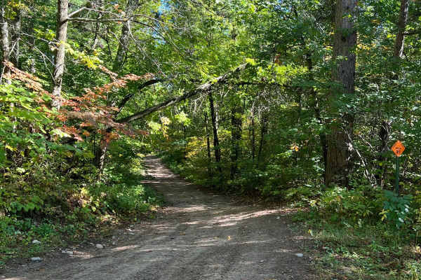
Located just east of Brainerd, Minnesota, this loop is part of the Miller Hills trail system. This outer loop snakes around the outer bounds of the North East section of the trail. The single track trail features many tight turns, lots of exposed rocks, ruts, and steep hills. Many fallen trees and a...
Learn more about Outer Loop
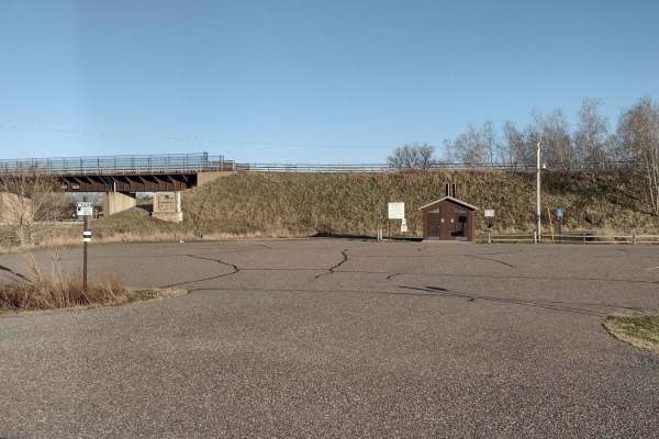
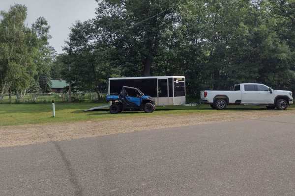
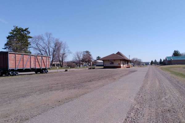
Trailhead Parking to Genola
This section of Soo Line South is an easy trail with a great parking lot at the trailhead that has lots of room for trailers. The parking lot has security cameras and two vault-type restrooms. The parking lot and first few hundred feet of trail going up the hill from the parking lot's northwest end ...
Learn more about Trailhead Parking to Genola
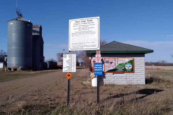
Genola to Hillman
Genola to Hillman on the Soo Line South Trail is a section of converted rail grade that is 12 miles long and takes about 40 minutes with an average speed of 19.6 mph. This section of the Soo Line South Trail is provided by Morrison County and maintained by the Eastern Morrison County 4 Wheelers Club...
Learn more about Genola to Hillman
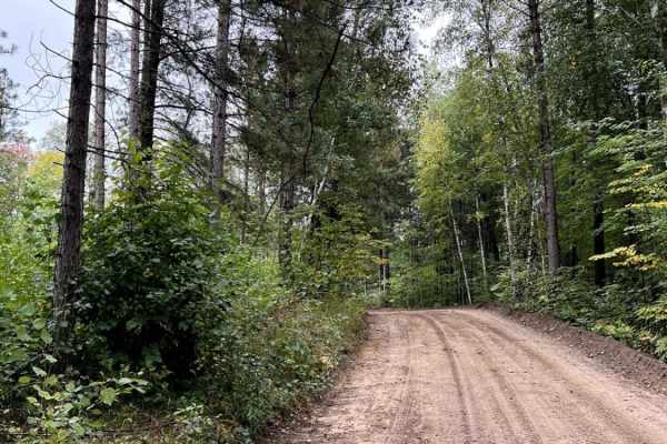
Bull Run Trail
Bull Moose Trail is an incredibly beautiful forest road with access to many activities besides trail riding. This road provides fishing access to two different backwoods lakes and plenty of dispersed camping. One lake has a small beach and appears to be fairly deep. The drive out to the two lakes at...
Learn more about Bull Run Trail
Emily - Blind Lake Trail - West 106
This section of Emily - Blind Lake TRL(West of County Road 106) is mapped from the Bloomquist Dr. ATV parking lot in Emily to the southern Crow Wing County Road 106 trail intersection. This section is 7.9 miles long and takes about an hour, including the time it took for trail pictures and a stop at...
Learn more about Emily - Blind Lake Trail - West 106
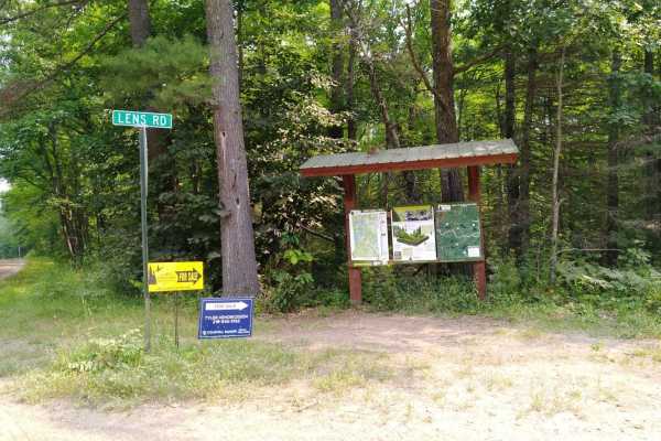
Emily - Blind Lake Trail - East 106
This section of Emily - Blind Lake Trail (East of County Road 106) is mapped from the southern Crow Wing County Road 106 trail intersection (Lens Road) to the Blind Lake Trail. This section is 8.2 miles long and takes about 45 minutes including the time it took for trail pictures. This section will ...
Learn more about Emily - Blind Lake Trail - East 106
Bull Run Trail Extension
This section of road seems to be tended to on occasion. Regardless, its a fairly wide trail with a few shoot off trails and campsites. One trail shoots off and connects up with a very long dirt bike/ATV trail. Overall the trail is tame with some pretty evergreens and small lakes. Note on Trail Ridin...
Learn more about Bull Run Trail Extension
Cut Lake Scenic Drive
This is one of the best trails in the Spider Lake, Foot Hills Park area. Don't ruin this gem! You drive off a beach and drive on small hills next to the lake with an incredible view. You'll experience some nice rolling spots within the trail. It is overall smooth and some areas with water but super ...
Learn more about Cut Lake Scenic Drive
Bull Moose Trail
This trail connects forest roads from Spider Lake to Foot Hills State Forest. This minimum maintenance road is a little narrower in spots, overgrown with grass in spots, and I presume pretty fun in the winter. You will see lots of Northern Minnesota scenery. Note on Trail Riding in MN: Many trails h...
Learn more about Bull Moose Trail
The Narrow Bull Moose Trail
This trail could basically be a forest road, granted it is ATV, SxS, and dirt bike only. It is really wide in spots and is primarily gravel, with some loose sand spots, water puddles to cross, and smaller rocks. It is a fun trail but primarily for cruising, nothing too technical. Some spots are roug...
Learn more about The Narrow Bull Moose Trail
Emily/Outing ATV A Trail
Emily/Outing ATV A Trail is mapped from the B Trail to the Bloomquist Dr. ATV parking lot in Emily. This section is 4.9 miles long and takes about 22 minutes with average speed of 12.8 MPH including the time it took for trail pictures.
Learn more about Emily/Outing ATV A Trail
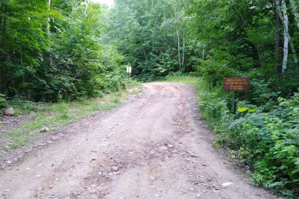
Hillman to Onamia
Hillman to Onamia on the Soo Line South Trail is a section of converted rail grade. At 12 miles long, it takes about 30 minutes with an average speed of 24.1 mph. This section of the Soo Line South Trail is provided by Mille Lacs County and maintained by the Mille Lacs Drift Skippers Snowmobile/ATV ...
Learn more about Hillman to Onamia
Spider Lake North State Forestry Rd
This is a smooth well maintained forest road with access to some small lakes and dispersed camping. This road continues on to connect with perch lake minimum maintenance forest road which has some other really pretty lakes and camping spots. The road is primarily sand and gravel and seems to be grad...
Learn more about Spider Lake North State Forestry Rd
Narrow Foothills Highway
This trail is the continuation of the Narrow Bull Moose Trail. A small jaunt across the paved road will get you here. The trail does not allow SUV/lifted 4x4 rigs but is wide in some areas. Five or more years ago, this used to be much more open and clear; logging will cause different changes to thes...
Learn more about Narrow Foothills Highway

Blind Lake Connector Trail - South 68
Blind Lake Connector Trail (South of County Road 68) is mapped from the end of the Emily Blind Lake Trail to the Aitkin County Road 68 area. This section is 10 miles long and takes about an hour including the time it took for trail pictures. This section is maintained by The Blind Lake ATV Club. The...
Learn more about Blind Lake Connector Trail - South 68
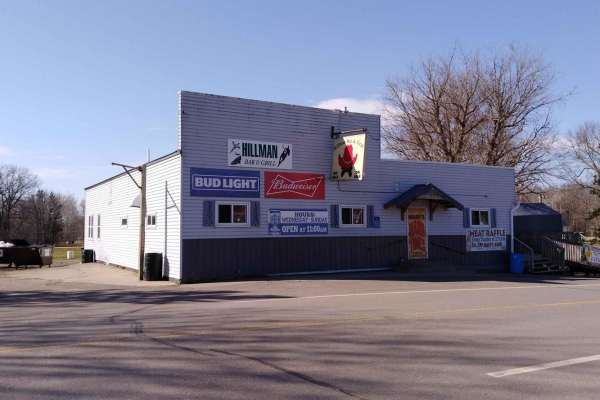
South of Outing on the A Trail
South of Outing on the Emily-Outing A Trail was mapped from the Outing ATV Parking lot to the Emily-Outing B Trail. The length is just under 5 miles, and it stops at the Outing gas station, which is right on the trail. A stop at the parking lot on the north end of the Pickled Loon and a stop at the ...
Learn more about South of Outing on the A Trail
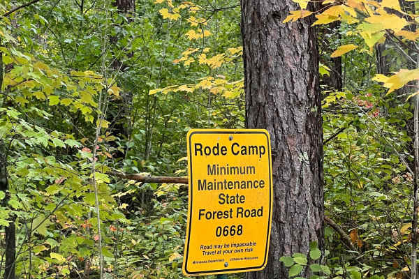
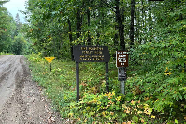
Thompson Minimum Maintenance Forest Road
Typical narrow minimum maintenance forest road. Some areas of rough mud and gravel. Overall nothing to really be worried about even in a stock SUV. There may be extra water or down branches depending on the weather. Typically 1-2 cars wide or space to pull off to get around other vehicles. Pine Moun...
Learn more about Thompson Minimum Maintenance Forest Road
Foot Hills North Lake Loop
This is a narrower tame trail with views of many small lakes. This trail is not overgrown but feels natural. It's not overrun and feels like a backwoods trail. There are not any large obstacles to get past. Note on Trail Riding in MN: Many trails heavily change in difficulty depending on the time of...
Learn more about Foot Hills North Lake Loop
Onamia to Wahkon
Onamia to Wahkon on the Soo Line South is a section of converted rail grade. At 8.2 miles long, it takes about 30 minutes with an average speed of 13.7 MPH. This section of the Soo Line South Trail is provided by Mille Lacs County and maintained by the Mille Lacs Drift Skippers Snowmobile/ATV Club. ...
Learn more about Onamia to Wahkon
Huntersville Southeast Leg
This trail is really nice. There are areas of open forest where you can ride faster and other areas where it winds through the trees. There were no notable obstacles. Compared to nearby Paul Bunyan and Spider Lake Trails, this trail system is generally narrower but has fewer obstacles, fewer incline...
Learn more about Huntersville Southeast Leg
Beginner ATV trails near Baxter, Minnesota
Explore ATV-friendly trails near you. These trails are accessible for vehicles up to 50 inches wide, perfect for ATVs and smaller off-road machines.
Trailhead Parking to Genola
This section of Soo Line South is an easy trail with a great parking lot at the trailhead that has lots of room for trailers. The parking lot has security cameras and two vault-type restrooms. The parking lot and first few hundred feet of trail going up the hill from the parking lot's northwest end ...
Learn more about Trailhead Parking to Genola
Genola to Hillman
Genola to Hillman on the Soo Line South Trail is a section of converted rail grade that is 12 miles long and takes about 40 minutes with an average speed of 19.6 mph. This section of the Soo Line South Trail is provided by Morrison County and maintained by the Eastern Morrison County 4 Wheelers Club...
Learn more about Genola to Hillman
Bull Run Trail
Bull Moose Trail is an incredibly beautiful forest road with access to many activities besides trail riding. This road provides fishing access to two different backwoods lakes and plenty of dispersed camping. One lake has a small beach and appears to be fairly deep. The drive out to the two lakes at...
Learn more about Bull Run Trail
Emily - Blind Lake Trail - West 106
This section of Emily - Blind Lake TRL(West of County Road 106) is mapped from the Bloomquist Dr. ATV parking lot in Emily to the southern Crow Wing County Road 106 trail intersection. This section is 7.9 miles long and takes about an hour, including the time it took for trail pictures and a stop at...
Learn more about Emily - Blind Lake Trail - West 106
Beginner UTV/side-by-side trails near Baxter, Minnesota
Find UTV and side-by-side trails near you. These trails accommodate vehicles up to 60 inches wide, ideal for UTVs, side-by-sides, and wider off-road rigs.
Trailhead Parking to Genola
This section of Soo Line South is an easy trail with a great parking lot at the trailhead that has lots of room for trailers. The parking lot has security cameras and two vault-type restrooms. The parking lot and first few hundred feet of trail going up the hill from the parking lot's northwest end ...
Learn more about Trailhead Parking to Genola
Genola to Hillman
Genola to Hillman on the Soo Line South Trail is a section of converted rail grade that is 12 miles long and takes about 40 minutes with an average speed of 19.6 mph. This section of the Soo Line South Trail is provided by Morrison County and maintained by the Eastern Morrison County 4 Wheelers Club...
Learn more about Genola to Hillman
Bull Run Trail
Bull Moose Trail is an incredibly beautiful forest road with access to many activities besides trail riding. This road provides fishing access to two different backwoods lakes and plenty of dispersed camping. One lake has a small beach and appears to be fairly deep. The drive out to the two lakes at...
Learn more about Bull Run Trail
Emily - Blind Lake Trail - West 106
This section of Emily - Blind Lake TRL(West of County Road 106) is mapped from the Bloomquist Dr. ATV parking lot in Emily to the southern Crow Wing County Road 106 trail intersection. This section is 7.9 miles long and takes about an hour, including the time it took for trail pictures and a stop at...
Learn more about Emily - Blind Lake Trail - West 106
The onX Offroad Difference
onX Offroad combines trail photos, descriptions, difficulty ratings, width restrictions, seasonality, and more in a user-friendly interface. Available on all devices, with offline access and full compatibility with CarPlay and Android Auto. Discover what you're missing today!
Open Trail Map