
Beginner Off-Road Trails
Near Anawalt, West Virginia
Explore All Beginner Trails Near Anawalt, West Virginia
Beginner Off-Road Trails Near Anawalt, West Virginia
Discover the best beginner-friendly off-road trails near you. These easier, lower-rated trails are a great place to start — browse trail maps, check difficulty ratings, and find your next adventure.
OP 56
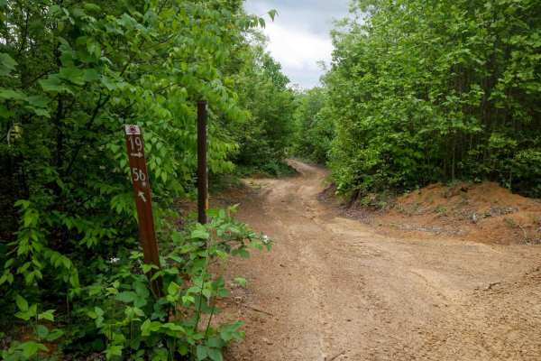
OP 56 is a flat, quarter-mile trail connecting two segments of OP 19. It follows a narrow shelf path cut into the hillside along a hilltop, with open skies and minimal elevation change. The surface is smooth with only minor shallow ruts. Leafy poplars and elder trees line the route.
Learn more about OP 56
19 Connector
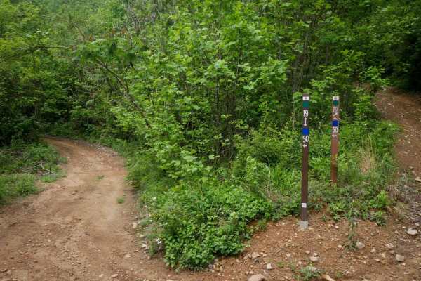
This connector is a flat, quarter-mile link between OP 19 and OP 50. It runs along a hillside with short trees and open skies, on a smooth dirt surface with mildly uneven ground. No obstacles or technical features make it a simple and easy transitional route through the trail system.
Learn more about 19 Connector
OP 18
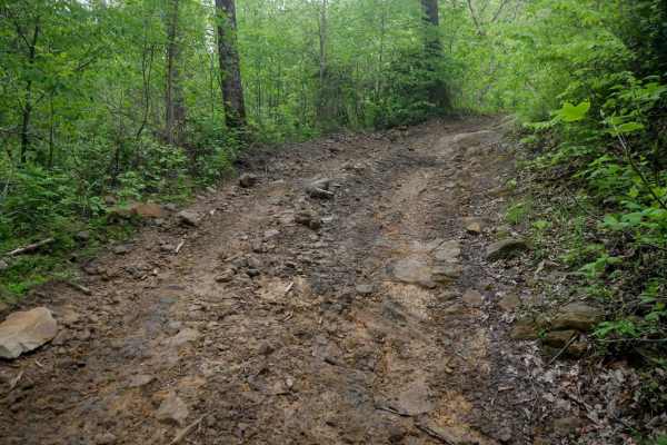
OP 18 is a 2-mile route that runs from OP 14 deeper into the trail system, serving as a connector to several easy trails. It drops down to a dense, lush forest floor, before climbing to 2,800 feet elevation on the north end on an easy path through the hilltops through pitch pines and poplar trees. E...
Learn more about OP 18
OP 59
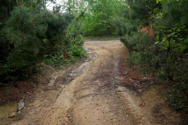
OP 59 is a 0.6-mile easy shelf path with gradual terrain and mostly smooth surfaces. Large mud puddles are present throughout, and while the trail is decently wide, thick brush near the edges can obscure visibility--use caution for oncoming traffic. Minor loose rock appears occasionally but is gener...
Learn more about OP 59
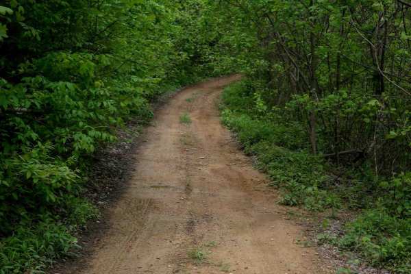
OP 19
OP 19 is an easy trail starting at the north end of OP 100 and continuing to the intersection with OP 18 and OP 57, passing OP 56 along the way. Trail 19 also spurs back south from that intersection to the intersection with OP 59. Both sections are easy;it follows a smooth, easy shelf path next to d...
Learn more about OP 19
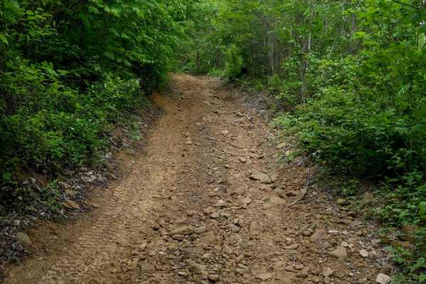
OP 57
OP 57 is a 1-mile trail that zigzags around the hillsides with semi-steep grades and gradual corners that can approach quickly. The path is decently wide and includes minor embedded and loose rock. Some sections are a bit overgrown, with low-hanging branches and brush. It passes through several unma...
Learn more about OP 57
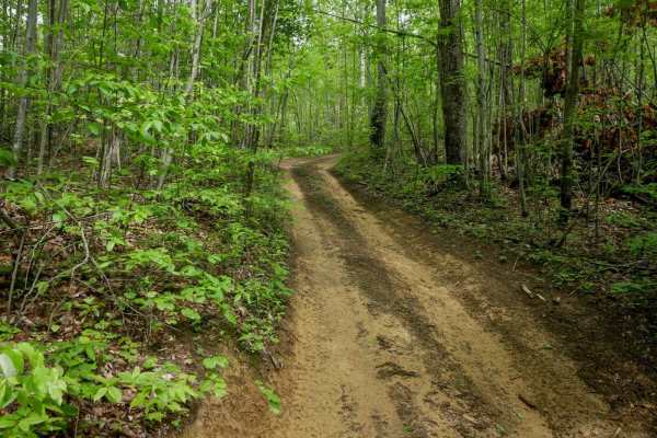
OP 40
Original Pocahontas 40 is a very short, easy connector trail linking OP 67 to OP 92. The trail follows a smooth, one-lane-wide path through dense Appalachian forest with hardly any rocks. Shaded by a thick canopy and surrounded by native undergrowth, it's just a quick stretch through classic Virgini...
Learn more about OP 40
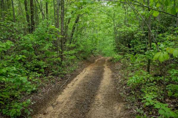
OP 34
OP 34 is a 0.6-mile trail connecting OP 67 to OP 15. It follows a narrow, one-lane shelf path cut into a hillside. The trail runs through lush Appalachian forest, with dense vegetation and thickets lining the route, creating a shaded, enclosed feel. The surface features shallow ruts, loose rock, and...
Learn more about OP 34
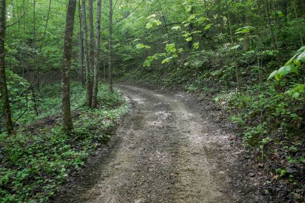
OP 12
The north end of OP 12 is a continuation from OP 43. It traverses a scenic forest with a dense leaf canopy along a shelf path cut into the hillside. The trail features small climbs and descents with numerous curvy sections. The surface includes muddy ruts and areas with loose rock, narrowing to a on...
Learn more about OP 12
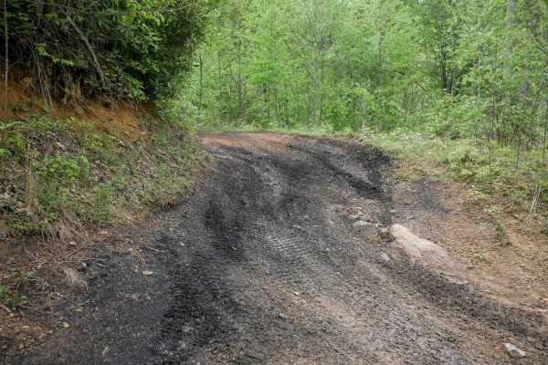
OP 58
OP 58 in the Original Pocahontas trail system is a short, easy loop off of OP 18, offering smooth terrain with no obstacles or rock. The trail features a semi-steep grade but remains very easy overall, making it a great option for beginners or anyone looking to add extra easy mileage to their ride.
Learn more about OP 58
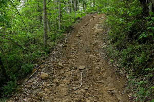
OP 32
OP 32 is a 0.6-mile easy trail that winds through scenic forest with tall ash and maple trees, offering a high canopy and consistent shade. The path is smooth with gradual curves and scattered mud puddles, making for a relaxed ride. A few short sections feature steeper grades and loose rock, but the...
Learn more about OP 32
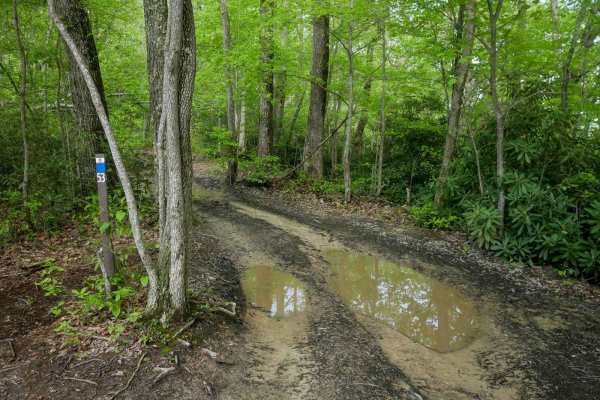
OP 53
OP 53 is a 0.25-mile connector trail linking OP 49 to OP 43. It follows the curvature of a hilltop through scenic forest on an easy, one-lane-wide path with ruts and patches of loose rock. The trail includes a few semi-steep sections as it descends off the ridge toward OP 43, but is easy overall and...
Learn more about OP 53
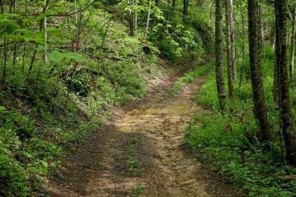
OP 11
The north end of OP 11 parallels a section of OP 12 and runs less than half a mile before ending at OP 46. This easy, one-lane-wide shelf path passes through dense forest with low-hanging branches and is lined with rhododendron and thick undergrowth. The trail shows lighter use, with grass growing i...
Learn more about OP 11
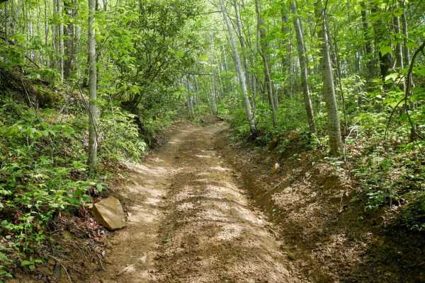
OP 43
OP 43 is an easy trail connecting OP 12 to OP 49, winding through dense forest with low-hanging branches and a lush, moss-covered hillside beside the shelf-cut path. It features gradual elevation changes, sweeping corners, and a fast, flowy feel. The surface is mostly clear, with minor muddy ruts an...
Learn more about OP 43
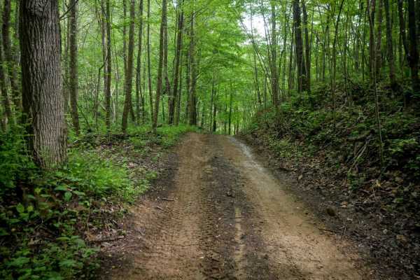
OP 46
OP 46 is a quarter-mile connector between OP 11 and OP 49. The trail is slightly bumpier with more embedded and loose rock, but remains easy overall. It features a steep descent from south to north and is lined in spots with rhododendron thickets, thick ash trees, and slender maple trees, offering a...
Learn more about OP 46
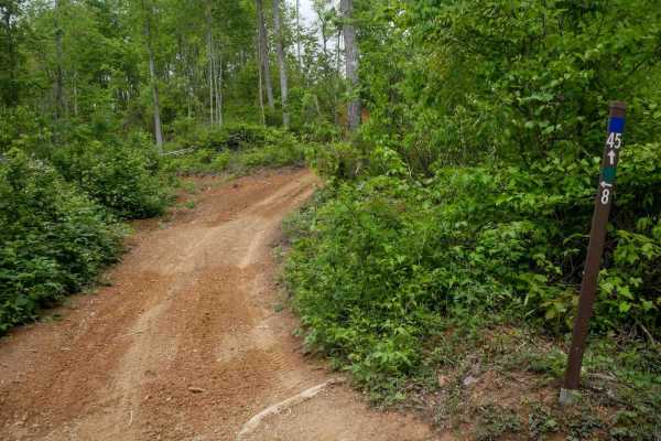
OP 45
OP 45 is a very short segment connecting OP 61 and OP 6. It makes a brief climb and descent over a semi-steep hill but remains smooth and obstacle-free throughout. With no rocks or technical features, it's easy to navigate. The trail runs along a forested hilltop at 2,700 feet, though the dense tree...
Learn more about OP 45
OP 49
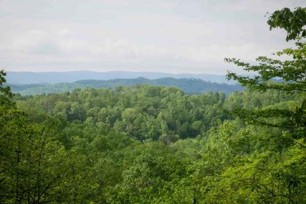
OP 49 is a short, gradually climbing trail that starts out easy on the east end, cut into a hillside through a logged area with smooth dirt, shallow ruts, and open views. It curves along the slope, passing a few intersections before transitioning into denser woods with full tree cover. The surface b...
Learn more about OP 49
OP 15
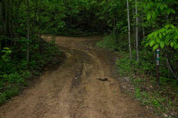
OP 15 is a 0.6-mile loop branching off OP 16. It follows a wide, easy path through scenic forest with gradual grades and smooth terrain, crossing Tank Hill Road about halfway through. The trail has some muddy ruts but remains accessible and beginner-friendly. It also provides access to several other...
Learn more about OP 15
OP 24
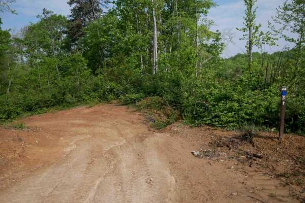
OP 24 in the Original Pocahontas trail system is a short, easy connector trail with smooth dirt, shallow ruts, and no rocks. It runs through a logged area, offering open views as it gradually traverses the hillside. This trail links OP 6 with the OP 28/128 loop and is straightforward to navigate.
Learn more about OP 24
OP 128
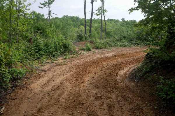
Original Pocahontas 128 is a 0.7-mile easy trail cut into a hillside, running through a recently logged area with small trees and open views. The one-lane-wide path is smooth and curvy with a gradual slope and no obstacles. Like OP 28, it offers an uncomplicated drive on a well-cleared surface.
Learn more about OP 128
Beginner ATV trails near Anawalt, West Virginia
Explore ATV-friendly trails near you. These trails are accessible for vehicles up to 50 inches wide, perfect for ATVs and smaller off-road machines.
OP 56
OP 56 is a flat, quarter-mile trail connecting two segments of OP 19. It follows a narrow shelf path cut into the hillside along a hilltop, with open skies and minimal elevation change. The surface is smooth with only minor shallow ruts. Leafy poplars and elder trees line the route.
Learn more about OP 56
19 Connector
This connector is a flat, quarter-mile link between OP 19 and OP 50. It runs along a hillside with short trees and open skies, on a smooth dirt surface with mildly uneven ground. No obstacles or technical features make it a simple and easy transitional route through the trail system.
Learn more about 19 Connector
OP 18
OP 18 is a 2-mile route that runs from OP 14 deeper into the trail system, serving as a connector to several easy trails. It drops down to a dense, lush forest floor, before climbing to 2,800 feet elevation on the north end on an easy path through the hilltops through pitch pines and poplar trees. E...
Learn more about OP 18
OP 59
OP 59 is a 0.6-mile easy shelf path with gradual terrain and mostly smooth surfaces. Large mud puddles are present throughout, and while the trail is decently wide, thick brush near the edges can obscure visibility--use caution for oncoming traffic. Minor loose rock appears occasionally but is gener...
Learn more about OP 59
Beginner UTV/side-by-side trails near Anawalt, West Virginia
Find UTV and side-by-side trails near you. These trails accommodate vehicles up to 60 inches wide, ideal for UTVs, side-by-sides, and wider off-road rigs.
OP 56
OP 56 is a flat, quarter-mile trail connecting two segments of OP 19. It follows a narrow shelf path cut into the hillside along a hilltop, with open skies and minimal elevation change. The surface is smooth with only minor shallow ruts. Leafy poplars and elder trees line the route.
Learn more about OP 56
19 Connector
This connector is a flat, quarter-mile link between OP 19 and OP 50. It runs along a hillside with short trees and open skies, on a smooth dirt surface with mildly uneven ground. No obstacles or technical features make it a simple and easy transitional route through the trail system.
Learn more about 19 Connector
OP 18
OP 18 is a 2-mile route that runs from OP 14 deeper into the trail system, serving as a connector to several easy trails. It drops down to a dense, lush forest floor, before climbing to 2,800 feet elevation on the north end on an easy path through the hilltops through pitch pines and poplar trees. E...
Learn more about OP 18
OP 59
OP 59 is a 0.6-mile easy shelf path with gradual terrain and mostly smooth surfaces. Large mud puddles are present throughout, and while the trail is decently wide, thick brush near the edges can obscure visibility--use caution for oncoming traffic. Minor loose rock appears occasionally but is gener...
Learn more about OP 59
The onX Offroad Difference
onX Offroad combines trail photos, descriptions, difficulty ratings, width restrictions, seasonality, and more in a user-friendly interface. Available on all devices, with offline access and full compatibility with CarPlay and Android Auto. Discover what you're missing today!
Open Trail Map