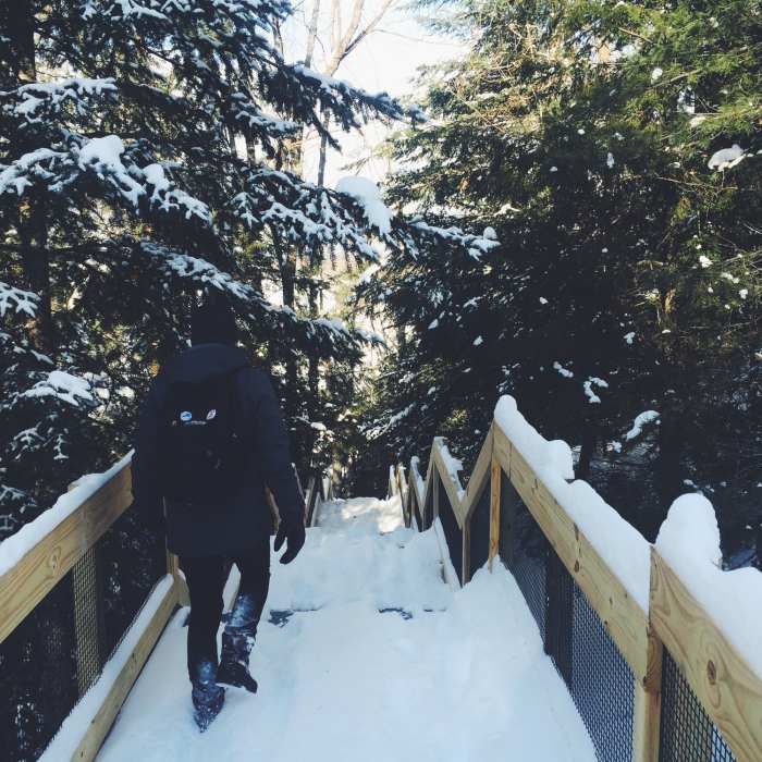
Near Highbanks Trail
It's a long walk down to the Au Sable River.

Looking for more photos?

View All Photos
View Map
Driving Directions
Hike Trail

Highbanks Trail

4.4 (8 Ratings)
A point-to-point trail along the Au Sable River.
6.2
mi
Distance
82
ft
Gain
moderate
Difficulty
BirdingFall ColorsRiver/CreekSpringViews

Route Details

Flatter
Steeper
6.17mi
Distance
82ft
Elevation Gain
219ft
Elevation Loss
10%
Max Grade
851ft
High Point
699ft
Low Point
Path Type
Point to Point
Description
Enjoy this route, strung along the towering bluffs above the Au Sable River is the Highbanks Trail, a skiing and hiking route that was developed through the Corsair Ski Council and the Huron National Forest. This is a point-to-point trail, and without two vehicles, it's almost impossible to avoid backtracking. At times, the route also winds close to River Road, and the sound of cars speeding by occasionally breaks up the peaceful tranquility of the wooded path. But the drawbacks are hardly worth considering when compared with what the Highbanks Trail has to offer: outstanding scenery and views, the possibility of spotting a bald eagle during the spring and summer, and an opportunity to learn about the life of a logger in the 1800s at the Lumberman's Monument all make this an exciting excursion for any visitor.

Route Conditions

Report Conditions
No Condition Reports
Report Conditions

Nearby Hike Routes

Hoist Lakes Area

Hike Route

Hoist Lakes Area

Lake
moderate
11.02 mi
+819 ft
Port Crescent Loop

Hike Route

Port Crescent Loop

Birding
moderate
2.8 mi
+33 ft
Marl Lake Trail System

Hike Route

Marl Lake Trail System

Birding
moderate
4.75 mi
+14 ft
Shingle Mill Pathway Loop

Hike Route

Shingle Mill Pathway Loop

Fall Colors
moderate
6.6 mi
+246 ft
Jordan Valley Loop

Hike Route

Jordan Valley Loop

Commonly Backpacked
moderate
18.54 mi
+1,743 ft
Contributors
Eric Buscarino
