Ready to explore this trail?
View Trail Map in AppParking is only available inside of Shade State Park. Park at the easternmost parking lot for Trail 10.
Path Type
Point to Point
After crossing IN 234, you'll hike the entrance trail for 0.65 miles. This stretch is very flat, and hikes through an old pine plantation featuring white, Jack, and scotch pines as well as Norway spruce trees. Note that this blend of northern forest is typical of Ontario, not Indiana. You'll have to return this way at the end of the hike.
Once the terrain begins to change, you'll arrive at Turkey Backbone. This area is very similar to the Red River Gorge in Kentucky, characterized by steep cliffs and narrow ridgelines, sometimes only four or five feet wide at the top. While not a perfect vertical drop, you can see the creekbed beneath you on both sides of the trail. After crossing the backbone, the trail descends to the bottom of the Clifty Creek valley. There are two short loops down here. Turn right.
Once the trail meets Clifty Creek, follow the creekbed to the left. Here is the site of a wool mill built in 1870. The mill only existed for three years before being moved. On Mill Cut Backbone, the ridge opposite of you, you may see a cut in the rock. This is all that remains from the Mill.
Continuing downstream, you'll come across The Slide to your right. This is an area of frequent rockslides caused by freezing and thawing rock. Heading away from the creek, take the first right you come to and follow the trail until another junction. Turn right and cross the creek. Now you are about to climb the famous Devil's Backbone.
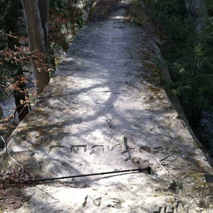
You'll come to a large rock wall. Follow the wall to the right until you can climb on top of it. Follow the top of the backbone across. At the top, the trail is only six feet wide with 100-foot drops on both sides. Look for carvings at the top. The backbone gets its name from a large carving of the devil made in 1910. There are also several carvings of passenger pigeons, which have been extinct since 1914. I have never been able to locate either of these carvings, so don't spend too long trying to find them. Instead, enjoy the view of Indian Creek from the top.
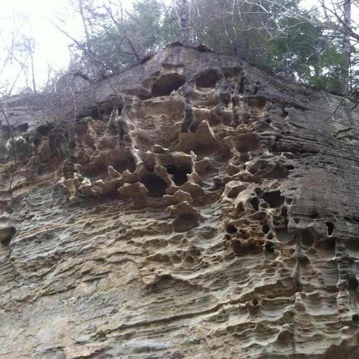
After descending the backbone, you'll come to the intersection of Clifty Creek and Indian Creek, as well as Honeycomb Rock. The 300 million-year-old rock face in front of you was once part of the bottom of a shallow sea. Easier dissolvable rocks and fossils have since been eroded from the surrounding sandstone, resulting in a very bizarre cliff. Turn left and follow Clifty Creek upstream and complete the second loop. Return via Turkey Backbone and the entrance trail.
No Condition Reports
Rocky Hollow Falls Canyon Nature Preserve: Trail 3
Rocky Hollow Falls Canyon Nature Preserve: Trail 3
Contributors

