Near Great Divide Trail - Section B (Coleman to Kananaskis Lakes)
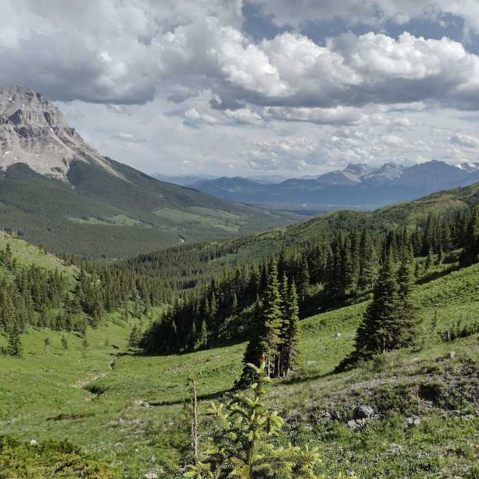
Seven Sisters, named for its seven spires on its top ridge, is on the left. Crowsnest Mountain is just left of center. Seen looking southeast as the trail crests a ridge just below the Great Divide.
Near Great Divide Trail - Section B (Coleman to Kananaskis Lakes)
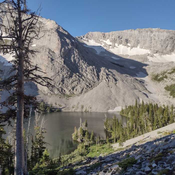
Window Mountain Lake seen looking south at the top of the switchbacks. Mt. Ward towers over the lake. On the far left in the distance is Crowsnest Mountain. All on a perfect July morning.
Near Great Divide Trail - Section B (Coleman to Kananaskis Lakes)
Crowsnest Mountain is on the left. The valley of Crowsnest Pass stretches into the distance looking southeast at the foot of the Great Divide.
Near Great Divide Trail - Section B (Coleman to Kananaskis Lakes)
Looking down on Window Mountain Lake from the switchbacks on its north slope. Behind the trees on the left is Mt. Ward. The rock wall on the right is part of the Great Divide.
Near Great Divide Trail - Section B (Coleman to Kananaskis Lakes)
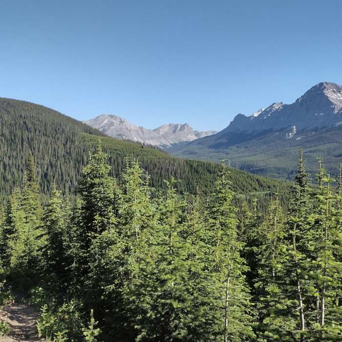
Gould Dome, 9,495 ft., is on the right. Funnel and Funnel N3 peaks are in the distance (center). Tornado Mountain and Tornado Saddle are hidden behind the ridge extending north-northwest from Gould Dome. Seen looking north.

Looking for more photos?

View All Photos
View Map
Driving Directions
Hike Trail
Buy Now View in 3D

Great Divide Trail - Section B (Coleman to Kananaskis Lakes)

5.0 (1 Rating)
Canadian Rockies at their best, wild and beautiful, along the Continental Divide.
119.4
mi
Distance
25,547
ft
Gain
strenuous
Difficulty
BirdingCommonly BackpackedLakeRiver/CreekViewsWaterfallWildflowersWildlife

Route Details

Flatter
Steeper
119.44mi
Distance
25,547ft
Elevation Gain
24,313ft
Elevation Loss
40%
Max Grade
8,117ft
High Point
4,383ft
Low Point
Path Type
Point to Point
Description
The GDT (Great Divide Trail) is a long distance hike along the Continental Divide in Canada. This is Section B, the second southernmost section of it. Section B runs from the town of Coleman, Alberta to the Kananaskis Lakes Day Use Area in Peter Lougheed Provincial Park, Alberta. Mountains are everywhere and can be seen from forested trails, stretches on Forest Service Roads, and while cruising along empty backroads. So pretty, regardless of the "trail" type :>) Please see the resources listed above under Need to Know for up to date detailed descriptions and valuable hiker information. Alternate Routes - Great Divide Trail - Crowsnest Pass Community Trail Alternate Route - Great Divide Trail - Window Mountain Lake Bypass Alternate Route - Great Divide Trail - Coral Pass Alternate Route - Great Divide Trail - Elkan Creek Alternate Route Access Trailheads (motor vehicle accessible) - Coleman (Section B start) - Allison Creek Road - Aldridge Creek Trail trailhead - Elk Lakes (Lower Elk Lake Trail) trailhead at the end of Elk River Forest Service Road - Elk Pass Trail trailhead (Section B end) Access Trails - Dutch Creek Road (4-wheel drive can drive this) (16.1 miles) - Cache Creek Trail (1.4 miles) - Soda Creek Trail (2.5 miles) - Cataract Creek Trail (6.9 miles) - Etherington Creek Trail (5.3 miles) - Baril Creek Trail (5.4 miles)

Route Conditions

Report Conditions
No Condition Reports
Report Conditions

Nearby Hike Routes

High Rock Hike

Hike Route

High Rock Hike

Commonly Backpacked
strenuous
28.6 mi
+7,433 ft
Tamarack Hike

Hike Route

Tamarack Hike

Commonly Backpacked
strenuous
21.23 mi
+5,534 ft
Goat Lake

Hike Route

Goat Lake

Lake
strenuous
10.45 mi
+1,058 ft
Blakiston Falls

Hike Route

Blakiston Falls

Family Friendly
easy
1.43 mi
+181 ft
Carthew - Alderson Traverse

Hike Route

Carthew - Alderson Traverse

Lake
strenuous
11.28 mi
+2,679 ft
Bluebird and Wolverine Lake Loop

Hike Route

Bluebird and Wolverine Lake Loop

Birding
strenuous
9.43 mi
+2,110 ft
Contributors
Joan Pendleton
