Near Berg Lake
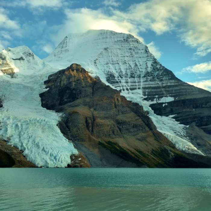
Mt. Robson, highest in the Canadian Rockies at 12,972, with Berg Glacier (left), Mist Glacier (right), and Berg Lake
Near Berg Lake
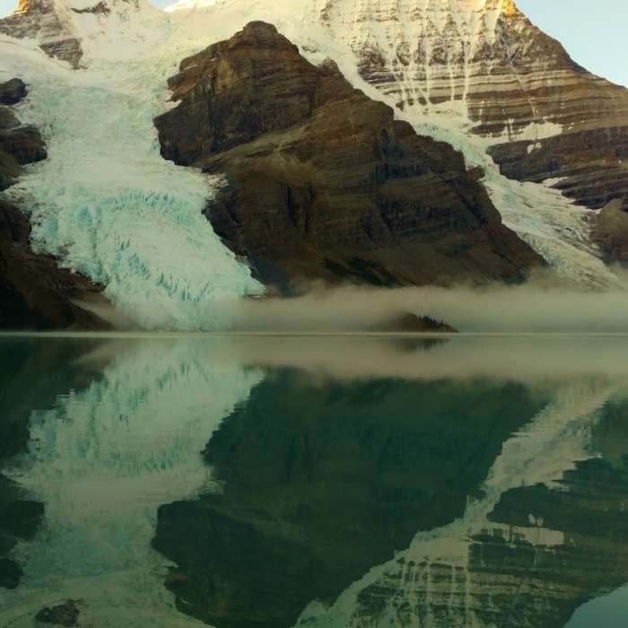
Mt. Robson reflecting into Berg Lake on a clear, still morning
Near Berg Lake
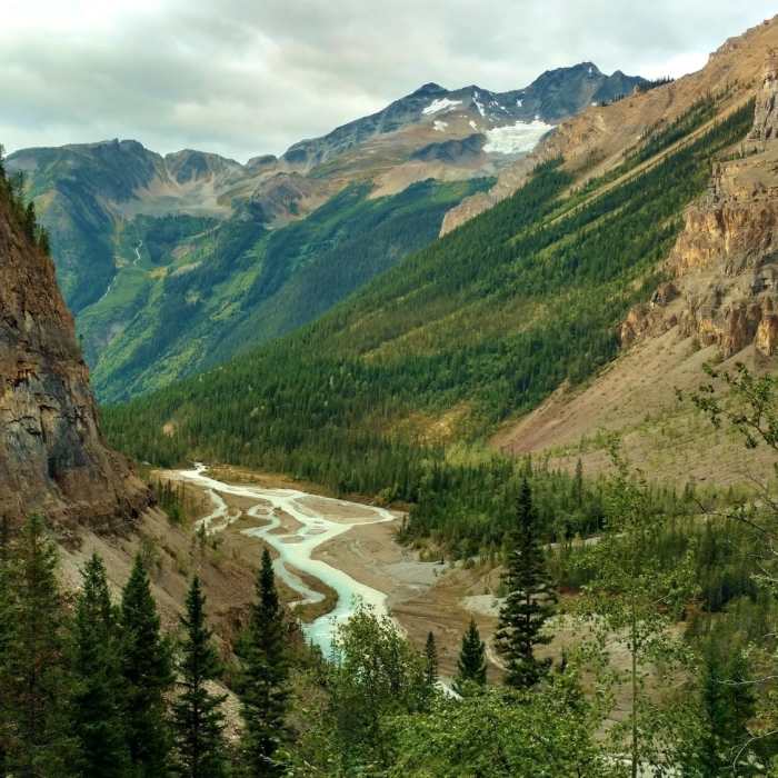
Looking down the Robson River Valley from near the bottom of the Valley of a Thousand Falls.
Near Berg Lake
Mt. Robson (12,972 ft., highest in Canadian Rockies) across Berg Lake, with Berg Glacier (left) and Mist Glacier (right), from the Berg lake Trail
Near Berg Lake
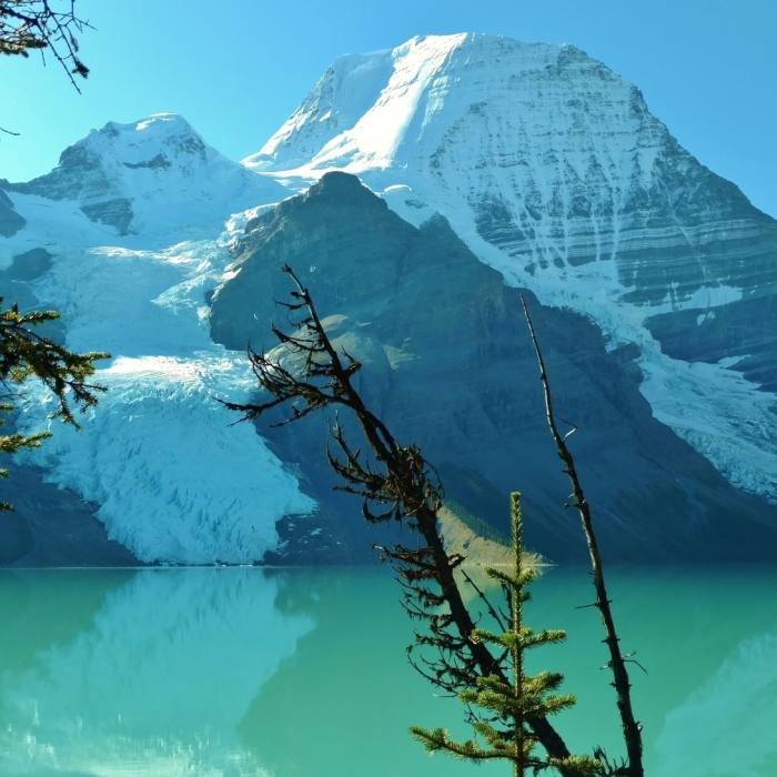
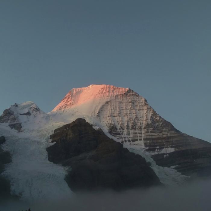
Early morning alpenglow on Mt. Robson, on a rare, perfectly clear morning.

Looking for more photos?

View All Photos
View Map
Driving Directions
Classic Hike Route
Buy Now View in 3D

Berg Lake

5.0 (4 Ratings)
The Berg Lake Trail is a world-renowned backcountry route in Mount Robson Provincial Park. The trail climbs through old-growth rainforest and glacial valleys to the base of Mount Robson, the highest peak in the Canadian Rockies.
22
mi
Distance
3,700
ft
Gain
extreme
Difficulty
Regional Classic
A must do route for the area handpicked by local experts.
Commonly BackpackedFall ColorsLakeLakefrontRiver/CreekViewsWaterfallWildlife
Access Issues
Overnight camping requires a BC Parks reservation released each Dec. 2 for the entire season; sites sell out within minutes. Dogs are permitted on leash for day-hiking only.

Route Details

Flatter
Steeper
21.99mi
Distance
3,700ft
Elevation Gain
3,700ft
Elevation Loss
50%
Max Grade
5,463ft
High Point
2,737ft
Low Point
Path Type
There and Back
Description
The route starts at a parking area at the end of Kinney Lake Road, past the Mount Robson Visitor Centre. This route is commonly broken up into a multi-day trip, but can be done as a day hike by ambitious hikers. Most parties take two to four days and camp at one or more of the trail's backcountry campgrounds. Common options include camping at Kinney Lake, Whitehorn, or Emperor Falls on the way in and staying at Marmot Campground on Berg Lake itself before returning. From the trailhead, follow the Robson River through rainforest to Kinney Lake at 7 km, then climb switchbacks above the lake's north shore. A hand-cranked cable car crosses the Robson River partway up this section when the footbridge is out; check current conditions before relying on it. Continue to Whitehorn at 11 km, then climb steadily past Emperor Falls to Emperor Falls Campground at 16 km, the steepest sustained section of the route. Beyond Emperor Falls, the trail levels into the Valley of a Thousand Falls and reaches Marmot Campground at 19 km, then Berg Lake itself at 21 km. Retrace the same route back to the trailhead; the descent past Emperor Falls is loose and exposed in sections and slower than it looks on the way up. Reserve campsites through BC Parks well ahead of the season — the release each December 2 sells out within minutes — and store food properly throughout, since this is bear country the entire length of the trail.

Route Conditions

Report Conditions
No Condition Reports
Report Conditions

Nearby Hike Routes

Find more hikes near:
Overlander Falls Trail

Hike Route

Overlander Falls Trail

River/Creek
moderate
1.41 mi
+304 ft
Swift Creek Lookout Hike

Hike Route

Swift Creek Lookout Hike

Fall Colors
moderate
2.19 mi
+351 ft
Valley of the Five Lakes Trail

Hike Route

Valley of the Five Lakes Trail

Family Friendly
moderate
2.98 mi
+435 ft
Mount Edith Cavell Tour

Hike Route

Mount Edith Cavell Tour

Geologically Significant
moderate
4.41 mi
+1,765 ft
Skyline Trail

Classic Hike Route

Skyline Trail

Commonly Backpacked
extreme
27.55 mi
+4,773 ft
Contributors
onX Maps, Inc
