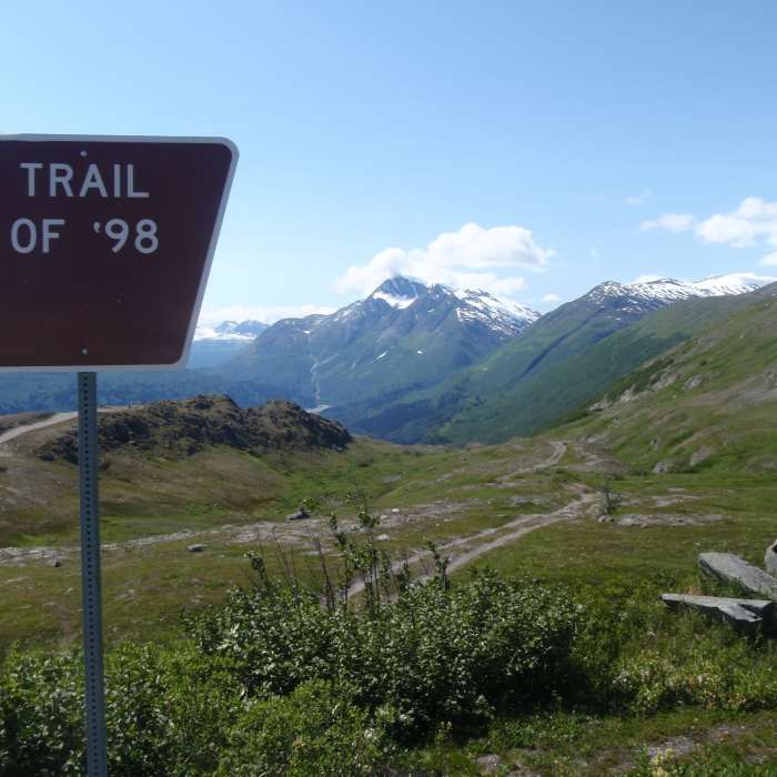
Near Trail of '98
This is the upper trailhead of the Trail of '98.

Looking for more photos?

View All Photos
View Map
Driving Directions
Hike Trail

Trail of '98

4.0 (1 Rating)
An amazing alpine and alder forest trail that winds it way along the historic Thompson Pass Route.
2.8
mi
Distance
14
ft
Gain
strenuous
Difficulty
BirdingFall ColorsRiver/CreekSpringViewsWaterfallWildflowersWildlife

Route Details

Flatter
Steeper
2.82mi
Distance
14ft
Elevation Gain
1,762ft
Elevation Loss
55%
Max Grade
2,615ft
High Point
867ft
Low Point
Path Type
Point to Point
Description
Starting from the large parking lot heading west, the two-track trail slowly descends for about a mile, leading from an amazing alpine area into the trees and brush below. When you reach the brush, the trail narrows to about one and a half feet. Water drainage issues are present for the next mile with several large mud holes; there are at least 20+ small stream crossings throughout this relatively short trail. At about two miles in, the trail gets steep and technical. Be sure to bring the proper footwear. The trail ends back on on the road with no trailhead and only a brown sign noting the 20 mile-mark on the Richardson Highway. If you're returning along this same path, be sure to save a little bit of energy as the return trip will be more strenuous than the way out.

Route Conditions

Report Conditions
No Condition Reports
Report Conditions

Nearby Hike Routes

Find more hikes near: Valdez, Alaska
Shoup Bay Trail Out-and-Back

Hike Route

Shoup Bay Trail Out-and-Back

Birding
strenuous
6.06 mi
+818 ft
Visitor Center Trail loop-Boreal Forest Trail and Copper River trail

Hike Route

Visitor Center Trail loop-Boreal Forest Trail and Copper River trail

Birding
moderate
1 mi
+72 ft
Lion Head Route

Hike Route

Lion Head Route

Views
strenuous
2.38 mi
+1,087 ft
Matanuska Glacier

Hike Route

Matanuska Glacier

Wildflowers
easy
1.36 mi
+285 ft
Colony Glacier Moraine Route

Hike Route

Colony Glacier Moraine Route

Birding
moderate
6.62 mi
+313 ft
Root Glacier Trail

Hike Route

Root Glacier Trail

Views
easy
1.74 mi
+236 ft
Contributors
Nick Weicht
