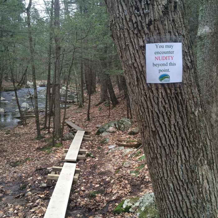
Near Old Minnewaska Trail
Nudity is permissible past a marked point on the Coxing Kill yellow blazed trail. Parents take note
Near Old Minnewaska Trail
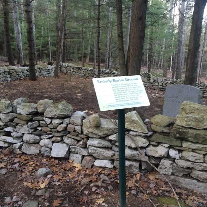
Enderly family burial plot along the High Peters Kill Trail.

Looking for more photos?

View All Photos
View Map
Driving Directions
Hike Trail
Buy Now View in 3D

Old Minnewaska Trail

3.0 (1 Rating)
An old carriage road with great views of Coxing Clove, Rondout Valley, and the Catskills.
2.2
mi
Distance
397
ft
Gain
moderate
Difficulty
BirdingFall ColorsRiver/CreekSwimmingViewsWaterfallWildflowersWildlife
Access Issues
No bicycling or skiing is permitted on this trail.

Route Details

Flatter
Steeper
2.24mi
Distance
397ft
Elevation Gain
144ft
Elevation Loss
15%
Max Grade
955ft
High Point
680ft
Low Point
Path Type
Point to Point
Description
Marked by signs and occasional light blue trail blazes, this trail begins opposite the Coxing Creek parking area and continues to Laurel Ledge Road. From Clove Road opposite the parking area, the Old Minnewaska Trail passes ruins of the Enderly barn on the right and a home on the left. Swimming is very popular in the Coxing Kill at this point. A yellow-marked trail on your left at the end of the bridge leads out to the park boundary and follows Coxing Kill. Farther along the trail on the right, the Shongum Path intersects marked with red blazes. Past this point the trail begins a gradual ascent, crossing several small streams on the way. The road continues fairly level with sloping rock walls on the right and fantastic views on the left. Towards Laurel Ledge Road, it veers right with some brief descents and ascents. Towards the end of the trail and prior to a final descent, the blue marked Undivided Lot Trail appears on the left. The Old Minnewaska Trail joins Laurel Ledge Road at a large boulder pile.

Route Conditions

Report Conditions
No Condition Reports
Report Conditions

Nearby Hike Routes

Shawangunk Ridge Trail: Mohonk Preserve Section

Hike Route

Shawangunk Ridge Trail: Mohonk Preserve Section

Views
moderate
7.59 mi
+1,564 ft
Lost City Escarmpnt Loop

Hike Route

Lost City Escarmpnt Loop

easy
2.28 mi
+537 ft
Millbrook Mountain + Gertrude's Nose

Hike Route

Millbrook Mountain + Gertrude's Nose

Dogs Allowed
strenuous
12.26 mi
+2,315 ft
Sky Top Tower via "The Trapps"

Hike Route

Sky Top Tower via "The Trapps"

Fall Colors
strenuous
7.04 mi
+926 ft
Shawangunk Ridge Trail: Peterskill Section

Hike Route

Shawangunk Ridge Trail: Peterskill Section

Views
moderate
8.34 mi
+1,263 ft
Minnewaska Lake Carriageway

Hike Route

Minnewaska Lake Carriageway

Birding
moderate
1.74 mi
+202 ft
Contributors
Gunks Jesse
