Near Doe Lake Trail
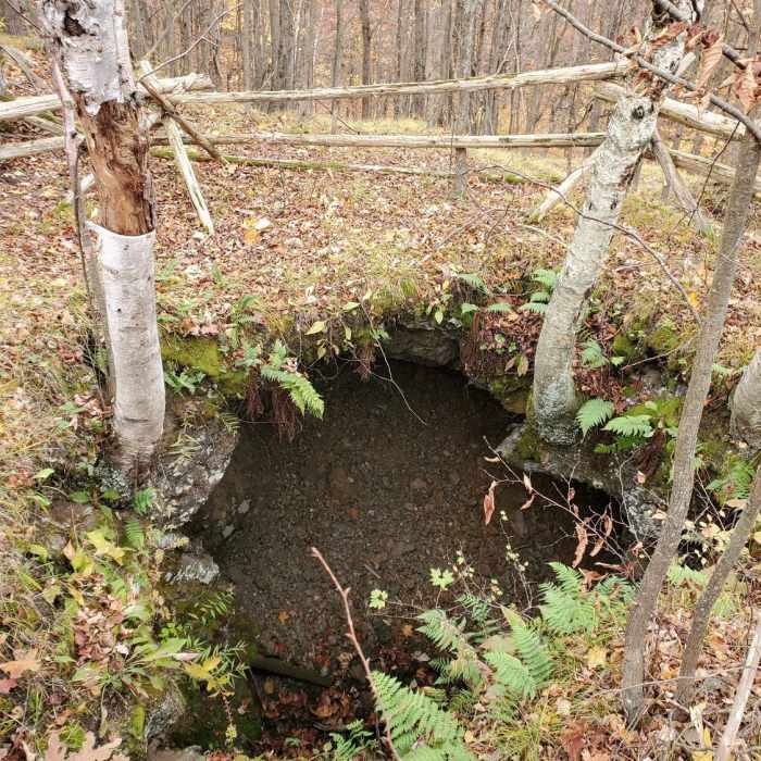
Kemp Mine, an abandoned mica mine.
Near Doe Lake Trail
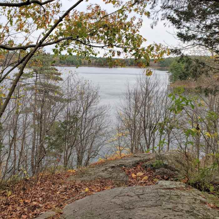
Lookout over Doe Lake.
Near Doe Lake Trail
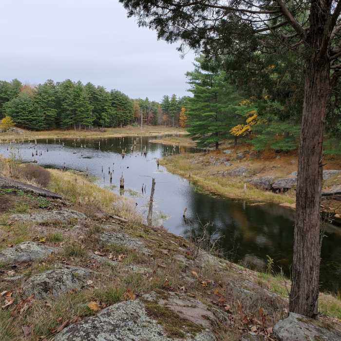
Tree stumps in a beaver pond.

Looking for more photos?

View All Photos
Driving Directions
Hike Trail

Doe Lake Trail

5.0 (1 Rating)
Hike along the shores of South Otter Lake and Doe Lake with a lookout over Doe Lake.
1.9
mi
Distance
165
ft
Gain
moderate
Difficulty
Fall ColorsLakeLakefrontViews

Route Details

Flatter
Steeper
1.89mi
Distance
165ft
Elevation Gain
164ft
Elevation Loss
15%
Max Grade
531ft
High Point
446ft
Low Point
Path Type
Loop
Description
This easy-to-access trail begins right near the Park Office and is a moderate 3-km loop with some ups and downs. The trail is well marked and there are marked point-of-interest posts which can be referenced using the available park guidebook (available for a donation) to identify some interesting features along the way. The terrain is typical for this region: Canadian Shield with rocky ground and mixed boreal forest. There are lots of oaks, maples, and pine trees, as is typical for the area. One of the first points of interest, as you hike along South Otter Lake, is Kemp Mine, one of several mica mines found in the area. It's a few minutes hike up a steeper incline along a side trail to view, but it is well marked. Next, you'll find a great viewpoint over Doe Lake, and hike along its shore for a while. Along the route, you'll find lots of signs of beaver activity, including dams and beaver-created wetlands. After an hour or so, the trail will bring you back to where you started, very close to the Arab Lake Gorge Trail.

Route Conditions

Report Conditions
No Condition Reports
Report Conditions

Nearby Hike Routes

Gould Lake North-East Loop

Hike Route

Gould Lake North-East Loop

Birding
strenuous
2.78 mi
+726 ft
Mine Loop to Point Spur

Hike Route

Mine Loop to Point Spur

Birding
moderate
2.54 mi
+330 ft
Depot Lake Loop

Hike Route

Depot Lake Loop

Geologically Significant
strenuous
2.6 mi
+432 ft
Sugarbush Loop

Hike Route

Sugarbush Loop

Birding
easy
1.75 mi
+51 ft
Little Cataraqui Creek Loop

Hike Route

Little Cataraqui Creek Loop

Birding
moderate
3.37 mi
+120 ft
Rock Dunder Loop

Hike Route

Rock Dunder Loop

Geologically Significant
strenuous
2.98 mi
+428 ft
Contributors
Ali Ryder
