Near Desolation Trail #19
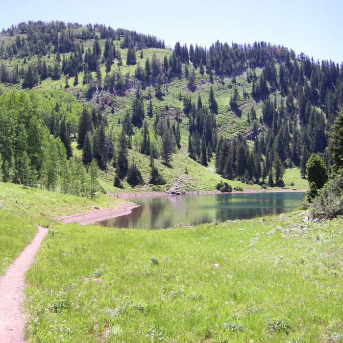
Desolation Lake in the morning light, from an adjacent meadow
Near Desolation Trail #19
Singletrack Desolation Trail winds through aspens, evergreens, and grassy meadows
Near Desolation Trail #19
In May, Desolation Lake and the surrounding area are still covered in snow.
Near Desolation Trail #19
Looking south across Big Cottonwood Canyon in May brings beautiful snowy views.
Near Desolation Trail #19
Desolation Lake

Looking for more photos?

View All Photos
Driving Directions
Hike Trail

Desolation Trail #19

3.5 (6 Ratings)
An epic trail that ties together many different trails and covers a variety of conditions.
18.8
mi
Distance
6,180
ft
Gain
strenuous
Difficulty
LakeViewsWildflowersWildlife

Route Details

Flatter
Steeper
18.76mi
Distance
6,180ft
Elevation Gain
2,387ft
Elevation Loss
70%
Max Grade
9,556ft
High Point
5,763ft
Low Point
Path Type
Point to Point
Description
The Desolation Trail is not difficult technically, but it is one of the longer continuous trails in the area. This steep canyon climb continues to a side mountain traverse. When you reach the shadow of Mt. Raymond, the trail opens up into a high meadow. The trail tends to get a bit more shade than others in the area, especially when you make your way past Dog Lake and finally onto Lake Desolation. You can also access many other trails in the area from the Desolation Trail, allowing for a variety of hikes. Sections of the trail are open to mountain biking and horseback riding so be courteous to other trails users. Other sections of the trail enter the Mount Olympus Wilderness where you'll enjoy a more remote feel.

Route Conditions

Report Conditions
Anonymous Adventurer
Some Issues
Looking for more condition reports?
View History

Nearby Hike Routes

Desolation Trail to Salt Lake Overlook

Classic Hike Route

Desolation Trail to Salt Lake Overlook

Fall Colors
moderate
4.69 mi
+1,466 ft
Salt Lake Overlook via Desolation Trail

Hike Route

Salt Lake Overlook via Desolation Trail

Dogs Allowed
moderate
4.79 mi
+1,521 ft
Pipeline Trail: Burch Hollow, Millcreek Canyon

Hike Route

Pipeline Trail: Burch Hollow, Millcreek Canyon

Views
moderate
9.2 mi
+176 ft
Maple Cove Trail

Hike Route

Maple Cove Trail

Dogs Allowed
moderate
5.95 mi
+713 ft
Grandeur Peak

Hike Route

Grandeur Peak

Views
moderate
2.63 mi
+0 ft
Bowman Fork Trail

Hike Route

Bowman Fork Trail

Dogs Allowed
strenuous
5.56 mi
+2,248 ft
Contributors
Whitney Durham
