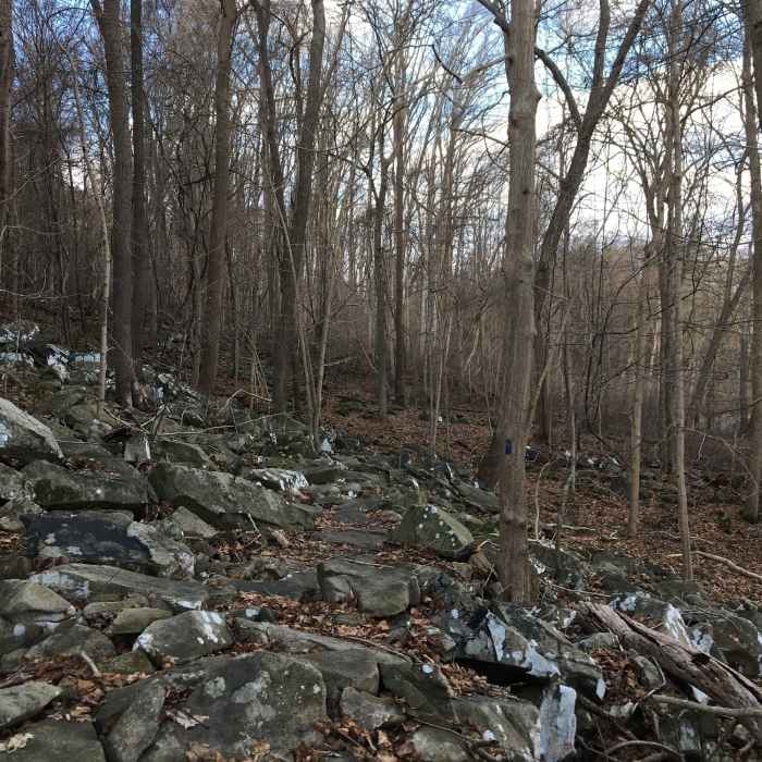
Near North Susquehanna Ridge Trail
A rocky area on the connector trail between the ridge trail and the greenway trail in Susquehanna park

Looking for more photos?

View All Photos
Driving Directions
Hike Trail

North Susquehanna Ridge Trail

3.7 (3 Ratings)
A section of the Susquehanna Ridge Trail from Deer Creek Picnic Area to Rock Run Mill
1.3
mi
Distance
276
ft
Gain
moderate
Difficulty
River/CreekViews
Access Issues
Open dawn to dusk.

Route Details

Flatter
Steeper
1.3mi
Distance
276ft
Elevation Gain
286ft
Elevation Loss
20%
Max Grade
288ft
High Point
16ft
Low Point
Path Type
Point to Point
Description
This trail can be picked up from the Deer Creek Picnic area and is blazed in red. The trail has both steep ascents and descents, and visitors will want to tread carefully at some points. During fall and winter views of the Susquehanna River can be seen. There is a creek crossing prior to ending at Rock Run Road. Trail maps for the state park can be found at: http://dnr2.maryland.gov/publiclands/Documents/SSP_map.pdf

Route Conditions

Report Conditions
No Condition Reports
Report Conditions

Nearby Hike Routes

Deer Creek Trail to Susquehanna Ridge Trail Loop

Hike Route

Deer Creek Trail to Susquehanna Ridge Trail Loop

River/Creek
moderate
5.26 mi
+682 ft
Lower Susquehanna Heritage Greenway Trail

Hike Route

Lower Susquehanna Heritage Greenway Trail

Birding
easy
4.66 mi
+0 ft
Serpentine Barrens Loop

Hike Route

Serpentine Barrens Loop

Family Friendly
moderate
2.99 mi
+330 ft
Rocks Loop

Hike Route

Rocks Loop

Birding
moderate
2.58 mi
+555 ft
Susquehannock Trail

Hike Route

Susquehannock Trail

Birding
strenuous
2.49 mi
+630 ft
Mason Dixon Trail: Lock 12 Shuttle

Hike Route

Mason Dixon Trail: Lock 12 Shuttle

Fall Colors
strenuous
9.99 mi
+1,904 ft
Contributors
Joe Scalies
