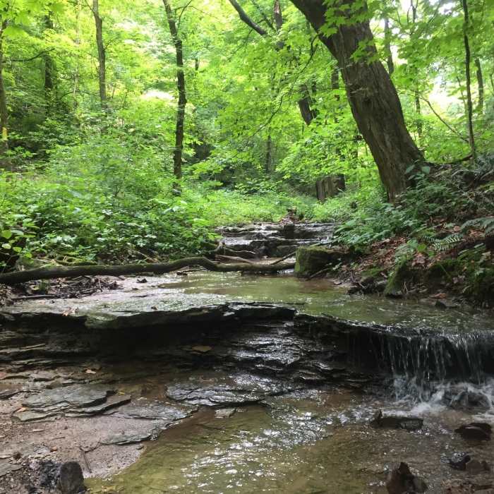
Near Vandalia Trail
Falling Run Creek in the spring, when flows are high

Looking for more photos?

View All Photos
View Map
Driving Directions
Hike Trail

Vandalia Trail

3.0 (1 Rating)
This is an urban trail along Falling Run Creek.
0.3
mi
Distance
55
ft
Gain
moderate
Difficulty
Fall ColorsRiver/Creek

Route Details

Flatter
Steeper
0.29mi
Distance
55ft
Elevation Gain
0ft
Elevation Loss
25%
Max Grade
1,018ft
High Point
963ft
Low Point
Path Type
Point to Point
Description
This trail makes for a great urban hike on a dirt path following the Falling Run Creek. You can access this trail off of the dead-end Falling Run Road northeast of the Vandalia Apartments. This trail criss-crosses a creek that changes with the seasons--experience it in spring to witness the creek at its peak flow or in winter to experience it frozen. For more info about West Virginia University's Falling Run Greenspace, check out their website.

Route Conditions

Report Conditions
No Condition Reports
Report Conditions

Nearby Hike Routes

Coopers Rock Grand Loop

Hike Route

Coopers Rock Grand Loop

Birding
moderate
9.81 mi
+1,530 ft
Cucumber Falls

Hike Route

Cucumber Falls

Views
easy
1.01 mi
+124 ft
Ferncliff Trail

Hike Route

Ferncliff Trail

Family Friendly
easy
1.77 mi
+154 ft
Laurel Highlands Trail: Ohiopyle State Park

Hike Route

Laurel Highlands Trail: Ohiopyle State Park

Fall Colors
strenuous
10.76 mi
+2,820 ft
Sugarloaf Sled Hill to Falls Overlook

Hike Route

Sugarloaf Sled Hill to Falls Overlook

Fall Colors
moderate
4.54 mi
+148 ft
Fork Run Loop

Hike Route

Fork Run Loop

River/Creek
moderate
7.65 mi
+964 ft
Contributors
Alex Dye
