Ready to explore this trail?
View Trail Map in AppRegional Classic
A must do route for the area handpicked by local experts.
No permit or fee is required. Vehicle access to the park runs 7:30 AM to 9:30 PM, May through October; the park is accessible on foot only from November through April.
Path Type
There and Back
This route starts and ends at the parking area at Timms Hill County Park, off County Road RR, covering 0.5 miles round trip with about 140 vertical feet of gain.
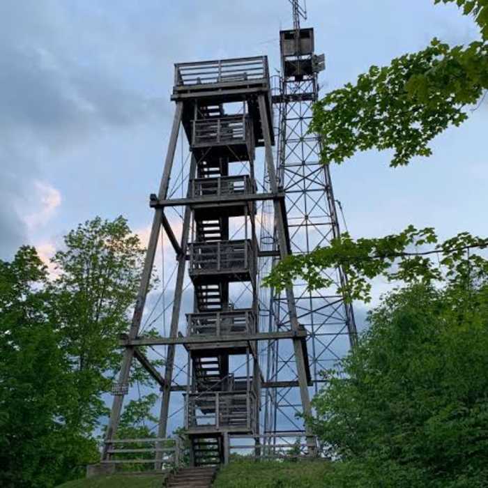
From the lot, follow the signed path south into second-growth maple and hemlock forest. The trail climbs steadily on a well-graded surface for 0.25 miles to a small clearing at the summit of Timms Hill (1,951.5'). Two observation towers stand here: a 65-foot steel tower reached by an exposed, attached ladder, and a 45-foot wooden tower with a stairway. Climbing either tower is optional — dogs are permitted on the trail but not on the towers themselves — and both offer views reported to reach 30 miles across the surrounding Northwoods, with Rib Mountain visible on the horizon to the southeast on clear days.
Return by retracing the same path to the parking area.
No Condition Reports
Timms Hill Loop
Timms Hill Loop
Little Falls-Slough Gundy Scenic Area Trail
Little Falls-Slough Gundy Scenic Area Trail
Lake Trail
Lake Trail
Old Abe State Trail
Old Abe State Trail
Red Granite Falls Trail
Red Granite Falls Trail
Takesson Trail
Takesson Trail
Contributors

