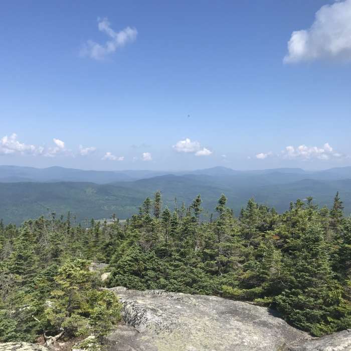
Near Gore Mountain via Gore Mountain Trail
Another view from the top

Looking for more photos?

View All Photos
View Map
Driving Directions
Classic Hike Route
Buy NowView in 3D

Gore Mountain via Gore Mountain Trail

No rating
A steady climb through hardwood forest and old logging roads to one of the Northeast Kingdom's higher, lesser-known summits, finishing over exposed granite bedrock at the site of a long-removed fire lookout near the Quebec border.
7.7
mi
Distance
2,038
ft
Gain
strenuous
Difficulty
Regional Classic
A must do route for the area handpicked by local experts.
Dogs AllowedFall ColorsScenicViews
Access Issues
The trail crosses conservation-easement timberland; mud season can make the lower logging-road sections difficult. Parking is a small roadside pull-off with no formal lot.

Route Details

Flatter
Steeper
7.71mi
Distance
2,038ft
Elevation Gain
2,038ft
Elevation Loss
--%
Max Grade
3,332ft
High Point
1,369ft
Low Point
Path Type
There and Back
Description
This route starts and ends at a roadside pull-off on VT-114 in Norton, near the north end of Norton Pond. From the pull-off, cross the road and follow an old logging road, climbing gradually past a series of abandoned beaver ponds and wet meadows that can be muddy underfoot. At about 1 miles, reach Gore Junction, where the Middle Mountain Trail splits right; continue straight, crossing a logging road at around 2. miles and climbing through hardwood forest. Cross a second logging road, then climb a steepening final mile over exposed granite bedrock on the mountain's shoulder to the wooded summit at 3.8 miles, marked by the site of a former fire lookout cabin and remnants of an old telegraph line. Retrace the same route back to VT-114 for a round trip of about 7.7 miles, gaining roughly 2,038 vertical feet.

Route Conditions

Report Conditions
No Condition Reports
Report Conditions

Nearby Hike Routes

Middle Mountain

Hike Route

Middle Mountain

strenuous
7.76 mi
+1,984 ft
Gore Mountain South Approach

Hike Route

Gore Mountain South Approach

Birding
strenuous
4.76 mi
+1,240 ft
Bluff Mountain Community Trails

Hike Route

Bluff Mountain Community Trails

moderate
2.95 mi
+1,198 ft
Mad Brook to Bald Mountain

Hike Route

Mad Brook to Bald Mountain

moderate
4.48 mi
+1,501 ft
Sentinel Rock

Hike Route

Sentinel Rock

easy
1.77 mi
+267 ft
Haystack Mountain Loop

Hike Route

Haystack Mountain Loop

easy
3.03 mi
+907 ft
Contributors
onX Maps, Inc
