
Ready to explore this trail?
View Trail Map in AppPath Type
There and Back
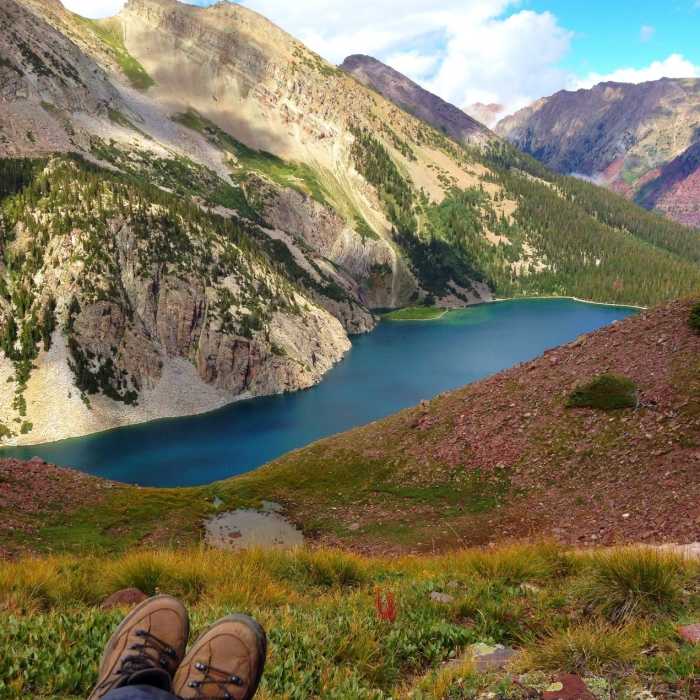
The Snowmass Lake Trail is a scenic, challenging out-and-back route measuring approximately 16.4 miles round-trip. Featuring a cumulative elevation gain of about 3,010 feet, the trail begins at an elevation of 8,392 feet and climbs to 11,000 feet at Snowmass Lake, located deep within the Maroon Bells-Snowmass Wilderness.
The initial miles of the trail wind through subalpine forest and traverse sections of private property. It is critical to stay on the designated trail and close all livestock gates securely. The path eventually opens into a wide valley along Snowmass Creek. Hikers will encounter a prominent log-jam crossing over the creek. This crossing requires careful balance on potentially slick logs, and wading across the water is often a preferred alternative during periods of high flow.
Beyond the log jam, the trail climbs more steadily through the forest, passing a scenic waterfall shortly before arriving at Snowmass Lake. The alpine lake sits directly below the massive slopes of Snowmass Mountain. For those planning overnight stays, backcountry camping is permitted in designated zones. An overnight permit must be acquired in advance through Recreation.gov, and approved bear-resistant food canisters are required.
No Condition Reports
Snowmass to Willow Lake Loop
Snowmass to Willow Lake Loop
Snowmass Mountain East Slopes
Snowmass Mountain East Slopes
Capitol Lake
Capitol Lake
Capitol Peak Northeast Ridge
Capitol Peak Northeast Ridge
Capitol Lake, Avalanche Creek, Hell's Roaring Pass Loop
Capitol Lake, Avalanche Creek, Hell's Roaring Pass Loop
Intercept Lot to Rodeo Lot via Sky Mountain Park
Intercept Lot to Rodeo Lot via Sky Mountain Park
Contributors

