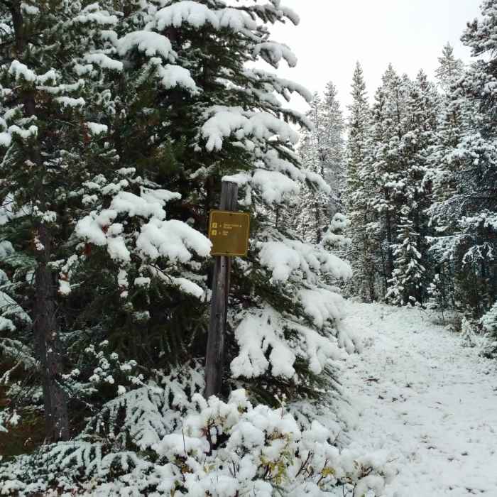
Near Evelyn Creek/Skyline Trail
Little used Evelyn Creek/Skyline Trail to the right, popular Bald Hills Trail on the very left on a late summer day; yes it can snow in the summer!

Looking for more photos?

View All Photos
View Map
Driving Directions
Hike Route
Buy NowView in 3D

Evelyn Creek/Skyline Trail

3.0 (1 Rating)
Fir forest trail from Bald Hills Trail to Skyline Trail near Maligne Lake.
1.6
mi
Distance
76
ft
Gain
moderate
Difficulty
Wildlife

Route Details

Flatter
Steeper
1.61mi
Distance
76ft
Elevation Gain
518ft
Elevation Loss
15%
Max Grade
6,459ft
High Point
5,960ft
Low Point
Path Type
Point to Point
Description
Evelyn Creek/Skyline Trail is found on the right (north), in the fir forest along Bald Hills Trail, 2.1 miles from the Bald Hills Trail trailhead at Maligne Lake. Going right onto Evelyn Creek/Skyline Trail, the trail continues in the thick fir forest and is basically flat for the first 0.8 miles. It then descends towards Evelyn Creek and veers right (north) to follow the creek downstream for about 0.7 miles. The trail runs near, but not next to the creek that is to the left (west). Evelyn Creek/Skyline Trail ends at Skyline Trail, very near the Evelyn Creek Trail Camp.

Route Conditions

Report Conditions
No Condition Reports
Report Conditions

Nearby Hike Routes

Skyline Trail

Classic Hike Route

Skyline Trail

Commonly Backpacked
extreme
22.74 mi
+4,491 ft
Valley of the Five Lakes Trail

Hike Route

Valley of the Five Lakes Trail

Family Friendly
moderate
2.98 mi
+435 ft
Mount Edith Cavell Tour

Hike Route

Mount Edith Cavell Tour

Geologically Significant
moderate
4.41 mi
+1,808 ft
Brazeau Loop

Hike Route

Brazeau Loop

Commonly Backpacked
strenuous
48.1 mi
+6,935 ft
Nigel Pass

Hike Route

Nigel Pass

River/Creek
moderate
9.71 mi
+1,203 ft
Swift Creek Lookout Hike

Hike Route

Swift Creek Lookout Hike

Fall Colors
moderate
2.19 mi
+360 ft
Contributors
Joan Pendleton
