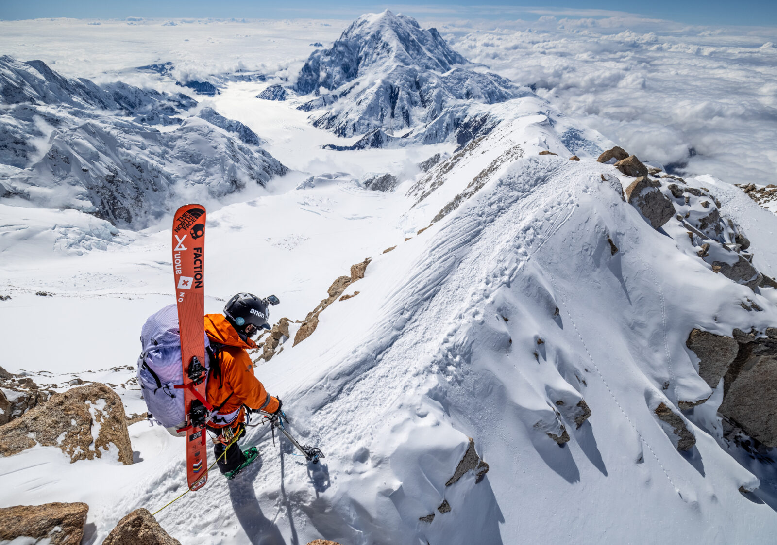
AMGA + onX Backcountry
Try the ultimate offline backcountry skiing and splitboarding GPS maps for 3 months FREE or save 40% on your purchase of onX Backcountry
40% off only valid only for purchases through onxmaps.com
Exclusive Discount
Sign up for a full year of the ultimate offline GPS backpacking and hiking maps. For a limited time, get 40% off onX Backcountry using the link and promo code AMGA40
 Premium
Find awe-inspiring trails, maps the are fun and helpful, and tools that help you get our and back all in one piece. With Premium you’ll have access to hundreds of Hiking Trails, unlimited Offline Maps, and Tracker.

Elite
All the features you love from Premium, overlaid with Private and Public land boundaries to keep you from trespassing and recent imagery so you can tell if a line still is holding snow or if a trail is dry.
Redeem Your 3 Month Trial
About onX Backcountry
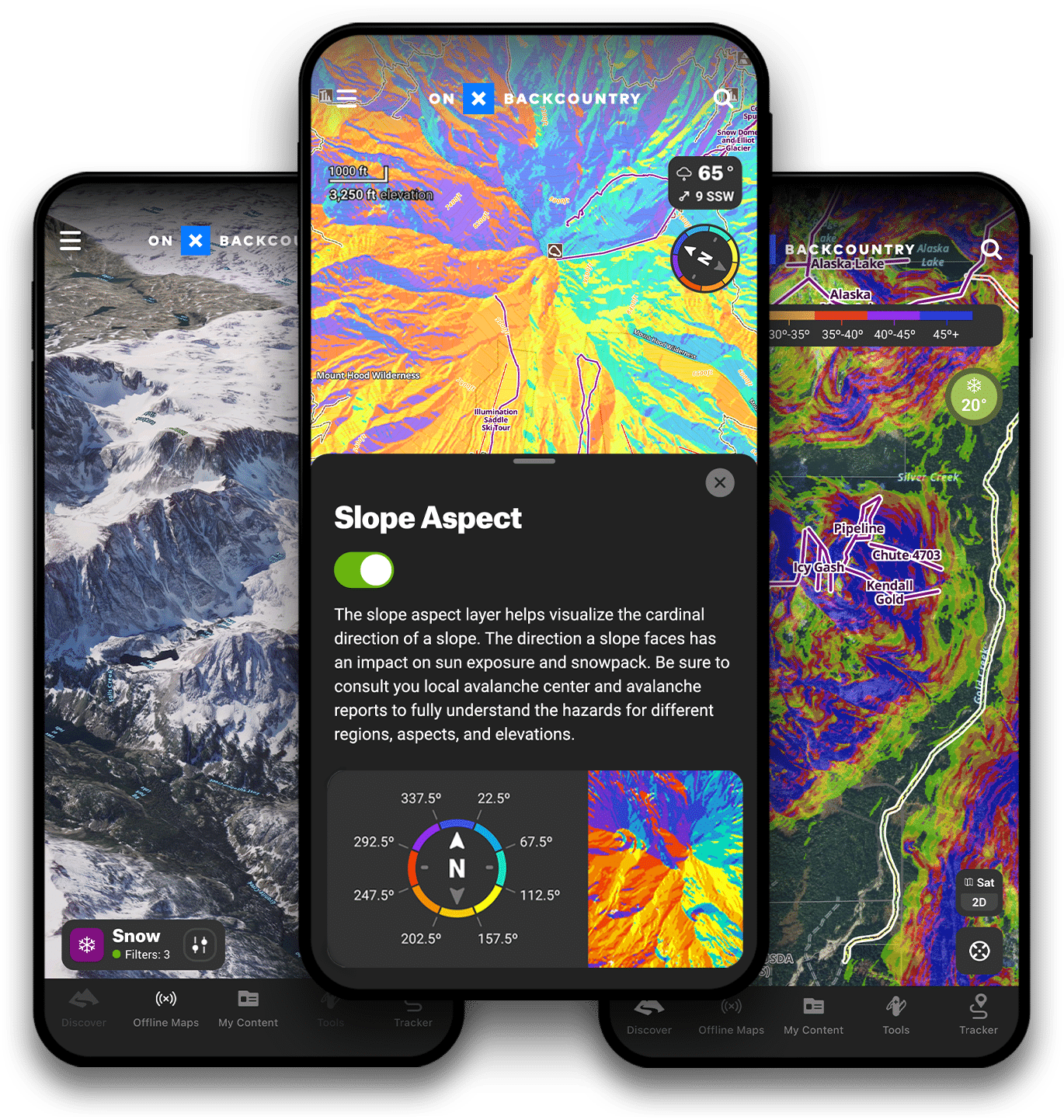
With onX Backcountry, you have a suite of tools at your fingertips to make better decisions in the backcountry. With guidebook quality route descriptions, detailed topo & 3D maps, slope angle & aspect maps, and avalanche observations and fatalities you will have all of the tools you’ll need in one app.
Winter Satellite Imagery
Winter aerial satellite imagery provides an in-depth look at what a mountain looks like with snowpack. Use this to evaluate safe zones, turnaround spots, and avalanche prone areas.
3D Tour Planning
Plan for a three dimensional adventure with 3D maps. The map comes to life when you can look directly into the contour, drainage, or ridgeline like you would if you were standing there.
Slope Aspect
Absolutely integral to avalanche safety—slope aspect is the cardinal direction the slope of a mountain faces. Understanding this allows you to gauge how much sun exposure that slope experiences.
Slope Angle
This map Layer color codes the angle of the slope on a given terrain feature with green representing lower angles and purple representing steeper. Mainly applied in a backcountry ski setting, Slope Angle is the most vital measure of avalanche risk.
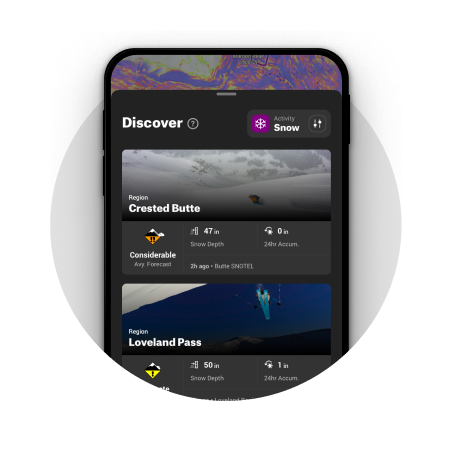
Avalanche Forecasts
In partnership with each U.S based avalanche forecast center, daily forecasts are pulled into this map Layer making it easy to understand the current danger level.
Offline Access
Use Offline Maps to download maps to your phone that include all of the markups you’ve made for any selected area. When you’ve turned your Offline Map on, the GPS in your phone will connect to satellites to give your real-time location—even when cell signal is long behind you.
SNOTEL Station Data
The best data source for current snow accumulation data in the mountains is SNOTEL (Snow Telemetry) which uses remote stations to measure snow depth, snow/water equivalent, and temperature.
Digital Guidebooks
With a robust network of trail contributors, we work with thousands of individuals and organizations to curate the most trusted and thorough data set of adventures in the country. These guidebook adventures include in-depth write-ups, photos, and relevant route stats like elevation, distance and more.