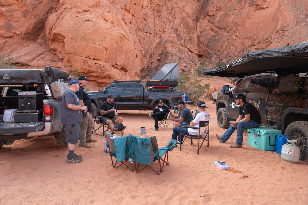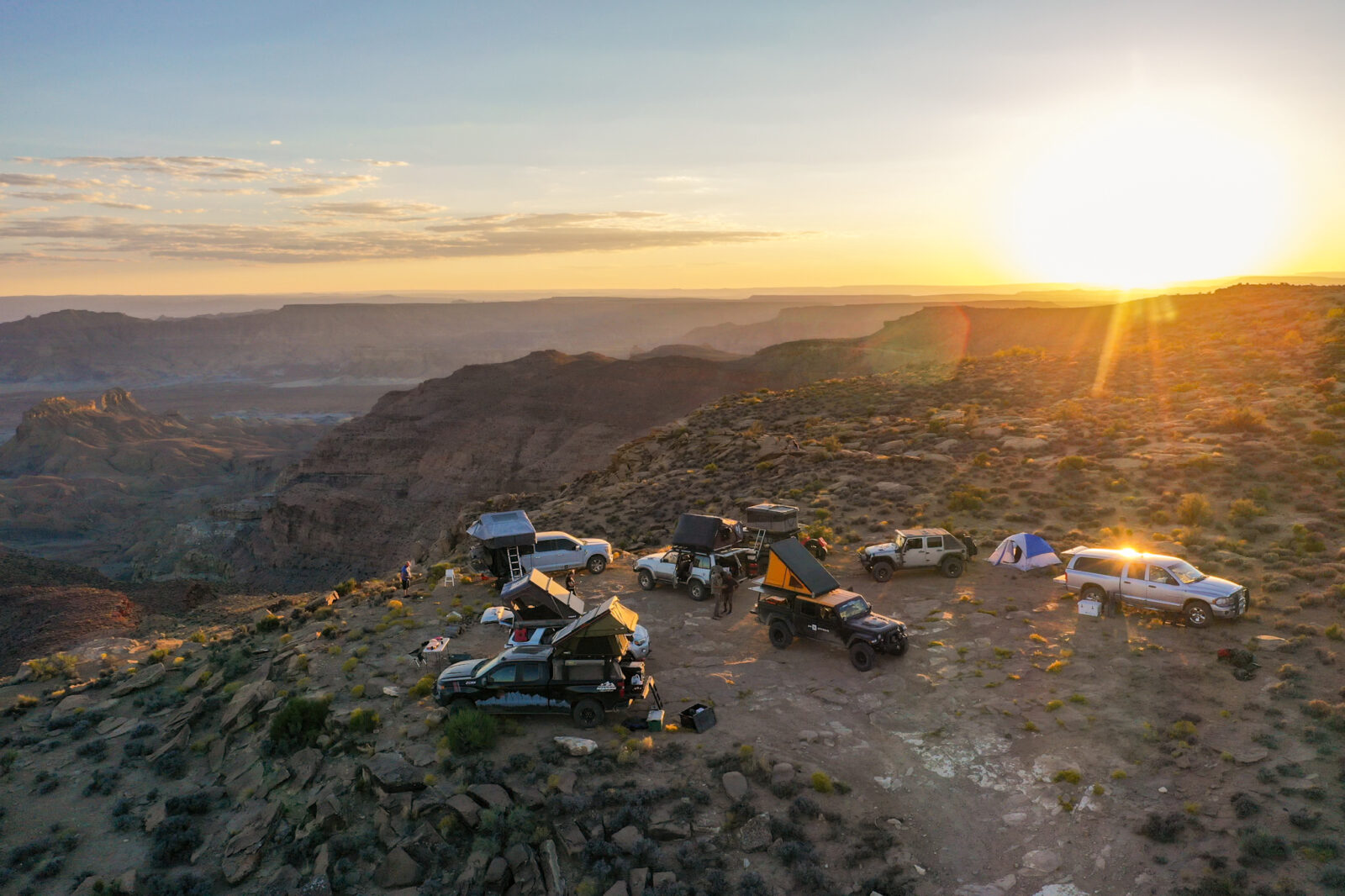

onX Offroad App
We’re offering event-goers a 3 month free trial or 20% off onX Offroad Premium and Elite memberships. Save on the most trusted off-road trail, off-grid camping, and GPS navigation App, and explore 650K+ miles of 4×4, Overland, SXS, dirt bike, ATV, and snowmobile trails. Use promo code onxoffroadevent or start a free trial.
We’re offering event-goers a 3 month free trial or 20% off onX Offroad Premium and Elite memberships. Save on the most trusted off-road trail, off-grid camping, and GPS navigation App, and explore 650K+ miles of 4×4, Overland, SXS, dirt bike, ATV, and snowmobile trails. Use promo code onxoffroadevent or start a free trial.
onX Offroad Premium
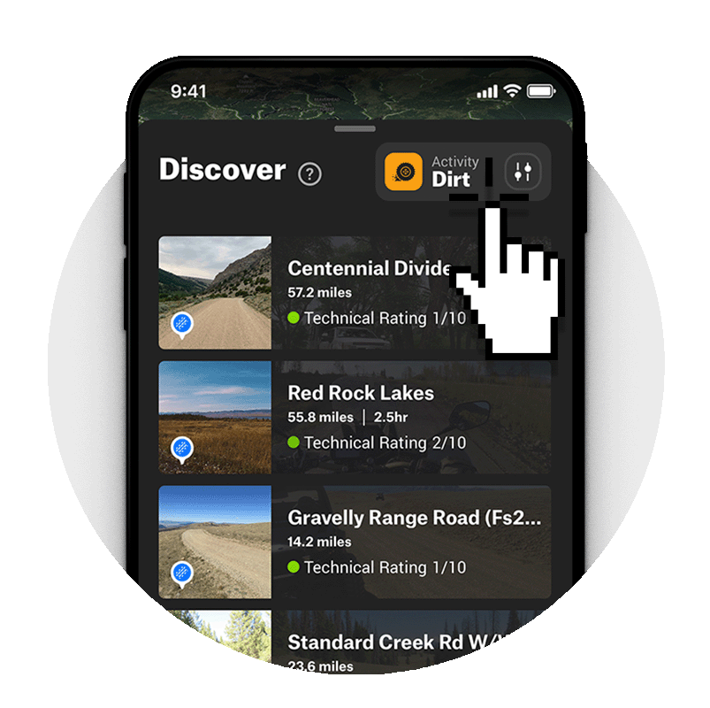
Whatever the vehicle, whatever your experience level—find your ideal adventure fast with trails color-coded by difficulty rating. Explore maps for the US, Canada, and Baja, and tap any trail for a guidebook-quality overview, including distance, open and closed dates, width, and more. Clearly marked public land boundaries and the Dispersed Camping map layer let you know where you can legally off-road and camp for free. Save unlimited Offline Maps for seamless GPS navigation coverage and 3D terrain when you’re out of cell service in the backcountry.
Good for 1 year
onX Offroad Elite
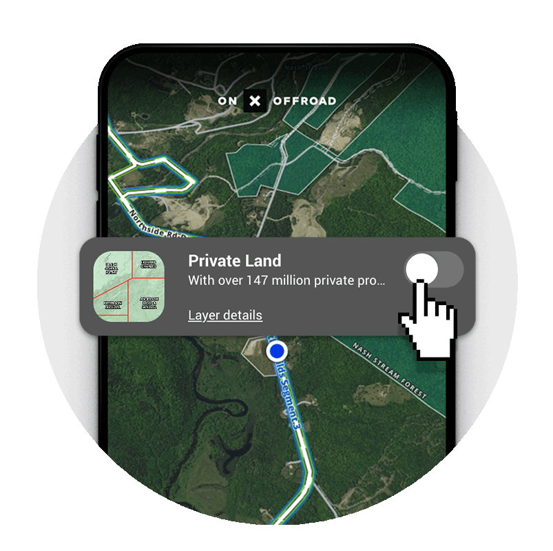
Find legal open riding and discover even more places camp, when you make your maps Elite. Premium tools will go even farther when you unlock Elite-exclusive features, including our nationwide layer for private land boundaries + landowner names. With Elite, you’ll also get access to Recent Imagery, which lets you scout trails and terrain with frequently updated satellite imagery that shows ice, snow, and conditions. Elite members also enjoy discounts on gear and parts from top off-road brands. Level up your adventures and your rig with onX Offroad Elite.
Good for 1 year
onX Offroad Features You Can’t Live Without
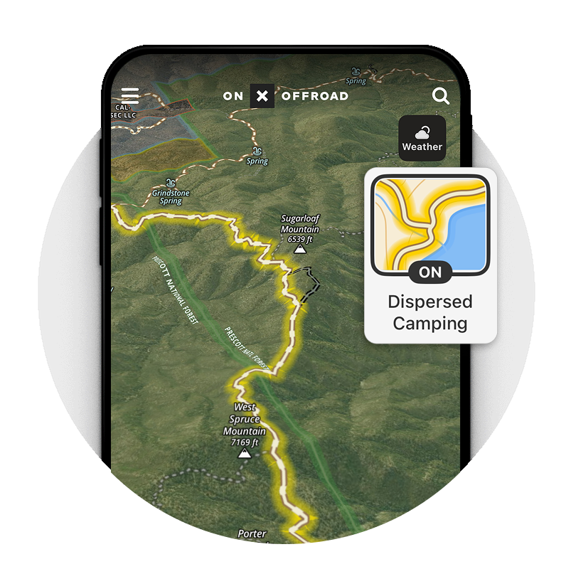
Dispersed Camping Map Layer
onX Offroad’s Dispersed Camping Layer lets you find legal dispersed camping near motorized trails on National Forest land. We’re the only off-road app in the industry with USFS-verified dispersed camping data integrated right into the map. No more tracking down individual ranger stations and deciphering confusing print maps, just activate the map layer to highlight motorized trails with legal free camping in National Forests. Find your own space away from the crowds, the noise, and the reservations.
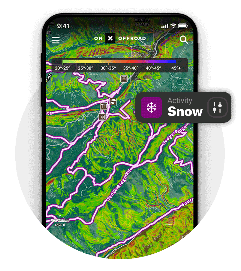
Info-Packed Trail Maps for Dirt + Snow
Explore 715K miles of off-road trails across the US, Canada, and Baja. Find the off-road trails you want fast. Color-coded trails let you see which are open at a glance. Filter your map for 4×4, SxS, dirt bikes, and ATVs, and tap on any trail for a detailed overview that includes distance, open and closed dates, width, and more.
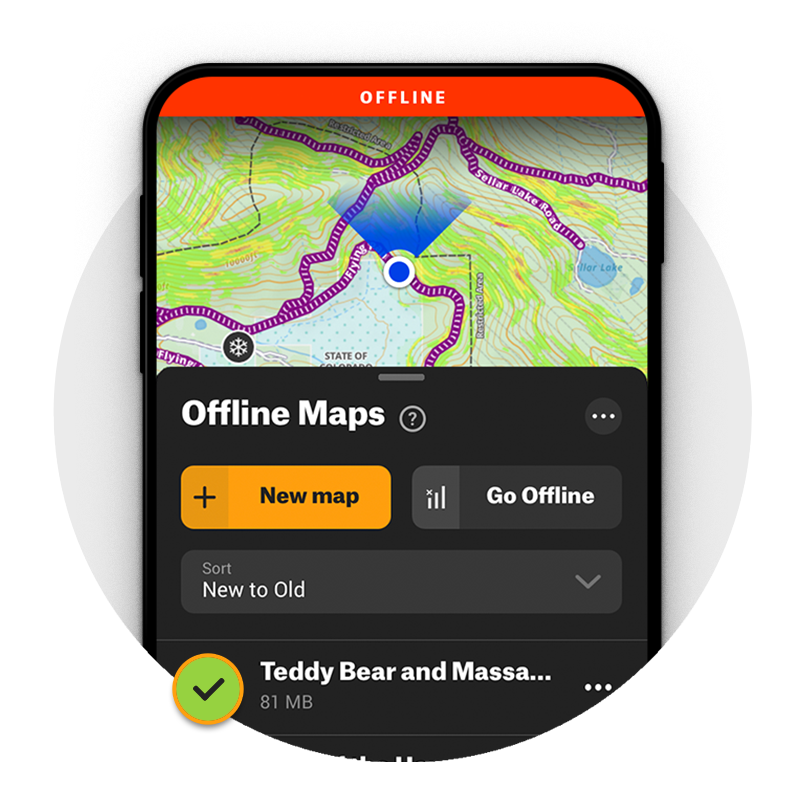
GPS Navigation Without Cell Service
Get home safely—from anywhere. Save Offline Maps to bring your adventures along when you’re outside coverage on the trail, and access maps in 3D to visualize the terrain wherever you explore. Navigate by following the blue dot from your phone’s internal GPS, and always know how to get home–wherever home is that night.
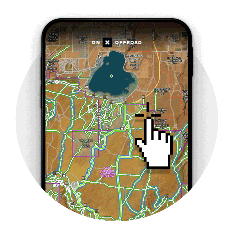
Public Land Boundaries + OHV Areas
Know where you can legally off-road and camp with clearly marked Public Land and OHV areas for the country. Find open riding areas, dispersed camping, and new terrain to explore that’s away from the crowds.
Build Routes From Desktop or Mobile
The days of planning a trip segment by segment are over; just drop points in the direction you want to go, and a Route will automatically connect by snapping to the closest road or trail. Build, edit, save, and share your custom Routes, and go hit the dirt.
App Reviews
Great Mapping App
“Easiest off-road mapping I’ve used.”
“Easiest off-road mapping I’ve used.”
Amazing Land Nav Use
“This app has made navigating the Mojave Road and East Mojave Heritage Trail a breeze. It has allowed me to focus on the scenery and history of the environment. Thanks.”
“This app has made navigating the Mojave Road and East Mojave Heritage Trail a breeze. It has allowed me to focus on the scenery and history of the environment. Thanks.”
Fave Off-Road Map System
“This is the easiest map system to use and reliable in areas with no cell service. We rely on onX for our trips. ”
“This is the easiest map system to use and reliable in areas with no cell service. We rely on onX for our trips. ”