
The most accurate draw odds, harvest data, and application trends for hunters.
Toprut is designed to help hunters research, plan, and apply for hunts and tags every year.
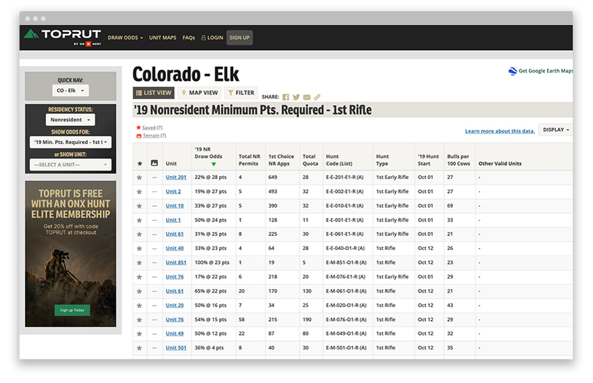
- View draw odds for all 10 western states.
- Explore comprehensive information on elk, deer, antelope, moose, sheep, mountain goat, and bison.
- Research using advanced filtering based on residency, species, weapon, and preference points.
- View success rates, harvest data, and applicant numbers to monitor trends.

The #1 GPS Hunting App
- 975 million acres of public land
- 10,668 unique hunting units
- 421 map overlays and counting
- 5,000 game wardens approve