How To Set Up the onX Hunt App for Deer Hunting
The onX Hunt App is the Best Deer Hunting App. Follow these simple steps to set up the Hunt App for Deer Hunting. Not yet a member?
The onX Hunt App is the Best Deer Hunting App. Follow these simple steps to set up the Hunt App for Deer Hunting. Not yet a member?
Step 1. Log in to your onX account to access tools and layers.
If you’re new to onX start a free 7-day trial and create your account. If you already have an onX Membership, log in here.
TRY THE ONX HUNT APP TODAY
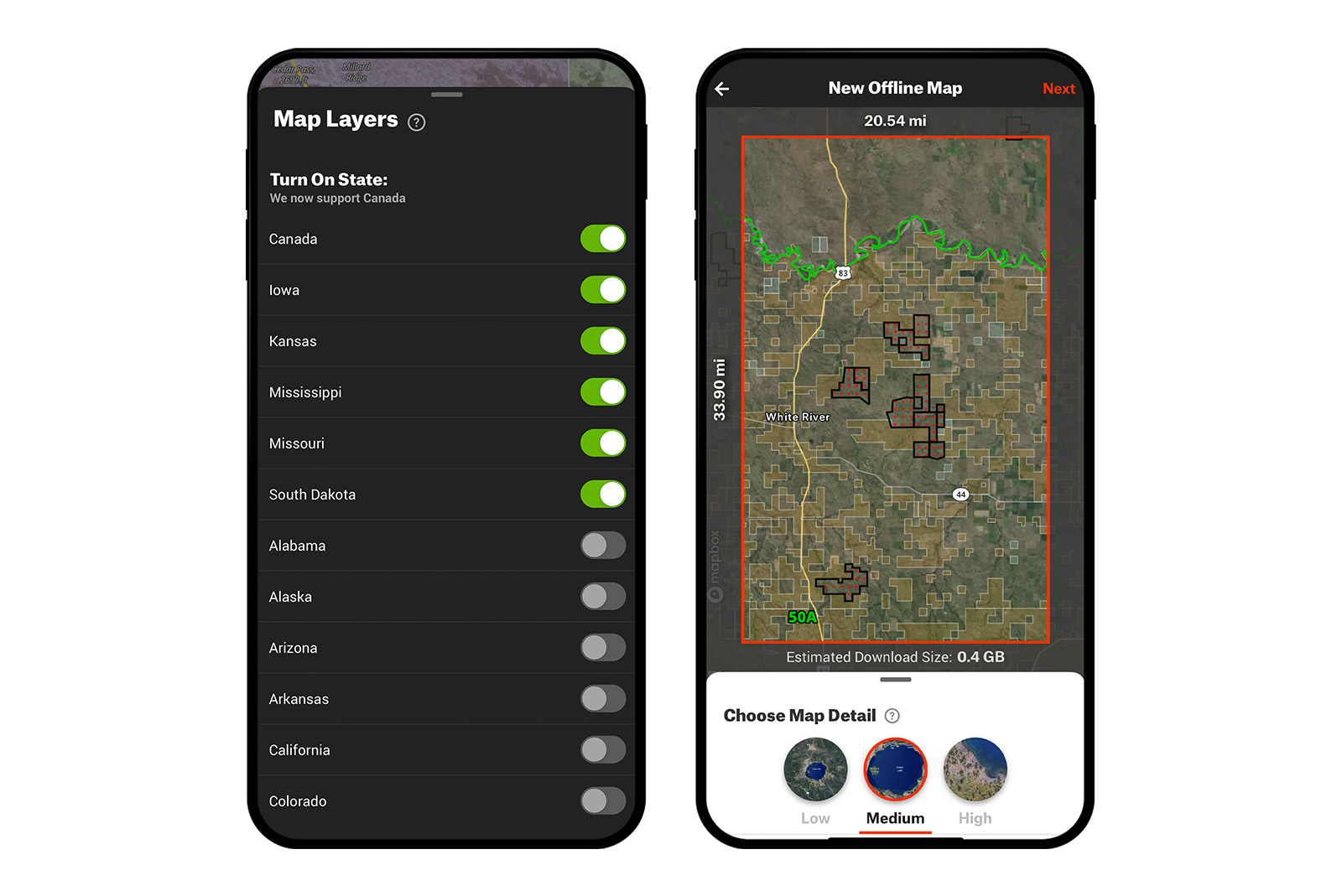
Step 2. Choose your state and download Offline Maps.
onX Hunt is available for all 50 U.S. states and Canada. Choose your state and find the area in which you plan to hunt deer.
Save your Offline Map so you won’t need cell service to use every feature in the onX Hunt App. Offline maps can be saved at three different resolutions and widths: low, medium, and high. Offline maps even work while you’re in airplane mode, so you can save your battery life when in the field.
When you want to use your saved Offline Map for deer hunting, click on Offline Maps at the bottom of the Hunt App, followed by Go Offline. All your saved maps will be visible at the same time, so you don’t need to do anything when you move from one saved map to another. Do you hunt in more than one state? It’s easy to switch states within the onX Hunt App.
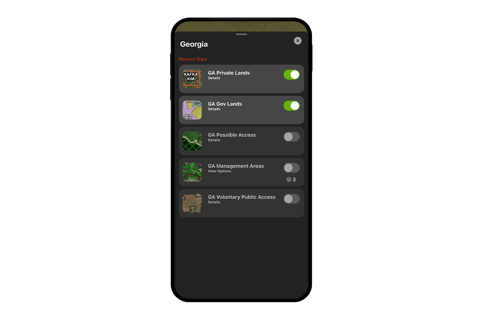
Step 3. Turn on Layers.
To find all available layers for your state, click Map Layers at the bottom of the Hunt App. Toggle between My Layers and Layer Library to find all available Layers. Premium and Elite onX Members will have access to all available layers.
To create the best deer hunting app experience, we recommend turning on all these layers as a baseline:
- Private Lands Layer
- GMUs/Hunting Units Layer
- Trails Layer, especially if you’re hiking into your deer hunting area
- NDA CWD Layer. If you’re concerned about the potential of CWD in your area, use this layer to identify counties where chronic wasting disease (CWD) is present.
- Topographic Maps Layer
The more layers you have turned on, the slower your device may run. You can turn layers on and off as you need. Move any layers you don’t use regularly into the Layer Library.
You should find all the information you’ll need for deer hunting since the onX Hunt App features 400,000+ miles of trails, 121 million private properties, 985 million acres of public land, 421 map overlays, and up-to-date landowner names and property boundaries.
Step 4. Know the Map Tools in the onX Hunt App.
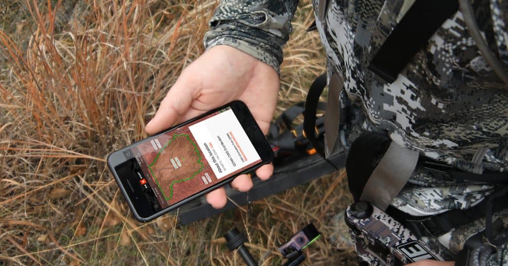
The onX Hunt App is one of the best tools to have with you when deer hunting because of these available features, all found under Map Tools at the bottom of the Hunt App:
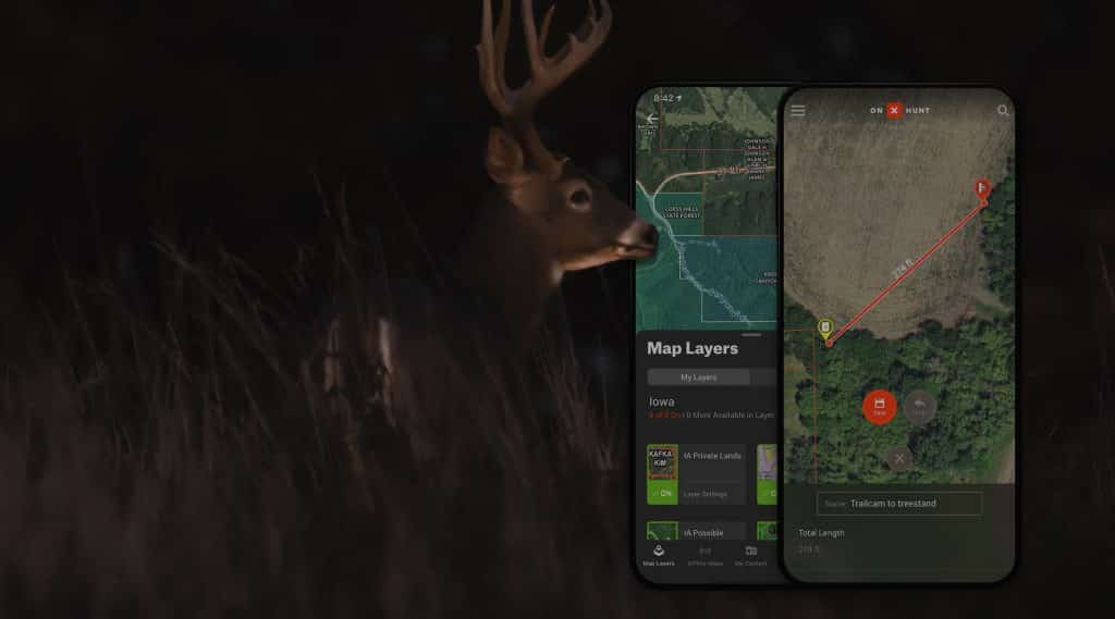
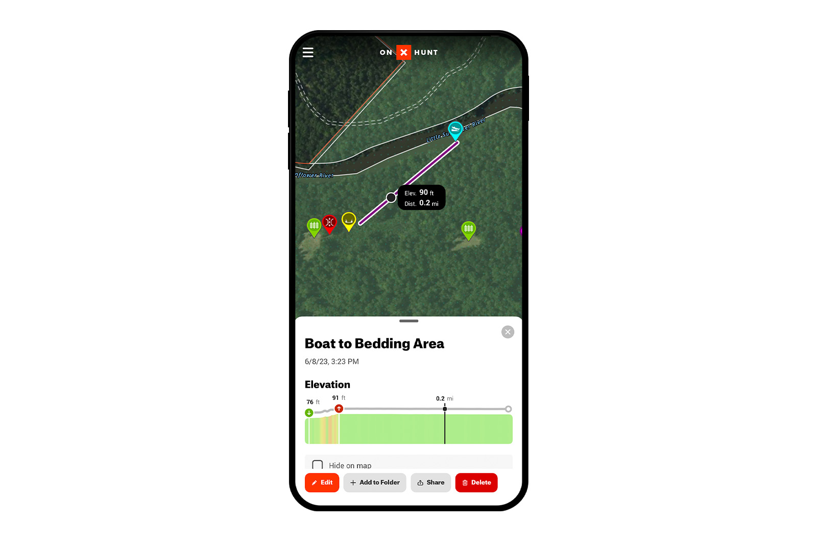
- Waypoints. onX members can also save Colored Waypoints and Photo Waypoints, which are great for marking specific tree stands, trail cameras, or water sources.
- Line Distance. Know the distance between two points on your map and save it. It’s perfect for measuring shooting lanes and distances between your deer stand and a food plot.
- Area Shape Tool. Use this tool to calculate the acreage of your deer hunting land or the size of a food plot you might plant.
Make a mistake marking a waypoint or drawing a line? It’s easy to edit your Markups.
Step 5. Before you go on your deer hunt.
After you’ve set up the onX Hunt App for deer hunting and you’re ready to head out for your hunt, there are few more important tools and features you can use.
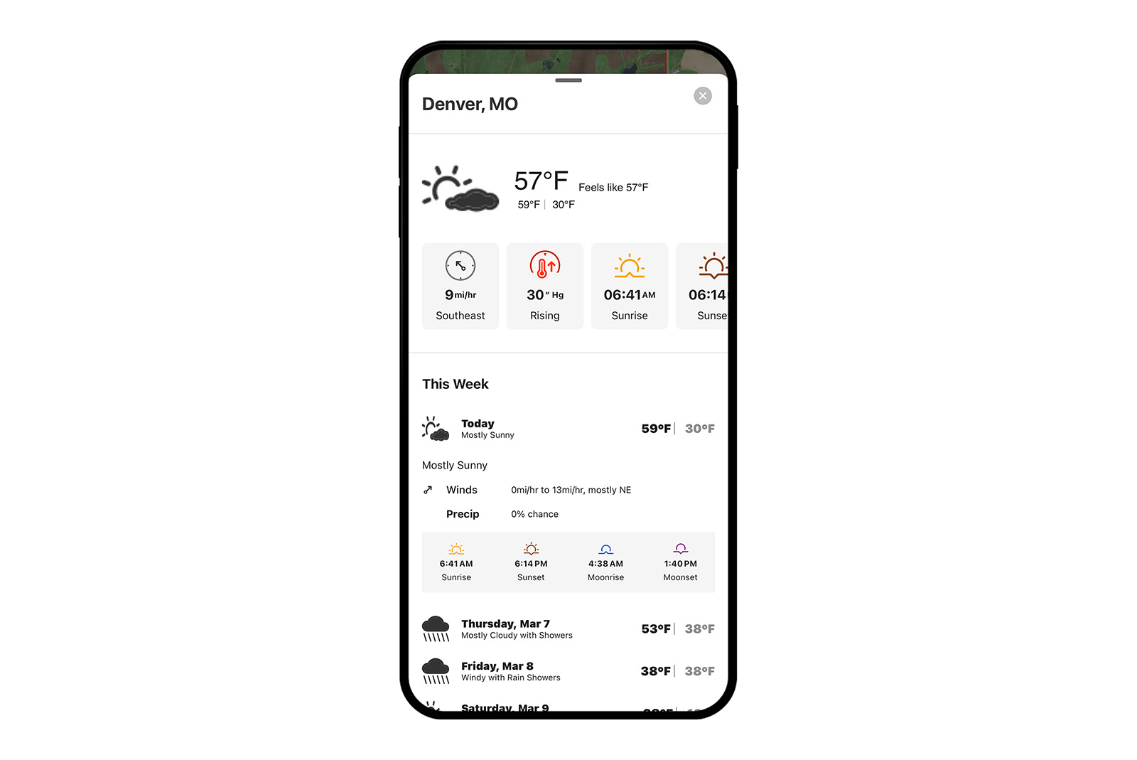
- Check the weather and wind direction. The Hunt App provides live weather reports, weather forecasts, wind direction, sunrise/sunset times, and barometric pressure all curated in one place.
- Share your waypoints. Whether you’re hunting with friends or want your family to know where you’ll be, waypoint sharing keeps you connected.
- Double-check your access. In addition to the public and private land boundaries in the Hunt App, users can add Walk-In Layers to find public access to private land. Learn more.
You Might Also Enjoy


THE #1 DEER HUNTING APP
Make Sure You’re Opener Ready. Try the Hunt App for Free.